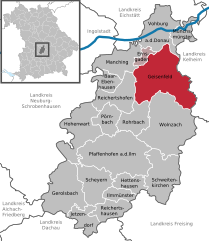
Эрнсгаден (Ernsgaden, Ernsgaden)

 Hiking in Эрнсгаден
Ernsgaden is a small district located near the town of Pfaffenhofen an der Ilm in Bavaria, Germany. While it may not be widely known as a hiking destination, the surrounding area offers some beautiful landscapes and trails suitable for hiking enthusiasts.
Hiking Highlights in and around Ernsgaden:
-
Scenic Routes: The region around Ernsgaden features picturesque countryside, including rolling fields and meadows, forests, and small streams. This makes for enjoyable and serene hiking experiences.
-
Nearby Nature Areas: You can explore nearby areas like the nature conservation areas along the Ilm river, offering trails with varying lengths and difficulties. These routes often provide opportunities to spot local wildlife and enjoy the natural beauty.
-
Well-Mark Resigned Paths: Trails are usually well marked, making it easier even for beginners to navigate. You typically find signposts that guide hikers to local points of interest.
-
Cultural Stops: In addition to nature, the region has various spots of cultural and historical significance. You might encounter traditional Bavarian architecture and local farms along your hiking route.
-
Accessibility: Being close to larger towns and cities in Bavaria, Ernsgaden is easily accessible, allowing hikers to explore the area without venturing too far from urban conveniences.
Tips for Hiking in Ernsgaden:
-
Know Your Route: Before heading out, plan your route using local maps or apps. Familiarize yourself with trail lengths, difficulty levels, and points of interest.
-
Check the Weather: Bavaria can have varied weather conditions, so check the forecast before you head out and dress accordingly.
-
Stay Hydrated: Always carry enough water, especially on hotter days. Some trails may not have easy access to water sources.
-
Respect Nature: Follow Leave No Trace principles. Stay on designated trails and dispose of waste properly to help preserve the environment.
-
Local Resources: Check with local tourism offices or online resources for updated information on trails, events, or even guided hikes available in the area.
Whether you are looking for a peaceful day hike or a more challenging trek, Ernsgaden and its surroundings can offer a lovely experience with the tranquility of Bavarian countryside and charming rural scenery.
- Страна:

- Почтовый код: 85119
- Телефонный код: 08452
- Код автомобильного номера: PAF
- Координаты: 48° 44' 0" N, 11° 35' 0" E


- GPS треки (wikiloc): [Ссылка]
- Высота над уровнем моря: 316 м m
- Площадь: 7.41 кв.км
- Население: 1138
- Веб сайт: http://www.ernsgaden.de/
- Википедия русская: wiki(ru)
- Википедия английская: wiki(en)
- Википедия национальная: wiki(de)
- Хранилище Wikidata: Wikidata: Q256113
- Катеория в википедии: [Ссылка]
- код Freebase: [/m/02q6w63]
- код GeoNames: Альт: [6556345]
- код VIAF: Альт: [243862406]
- ID отношения в OpenStreetMap: [380993]
- код GND: Альт: [4579321-9]
- код Historical Gazetteer: [object_300676]
- Bavarikon ID: [ODB_A00001273]
- идентификатор муниципалитетов в Германии: 09186116
Граничит с регионами:


Фобург-на-Дунае
Hiking in Фобург-на-Дунае
Vohburg, located in Bavaria, Germany, offers a variety of hiking opportunities that can appeal to both casual walkers and more serious hikers. Here are some highlights and tips for hiking in and around Vohburg:...
- Страна:
- Почтовый код: 85088
- Телефонный код: 08457
- Код автомобильного номера: PAF
- Координаты: 48° 46' 11" N, 11° 37' 6" E
- GPS треки (wikiloc): [Ссылка]
- Высота над уровнем моря: 371 м m
- Площадь: 45.19 кв.км
- Население: 5863
- Веб сайт: [Ссылка]

Гайзенфельд
Hiking in Гайзенфельд
Geisenfeld, located in Bavaria, Germany, offers a charming environment for hiking enthusiasts. The region is characterized by picturesque landscapes, tranquil countryside, and well-marked trails that cater to various skill levels. Here are some key points to consider for hiking in Geisenfeld:...
- Страна:
- Почтовый код: 85290
- Телефонный код: 08452
- Код автомобильного номера: PAF
- Координаты: 48° 40' 0" N, 11° 36' 0" E
- GPS треки (wikiloc): [Ссылка]
- Высота над уровнем моря: 385 м m
- Площадь: 88.33 кв.км
- Население: 7689
- Веб сайт: [Ссылка]