Essert-Romand (Essert-Romand)

- коммуна во Франции
 Hiking in Essert-Romand
Essert-Romand is a picturesque village located in the French Alps, near the popular resort town of Morzine. It offers stunning views, lush landscapes, and a variety of hiking trails suitable for different levels of hikers.
Hiking Opportunities
-
Scenic Trails: The region boasts several trails that provide breathtaking views of the surrounding mountains, valleys, and lakes. Popular routes may lead through charming alpine pastures and dense forests.
-
Difficulty Levels: You can find hikes ranging from easy, family-friendly walks to more challenging routes for experienced hikers. The terrain varies, so be sure to choose a trail that matches your fitness level and hiking experience.
-
Local Points of Interest: Many trails provide access to local flora and fauna, as well as cultural landmarks, such as traditional Alpine chalets and churches.
-
Seasonal Hiking: The best time for hiking in Essert-Romand is typically during the late spring through early autumn (May to October). In winter, the area is popular for skiing and snowboarding.
Preparation Tips
-
Equipment: Make sure to wear suitable hiking boots and attire depending on the weather. Always bring water, snacks, and a map or GPS device.
-
Safety: Check the weather forecast before heading out, and let someone know your plans. Familiarize yourself with the trails and any potential hazards or wildlife in the area.
-
Guided Tours: If you're unfamiliar with the area or prefer guidance, consider joining a local hiking group or hiring a guide who knows the terrain.
Conclusion
Hiking in Essert-Romand offers a chance to explore the natural beauty of the French Alps while providing opportunities for adventure and relaxation. Enjoy the stunning scenery, breathe in the fresh mountain air, and immerse yourself in the tranquil environment of this charming village.
- Страна:

- Почтовый код: 74110
- Координаты: 46° 12' 6" N, 6° 40' 16" E


- GPS треки (wikiloc): [Ссылка]
- Площадь: 6.78 кв.км
- Население: 509
- Веб сайт: http://www.essert-romand.fr
- Википедия английская: wiki(en)
- Википедия национальная: wiki(fr)
- Хранилище Wikidata: Wikidata: Q829221
- Катеория в википедии: [Ссылка]
- код Freebase: [/m/03ntyrb]
- код GeoNames: Альт: [6442947]
- номер SIREN: [217401140]
- код BNF: [152743729]
- код муниципалитета INSEE: 74114
Граничит с регионами:

Morzine
- коммуна во Франции
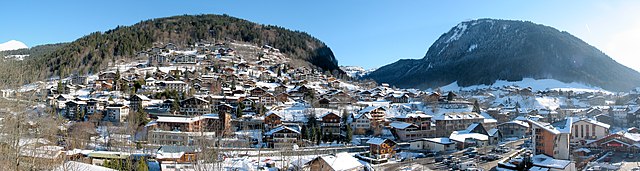
Hiking in Morzine
Morzine is a beautiful alpine town located in the French Alps, part of the Portes du Soleil ski area, which is well-known for both winter sports and summer hiking opportunities. The region offers a diverse range of trails and breathtaking landscapes, making it ideal for hikers of all levels. Here’s what you need to know about hiking in Morzine:...
- Страна:
- Почтовый код: 74110
- Координаты: 46° 10' 48" N, 6° 42' 33" E
- GPS треки (wikiloc): [Ссылка]
- Высота над уровнем моря: 1000 м m
- Площадь: 44.1 кв.км
- Население: 2870
- Веб сайт: [Ссылка]


La Côte-d'Arbroz
- коммуна во Франции
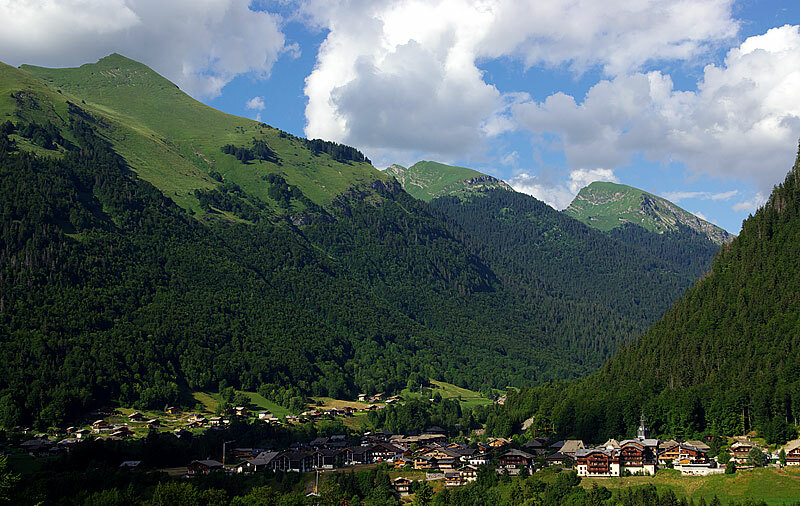
Hiking in La Côte-d'Arbroz
La Côte-d'Arbroz is a charming commune located in the Haute-Savoie region of the French Alps. Known for its stunning landscapes and proximity to the Portes du Soleil ski area, it also offers fantastic hiking opportunities, particularly in the summer months when the snow melts and the meadows bloom....
- Страна:
- Почтовый код: 74110
- Координаты: 46° 11' 16" N, 6° 40' 5" E
- GPS треки (wikiloc): [Ссылка]
- Площадь: 12.24 кв.км
- Население: 323
- Веб сайт: [Ссылка]

Montriond
- коммуна во Франции
Hiking in Montriond
Montriond, located in the French Alps near Morzine, is a beautiful destination for hiking enthusiasts. The area offers a range of trails with stunning views of the surrounding mountains, lush valleys, and crystal-clear lakes. Here are some key points about hiking in Montriond:...
- Страна:
- Почтовый код: 74110
- Координаты: 46° 11' 50" N, 6° 41' 39" E
- GPS треки (wikiloc): [Ссылка]
- Площадь: 24.71 кв.км
- Население: 902
- Веб сайт: [Ссылка]

Saint-Jean-d'Aulps
- коммуна во Франции
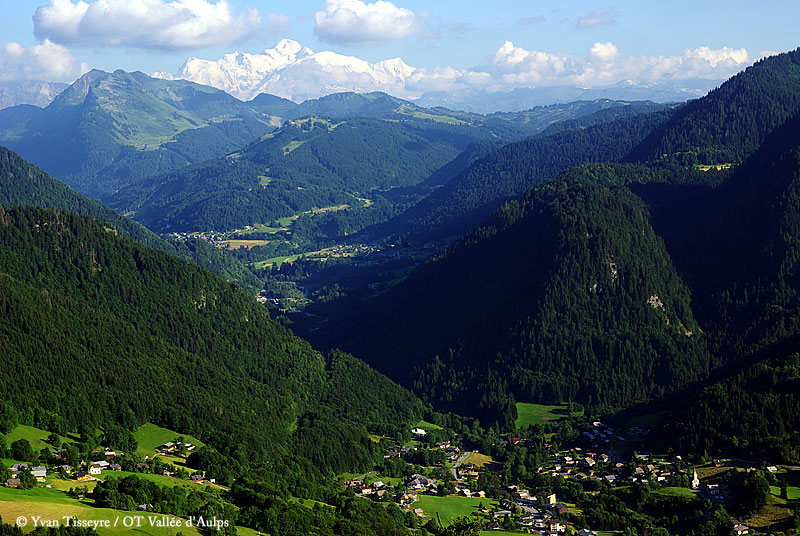
Hiking in Saint-Jean-d'Aulps
Saint-Jean-d'Aulps is a beautiful mountain resort located in the Rhône-Alpes region of France, within the wider Portes du Soleil area. It’s an excellent destination for hiking enthusiasts, offering a range of trails and stunning alpine scenery....
- Страна:
- Почтовый код: 74430
- Координаты: 46° 14' 5" N, 6° 39' 20" E
- GPS треки (wikiloc): [Ссылка]
- Площадь: 40.19 кв.км
- Население: 1241
- Веб сайт: [Ссылка]