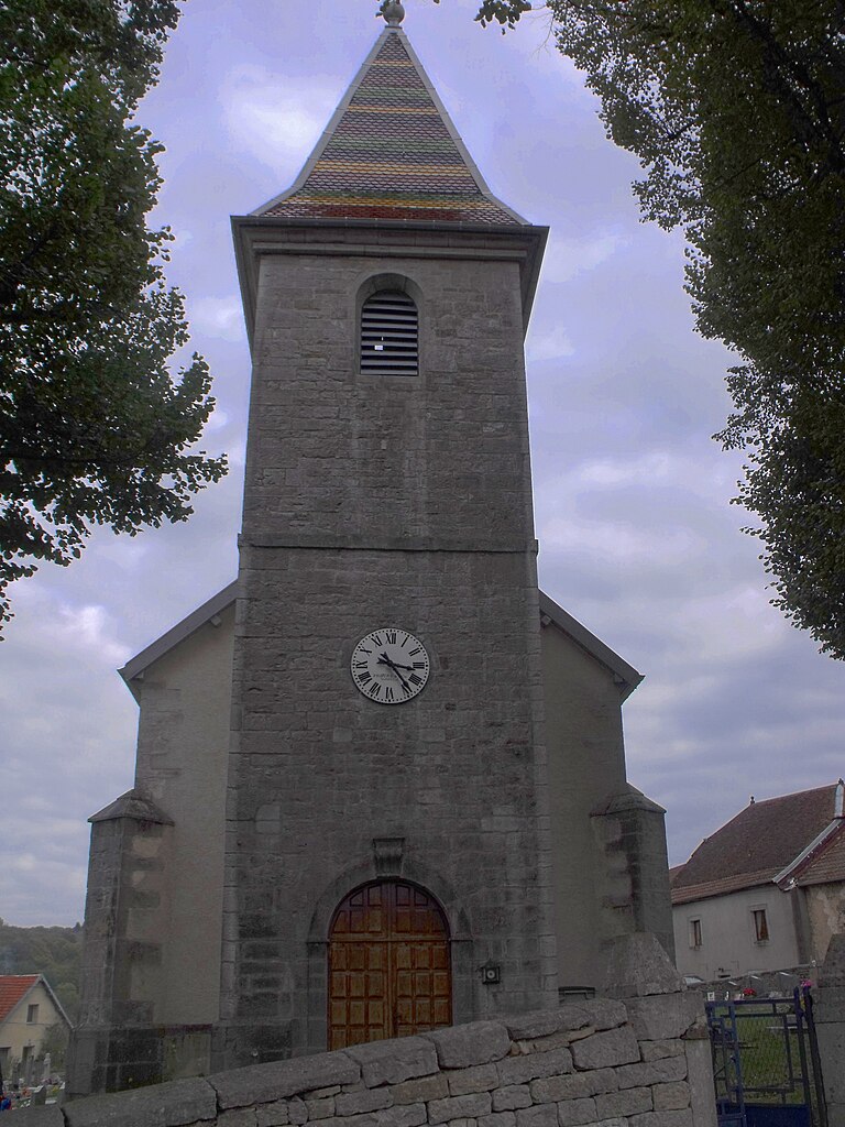
Fontaine-lès-Clerval (Fontaine-lès-Clerval)

- коммуна во Франции
 Hiking in Fontaine-lès-Clerval
Fontaine-lès-Clerval is a charming village located in the Doubs department of the Bourgogne-Franche-Comté region in eastern France. The surrounding area offers a variety of hiking opportunities, featuring beautiful landscapes full of natural beauty, rolling hills, forests, and rivers.
Hiking Trails and Nature:
-
Scenic Routes: The region around Fontaine-lès-Clerval provides access to numerous hiking trails that cater to different skill levels. You can find marked paths that range from easy strolls to more challenging hikes.
-
Monts de Gy: This nearby mountain range offers picturesque landscapes, with trails that provide panoramic views of the valleys and the surrounding countryside. Hikes here can range from short walks to longer excursions.
-
Local Flora and Fauna: While hiking, you can enjoy the rich biodiversity of the region. Look out for local wildlife, including deer, birds, and various plant species.
-
Rivers and Waterways: The area is also characterized by rivers, making it possible to combine hiking with activities like fishing or simply enjoying the scenic riverside.
Recommendations for Hikers:
- Preparation: Make sure to wear comfortable hiking shoes and bring appropriate gear, especially if you plan to explore longer trails.
- Navigation: Carry a map or use a GPS app to ensure you stay on track. While many trails are marked, some may require more navigation skill.
- Weather Conditions: Check the local weather before heading out, as conditions can change rapidly in mountainous areas.
- Local Rules: Be aware of local regulations and guidelines regarding wildlife and plant protection to ensure a respectful experience in nature.
Nearby Attractions:
If you're in the area for hiking, consider visiting local attractions such as historical sites, charming villages, and regional cuisine spots where you can relax after a day of trekking.
Overall, hiking in Fontaine-lès-Clerval and its vicinity can offer a rejuvenating experience amidst nature, ideal for both seasoned hikers and casual walkers.
- Страна:

- Почтовый код: 25340
- Координаты: 47° 25' 31" N, 6° 28' 17" E


- GPS треки (wikiloc): [Ссылка]
- Высота над уровнем моря: 420 м m
- Площадь: 11.5 кв.км
- Население: 283
- Википедия английская: wiki(en)
- Википедия национальная: wiki(fr)
- Хранилище Wikidata: Wikidata: Q567993
- Катеория в википедии: [Ссылка]
- код Freebase: [/m/03mh8c7]
- код Freebase: [/m/03mh8c7]
- код GeoNames: Альт: [6616215]
- код GeoNames: Альт: [6616215]
- номер SIREN: [212502462]
- номер SIREN: [212502462]
- код муниципалитета INSEE: 25246
- код муниципалитета INSEE: 25246
Граничит с регионами:
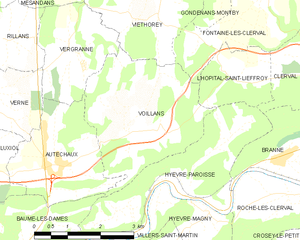
Voillans
- коммуна во Франции
Hiking in Voillans
Voillans is a picturesque village located in the Franche-Comté region of eastern France, known for its beautiful landscapes and serene natural surroundings. Hiking in and around Voillans offers a great opportunity to explore the scenic beauty of the area, including rolling hills, forests, and small rivers....
- Страна:
- Почтовый код: 25110
- Координаты: 47° 23' 12" N, 6° 24' 47" E
- GPS треки (wikiloc): [Ссылка]
- Площадь: 10.12 кв.км
- Население: 207


Clerval
- коммуна во Франции
Hiking in Clerval
Clerval, located in the Doubs department of the Bourgogne-Franche-Comté region in eastern France, offers a charming backdrop for hiking enthusiasts. The area is rich in natural beauty, with rolling hills, forests, and the scenic Doubs River winding through the landscape....
- Страна:
- Почтовый код: 25340
- Координаты: 47° 23' 32" N, 6° 29' 51" E
- GPS треки (wikiloc): [Ссылка]
- Площадь: 11.83 кв.км
- Население: 1035


Soye
- коммуна во Франции
Hiking in Soye
Hiking in Soye can be a wonderful experience for outdoor enthusiasts. While Soye may not be as widely known as other hiking destinations, it typically offers beautiful natural landscapes, varying terrain, and trails suitable for different skill levels....
- Страна:
- Почтовый код: 25250
- Координаты: 47° 26' 41" N, 6° 29' 54" E
- GPS треки (wikiloc): [Ссылка]
- Площадь: 13.89 кв.км
- Население: 385


Santoche
- коммуна во Франции
Hiking in Santoche
It seems there may be a small misunderstanding, as there isn't a widely recognized hiking destination called "Santoche." However, if you meant "Santoch," please note that it might be a smaller or lesser-known location not widely documented in popular hiking resources....
- Страна:
- Почтовый код: 25340
- Координаты: 47° 24' 14" N, 6° 30' 27" E
- GPS треки (wikiloc): [Ссылка]
- Площадь: 2.15 кв.км
- Население: 84


Gondenans-Montby
- коммуна во Франции
Hiking in Gondenans-Montby
Gondenans-Montby is a picturesque village located in the Jura region of France, known for its stunning landscapes and diverse hiking opportunities. The area is characterized by rolling hills, dense forests, and meandering rivers, making it a great destination for outdoor enthusiasts. Here are some highlights and tips for hiking in Gondenans-Montby:...
- Страна:
- Почтовый код: 25340
- Координаты: 47° 25' 58" N, 6° 27' 9" E
- GPS треки (wikiloc): [Ссылка]
- Площадь: 11.78 кв.км
- Население: 176

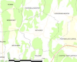
Viéthorey
- коммуна во Франции
Hiking in Viéthorey
Viéthorey is a picturesque village located in the Vosges region of France. This area is characterized by its stunning natural landscapes, making it a wonderful destination for hiking enthusiasts. Here are some key points to consider when planning a hiking trip in Viéthorey:...
- Страна:
- Почтовый код: 25340
- Координаты: 47° 25' 32" N, 6° 25' 46" E
- GPS треки (wikiloc): [Ссылка]
- Площадь: 7.92 кв.км
- Население: 95


Pompierre-sur-Doubs
- коммуна во Франции
Hiking in Pompierre-sur-Doubs
Pompierre-sur-Doubs is a picturesque village located in the Doubs department in the Bourgogne-Franche-Comté region of France. The area offers beautiful natural scenery, making it a suitable destination for hiking enthusiasts. Here are some highlights and tips for hiking in and around Pompierre-sur-Doubs:...
- Страна:
- Почтовый код: 25340
- Координаты: 47° 25' 7" N, 6° 31' 27" E
- GPS треки (wikiloc): [Ссылка]
- Площадь: 8.16 кв.км
- Население: 304


L'Hôpital-Saint-Lieffroy
- коммуна во Франции
Hiking in L'Hôpital-Saint-Lieffroy
L'Hôpital-Saint-Lieffroy is a charming commune in the Auvergne-Rhône-Alpes region of France. It's not as widely known for its hiking trails as some larger areas, but it offers a lovely countryside experience. Here are some highlights for hiking in and around L'Hôpital-Saint-Lieffroy:...
- Страна:
- Почтовый код: 25340
- Координаты: 47° 23' 56" N, 6° 27' 27" E
- GPS треки (wikiloc): [Ссылка]
- Площадь: 3.43 кв.км
- Население: 108