Clerval (Clerval)

- коммуна во Франции
 Hiking in Clerval
Clerval, located in the Doubs department of the Bourgogne-Franche-Comté region in eastern France, offers a charming backdrop for hiking enthusiasts. The area is rich in natural beauty, with rolling hills, forests, and the scenic Doubs River winding through the landscape.
Hiking Trails
-
Local Trails: There are several local trails around Clerval that cater to various skill levels. These trails often lead through picturesque countryside, offering views of lush greenery and the traditional architecture of the region.
-
GR Hiking Routes: The region may have access to larger long-distance trails such as the "GR 59," which runs through the Doubs department. These trails connect various towns and natural features, offering more extensive hiking opportunities for those looking for an adventure.
-
Nature Reserves: Nearby nature reserves, like the Doubs Valley, provide opportunities for hiking while experiencing diverse ecosystems and local wildlife.
Best Hiking Seasons
-
Spring and Fall: These seasons are particularly beautiful, offering mild weather and vibrant foliage. Spring features blooming wildflowers, while fall showcases stunning autumn colors.
-
Summer: Ideal for longer treks, but ensure to start hikes early to avoid the midday heat.
Tips for Hiking in Clerval
-
Local Weather: Be prepared for rapidly changing weather, especially if hiking in higher elevations. It's wise to check forecasts before heading out.
-
Gear Up: Bring appropriate footwear, plenty of water, snacks, and a first-aid kit. A good map or a GPS device can be valuable as well.
-
Respect Nature: Follow local rules and regulations to preserve the natural beauty of the area. Leave no trace of your visit.
-
Explore the Culture: While hiking, take time to appreciate the local culture, including historical sites and traditional farms.
Clerval and its surrounding landscapes offer a great experience for hikers looking to explore the natural beauty of the Doubs department. Whether you're on a leisurely stroll or a challenging hike, the area's serene environment is sure to provide a satisfying outdoor experience.
- Страна:

- Почтовый код: 25340
- Координаты: 47° 23' 32" N, 6° 29' 51" E


- GPS треки (wikiloc): [Ссылка]
- Площадь: 11.83 кв.км
- Население: 1035
- Википедия английская: wiki(en)
- Википедия национальная: wiki(fr)
- Хранилище Wikidata: Wikidata: Q614895
- Катеория в википедии: [Ссылка]
- код Freebase: [/m/03mgs81]
- код Freebase: [/m/03mgs81]
- код GeoNames: Альт: [6453841]
- код GeoNames: Альт: [6453841]
- код BNF: [15252382q]
- код BNF: [15252382q]
- WOEID: [586252]
- WOEID: [586252]
- код муниципалитета INSEE: 25156
- код муниципалитета INSEE: 25156
Граничит с регионами:


Chaux-lès-Clerval
- коммуна во Франции
Hiking in Chaux-lès-Clerval
Chaux-lès-Clerval is a small commune located in the Doubs department in the Bourgogne-Franche-Comté region of eastern France. The surrounding landscape offers beautiful natural scenery that can be quite enjoyable for hikers....
- Страна:
- Почтовый код: 25340
- Координаты: 47° 22' 58" N, 6° 30' 28" E
- GPS треки (wikiloc): [Ссылка]
- Площадь: 8.57 кв.км
- Население: 156


Fontaine-lès-Clerval
- коммуна во Франции
Hiking in Fontaine-lès-Clerval
Fontaine-lès-Clerval is a charming village located in the Doubs department of the Bourgogne-Franche-Comté region in eastern France. The surrounding area offers a variety of hiking opportunities, featuring beautiful landscapes full of natural beauty, rolling hills, forests, and rivers....
- Страна:
- Почтовый код: 25340
- Координаты: 47° 25' 31" N, 6° 28' 17" E
- GPS треки (wikiloc): [Ссылка]
- Высота над уровнем моря: 420 м m
- Площадь: 11.5 кв.км
- Население: 283


Anteuil
- коммуна во Франции
Hiking in Anteuil
Anteuil is a small commune in the Doubs department in eastern France. While it might not be as widely recognized for hiking as some larger national parks or regions, it offers beautiful landscapes typical of the Jura foothills. Here are some things to consider when hiking in and around Anteuil:...
- Страна:
- Почтовый код: 25340
- Координаты: 47° 23' 15" N, 6° 33' 39" E
- GPS треки (wikiloc): [Ссылка]
- Площадь: 24.29 кв.км
- Население: 661


Santoche
- коммуна во Франции
Hiking in Santoche
It seems there may be a small misunderstanding, as there isn't a widely recognized hiking destination called "Santoche." However, if you meant "Santoch," please note that it might be a smaller or lesser-known location not widely documented in popular hiking resources....
- Страна:
- Почтовый код: 25340
- Координаты: 47° 24' 14" N, 6° 30' 27" E
- GPS треки (wikiloc): [Ссылка]
- Площадь: 2.15 кв.км
- Население: 84


Branne
- коммуна во Франции
Hiking in Branne
Branne is a charming village in the Doubs department of the Bourgogne-Franche-Comté region in eastern France. This area is known for its picturesque landscapes, rolling hills, and forested mountains, making it a wonderful destination for hiking enthusiasts....
- Страна:
- Почтовый код: 25340
- Координаты: 47° 22' 36" N, 6° 28' 21" E
- GPS треки (wikiloc): [Ссылка]
- Площадь: 6.45 кв.км
- Население: 169


Hyèvre-Paroisse
- коммуна во Франции
Hiking in Hyèvre-Paroisse
Hyèvre-Paroisse is a charming village located in the Jura department of eastern France, nestled in the stunning Jura Mountains. This area is known for its beautiful landscapes, rich biodiversity, and a variety of outdoor activities, including hiking....
- Страна:
- Почтовый код: 25110
- Координаты: 47° 22' 17" N, 6° 25' 49" E
- GPS треки (wikiloc): [Ссылка]
- Площадь: 8.79 кв.км
- Население: 186


Pompierre-sur-Doubs
- коммуна во Франции
Hiking in Pompierre-sur-Doubs
Pompierre-sur-Doubs is a picturesque village located in the Doubs department in the Bourgogne-Franche-Comté region of France. The area offers beautiful natural scenery, making it a suitable destination for hiking enthusiasts. Here are some highlights and tips for hiking in and around Pompierre-sur-Doubs:...
- Страна:
- Почтовый код: 25340
- Координаты: 47° 25' 7" N, 6° 31' 27" E
- GPS треки (wikiloc): [Ссылка]
- Площадь: 8.16 кв.км
- Население: 304


L'Hôpital-Saint-Lieffroy
- коммуна во Франции
Hiking in L'Hôpital-Saint-Lieffroy
L'Hôpital-Saint-Lieffroy is a charming commune in the Auvergne-Rhône-Alpes region of France. It's not as widely known for its hiking trails as some larger areas, but it offers a lovely countryside experience. Here are some highlights for hiking in and around L'Hôpital-Saint-Lieffroy:...
- Страна:
- Почтовый код: 25340
- Координаты: 47° 23' 56" N, 6° 27' 27" E
- GPS треки (wikiloc): [Ссылка]
- Площадь: 3.43 кв.км
- Население: 108

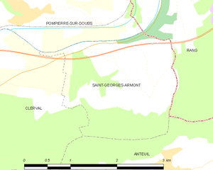
Saint-Georges-Armont
- коммуна во Франции
Hiking in Saint-Georges-Armont
Saint-Georges-Armont, located in the picturesque Vosges region of France, offers a unique hiking experience amidst beautiful landscapes. The area is characterized by rolling hills, dense forests, and panoramic views of the surrounding countryside. Here are some highlights and tips for hiking in this region:...
- Страна:
- Почтовый код: 25340
- Координаты: 47° 23' 56" N, 6° 33' 25" E
- GPS треки (wikiloc): [Ссылка]
- Площадь: 4.74 кв.км
- Население: 118