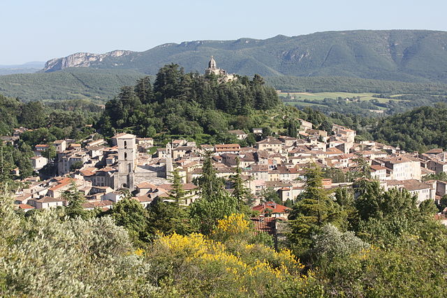
Фонтьен (Fontienne, Fontienne)
- коммуна во Франции
 Hiking in Фонтьен
Fontienne is not a widely known hiking destination, so it's possible that you're referring to a specific area or a local trail that has not gained significant recognition outside its immediate region. Here are some general guidelines and tips for hiking in lesser-known areas that may apply to hiking in Fontienne or similar locations:
-
Research the Area: Before heading out, do some research about the specific trails in Fontienne. Look for maps, trail reviews, and any other available information. Local hiking groups or forums can be invaluable resources.
-
Know the Terrain: Understand the type of terrain you'll be hiking. Is it mountainous, flat, or hilly? What’s the level of difficulty? Being prepared can make your hiking experience much more enjoyable.
-
Check Weather Conditions: Weather can change rapidly in outdoor settings. Check the forecast before you head out, and be prepared for varying conditions.
-
Pack Essentials: Bring enough water, snacks, appropriate clothing, and gear according to the distance and difficulty of your hike. A first aid kit, navigation tools (like a map or GPS), and a multitool can also be useful.
-
Leave No Trace Principles: Follow Leave No Trace principles to minimize your impact on the environment. This includes staying on established trails, packing out what you pack in, and respecting wildlife.
-
Safety First: Always let someone know your plans before you go. If hiking alone, consider carrying a whistle or a personal locator beacon for emergencies.
-
Wildlife Awareness: Be knowledgeable about the local wildlife. Know what to do in case of encounters with animals such as bears or snakes.
-
Trail Etiquette: Be courteous to other hikers. Yield the trail to those going uphill, and keep noise levels down.
If Fontienne is in reference to a particular region, national park, or trail system, please provide more context, and I'll be happy to give more specific information!
- Страна:

- Почтовый код: 04230
- Координаты: 44° 0' 32" N, 5° 47' 36" E


- GPS треки (wikiloc): [Ссылка]
- Площадь: 8.18 кв.км
- Население: 129
- Википедия русская: wiki(ru)
- Википедия английская: wiki(en)
- Википедия национальная: wiki(fr)
- Хранилище Wikidata: Wikidata: Q877440
- Катеория в википедии: [Ссылка]
- код Freebase: [/m/03m7wn2]
- код Freebase: [/m/03m7wn2]
- код GeoNames: Альт: [3017843]
- код GeoNames: Альт: [3017843]
- номер SIREN: [210400875]
- номер SIREN: [210400875]
- код муниципалитета INSEE: 04087
- код муниципалитета INSEE: 04087
Граничит с регионами:

Сент-Этьен-лез-Орг
- коммуна во Франции
Hiking in Сент-Этьен-лез-Орг
Saint-Étienne-les-Orgues is a picturesque village located in the Alpes-de-Haute-Provence region of southern France. It lies in a beautiful natural setting, surrounded by diverse landscapes, which makes it a great destination for hiking enthusiasts. Here are some key points about hiking in this area:...
- Страна:
- Почтовый код: 04230
- Координаты: 44° 2' 46" N, 5° 46' 49" E
- GPS треки (wikiloc): [Ссылка]
- Площадь: 48.42 кв.км
- Население: 1249
- Веб сайт: [Ссылка]

Ревест-Сен-Мартен
- коммуна во Франции
Hiking in Ревест-Сен-Мартен
Revest-Saint-Martin, located in the Provence-Alpes-Côte d'Azur region of southeastern France, offers beautiful hiking opportunities amid stunning natural landscapes. The area is characterized by its diverse topography, including hills, forests, and panoramic views of the surrounding mountains and valleys....
- Страна:
- Почтовый код: 04230
- Координаты: 44° 0' 41" N, 5° 49' 36" E
- GPS треки (wikiloc): [Ссылка]
- Площадь: 7.56 кв.км
- Население: 69
Форкалькье
- коммуна во Франции
Hiking in Форкалькье
Forcalquier is a charming town located in the Alpes-de-Haute-Provence region of southeastern France. It is surrounded by stunning natural landscapes, making it a great destination for hiking enthusiasts....
- Страна:
- Почтовый код: 04300
- Координаты: 43° 57' 33" N, 5° 46' 47" E
- GPS треки (wikiloc): [Ссылка]
- Площадь: 42.76 кв.км
- Население: 4981
- Веб сайт: [Ссылка]

Сигонс
- коммуна во Франции
Hiking in Сигонс
Sigonce, a picturesque village located in the Provence-Alpes-Côte d'Azur region of France, is a hidden gem for outdoor enthusiasts. The surrounding landscape features rolling hills, dense forests, and stunning views that make it an ideal destination for hiking. Here are some highlights and tips for hiking in Sigonce:...
- Страна:
- Почтовый код: 04300
- Координаты: 43° 59' 49" N, 5° 50' 25" E
- GPS треки (wikiloc): [Ссылка]
- Площадь: 19.97 кв.км
- Население: 429