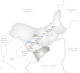
Формацца (Formazza, Formazza)
- коммуна Италии
 Hiking in Формацца
Formazza, located in the northeastern part of Italy's Piedmont region, is a beautiful area renowned for its stunning landscapes, alpine scenery, and rich cultural heritage, making it an exceptional hiking destination. Here are some key points about hiking in Formazza:
Natural Beauty
- Alpine Landscapes: Formazza is surrounded by majestic mountains, deep valleys, and crystal-clear streams, providing picturesque views and diverse terrains.
- Waterfalls: One of the highlights is the impressive Toce Waterfall, which is one of the tallest waterfalls in Italy. The route leading to the waterfall offers breathtaking vistas.
- Flora and Fauna: The area's rich biodiversity includes various alpine flowers, and it is common to spot wildlife like ibex, chamois, and a variety of bird species.
Hiking Trails
- Varied Difficulty Levels: There are numerous hiking trails suitable for all levels of hikers, from easy walks to more challenging treks.
- Popular Routes: Some popular trails include:
- Val Formazza Trail: A relatively easy trail that offers access to beautiful meadows and views of the surrounding peaks.
- Ghiffa to Formazza: A moderate trek that provides a fantastic opportunity to experience the local flora and fauna.
- Sentiero dei Camosci: This is a more challenging route that rewards hikers with stunning views and a sense of adventure.
Cultural Aspects
- Walser Heritage: Formazza is home to the Walser people, a Swiss-German ethnic group. You can experience their unique architecture, traditions, and local cuisine while hiking.
- Mountain Huts and Refuges: Along many trails, you can find mountain huts where you can enjoy local dishes and recharge during your hike.
Best Time to Hike
- Summer and Early Fall: The best months for hiking in Formazza are usually from late June to early October when the weather is milder, and trails are usually less snowy.
- Wildflower Season: If you visit in late spring and early summer, you’ll be treated to vibrant alpine wildflower displays.
Safety and Preparation
- Equipment: Ensure you wear appropriate hiking boots, carry a map or GPS device, and have enough water and snacks.
- Weather: Always check the weather forecast before heading out, as conditions can change rapidly in the mountains.
Accessibility
- Transport: The area is accessible by car from larger towns such as Domodossola, but public transport options are also available.
Hiking in Formazza offers not only physical activity but also an opportunity to immerse yourself in nature and local culture. Remember to leave no trace and respect the natural environment while you enjoy your adventure!
- Страна:

- Почтовый код: 28863
- Телефонный код: 0324
- Код автомобильного номера: VB
- Координаты: 46° 23' 0" N, 8° 26' 0" E


- GPS треки (wikiloc): [Ссылка]
- Высота над уровнем моря: 1280 м m
- Площадь: 130.65 кв.км
- Население: 442
- Веб сайт: http://www.comune.formazza.vb.it
- Википедия русская: wiki(ru)
- Википедия английская: wiki(en)
- Википедия национальная: wiki(it)
- Хранилище Wikidata: Wikidata: Q23336
- Галерея изображений в википедии: [Ссылка]
- Катеория в википедии: [Ссылка]
- код Freebase: [/m/0gr899]
- код GeoNames: Альт: [6540303]
- код VIAF: Альт: [129183380]
- ID отношения в OpenStreetMap: [47153]
- код ISTAT: 103031
- кадастровый код Италии: D706
Граничит с регионами:

Бачено
- коммуна Италии
Hiking in Бачено
Baceno is a charming village located in the Piedmont region of northern Italy, nestled in the Ossola Valley. This area is known for its beautiful landscapes, rich history, and a variety of hiking trails suitable for different skill levels. Here are some highlights about hiking in Baceno:...
- Страна:
- Почтовый код: 28861
- Телефонный код: 0324
- Код автомобильного номера: VB
- Координаты: 46° 16' 0" N, 8° 19' 0" E
- GPS треки (wikiloc): [Ссылка]
- Высота над уровнем моря: 655 м m
- Площадь: 77.27 кв.км
- Население: 900
- Веб сайт: [Ссылка]

Премиа
- коммуна Италии
Hiking in Премиа
Premia, a town located in the province of Barcelona, Spain, offers beautiful landscapes and opportunities for hiking enthusiasts. The area is characterized by its scenic views, forests, and proximity to both the mountains and the Mediterranean coast....
- Страна:
- Почтовый код: 28866
- Телефонный код: 0324
- Код автомобильного номера: VB
- Координаты: 46° 16' 0" N, 8° 20' 0" E
- GPS треки (wikiloc): [Ссылка]
- Высота над уровнем моря: 800 м m
- Площадь: 88.9 кв.км
- Население: 557
- Веб сайт: [Ссылка]


Bedretto
Hiking in Bedretto
Bedretto, a picturesque valley located in the Swiss Alps, is a fantastic destination for hiking enthusiasts. Nestled between the mountain chains of the Lepontine Alps, it offers breathtaking landscapes, lush meadows, and a range of trails suitable for various skill levels....
- Страна:

- Почтовый код: 6781
- Телефонный код: 091
- Код автомобильного номера: TI
- Координаты: 46° 30' 0" N, 8° 31' 0" E
- GPS треки (wikiloc): [Ссылка]
- Высота над уровнем моря: 1402 м m
- Площадь: 75.2 кв.км
- Население: 109
- Веб сайт: [Ссылка]


Севио
Hiking in Севио
Cevio is a charming village located in the Maggia Valley in the Canton of Ticino, Switzerland. It's known for its picturesque landscapes, rich history, and the surrounding natural beauty, making it an excellent destination for hiking enthusiasts....
- Страна:
- Почтовый код: 6675
- Телефонный код: 091
- Код автомобильного номера: TI
- Координаты: 46° 22' 42" N, 8° 32' 32" E
- GPS треки (wikiloc): [Ссылка]
- Высота над уровнем моря: 788 м m
- Площадь: 151.27 кв.км
- Население: 1177
- Веб сайт: [Ссылка]


Reckingen-Gluringen
Hiking in Reckingen-Gluringen
Reckingen-Gluringen is a charming village located in the Upper Valais region of Switzerland, nestled in the beautiful landscapes of the Swiss Alps. Hiking opportunities in this area are abundant, offering a variety of trails that cater to different skill levels and interests....
- Страна:
- Почтовый код: 3998
- Телефонный код: 027
- Код автомобильного номера: VS
- Координаты: 46° 28' 0" N, 8° 14' 0" E
- GPS треки (wikiloc): [Ссылка]
- Высота над уровнем моря: 1326 м m
- Площадь: 41.2 кв.км
- Веб сайт: [Ссылка]

Binn
Hiking in Binn
Binn is a small village located in the picturesque Val Binn in the Swiss Alps, specifically in the Canton of Valais. It’s known for its stunning natural beauty and is a great spot for hiking enthusiasts. Here’s what you should know about hiking in Binn:...
- Страна:
- Почтовый код: 3996
- Телефонный код: 027
- Код автомобильного номера: VS
- Координаты: 46° 22' 0" N, 8° 11' 0" E
- GPS треки (wikiloc): [Ссылка]
- Высота над уровнем моря: 1400 м m
- Площадь: 65.0 кв.км
- Население: 140
- Веб сайт: [Ссылка]


Bosco Gurin
Hiking in Bosco Gurin
Bosco Gurin is a picturesque village located in the Ticino region of Switzerland, known for its stunning natural landscapes, rich history, and charming architecture. Hiking in Bosco Gurin offers a unique combination of serene alpine scenery and cultural exploration. Here are some highlights and tips for hiking in this area:...
- Страна:
- Почтовый код: 6685
- Телефонный код: 091
- Код автомобильного номера: TI
- Координаты: 46° 19' 0" N, 8° 30' 0" E
- GPS треки (wikiloc): [Ссылка]
- Высота над уровнем моря: 1506 м m
- Площадь: 22.06 кв.км
- Население: 50
- Веб сайт: [Ссылка]