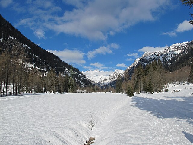
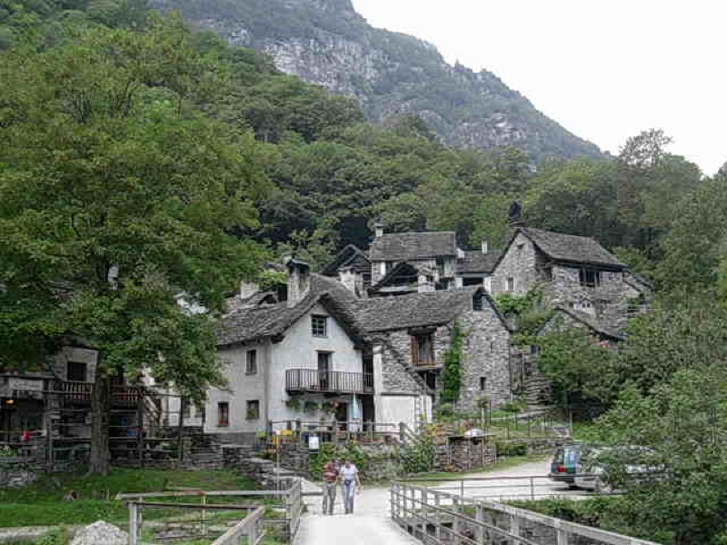
Севио (Cevio, Cevio)

 Hiking in Севио
Cevio is a charming village located in the Maggia Valley in the Canton of Ticino, Switzerland. It's known for its picturesque landscapes, rich history, and the surrounding natural beauty, making it an excellent destination for hiking enthusiasts.
Hiking Trails in Cevio
-
Maggia Valley Trails: Cevio serves as a great starting point for exploring the diverse trails that wind through the Maggia Valley. These trails range from easy walks along the river to more challenging hikes that lead up into the mountains.
-
Cevio to Fusio: This moderate hike takes you from Cevio to the nearby village of Fusio. The trail offers stunning views of the surrounding mountains and valleys, and you'll also encounter traditional stone houses and lush forests along the way.
-
Tacà da Cavagnola: This is a more challenging trail that leads to the stunning site of Tacà da Cavagnola. The hike offers beautiful panoramic views and is a great option for those looking to experience the rugged landscape of the region.
-
Val di Maggia: Explore deeper into the Val di Maggia for various hikes that take you through picturesque landscapes, charming villages, and untouched nature. The trails here can vary significantly in difficulty, catering to all experience levels.
Things to Consider
-
Weather: Always check the weather conditions before heading out, as they can change quickly in the mountains.
-
Trail Conditions: Some trails may be more rugged and demanding than others. Make sure to wear appropriate footwear and carry enough water and snacks.
-
Local Regulations: Be aware of local regulations and guidelines, especially regarding wildlife and protected areas.
-
Guided Hikes: If you're not familiar with the area, consider joining a guided hike. Local guides can provide insights into the natural history and culture of the region.
Facilities
Cevio has several amenities such as restaurants, accommodations, and information centers where you can get maps and additional information about hiking opportunities.
Whether you're a novice hiker or an experienced mountaineer, Cevio and the surrounding areas offer something for everyone in the great outdoors! Always ensure to plan your hike wisely and respect nature!
- Страна:

- Почтовый код: 6675
- Телефонный код: 091
- Код автомобильного номера: TI
- Координаты: 46° 22' 42" N, 8° 32' 32" E


- GPS треки (wikiloc): [Ссылка]
- Высота над уровнем моря: 788 м m
- Площадь: 151.27 кв.км
- Население: 1177
- Веб сайт: http://www.cevio.ch
- Википедия английская: wiki(en)
- Википедия национальная: wiki(de)
- Хранилище Wikidata: Wikidata: Q67675
- Катеория в википедии: [Ссылка]
- код Freebase: [/m/0gxqb4]
- код GeoNames: Альт: [7285458]
- код BNF: [12128595v]
- код VIAF: Альт: [237768525]
- ID отношения в OpenStreetMap: [1684658]
- код GND: Альт: [4213570-9]
- идентификатор местоположения ArchINFORM: [42783]
- идентификатор HDS: [2263]
- код швейцарского муниципалитета: [5310]
Граничит с регионами:
Формацца
- коммуна Италии
Hiking in Формацца
Formazza, located in the northeastern part of Italy's Piedmont region, is a beautiful area renowned for its stunning landscapes, alpine scenery, and rich cultural heritage, making it an exceptional hiking destination. Here are some key points about hiking in Formazza:...
- Страна:

- Почтовый код: 28863
- Телефонный код: 0324
- Код автомобильного номера: VB
- Координаты: 46° 23' 0" N, 8° 26' 0" E
- GPS треки (wikiloc): [Ссылка]
- Высота над уровнем моря: 1280 м m
- Площадь: 130.65 кв.км
- Население: 442
- Веб сайт: [Ссылка]


Bedretto
Hiking in Bedretto
Bedretto, a picturesque valley located in the Swiss Alps, is a fantastic destination for hiking enthusiasts. Nestled between the mountain chains of the Lepontine Alps, it offers breathtaking landscapes, lush meadows, and a range of trails suitable for various skill levels....
- Страна:
- Почтовый код: 6781
- Телефонный код: 091
- Код автомобильного номера: TI
- Координаты: 46° 30' 0" N, 8° 31' 0" E
- GPS треки (wikiloc): [Ссылка]
- Высота над уровнем моря: 1402 м m
- Площадь: 75.2 кв.км
- Население: 109
- Веб сайт: [Ссылка]


Campo
- административная единица в Швейцарии
Hiking in Campo
Campo, located in the beautiful Vallemaggia valley of Switzerland, is a fantastic destination for hiking and enjoying nature. Nestled in the Ticino canton, this region is known for its stunning landscapes, lush greenery, and charming villages....
- Страна:
- Почтовый код: 6684
- Телефонный код: 091
- Код автомобильного номера: TI
- Координаты: 46° 17' 0" N, 8° 29' 0" E
- GPS треки (wikiloc): [Ссылка]
- Высота над уровнем моря: 1405 м m
- Площадь: 43.34 кв.км
- Население: 53
- Веб сайт: [Ссылка]


Cerentino
Hiking in Cerentino
Cerentino, a picturesque village located in the Swiss Alps, is an excellent destination for hiking enthusiasts. The region offers breathtaking landscapes, charming alpine scenery, and a variety of trails suitable for all skill levels....
- Страна:
- Почтовый код: 6683
- Телефонный код: 091
- Код автомобильного номера: TI
- Координаты: 46° 18' 0" N, 8° 32' 0" E
- GPS треки (wikiloc): [Ссылка]
- Высота над уровнем моря: 981 м m
- Площадь: 20.1 кв.км
- Население: 49
- Веб сайт: [Ссылка]


Linescio
Hiking in Linescio
Linescio is a charming village located in the Onsernone Valley, in the Ticino region of Switzerland. This area is known for its stunning natural beauty, making it an excellent destination for hiking enthusiasts. Here are some highlights you can expect when hiking in and around Linescio:...
- Страна:
- Почтовый код: 6682
- Телефонный код: 091
- Код автомобильного номера: TI
- Координаты: 46° 18' 0" N, 8° 35' 0" E
- GPS треки (wikiloc): [Ссылка]
- Высота над уровнем моря: 668 м m
- Площадь: 6.58 кв.км
- Население: 48

Maggia
Hiking in Maggia
Maggia, a picturesque municipality located in the Ticino region of Switzerland, is renowned for its stunning natural landscapes and diverse hiking opportunities. Situated in the Maggia Valley, this area features beautiful scenery with lush forests, dramatic mountain vistas, and the refreshing waters of the Maggia River....
- Страна:
- Почтовый код: 6673
- Телефонный код: 091
- Код автомобильного номера: TI
- Координаты: 46° 16' 9" N, 8° 40' 51" E
- GPS треки (wikiloc): [Ссылка]
- Высота над уровнем моря: 342 м m
- Площадь: 111.07 кв.км
- Население: 2586
- Веб сайт: [Ссылка]


Lavizzara
Hiking in Lavizzara
Lavizzara is a beautiful region located in the southern part of Switzerland, specifically in the Ticino canton. It is well-known for its stunning landscapes, rich natural beauty, and picturesque mountain views, making it an excellent destination for hiking enthusiasts....
- Страна:
- Почтовый код: 6695
- Телефонный код: 091
- Код автомобильного номера: TI
- Координаты: 46° 26' 0" N, 8° 39' 0" E
- GPS треки (wikiloc): [Ссылка]
- Высота над уровнем моря: 702 м m
- Площадь: 187.21 кв.км
- Население: 526
- Веб сайт: [Ссылка]

Brione (Verzasca)
Hiking in Brione (Verzasca)
Hiking in Brione, located in the Verzasca Valley of Switzerland, offers a stunning experience featuring picturesque landscapes, dramatic cliffs, and the beautiful Verzasca River. Here’s what you can expect and some tips for your hiking adventure:...
- Страна:
- Почтовый код: 6634
- Телефонный код: 091
- Код автомобильного номера: TI
- Координаты: 46° 17' 45" N, 8° 47' 27" E
- GPS треки (wikiloc): [Ссылка]
- Высота над уровнем моря: 750 м m
- Площадь: 48.5 кв.км
- Население: 190
- Веб сайт: [Ссылка]


Bosco Gurin
Hiking in Bosco Gurin
Bosco Gurin is a picturesque village located in the Ticino region of Switzerland, known for its stunning natural landscapes, rich history, and charming architecture. Hiking in Bosco Gurin offers a unique combination of serene alpine scenery and cultural exploration. Here are some highlights and tips for hiking in this area:...
- Страна:
- Почтовый код: 6685
- Телефонный код: 091
- Код автомобильного номера: TI
- Координаты: 46° 19' 0" N, 8° 30' 0" E
- GPS треки (wikiloc): [Ссылка]
- Высота над уровнем моря: 1506 м m
- Площадь: 22.06 кв.км
- Население: 50
- Веб сайт: [Ссылка]