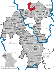
Гюнтерслебен (Güntersleben, Güntersleben)

 Hiking in Гюнтерслебен
Güntersleben, a quaint village located near Würzburg in Bavaria, Germany, offers several opportunities for hiking enthusiasts. While it may not be as well-known as some larger hiking destinations, the surrounding countryside provides picturesque trails and scenic views.
Hiking Trails:
-
Local Paths: Güntersleben has a network of well-marked walking trails that lead through fields, forests, and along the banks of the Main River. These trails are often less crowded and allow for a peaceful hiking experience.
-
Würzburg Trails: The village's proximity to Würzburg means you can easily access trails that start in the city and venture through vineyards and along riverbanks. The trails often offer beautiful vistas overlooking the vineyards and the Main River.
-
Nature Reserves: Explore nearby nature reserves and protected areas. These often have designated hiking paths that allow you to immerse yourself in the local flora and fauna.
Hiking Recommendations:
- Difficulty Levels: Trails in and around Güntersleben vary in difficulty, making it suitable for both beginners and experienced hikers. Check local maps for trail options that suit your fitness level.
- Is it family-friendly? Many paths are suitable for families, with shorter trails ideal for children and less experienced hikers.
- Seasonal Hiking: Each season offers a unique experience. Spring brings blooming flowers, summer has lush greenery, autumn offers vibrant foliage, and winter can provide a quiet, snowy landscape.
Tips for Hiking in Güntersleben:
- Wear Appropriate Footwear: Depending on the trail, sturdy hiking shoes or boots are recommended.
- Stay Hydrated: Bring plenty of water, especially on warmer days.
- Check Weather Conditions: Bavaria can have unpredictable weather, so check the forecast before heading out.
- Consider Local Regulations: Be mindful of local wildlife and stay on marked trails to protect the environment.
Overall, hiking in Güntersleben and the surrounding areas is a delightful way to experience the natural beauty of Bavaria. Enjoy your hike!
- Страна:

- Почтовый код: 97261
- Телефонный код: 09365
- Координаты: 49° 52' 0" N, 9° 54' 0" E


- GPS треки (wikiloc): [Ссылка]
- Высота над уровнем моря: 273 м m
- Площадь: 16.05 кв.км
- Население: 3591
- Веб сайт: https://www.guentersleben.de/
- Википедия русская: wiki(ru)
- Википедия английская: wiki(en)
- Википедия национальная: wiki(de)
- Хранилище Wikidata: Wikidata: Q510716
- Катеория в википедии: [Ссылка]
- код Freebase: [/m/02q953q]
- код GeoNames: Альт: [2913587]
- код VIAF: Альт: [235926678]
- ID отношения в OpenStreetMap: [181169]
- код GND: Альт: [4086848-5]
- идентификатор местоположения ArchINFORM: [11401]
- Bavarikon ID: [ODB_A00000508]
- идентификатор муниципалитетов в Германии: 09679142
Граничит с регионами:

Gramschatzer Wald
Hiking in Gramschatzer Wald
Gramschatzer Wald is a beautiful forested area located in the region of Bavaria, Germany. This vast area offers various opportunities for hiking and outdoor activities, making it a great destination for nature enthusiasts. Here’s what you should know about hiking in Gramschatzer Wald:...
- Страна:
- Координаты: 49° 54' 6" N, 9° 56' 46" E
- GPS треки (wikiloc): [Ссылка]

Рецштадт
Hiking in Рецштадт
Retzstadt, a small picturesque village located in Bavaria, Germany, is a charming destination for hiking enthusiasts. It serves as a gateway to the surrounding natural beauty of the region, which is characterized by rolling hills, vineyards, and scenic landscapes....
- Страна:
- Почтовый код: 97282
- Телефонный код: 09364
- Код автомобильного номера: MSP
- Координаты: 49° 55' 0" N, 9° 53' 0" E
- GPS треки (wikiloc): [Ссылка]
- Высота над уровнем моря: 240 м m
- Площадь: 18.07 кв.км
- Население: 1520
- Веб сайт: [Ссылка]


Тюнгерсхайм
Hiking in Тюнгерсхайм
Thüngersheim is a charming village located in the Würzburg district of Bavaria, Germany, known for its picturesque vineyards and beautiful landscapes. Hiking in and around Thüngersheim offers stunning views of the Main Valley and the surrounding countryside, making it a popular destination for nature lovers and outdoor enthusiasts....
- Страна:
- Почтовый код: 97291
- Телефонный код: 09364
- Координаты: 49° 52' 0" N, 9° 50' 0" E
- GPS треки (wikiloc): [Ссылка]
- Высота над уровнем моря: 169 м m
- Площадь: 11.06 кв.км
- Население: 2453
- Веб сайт: [Ссылка]


Римпар
Hiking in Римпар
Rimpar is a small town in Bavaria, Germany, located near Würzburg. While it may not be a well-known hiking destination compared to larger national parks or mountain ranges, it still offers some pleasant walking and hiking opportunities in the surrounding area. Here are a few key points about hiking in and around Rimpar:...
- Страна:
- Почтовый код: 97222
- Телефонный код: 09365
- Координаты: 49° 51' 0" N, 9° 57' 0" E
- GPS треки (wikiloc): [Ссылка]
- Высота над уровнем моря: 249 м m
- Площадь: 36.42 кв.км
- Население: 7016
- Веб сайт: [Ссылка]


Файтсхёхгайм
Hiking in Файтсхёхгайм
Veitshöchheim is a charming town located in Bavaria, Germany, just a few kilometers from Würzburg. It’s noted for its picturesque scenery along the banks of the Main River, and it offers a variety of hiking opportunities in the surrounding area. Here’s what you can expect when hiking in and around Veitshöchheim:...
- Страна:
- Почтовый код: 97209
- Телефонный код: 0931
- Координаты: 49° 49' 58" N, 9° 52' 54" E
- GPS треки (wikiloc): [Ссылка]
- Высота над уровнем моря: 185 м m
- Площадь: 10.76 кв.км
- Население: 8535
- Веб сайт: [Ссылка]