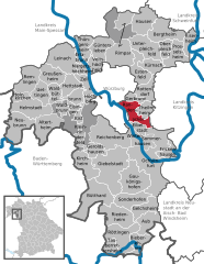
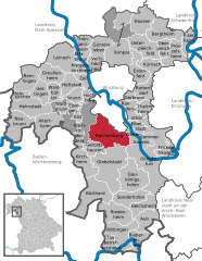
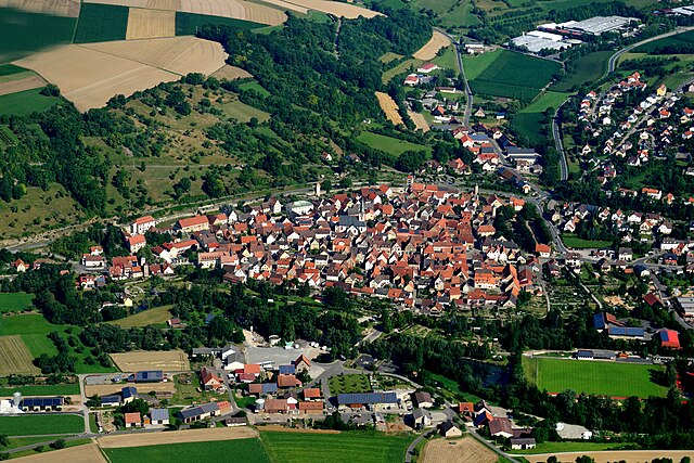
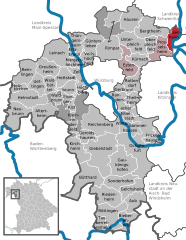
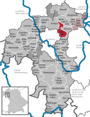
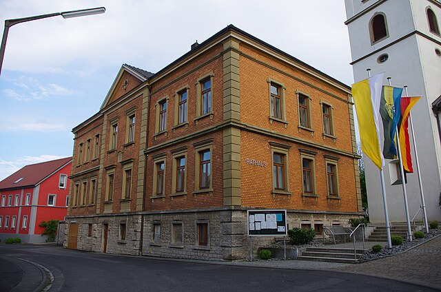
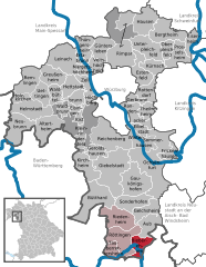
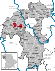
Вюрцбург (Würzburg, Landkreis Würzburg)
.svg)
 Hiking in Вюрцбург
Würzburg, located in the Lower Franconia region of Bavaria, Germany, is surrounded by beautiful landscapes, making it a great starting point for hiking adventures. Here are some highlights and considerations for hiking in and around the Würzburg district:
Natural Landscapes
-
Main River: The Main River provides scenic paths along its banks, perfect for leisurely hikes or walks. The trails often feature picturesque views of the vineyards and the city.
-
Vineyard Trails: The wine-growing region around Würzburg offers several vineyard hiking trails. The "Vineyard Trail" (Weinwanderweg) winds through the hills and provides opportunities to sample local wines.
-
Hassberge Nature Park: A short drive from Würzburg, this nature park offers a variety of trails through forests, rolling hills, and charming villages. It's ideal for those looking for more rugged terrain.
-
Mainschleife: This loop around the Main River provides stunning views and a mix of terrains, including forested areas and open fields. It's excellent for both hiking and cycling.
Popular Hiking Routes
- The Main Trail: A well-marked path that runs along the Main River, offering both short and long-distance options.
- The Romantic Road (Romantische Straße): While not strictly a hiking trail, parts of this famous route can be explored through hiking, with various charming towns and scenic vistas along the way.
- Circle of Wuerzburg: A circular hiking route that combines urban and nature experiences, taking you through parks, by the river, and toward the vineyards.
Hiking Tips
- Best Time to Hike: Late spring through early fall is ideal when the weather is milder and the landscapes are lush.
- Local Information: Always check local hiking maps or the tourist information center in Würzburg for updated trail information, maps, and recommendations.
- Safety: Make sure to wear appropriate footwear, carry enough water, and be prepared for sudden weather changes.
Additional Attractions
After a day of hiking, Würzburg offers a wealth of cultural experiences, including the UNESCO-listed Würzburg Residence, beautiful baroque architecture, and a vibrant dining scene featuring local wines and cuisine.
Overall, hiking in Würzburg provides a harmonious mix of nature, culture, and history, making it an excellent choice for outdoor enthusiasts.
- Страна:

- Столица: Вюрцбург
- Код автомобильного номера: OCH; WÜ
- Координаты: 49° 39' 36" N, 10° 0' 0" E


- GPS треки (wikiloc): [Ссылка]
- Высота над уровнем моря: 346 м m
- Площадь: 967.56 кв.км
- Население: 161340
- Веб сайт: http://www.landkreis-wuerzburg.de/
- Википедия русская: wiki(ru)
- Википедия английская: wiki(en)
- Википедия национальная: wiki(de)
- Хранилище Wikidata: Wikidata: Q10458
- Катеория в википедии: [Ссылка]
- Карты в википедии: [Ссылка]
- код Freebase: [/m/02g8xf]
- код GeoNames: Альт: [3220898]
- код VIAF: Альт: [235033291]
- ID отношения в OpenStreetMap: [62465]
- код GND: Альт: [4067038-7]
- идентификатор местоположения ArchINFORM: [2676]
- код LCNAF: Альт: [nr90015672]
- код TGN: [7077073]
- Bavarikon ID: [ODB_A00000492]
- код NUTS: [DE26C]
- код района Германии: 09679
Включает регионы:

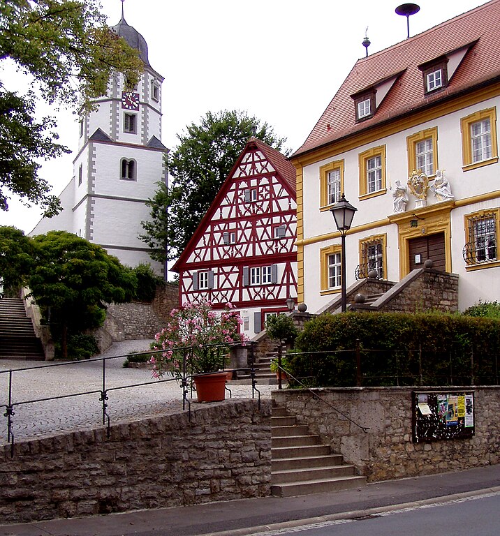
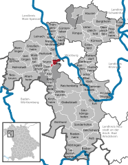
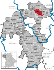
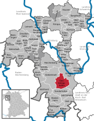
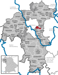
Рандерзаккер
Hiking in Рандерзаккер
Randersacker, located in Bavaria, Germany, is known for its picturesque vineyards and scenic landscapes, making it an excellent destination for hiking enthusiasts. The area offers various trails that cater to different levels of hikers, from leisurely walks to more challenging hikes....
- Страна:
- Почтовый код: 97236
- Телефонный код: 0931
- Координаты: 49° 45' 32" N, 9° 58' 58" E
- GPS треки (wikiloc): [Ссылка]
- Высота над уровнем моря: 175 м m
- Площадь: 16.20 кв.км
- Население: 3366
- Веб сайт: [Ссылка]
Irtenberger Wald
Hiking in Irtenberger Wald
Irtenberger Wald, located in Bavaria, Germany, is a beautiful area known for its lush forests, diverse wildlife, and serene landscapes, making it a great hiking destination. Here are some key points to consider for your hiking adventure in Irtenberger Wald:...
- Страна:
- Координаты: 49° 44' 36" N, 9° 48' 0" E
- GPS треки (wikiloc): [Ссылка]

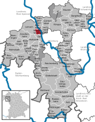
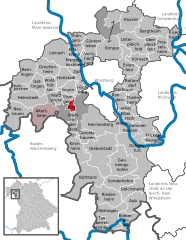
Винтерхаузен
Hiking in Винтерхаузен
Winterhausen is a charming village located in Germany, known for its picturesque landscapes and access to beautiful hiking trails. While it may not be as widely recognized as some of the larger hiking destinations, it offers a delightful experience for outdoor enthusiasts, especially those looking for a peaceful escape in nature....
- Страна:
- Почтовый код: 97286
- Телефонный код: 09333
- Координаты: 49° 42' 0" N, 10° 1' 0" E
- GPS треки (wikiloc): [Ссылка]
- Высота над уровнем моря: 188 м m
- Площадь: 8.73 кв.км
- Население: 1209
- Веб сайт: [Ссылка]

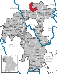
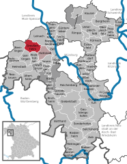
Gramschatzer Wald
Hiking in Gramschatzer Wald
Gramschatzer Wald is a beautiful forested area located in the region of Bavaria, Germany. This vast area offers various opportunities for hiking and outdoor activities, making it a great destination for nature enthusiasts. Here’s what you should know about hiking in Gramschatzer Wald:...
- Страна:
- Координаты: 49° 54' 6" N, 9° 56' 46" E
- GPS треки (wikiloc): [Ссылка]


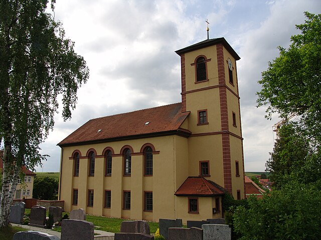
Бергтайм
Hiking in Бергтайм
Bergtheim is a quaint village located in the Würzburg district of Bavaria, Germany. While it may not be as widely known as some of the larger hiking regions in Bavaria, it offers beautiful countryside and scenic trails that are suitable for hiking enthusiasts of varying skill levels....
- Страна:
- Почтовый код: 97241
- Телефонный код: 09367
- Координаты: 49° 54' 0" N, 10° 4' 0" E
- GPS треки (wikiloc): [Ссылка]
- Высота над уровнем моря: 216 м m
- Площадь: 26.48 кв.км
- Население: 2874
- Веб сайт: [Ссылка]

Альтертайм
Hiking in Альтертайм
Altertheim is a small municipality in Germany, located in the Bavarian region of Lower Franconia. While it's not widely recognized as a major hiking destination, the surrounding areas of Franconia offer beautiful landscapes and opportunities for outdoor activities, including hiking....
- Страна:
- Почтовый код: 97237
- Телефонный код: 09307
- Координаты: 49° 43' 0" N, 9° 45' 0" E
- GPS треки (wikiloc): [Ссылка]
- Высота над уровнем моря: 305 м m
- Площадь: 24.08 кв.км
- Население: 1775
- Веб сайт: [Ссылка]

Райхенберг
Hiking in Райхенберг
Reichenberg, located in Bavaria, Germany, offers some beautiful hiking opportunities, particularly due to its scenic landscapes and proximity to the mountains. Here are a few highlights about hiking in this area:...
- Страна:
- Почтовый код: 97234
- Телефонный код: 0931
- Код автомобильного номера: WÜ, OCH
- Координаты: 49° 43' 54" N, 9° 55' 6" E
- GPS треки (wikiloc): [Ссылка]
- Высота над уровнем моря: 231 м m
- Площадь: 35 кв.км
- Население: 4035
- Веб сайт: [Ссылка]


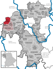
Guttenberger Wald
Hiking in Guttenberger Wald
Guttenberger Wald is a beautiful forested area located in Germany. It offers a variety of trails and natural scenery that make it an excellent destination for hiking enthusiasts. Here are some key points you may find helpful when considering a hike in Guttenberger Wald:...
- Страна:
- Координаты: 49° 44' 0" N, 9° 53' 0" E
- GPS треки (wikiloc): [Ссылка]
- Высота над уровнем моря: 362 м m


Ауб
Hiking in Ауб
Aub, located in the Aube department in the Grand Est region of France, offers some beautiful hiking opportunities. The area is characterized by rolling hills, picturesque vineyards, and scenic countryside, making it a great destination for outdoor enthusiasts....
- Страна:
- Почтовый код: 97239
- Телефонный код: 09335
- Координаты: 49° 32' 0" N, 10° 3' 0" E
- GPS треки (wikiloc): [Ссылка]
- Высота над уровнем моря: 310 м m
- Площадь: 17.54 кв.км
- Население: 1631
- Веб сайт: [Ссылка]


Лайнах
Hiking in Лайнах
Leinach, located in Bavaria, Germany, offers beautiful landscapes and a variety of hiking trails suitable for different skill levels. The area is characterized by rolling hills, lush forests, and picturesque views of the surrounding countryside. Here are some highlights and tips for hiking in Leinach:...
- Страна:
- Почтовый код: 97274
- Телефонный код: 09364
- Координаты: 49° 52' 0" N, 9° 48' 0" E
- GPS треки (wikiloc): [Ссылка]
- Высота над уровнем моря: 280 м m
- Площадь: 28.02 кв.км
- Население: 2568
- Веб сайт: [Ссылка]


Целль-на-Майне
Hiking in Целль-на-Майне
Zell am Main is a picturesque village located in Bavaria, Germany, known for its beautiful landscapes and outdoor activities, including hiking. The area offers a variety of trails suitable for different skill levels, from easy walks to more challenging hikes, making it an excellent destination for both beginners and experienced hikers....
- Страна:
- Почтовый код: 97299
- Телефонный код: 0931
- Координаты: 49° 49' 0" N, 9° 52' 0" E
- GPS треки (wikiloc): [Ссылка]
- Высота над уровнем моря: 179 м m
- Площадь: 9.96 кв.км
- Население: 3226
- Веб сайт: [Ссылка]


Нойбрунн
Hiking in Нойбрунн
Neubrunn, located in Lower Franconia, Germany, is an excellent spot for hiking enthusiasts. This charming small town is surrounded by picturesque landscapes, including rolling hills, vineyards, and lush forests, making it a delightful area for outdoor activities....
- Страна:
- Почтовый код: 97277
- Телефонный код: 09307
- Координаты: 49° 44' 0" N, 9° 40' 0" E
- GPS треки (wikiloc): [Ссылка]
- Высота над уровнем моря: 293 м m
- Площадь: 26.54 кв.км
- Население: 2124
- Веб сайт: [Ссылка]

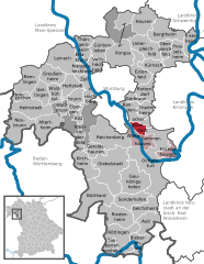
Айбельштадт
- город в Германии
Hiking in Айбельштадт
Eibelstadt is a picturesque town located in Bavaria, Germany, near the scenic Main River. The surrounding region offers beautiful landscapes that are ideal for hiking enthusiasts. Here are some highlights of hiking in and around Eibelstadt:...
- Страна:
- Почтовый код: 97246
- Телефонный код: 09303
- Код автомобильного номера: WÜ, OCH
- Координаты: 49° 43' 26" N, 10° 0' 3" E
- GPS треки (wikiloc): [Ссылка]
- Высота над уровнем моря: 180 м m
- Площадь: 7 кв.км
- Население: 2279
- Веб сайт: [Ссылка]


Эрлабрунн
Hiking in Эрлабрунн
Erlabrunn, a picturesque village in Bavaria, Germany, offers several opportunities for hiking enthusiasts. Nestled in the lush countryside and close to the stunning landscape of the Franconian Switzerland region, it provides a serene environment for walkers and nature lovers....
- Страна:
- Почтовый код: 97250
- Телефонный код: 09364
- Координаты: 49° 52' 0" N, 9° 51' 0" E
- GPS треки (wikiloc): [Ссылка]
- Высота над уровнем моря: 180 м m
- Площадь: 4.01 кв.км
- Население: 1320
- Веб сайт: [Ссылка]


Хельмштадт
Hiking in Хельмштадт
Helmstadt, a small village in Germany, offers a variety of hiking opportunities that cater to different skill levels. The surrounding landscape is characterized by rolling hills, dense forests, and picturesque countryside, making it ideal for both casual walkers and more seasoned hikers. Here are some key points to consider for hiking in and around Helmstadt:...
- Страна:
- Почтовый код: 97264
- Телефонный код: 09397; 09369
- Координаты: 49° 46' 0" N, 9° 43' 0" E
- GPS треки (wikiloc): [Ссылка]
- Высота над уровнем моря: 301 м m
- Площадь: 22.80 кв.км
- Население: 2307
- Веб сайт: [Ссылка]
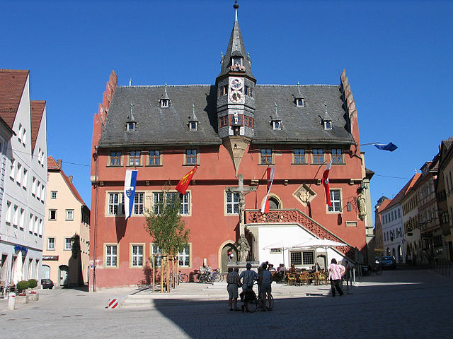
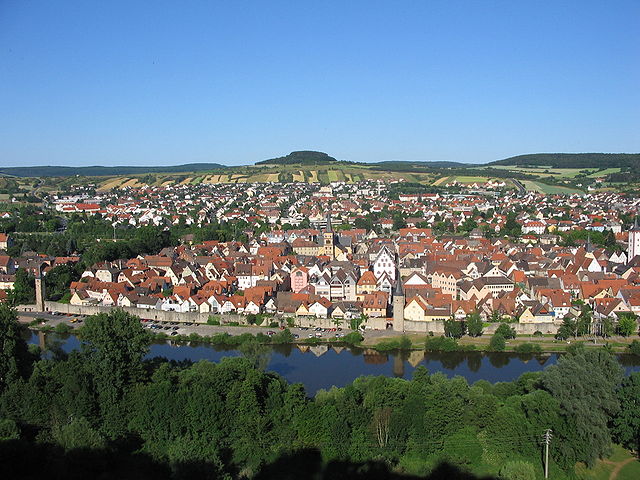
Оксенфурт
Hiking in Оксенфурт
Ochsenfurt, located in Bavaria, Germany, is a charming town that offers various opportunities for hiking and enjoying the beautiful Franconian landscape. While the town itself is known for its picturesque medieval architecture and scenic views of the Main River, the surrounding countryside provides several trails and routes that cater to different levels of hikers....
- Страна:
- Почтовый код: 97199
- Телефонный код: 09331
- Координаты: 49° 39' 0" N, 10° 4' 0" E
- GPS треки (wikiloc): [Ссылка]
- Высота над уровнем моря: 187 м m
- Площадь: 63.55 кв.км
- Население: 11155
- Веб сайт: [Ссылка]

Рёттинген
Hiking in Рёттинген
Röttingen, a picturesque town in Bavaria, Germany, offers a beautiful backdrop for hiking enthusiasts. Nestled in the midst of the Franconian countryside, it features rolling hills, vineyards, and charming medieval architecture. Here are some highlights to consider when hiking in and around Röttingen:...
- Страна:
- Почтовый код: 97285
- Телефонный код: 09338
- Координаты: 49° 30' 0" N, 9° 58' 0" E
- GPS треки (wikiloc): [Ссылка]
- Высота над уровнем моря: 243 м m
- Площадь: 27.19 кв.км
- Население: 1733
- Веб сайт: [Ссылка]


Проссельсхайм
Hiking in Проссельсхайм
Prosselsheim is a quaint village in Bavaria, Germany, situated along the Main River. While it may not be as well-known for hiking as some other areas in Bavaria, it offers a peaceful setting with beautiful natural surroundings that can be explored on foot....
- Страна:
- Почтовый код: 97279
- Телефонный код: 09386
- Координаты: 49° 52' 0" N, 10° 8' 0" E
- GPS треки (wikiloc): [Ссылка]
- Высота над уровнем моря: 269 м m
- Площадь: 20.03 кв.км
- Население: 989
- Веб сайт: [Ссылка]


Фриккенхаузен-на-Майне
Hiking in Фриккенхаузен-на-Майне
Frickenhausen am Main is a scenic destination located in Bavaria, Germany, known for its beautiful landscapes and hiking opportunities. The region offers a mix of natural beauty, including vineyards, forests, and views of the Main River, making it an enjoyable place for outdoor enthusiasts....
- Страна:
- Почтовый код: 97252
- Телефонный код: 09331
- Координаты: 49° 40' 0" N, 10° 5' 0" E
- GPS треки (wikiloc): [Ссылка]
- Высота над уровнем моря: 180 м m
- Площадь: 10.55 кв.км
- Население: 1236
- Веб сайт: [Ссылка]

Айзенхайм
Hiking in Айзенхайм
Eisenheim, located in Germany, is surrounded by beautiful natural landscapes, making it a great destination for hiking enthusiasts. While the area may not be as well-known as some of Germany's larger hiking regions, it offers a variety of trails suited for different skill levels, from leisurely walks to more challenging hikes....
- Страна:
- Почтовый код: 97247
- Телефонный код: 09386
- Координаты: 49° 53' 0" N, 10° 10' 0" E
- GPS треки (wikiloc): [Ссылка]
- Высота над уровнем моря: 197 м m
- Площадь: 11.56 кв.км
- Население: 1177
- Веб сайт: [Ссылка]
Оберплайхфельд
Hiking in Оберплайхфельд
Oberpleichfeld is a small municipality in Bavaria, Germany, known for its picturesque landscapes and tranquil hiking opportunities. The area around Oberpleichfeld offers various hiking trails that cater to different skill levels, providing a chance to explore the beautiful Bavarian countryside....
- Страна:
- Почтовый код: 97241
- Телефонный код: 09367
- Координаты: 49° 53' 0" N, 10° 5' 0" E
- GPS треки (wikiloc): [Ссылка]
- Высота над уровнем моря: 263 м m
- Площадь: 8.66 кв.км
- Население: 908
- Веб сайт: [Ссылка]

Тайльхайм
Hiking in Тайльхайм
Theilheim, a small village in Bavaria, Germany, is surrounded by scenic landscapes that make it an appealing destination for hiking enthusiasts. While it may not be as widely recognized as other hiking hotspots, it offers several opportunities to explore the beautiful countryside, wooded areas, and charming farms....
- Страна:
- Почтовый код: 97288
- Телефонный код: 09303
- Координаты: 49° 45' 0" N, 10° 2' 0" E
- GPS треки (wikiloc): [Ссылка]
- Высота над уровнем моря: 231 м m
- Площадь: 9.69 кв.км
- Население: 2067
- Веб сайт: [Ссылка]
Эстенфельд
Hiking in Эстенфельд
Estenfeld, located in Bavaria, Germany, offers a variety of hiking opportunities suitable for different skill levels. While the area is not as widely known as some larger national parks or mountain ranges, it does have appealing natural scenery and scenic trails that can make for a pleasant outdoor experience....
- Страна:
- Почтовый код: 97230
- Телефонный код: 09305
- Координаты: 49° 49' 41" N, 10° 0' 27" E
- GPS треки (wikiloc): [Ссылка]
- Высота над уровнем моря: 246 м m
- Площадь: 18.12 кв.км
- Население: 4391
- Веб сайт: [Ссылка]
Риденхайм
Hiking in Риденхайм
Riedenheim is a small village in Germany, located in a picturesque setting that is ideal for hiking enthusiasts. While it may not be as well-known as other hiking destinations, it offers a charming experience for those looking to explore nature away from the more crowded trails....
- Страна:
- Почтовый код: 97283
- Телефонный код: 09338
- Координаты: 49° 33' 0" N, 9° 59' 0" E
- GPS треки (wikiloc): [Ссылка]
- Высота над уровнем моря: 313 м m
- Площадь: 23.99 кв.км
- Население: 755
- Веб сайт: [Ссылка]

Хёхберг
Hiking in Хёхберг
Höchberg is a charming village located in Bavaria, Germany, near Würzburg. While it may not be as well-known for its hiking trails as some larger regions, there are still opportunities for enjoyable outdoor experiences in and around Höchberg....
- Страна:
- Почтовый код: 97204
- Телефонный код: 0931
- Координаты: 49° 46' 59" N, 9° 52' 54" E
- GPS треки (wikiloc): [Ссылка]
- Высота над уровнем моря: 280 м m
- Площадь: 7.55 кв.км
- Население: 8761
- Веб сайт: [Ссылка]
Хетштадт
Hiking in Хетштадт
Hettstadt is a charming municipality located in the Lower Franconia region of Bavaria, Germany. It’s surrounded by beautiful landscapes, making it a great destination for hiking enthusiasts. Here are a few highlights about hiking in and around Hettstadt:...
- Страна:
- Почтовый код: 97265
- Телефонный код: 0931
- Координаты: 49° 48' 0" N, 9° 49' 0" E
- GPS треки (wikiloc): [Ссылка]
- Высота над уровнем моря: 307 м m
- Площадь: 13.92 кв.км
- Население: 2235
- Веб сайт: [Ссылка]


Клайнриндерфельд
Hiking in Клайнриндерфельд
Kleinrinderfeld is a small municipality located in Bavaria, Germany, and while it is not a major hiking destination, it offers a charming landscape for those looking to enjoy nature and outdoor activities. Here are some details about hiking in the area:...
- Страна:
- Почтовый код: 97271
- Телефонный код: 09366
- Координаты: 49° 42' 0" N, 9° 51' 0" E
- GPS треки (wikiloc): [Ссылка]
- Высота над уровнем моря: 331 м m
- Площадь: 7.74 кв.км
- Население: 1823
- Веб сайт: [Ссылка]


Хаузен-Вюрцбург
Hiking in Хаузен-Вюрцбург
Hausen bei Würzburg is a picturesque village located near the city of Würzburg in Bavaria, Germany. The surrounding area offers several hiking opportunities that are suitable for various skill levels, with beautiful landscapes, vineyards, and scenic views over the Main River and the Würzburg area....
- Страна:
- Почтовый код: 97262
- Телефонный код: 09367
- Координаты: 49° 56' 0" N, 10° 1' 0" E
- GPS треки (wikiloc): [Ссылка]
- Высота над уровнем моря: 272 м m
- Площадь: 21.97 кв.км
- Население: 1954
- Веб сайт: [Ссылка]


Иттинген
Hiking in Иттинген
Uettingen, a small village in Bavaria, Germany, is situated near the banks of the Main River, providing a picturesque setting for outdoor enthusiasts. While Uettingen itself may not be a major hiking destination, there are several opportunities for hiking and enjoying nature in the surrounding areas....
- Страна:
- Почтовый код: 97292
- Телефонный код: 09369
- Координаты: 49° 48' 0" N, 9° 44' 0" E
- GPS треки (wikiloc): [Ссылка]
- Высота над уровнем моря: 242 м m
- Площадь: 13.52 кв.км
- Население: 1401
- Веб сайт: [Ссылка]
Гюнтерслебен
Hiking in Гюнтерслебен
Güntersleben, a quaint village located near Würzburg in Bavaria, Germany, offers several opportunities for hiking enthusiasts. While it may not be as well-known as some larger hiking destinations, the surrounding countryside provides picturesque trails and scenic views....
- Страна:
- Почтовый код: 97261
- Телефонный код: 09365
- Координаты: 49° 52' 0" N, 9° 54' 0" E
- GPS треки (wikiloc): [Ссылка]
- Высота над уровнем моря: 273 м m
- Площадь: 16.05 кв.км
- Население: 3591
- Веб сайт: [Ссылка]

Бюттард
Hiking in Бюттард
Bütthard is a charming village located in the Franconian region of Bavaria, Germany. While it may not be as well-known as some of the larger hiking destinations in the area, it offers a peaceful environment and beautiful landscapes for walkers and nature enthusiasts....
- Страна:
- Почтовый код: 97244
- Телефонный код: 09336
- Координаты: 49° 36' 0" N, 9° 53' 0" E
- GPS треки (wikiloc): [Ссылка]
- Высота над уровнем моря: 290 м m
- Площадь: 36.26 кв.км
- Население: 1318
- Веб сайт: [Ссылка]


Зоммерхаузен
Hiking in Зоммерхаузен
Sommerhausen is a picturesque village located in Bavaria, Germany, known for its charming streets, vineyards, and the scenic beauty of the surrounding area. Hiking around Sommerhausen offers a delightful experience with varied landscapes including hills, forests, and views of the Main River. Here are some highlights and tips for hiking in this region:...
- Страна:
- Почтовый код: 97286
- Телефонный код: 09333
- Координаты: 49° 42' 0" N, 10° 2' 0" E
- GPS треки (wikiloc): [Ссылка]
- Высота над уровнем моря: 181 м m
- Площадь: 7.22 кв.км
- Население: 1403
- Веб сайт: [Ссылка]

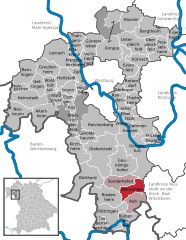
Зондерхофен
Hiking in Зондерхофен
Sonderhofen is a serene village located in Bavaria, Germany, surrounded by picturesque countryside and scenic landscapes, making it a great spot for hiking enthusiasts. While it may not be as well-known as the larger hiking regions in the Bavarian Alps, it offers a variety of hiking trails that can cater to different skill levels....
- Страна:
- Почтовый код: 97255
- Телефонный код: 09337
- Координаты: 49° 36' 0" N, 10° 0' 0" E
- GPS треки (wikiloc): [Ссылка]
- Высота над уровнем моря: 293 м m
- Площадь: 18.8 кв.км
- Население: 791
- Веб сайт: [Ссылка]
Унтерплайхфельд
Hiking in Унтерплайхфельд
Unterpleichfeld is a charming village located in Bavaria, Germany, situated not far from the city of Würzburg. The surrounding region offers a variety of hiking opportunities that cater to different skill levels, making it an inviting destination for both novice and seasoned hikers....
- Страна:
- Почтовый код: 97294
- Телефонный код: 09367
- Координаты: 49° 52' 8" N, 10° 2' 38" E
- GPS треки (wikiloc): [Ссылка]
- Высота над уровнем моря: 265 м m
- Площадь: 23.93 кв.км
- Население: 2376
- Веб сайт: [Ссылка]

Маргетсхёхгайм
Hiking in Маргетсхёхгайм
Margetshöchheim is a small municipality near Würzburg, Germany, known for its picturesque landscapes and access to beautiful hiking trails. The area is characterized by its rolling hills, vineyards, and views of the Main River, making it a charming destination for outdoor enthusiasts....
- Страна:
- Почтовый код: 97276
- Телефонный код: 0931
- Координаты: 49° 50' 0" N, 9° 51' 0" E
- GPS треки (wikiloc): [Ссылка]
- Высота над уровнем моря: 170 м m
- Площадь: 6.67 кв.км
- Население: 2768
- Веб сайт: [Ссылка]


Тюнгерсхайм
Hiking in Тюнгерсхайм
Thüngersheim is a charming village located in the Würzburg district of Bavaria, Germany, known for its picturesque vineyards and beautiful landscapes. Hiking in and around Thüngersheim offers stunning views of the Main Valley and the surrounding countryside, making it a popular destination for nature lovers and outdoor enthusiasts....
- Страна:
- Почтовый код: 97291
- Телефонный код: 09364
- Координаты: 49° 52' 0" N, 9° 50' 0" E
- GPS треки (wikiloc): [Ссылка]
- Высота над уровнем моря: 169 м m
- Площадь: 11.06 кв.км
- Население: 2453
- Веб сайт: [Ссылка]


Тауберреттерсхайм
Hiking in Тауберреттерсхайм
Tauberrettersheim is a small village in the Franconia region of Bavaria, Germany, nestled near the scenic Tauber River. While it may not be as widely known as some larger hiking destinations, the area offers charming trails that allow hikers to explore the beautiful Franconian countryside....
- Страна:
- Почтовый код: 97285
- Телефонный код: 09338
- Координаты: 49° 29' 40" N, 9° 56' 12" E
- GPS треки (wikiloc): [Ссылка]
- Высота над уровнем моря: 188 м m
- Площадь: 8.56 кв.км
- Население: 754
- Веб сайт: [Ссылка]


Римпар
Hiking in Римпар
Rimpar is a small town in Bavaria, Germany, located near Würzburg. While it may not be a well-known hiking destination compared to larger national parks or mountain ranges, it still offers some pleasant walking and hiking opportunities in the surrounding area. Here are a few key points about hiking in and around Rimpar:...
- Страна:
- Почтовый код: 97222
- Телефонный код: 09365
- Координаты: 49° 51' 0" N, 9° 57' 0" E
- GPS треки (wikiloc): [Ссылка]
- Высота над уровнем моря: 249 м m
- Площадь: 36.42 кв.км
- Население: 7016
- Веб сайт: [Ссылка]


Роттендорф
Hiking in Роттендорф
Rottendorf, located in Bavaria, Germany, is a quaint village that offers some beautiful hiking opportunities, especially if you enjoy exploring rolling hills, lush forests, and scenic countryside. Here are a few insights into hiking in the area:...
- Страна:
- Почтовый код: 97228
- Телефонный код: 09302
- Код автомобильного номера: WÜ, OCH
- Координаты: 49° 47' 26" N, 10° 1' 36" E
- GPS треки (wikiloc): [Ссылка]
- Высота над уровнем моря: 252 м m
- Площадь: 15 кв.км
- Население: 4286
- Веб сайт: [Ссылка]

Гельксхайм
Hiking in Гельксхайм
Gelchsheim is a small village located in Bavaria, Germany, and while it might not be as widely known for hiking as some other areas in the region, it can still offer enjoyable experiences for those looking to explore the natural landscape....
- Страна:
- Почтовый код: 97255
- Телефонный код: 09335
- Координаты: 49° 34' 0" N, 10° 1' 0" E
- GPS треки (wikiloc): [Ссылка]
- Высота над уровнем моря: 304 м m
- Площадь: 15.75 кв.км
- Население: 855
- Веб сайт: [Ссылка]

Биберерен
Hiking in Биберерен
Bieberehren is a small village in Bavaria, Germany, known for its picturesque landscapes and inviting hiking trails. While it may not be as well-known as larger hiking destinations, it offers a charming experience for nature enthusiasts....
- Страна:
- Почтовый код: 97243
- Телефонный код: 09338
- Координаты: 49° 30' 56" N, 10° 0' 28" E
- GPS треки (wikiloc): [Ссылка]
- Высота над уровнем моря: 248 м m
- Площадь: 14.83 кв.км
- Население: 988
- Веб сайт: [Ссылка]

Гаукёнигсхофен
Hiking in Гаукёнигсхофен
Gaukönigshofen is a small village located in Bavaria, Germany, near Würzburg. While it may not be as prominent as some of the larger hiking destinations in Germany, it offers a few lovely nearby trails and scenic countryside for those looking to enjoy the outdoors....
- Страна:
- Почтовый код: 97253
- Телефонный код: 09337
- Координаты: 49° 38' 0" N, 10° 0' 0" E
- GPS треки (wikiloc): [Ссылка]
- Высота над уровнем моря: 270 м m
- Площадь: 31.98 кв.км
- Население: 1938
- Веб сайт: [Ссылка]
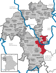
Кирхгайм
- муниципалитет в Германии, Бавария
Hiking in Кирхгайм
Kirchheim in Lower Franconia is a charming area for hiking enthusiasts, offering a variety of scenic trails that showcase the beautiful landscapes of the region. Here are some highlights and tips for hiking in this area:...
- Страна:
- Почтовый код: 97268
- Телефонный код: 09366
- Координаты: 49° 39' 0" N, 9° 52' 0" E
- GPS треки (wikiloc): [Ссылка]
- Высота над уровнем моря: 277 м m
- Площадь: 18.99 кв.км
- Население: 2008
- Веб сайт: [Ссылка]


Герольдсхаузен
Hiking in Герольдсхаузен
Geroldshausen is a small village in Bavaria, Germany, situated near the scenic landscapes of the Franconian region. While it may not be as widely recognized as other hiking destinations, it offers beautiful trails and the chance to explore the natural beauty and charm of the Bavarian countryside....
- Страна:
- Почтовый код: 97256
- Телефонный код: 09366
- Координаты: 49° 41' 0" N, 9° 54' 0" E
- GPS треки (wikiloc): [Ссылка]
- Высота над уровнем моря: 313 м m
- Площадь: 10.40 кв.км
- Население: 1011
- Веб сайт: [Ссылка]

Гройсенхайм
Hiking in Гройсенхайм
Greußenheim is a small municipality in Bavaria, Germany, situated near the scenic landscapes of the Fränkisches Würzburg region, which makes it an attractive destination for hiking enthusiasts. Here are some highlights about hiking in and around Greußenheim:...
- Страна:
- Почтовый код: 97259
- Телефонный код: 09369
- Координаты: 49° 49' 0" N, 9° 46' 0" E
- GPS треки (wikiloc): [Ссылка]
- Высота над уровнем моря: 259 м m
- Площадь: 17.66 кв.км
- Население: 1251
- Веб сайт: [Ссылка]


Хольцкирхен
Hiking in Хольцкирхен
Holzkirchen, located in Lower Franconia, Germany, is a charming village that offers a range of hiking opportunities in its picturesque surroundings. Here are some key points to consider for hiking in and around Holzkirchen:...
- Страна:
- Почтовый код: 97292
- Телефонный код: 09369
- Координаты: 49° 47' 0" N, 9° 41' 0" E
- GPS треки (wikiloc): [Ссылка]
- Высота над уровнем моря: 198 м m
- Площадь: 8.42 кв.км
- Население: 945
- Веб сайт: [Ссылка]

Ремлинген
Hiking in Ремлинген
Remlingen, located in Bavaria, Germany, is a charming small village that offers a variety of outdoor activities, including hiking. Nestled in the scenic landscapes of Southern Germany, it serves as a great starting point for exploring the natural beauty of the region. Here are some highlights and suggestions for hiking in and around Remlingen:...
- Страна:
- Почтовый код: 97280
- Телефонный код: 09369
- Координаты: 49° 48' 16" N, 9° 41' 39" E
- GPS треки (wikiloc): [Ссылка]
- Высота над уровнем моря: 261 м m
- Площадь: 20.44 кв.км
- Население: 1371
- Веб сайт: [Ссылка]


Кюрнах
Hiking in Кюрнах
Kürnach, a small municipality in Bavaria, Germany, is surrounded by beautiful natural landscapes that offer excellent hiking opportunities. The region is characterized by its gentle rolling hills, lush forests, and scenic views, making it a great destination for both beginner and experienced hikers....
- Страна:
- Почтовый код: 97273
- Телефонный код: 09367
- Координаты: 49° 51' 0" N, 10° 2' 0" E
- GPS треки (wikiloc): [Ссылка]
- Высота над уровнем моря: 268 м m
- Площадь: 12.29 кв.км
- Население: 2849
- Веб сайт: [Ссылка]


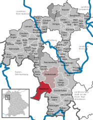
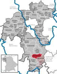
Гибельштадт
Hiking in Гибельштадт
Giebelstadt, located in Bavaria, Germany, is a charming small town that, while not as widely known as some major hiking destinations, offers access to beautiful hiking opportunities in the surrounding region. The area is characterized by rolling hills, forests, and picturesque landscapes, making it suitable for both casual and more adventurous hikers....
- Страна:
- Почтовый код: 97232
- Телефонный код: 09334
- Код автомобильного номера: WÜ, OCH
- Координаты: 49° 39' 0" N, 9° 57' 0" E
- GPS треки (wikiloc): [Ссылка]
- Высота над уровнем моря: 300 м m
- Площадь: 48 кв.км
- Население: 3642
- Веб сайт: [Ссылка]

Вальдбюттельбрунн
Hiking in Вальдбюттельбрунн
Waldbüttelbrunn is a charming municipality located in the state of Bavaria, Germany, not far from the city of Würzburg. The area is known for its beautiful landscapes, rolling hills, and scenic woodlands, making it an excellent destination for hiking enthusiasts. Here are some highlights and tips for hiking in and around Waldbüttelbrunn:...
- Страна:
- Почтовый код: 97297
- Телефонный код: 0931
- Координаты: 49° 46' 0" N, 9° 50' 0" E
- GPS треки (wikiloc): [Ссылка]
- Высота над уровнем моря: 320 м m
- Площадь: 19.10 кв.км
- Население: 4066
- Веб сайт: [Ссылка]
Айзинген
Hiking in Айзинген
Eisingen, a small village located in Bavaria, Germany, is surrounded by beautiful landscapes that offer opportunities for hiking enthusiasts. Here are some key points about hiking in the area:...
- Страна:
- Почтовый код: 97249
- Телефонный код: 09306
- Координаты: 49° 45' 32" N, 9° 49' 43" E
- GPS треки (wikiloc): [Ссылка]
- Высота над уровнем моря: 316 м m
- Площадь: 5.32 кв.км
- Население: 2492
- Веб сайт: [Ссылка]

Гербрунн
Hiking in Гербрунн
Gerbrunn is a small municipality located near Würzburg in Bavaria, Germany. It offers a variety of scenic hiking opportunities in and around the region. Here are some highlights regarding hiking in Gerbrunn:...
- Страна:
- Почтовый код: 97218
- Телефонный код: 0931
- Координаты: 49° 46' 31" N, 9° 59' 37" E
- GPS треки (wikiloc): [Ссылка]
- Высота над уровнем моря: 244 м m
- Площадь: 4.58 кв.км
- Население: 5791
- Веб сайт: [Ссылка]


Вальдбрунн
Hiking in Вальдбрунн
Waldbrunn is a charming municipality located in the Bavarian region of Germany, offering a picturesque setting for hiking enthusiasts. Surrounded by lush forests, rolling hills, and scenic landscapes, it serves as an excellent starting point for several hiking trails suitable for all levels of experience....
- Страна:
- Почтовый код: 97295
- Телефонный код: 09306
- Координаты: 49° 45' 31" N, 9° 48' 13" E
- GPS треки (wikiloc): [Ссылка]
- Высота над уровнем моря: 315 м m
- Площадь: 6.62 кв.км
- Население: 2737
- Веб сайт: [Ссылка]


Файтсхёхгайм
Hiking in Файтсхёхгайм
Veitshöchheim is a charming town located in Bavaria, Germany, just a few kilometers from Würzburg. It’s noted for its picturesque scenery along the banks of the Main River, and it offers a variety of hiking opportunities in the surrounding area. Here’s what you can expect when hiking in and around Veitshöchheim:...
- Страна:
- Почтовый код: 97209
- Телефонный код: 0931
- Координаты: 49° 49' 58" N, 9° 52' 54" E
- GPS треки (wikiloc): [Ссылка]
- Высота над уровнем моря: 185 м m
- Площадь: 10.76 кв.км
- Население: 8535
- Веб сайт: [Ссылка]

Кист
Hiking in Кист
Kist, a small municipality in Bavaria, Germany, offers a charming backdrop for hiking enthusiasts. While it may not be as renowned as some of the larger hiking destinations in Bavaria, it serves as a great starting point for exploring the natural beauty of the region....
- Страна:
- Почтовый код: 97270
- Телефонный код: 09306
- Координаты: 49° 44' 0" N, 9° 50' 0" E
- GPS треки (wikiloc): [Ссылка]
- Высота над уровнем моря: 373 м m
- Площадь: 3.87 кв.км
- Население: 2293
- Веб сайт: [Ссылка]
Граничит с регионами:
Нойштадт-ан-дер-Айш-Бад-Виндсхайм
- район в Баварии, Германия
Hiking in Нойштадт-ан-дер-Айш-Бад-Виндсхайм
Neustadt (Aisch)-Bad Windsheim, located in the Franconian region of Bavaria, Germany, offers a variety of scenic hiking opportunities for outdoor enthusiasts. The area is characterized by its picturesque landscapes, charming villages, and the rich cultural heritage of Franconia. Here are some highlights of hiking in this region:...
- Страна:
- Столица: Нойштадт-ан-дер-Айш
- Код автомобильного номера: UFF; SEF; NEA
- Координаты: 49° 34' 48" N, 10° 30' 0" E
- GPS треки (wikiloc): [Ссылка]
- Высота над уровнем моря: 384 м m
- Площадь: 1267.54 кв.км
- Население: 85686
- Веб сайт: [Ссылка]

Китцинген
Hiking in Китцинген
Kitzingen district, located in Bavaria, Germany, offers a variety of scenic landscapes suitable for hiking. The region is characterized by vineyards, rolling hills, and charming riverside paths along the Main River. Here are some highlights for hiking in Kitzingen district:...
- Страна:
- Столица: Китцинген
- Код автомобильного номера: KT
- Координаты: 49° 45' 0" N, 10° 15' 36" E
- GPS треки (wikiloc): [Ссылка]
- Высота над уровнем моря: 231 м m
- Площадь: 684.00 кв.км
- Население: 79304
- Веб сайт: [Ссылка]

Швайнфурт
Hiking in Швайнфурт
Schweinfurt, located in the northern part of Bavaria, Germany, offers a variety of hiking opportunities that showcase the beautiful landscapes of the region. The area is characterized by rolling hills, forests, and scenic valleys, making it ideal for both leisurely strolls and more challenging hikes....
- Страна:
- Столица: Швайнфурт
- Код автомобильного номера: GEO; SW
- Координаты: 50° 1' 12" N, 10° 15' 36" E
- GPS треки (wikiloc): [Ссылка]
- Высота над уровнем моря: 222 м m
- Площадь: 842.00 кв.км
- Население: 103697
- Веб сайт: [Ссылка]
Майн-Шпессарт
Hiking in Майн-Шпессарт
Main-Spessart is a beautiful region located in Bavaria, Germany, known for its scenic landscapes, charming villages, and rich cultural heritage. It's a fantastic destination for hiking enthusiasts, offering a variety of trails that cater to different skill levels. Here’s what you can expect when hiking in Main-Spessart:...
- Страна:
- Столица: Карлштадт
- Код автомобильного номера: MSP
- Координаты: 49° 55' 12" N, 9° 45' 0" E
- GPS треки (wikiloc): [Ссылка]
- Высота над уровнем моря: 313 м m
- Площадь: 1321.4186 кв.км
- Население: 125915
- Веб сайт: [Ссылка]

Вюрцбург
- город в Германии
Hiking in Вюрцбург
Würzburg, located in Bavaria, Germany, offers a blend of urban exploration and access to beautiful hiking trails in the surrounding regions. Here are some highlights for hikers interested in this area:...
- Страна:
- Почтовый код: 97084; 97082; 97080; 97078; 97076; 97074; 97072; 97070
- Телефонный код: 0931
- Код автомобильного номера: WÜ
- Координаты: 49° 47' 40" N, 9° 55' 46" E
- GPS треки (wikiloc): [Ссылка]
- Высота над уровнем моря: 177 м m
- Площадь: 87.6 кв.км
- Население: 126010
- Веб сайт: [Ссылка]


Майн-Таубер
Hiking in Майн-Таубер
Main-Tauber-Kreis, located in the Baden-Württemberg state of Germany, is a beautiful region known for its stunning landscapes, historic towns, and rich cultural heritage, making it an excellent destination for hiking enthusiasts. Here are some key aspects of hiking in this picturesque area:...
- Страна:
- Столица: Таубербишофсхайм
- Код автомобильного номера: TBB
- Координаты: 49° 34' 12" N, 9° 42' 36" E
- GPS треки (wikiloc): [Ссылка]
- Высота над уровнем моря: 190 м m
- Площадь: 1304.41 кв.км
- Население: 132181
- Веб сайт: [Ссылка]