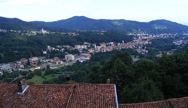
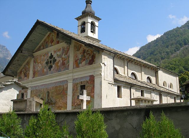
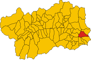
Габи (Gaby, Gaby)
.svg)
- коммуна Италии
 Hiking in Габи
Gaby is a charming small village located in the Aosta Valley region of Italy, which is known for its stunning mountainous landscapes, rich history, and outdoor activities, including hiking. Here are some key points to consider when planning a hiking trip in and around Gaby:
Hiking Trails
-
Valle di Gaby: The main hiking routes will often lead you through the scenic Valle di Gaby, where you can enjoy views of the surrounding mountains and forests. The trails vary in difficulty, making them suitable for both beginners and experienced hikers.
-
Mont Emilius: For those looking for a challenge, consider hiking Mont Emilius, which offers panoramic views of the Aosta Valley and is accessible from various starting points, including Gaby.
-
Ancient Paths and Villages: Many trails in the region link small villages and historical sites. Exploring these paths not only provides a good workout but also a chance to immerse yourself in local culture.
-
Flora and Fauna: Keep an eye out for the diverse wildlife and unique plant species along the trails, especially if you're hiking during spring or summer.
Hiking Tips
-
Physical Preparation: Depending on the trail, ensure you are physically prepared and choose hikes that align with your fitness level.
-
Weather Conditions: The weather in the mountains can change rapidly. Check forecasts and prepare accordingly, wearing layers and bringing rain gear if necessary.
-
Trail Markings: Trails are typically marked with signs and paint on trees or rocks; familiarize yourself with these markings to avoid getting lost.
-
Local Guides: Consider hiring a local guide for more challenging hikes or to gain insights into the flora, fauna, and history of the area.
-
Safety Gear: Carry essential safety gear, including a first aid kit, adequate water, snacks, and a map or GPS device.
Accommodations and Amenities
Gaby, being a small village, offers a few accommodation options, including guesthouses and hotels. Make sure to book in advance, especially during peak hiking seasons (late spring to early fall). Additionally, local restaurants typically serve delicious Aosta Valley cuisine, providing a nice way to recover after a day of hiking.
Overall Experience
Hiking in Gaby offers a wonderful blend of stunning natural beauty, physical activity, and cultural experiences. Whether you're trekking to high peaks or exploring serene valleys, the Aosta Valley provides a perfect backdrop for outdoor adventures. Always respect the natural environment and local regulations while enjoying your hike!
- Страна:

- Почтовый код: 11020
- Телефонный код: 0125
- Код автомобильного номера: AO
- Координаты: 45° 42' 16" N, 7° 53' 2" E


- GPS треки (wikiloc): [Ссылка]
- Высота над уровнем моря: 1047 м m
- Площадь: 32.17 кв.км
- Население: 467
- Веб сайт: http://www.comune.gaby.ao.it
- Википедия русская: wiki(ru)
- Википедия английская: wiki(en)
- Википедия национальная: wiki(it)
- Хранилище Wikidata: Wikidata: Q35053
- Галерея изображений в википедии: [Ссылка]
- Катеория в википедии: [Ссылка]
- Карты в википедии: [Ссылка]
- код Freebase: [/m/0fs__q]
- код GeoNames: Альт: [6537030]
- ID отношения в OpenStreetMap: [45813]
- код ISTAT: 007029
- кадастровый код Италии: D839
Граничит с регионами:

Андорно-Микка
- коммуна Италии
Hiking in Андорно-Микка
Andorno Micca is a charming town situated in the Piedmont region of Italy, specifically in the province of Biella. The area is known for its beautiful natural landscapes, which make it an excellent destination for hiking enthusiasts. Here are some highlights and tips for hiking in Andorno Micca:...
- Страна:
- Почтовый код: 13811
- Телефонный код: 015
- Код автомобильного номера: BI
- Координаты: 45° 36' 0" N, 8° 3' 0" E
- GPS треки (wikiloc): [Ссылка]
- Высота над уровнем моря: 544 м m
- Площадь: 11.89 кв.км
- Население: 3218
- Веб сайт: [Ссылка]
Каллабьяна
- коммуна Италии
Hiking in Каллабьяна
Callabiana is not a widely recognized hiking destination, and it seems there may be some confusion with the name. However, if you meant "Calabrian" hiking in the Calabria region of Italy, I can certainly provide information on that!...
- Страна:
- Почтовый код: 13821
- Телефонный код: 015
- Код автомобильного номера: BI
- Координаты: 45° 37' 54" N, 8° 5' 58" E
- GPS треки (wikiloc): [Ссылка]
- Высота над уровнем моря: 743 м m
- Площадь: 6.56 кв.км
- Население: 136
- Веб сайт: [Ссылка]

Пьедикавалло
- коммуна Италии
Hiking in Пьедикавалло
Piedicavallo is a charming village located in the Biella region of Italy, nestled in the Cervo Valley. It offers a variety of hiking opportunities that showcase its stunning natural landscapes, rich wildlife, and picturesque views....
- Страна:
- Почтовый код: 13812
- Телефонный код: 015
- Код автомобильного номера: BI
- Координаты: 45° 42' 0" N, 7° 57' 0" E
- GPS треки (wikiloc): [Ссылка]
- Высота над уровнем моря: 1050 м m
- Площадь: 17.75 кв.км
- Население: 180
- Веб сайт: [Ссылка]
Сальяно-Микка
- коммуна Италии
Hiking in Сальяно-Микка
Sagliano Micca is a charming municipality located in the Biella region of Piedmont, Italy. It is nestled in the beautiful foothills of the Alps, making it an excellent destination for hiking enthusiasts. Here are some highlights and tips regarding hiking in and around Sagliano Micca:...
- Страна:
- Почтовый код: 13816
- Телефонный код: 015
- Код автомобильного номера: BI
- Координаты: 45° 37' 0" N, 8° 3' 0" E
- GPS треки (wikiloc): [Ссылка]
- Высота над уровнем моря: 589 м m
- Площадь: 14.61 кв.км
- Население: 1610
- Веб сайт: [Ссылка]

Расса
- коммуна Италии
Hiking in Расса
Rassa, located in the Piedmont region of Italy, is a small village nestled in the Valsesia valley and surrounded by the stunning landscapes of the Sesia Valley Natural Park. This area is known for its picturesque mountains, rich flora and fauna, and the beautiful Sesia River. Hiking in Rassa provides a unique opportunity to explore both natural beauty and cultural heritage....
- Страна:
- Почтовый код: 13020
- Телефонный код: 0163
- Код автомобильного номера: VC
- Координаты: 45° 46' 0" N, 8° 1' 0" E
- GPS треки (wikiloc): [Ссылка]
- Высота над уровнем моря: 917 м m
- Площадь: 43.27 кв.км
- Население: 66
- Веб сайт: [Ссылка]


Брюссон
- коммуна Италии
Hiking in Брюссон
Brusson is a charming village located in the Aosta Valley region of Italy, known for its stunning natural scenery and excellent hiking opportunities. Nestled in the midst of the Alps, Brusson offers a mix of challenging trails and easier walks suitable for hikers of all levels. Here’s what you need to know about hiking in Brusson:...
- Страна:
- Почтовый код: 11022
- Телефонный код: 0125
- Код автомобильного номера: AO
- Координаты: 45° 46' 0" N, 7° 44' 0" E
- GPS треки (wikiloc): [Ссылка]
- Высота над уровнем моря: 1338 м m
- Площадь: 55.26 кв.км
- Население: 887
- Веб сайт: [Ссылка]


Грессоне-Сен-Жан
- коммуна Италии
Hiking in Грессоне-Сен-Жан
Gressoney-Saint-Jean, located in the Aosta Valley of Italy, is a beautiful mountain village that offers excellent hiking opportunities in the scenic backdrop of the Alps. The area is particularly known for its stunning landscapes, featuring majestic peaks, lush valleys, and picturesque forests....
- Страна:
- Почтовый код: 11025
- Телефонный код: 0125
- Код автомобильного номера: AO
- Координаты: 45° 47' 0" N, 7° 49' 0" E
- GPS треки (wikiloc): [Ссылка]
- Высота над уровнем моря: 1385 м m
- Площадь: 69.65 кв.км
- Население: 818
- Веб сайт: [Ссылка]
Иссим
- коммуна Италии
Hiking in Иссим
Issime is a charming municipality located in the Aosta Valley region of Italy, nestled in the Alps. It offers a variety of hiking opportunities that cater to different levels of experience, making it a great destination for outdoor enthusiasts....
- Страна:
- Почтовый код: 11020
- Телефонный код: 0125
- Код автомобильного номера: AO
- Координаты: 45° 41' 0" N, 7° 51' 0" E
- GPS треки (wikiloc): [Ссылка]
- Высота над уровнем моря: 956 м m
- Площадь: 35.38 кв.км
- Население: 413
- Веб сайт: [Ссылка]