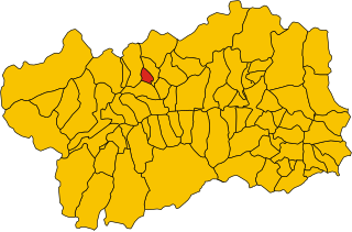
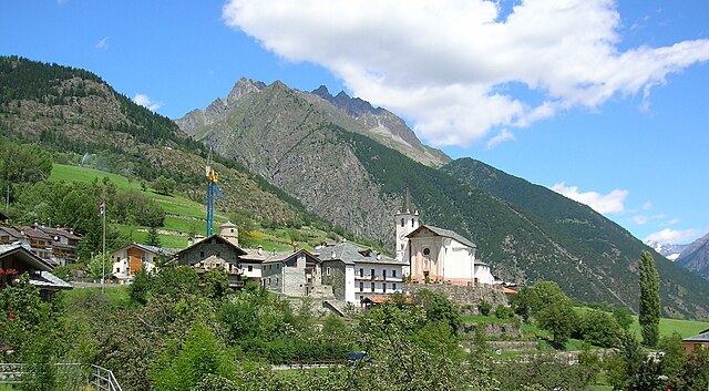
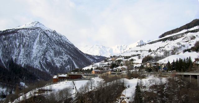
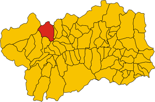
Жиньо (Gignod, Gignod)
.svg)
- коммуна Италии
 Hiking in Жиньо
Gignod is a small municipality located in the Aosta Valley region of Italy, surrounded by stunning alpine scenery. It's an excellent destination for hiking enthusiasts of all levels, offering a variety of trails that showcase the natural beauty of the region, its rugged mountains, picturesque valleys, and rich biodiversity. Here are some highlights for hiking in Gignod:
Hiking Trails:
-
Tourist Paths: There are numerous marked trails that cater to different skill levels. Beginners can find easier paths with gentle slopes, while experienced hikers can tackle more challenging routes with steep ascents.
-
Panoramic Views: Many trails in Gignod offer breathtaking views of the Aosta Valley and the surrounding peaks, including the Grand Combin and the Matterhorn.
-
Natural Parks: The area is close to the Gran Paradiso National Park, which features a rich variety of flora and fauna. Some trails might lead you into the park, allowing you to enjoy an even more diverse landscape.
-
Cultural Significance: Hiking in Gignod also provides the opportunity to explore local history and culture. You might come across ancient sites, traditional alpine huts, and beautiful churches as you walk.
Suggested Hikes:
- L'Arbey: A relatively easy hike suitable for families, with gentle slopes and scenic views.
- Mont Emilius: For more experienced hikers, this trail offers a good workout with rewarding views from the summit.
- Col de Joux: A moderate trail that takes you through beautiful meadows and mountain landscapes.
Tips for Hiking in Gignod:
- Weather Awareness: Always check the weather before heading out, as mountain weather can change rapidly.
- Gear: Wear proper hiking shoes, and dress in layers to adjust to temperature changes as you ascend or descend.
- Hydration: Carry plenty of water, as trail facilities might be limited.
- Respect Nature: Stay on marked trails, and practice Leave No Trace principles to preserve the area's beauty.
Before heading out, it’s always a good idea to check with local tourist offices or guides for the most current trail conditions and additional recommendations. Enjoy your hiking adventure in Gignod!
- Страна:

- Почтовый код: 11010
- Телефонный код: 0165
- Код автомобильного номера: AO
- Координаты: 45° 47' 0" N, 7° 18' 0" E


- GPS треки (wikiloc): [Ссылка]
- Высота над уровнем моря: 988 м m
- Площадь: 25.98 кв.км
- Население: 1727
- Веб сайт: http://www.comune.gignod.ao.it
- Википедия русская: wiki(ru)
- Википедия английская: wiki(en)
- Википедия национальная: wiki(it)
- Хранилище Wikidata: Wikidata: Q35060
- Галерея изображений в википедии: [Ссылка]
- Катеория в википедии: [Ссылка]
- Карты в википедии: [Ссылка]
- код Freebase: [/m/0ft004]
- код GeoNames: Альт: [6543059]
- ID отношения в OpenStreetMap: [46084]
- код ISTAT: 007030
- кадастровый код Италии: E029
Граничит с регионами:

Аоста
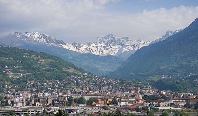
- коммуна Италии
Hiking in Аоста
Aosta, the capital of the Aosta Valley in Italy, is a fantastic destination for hiking enthusiasts. Nestled in the Italian Alps, the region offers stunning landscapes, charming villages, and a mix of both easy and challenging hiking trails. Here are some key points to consider for hiking in Aosta:...
- Страна:
- Почтовый код: 11100
- Телефонный код: 0165
- Код автомобильного номера: AO
- Координаты: 45° 44' 14" N, 7° 19' 14" E
- GPS треки (wikiloc): [Ссылка]
- Высота над уровнем моря: 583 м m
- Площадь: 21 кв.км
- Население: 34324
- Веб сайт: [Ссылка]

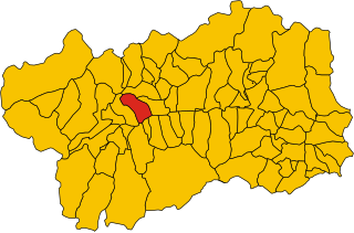
Аллен
- коммуна Италии
Hiking in Аллен
If you're considering hiking in Allan, it seems you might be referring to a specific location or region. However, there might be some confusion about the name. Could you clarify whether you meant Allan, which may refer to places in different countries, or if you possibly meant another name, such as "Alps," or "Alaska," known for their hiking trails?...
- Страна:
- Почтовый код: 11010
- Телефонный код: 0165
- Код автомобильного номера: AO
- Координаты: 45° 48' 30" N, 7° 16' 21" E
- GPS треки (wikiloc): [Ссылка]
- Высота над уровнем моря: 1190 м m
- Площадь: 7.96 кв.км
- Население: 219
- Веб сайт: [Ссылка]

Дуэ
- коммуна Италии
Hiking in Дуэ
Doues is a small municipality located in the Aosta Valley region of Italy, surrounded by stunning mountainous landscapes that are perfect for hiking enthusiasts. The area offers a range of trails suitable for various skill levels, from easy walks to more challenging treks....
- Страна:
- Почтовый код: 11010
- Телефонный код: 0165
- Код автомобильного номера: AO
- Координаты: 45° 49' 0" N, 7° 18' 0" E
- GPS треки (wikiloc): [Ссылка]
- Высота над уровнем моря: 1176 м m
- Площадь: 16.25 кв.км
- Население: 506
- Веб сайт: [Ссылка]


Этрубль
- коммуна Италии
Hiking in Этрубль
Etroubles is a charming village located in the Aosta Valley region of Italy, known for its stunning alpine landscapes and rich cultural heritage. Hiking in and around Etroubles offers a fantastic experience for outdoor enthusiasts, with a variety of trails suitable for different skill levels....
- Страна:
- Почтовый код: 11014
- Телефонный код: 0165
- Код автомобильного номера: AO
- Координаты: 45° 49' 17" N, 7° 13' 49" E
- GPS треки (wikiloc): [Ссылка]
- Высота над уровнем моря: 1280 м m
- Площадь: 39.57 кв.км
- Население: 489
- Веб сайт: [Ссылка]


Руазан
- коммуна Италии
Hiking in Руазан
Roisan is a charming commune in the Aosta Valley region of Italy, known for its beautiful natural landscapes, historical sites, and cultural heritage. Hiking in Roisan offers access to stunning views of the surrounding mountains, valleys, and forests....
- Страна:
- Почтовый код: 11010
- Телефонный код: 0165
- Код автомобильного номера: AO
- Координаты: 45° 47' 0" N, 7° 19' 0" E
- GPS треки (wikiloc): [Ссылка]
- Высота над уровнем моря: 866 м m
- Площадь: 14.64 кв.км
- Население: 1012
- Веб сайт: [Ссылка]


Сент-Уайен
- коммуна Италии
Hiking in Сент-Уайен
Saint-Oyen, located in the Aosta Valley of Italy, is a picturesque destination for hiking enthusiasts. Nestled at the foothills of the Alps, this area is characterized by its stunning natural scenery, rich biodiversity, and a range of hiking trails suitable for various skill levels. Here are some highlights and useful information about hiking in this region:...
- Страна:
- Почтовый код: 11014
- Телефонный код: 0165
- Код автомобильного номера: AO
- Координаты: 45° 49' 0" N, 7° 13' 0" E
- GPS треки (wikiloc): [Ссылка]
- Высота над уровнем моря: 1373 м m
- Площадь: 9.42 кв.км
- Население: 194
- Веб сайт: [Ссылка]

Сен-Пьер
- коммуна Италии
Hiking in Сен-Пьер
Saint-Pierre, located in the Aosta Valley region of Italy, is a fantastic destination for hiking enthusiasts. The area is known for its stunning mountain scenery, rich history, and diverse trails that cater to a variety of skill levels. Here are some key points about hiking in this picturesque region:...
- Страна:
- Почтовый код: 11010
- Телефонный код: 0165
- Код автомобильного номера: AO
- Координаты: 45° 42' 36" N, 7° 13' 34" E
- GPS треки (wikiloc): [Ссылка]
- Высота над уровнем моря: 731 м m
- Площадь: 26.18 кв.км
- Население: 3213
- Веб сайт: [Ссылка]
Сен-Реми-ан-Босс
- коммуна Италии
Hiking in Сен-Реми-ан-Босс
Saint-Rhémy-en-Bosses is a picturesque village located in the Aosta Valley region of Italy, nestled in the Italian Alps. The area is known for its stunning landscapes, charming architecture, and many outdoor activities, including hiking....
- Страна:
- Почтовый код: 11010
- Телефонный код: 0165
- Код автомобильного номера: AO
- Координаты: 45° 49' 19" N, 7° 10' 32" E
- GPS треки (wikiloc): [Ссылка]
- Высота над уровнем моря: 1519 м m
- Площадь: 64.88 кв.км
- Население: 335
- Веб сайт: [Ссылка]

Сарр
- коммуна Италии
Hiking in Сарр
Hiking in Sarre, located in the Aosta Valley of northern Italy, offers a fantastic outdoor experience surrounded by stunning mountain scenery. The Aosta Valley is known for its breathtaking landscapes, rich history, and numerous hiking trails suitable for all levels of experience....
- Страна:
- Почтовый код: 11010
- Телефонный код: 0165
- Код автомобильного номера: AO
- Координаты: 45° 43' 4" N, 7° 15' 27" E
- GPS треки (wikiloc): [Ссылка]
- Высота над уровнем моря: 631 м m
- Площадь: 28.28 кв.км
- Население: 4878
- Веб сайт: [Ссылка]