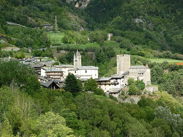
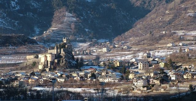
Сен-Реми-ан-Босс (Saint-Rhémy-en-Bosses, Saint-Rhémy-en-Bosses)
.svg)
- коммуна Италии
 Hiking in Сен-Реми-ан-Босс
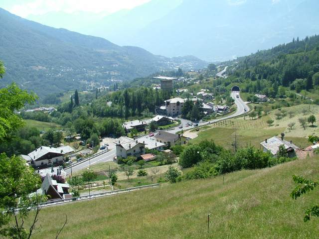
Saint-Rhémy-en-Bosses is a picturesque village located in the Aosta Valley region of Italy, nestled in the Italian Alps. The area is known for its stunning landscapes, charming architecture, and many outdoor activities, including hiking.
Hiking Highlights in Saint-Rhémy-en-Bosses
-
Scenic Trails: The region offers a variety of hiking trails that cater to different skill levels, from leisurely walks suitable for families to more challenging hikes that appeal to experienced trekkers.
-
Natural Beauty: The trails provide breathtaking views of the surrounding Alps, lush meadows, and forests. You may encounter diverse flora and fauna along your hike, making it a rewarding experience for nature enthusiasts.
-
Historical Sites: Many trails connect to historical landmarks, including ancient churches and traditional mountain huts, providing an added cultural aspect to your hiking experience.
-
Local Cuisine: After a day of hiking, you can enjoy local Aostan cuisine at nearby inns or restaurants. Traditional dishes often feature hearty ingredients, perfect for refueling after an outdoor adventure.
-
Seasonal Activities: While summer is ideal for hiking, spring and autumn also offer unique experiences. In spring, you can witness wildflowers blooming, and in autumn, the foliage transforms into stunning fall colors.
Tips for Hiking in Saint-Rhémy-en-Bosses
- Trail Maps: Be sure to pick up a trail map or download one online to help navigate the routes safely.
- Weather Preparedness: The weather in the Alps can change rapidly. It's important to dress in layers and carry rain gear, as well as sufficient water and snacks.
- Guided Tours: If you’re unfamiliar with the area, consider joining a guided hiking tour. Local guides can enhance your experience with their knowledge of the region’s history and ecology.
- Respect Nature: Practice Leave No Trace principles by staying on marked trails, packing out trash, and respecting wildlife.
Hiking in Saint-Rhémy-en-Bosses offers a chance to immerse yourself in stunning alpine scenery while enjoying the tranquility of nature. Whether you're out for a day hike or longer, the area's beauty and charm make it an excellent destination for outdoor lovers.
- Страна:

- Почтовый код: 11010
- Телефонный код: 0165
- Код автомобильного номера: AO
- Координаты: 45° 49' 19" N, 7° 10' 32" E


- GPS треки (wikiloc): [Ссылка]
- Высота над уровнем моря: 1519 м m
- Площадь: 64.88 кв.км
- Население: 335
- Веб сайт: http://www.comune.saintrhemyenbosses.ao.it/
- Википедия русская: wiki(ru)
- Википедия английская: wiki(en)
- Википедия национальная: wiki(it)
- Хранилище Wikidata: Wikidata: Q35433
- Катеория в википедии: [Ссылка]
- Карты в википедии: [Ссылка]
- код Freebase: [/m/0fwz7f]
- код GeoNames: Альт: [6535966]
- ID отношения в OpenStreetMap: [46104]
- код Цифрового атласа Римской империи: [7766]
- код ISTAT: 007064
- кадастровый код Италии: H675
Граничит с регионами:

Авиз
- коммуна Италии
Hiking in Авиз
Avise is a charming commune in the Aosta Valley region of Italy, located in the picturesque Alpine area. It offers a variety of hiking opportunities that cater to different skill levels and preferences. Here are some highlights for those interested in hiking in Avise:...
- Страна:
- Почтовый код: 11010
- Телефонный код: 0165
- Код автомобильного номера: AO
- Координаты: 45° 42' 31" N, 7° 8' 26" E
- GPS треки (wikiloc): [Ссылка]
- Высота над уровнем моря: 775 м m
- Площадь: 52.62 кв.км
- Население: 298
- Веб сайт: [Ссылка]

Курмайёр
- коммуна Италии
Hiking in Курмайёр
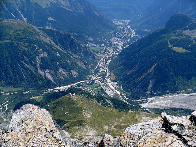
Courmayeur, located in the Aosta Valley of Italy, is a fantastic destination for hikers. Nestled at the foot of Mont Blanc, the area offers a variety of trails that cater to all skill levels, from leisurely walks to challenging alpine hikes. Here are some highlights for hiking in Courmayeur:...
- Страна:
- Почтовый код: 11013
- Телефонный код: 0165
- Код автомобильного номера: AO
- Координаты: 45° 47' 0" N, 6° 58' 0" E
- GPS треки (wikiloc): [Ссылка]
- Высота над уровнем моря: 1224 м m
- Площадь: 210 кв.км
- Население: 2798
- Веб сайт: [Ссылка]

Жиньо
- коммуна Италии
Hiking in Жиньо
Gignod is a small municipality located in the Aosta Valley region of Italy, surrounded by stunning alpine scenery. It's an excellent destination for hiking enthusiasts of all levels, offering a variety of trails that showcase the natural beauty of the region, its rugged mountains, picturesque valleys, and rich biodiversity. Here are some highlights for hiking in Gignod:...
- Страна:
- Почтовый код: 11010
- Телефонный код: 0165
- Код автомобильного номера: AO
- Координаты: 45° 47' 0" N, 7° 18' 0" E
- GPS треки (wikiloc): [Ссылка]
- Высота над уровнем моря: 988 м m
- Площадь: 25.98 кв.км
- Население: 1727
- Веб сайт: [Ссылка]

Ла-Саль
- коммуна Италии
Hiking in Ла-Саль
La Salle, located in the Aosta Valley of Italy, is a picturesque destination for hiking enthusiasts. Nestled in the foothills of the Alps, La Salle offers a blend of stunning natural beauty, rich cultural heritage, and diverse hiking trails suitable for various skill levels....
- Страна:
- Почтовый код: 11015
- Телефонный код: 0165
- Код автомобильного номера: AO
- Координаты: 45° 44' 49" N, 7° 4' 22" E
- GPS треки (wikiloc): [Ссылка]
- Высота над уровнем моря: 1001 м m
- Площадь: 83.94 кв.км
- Население: 2056
- Веб сайт: [Ссылка]


Сент-Уайен
- коммуна Италии
Hiking in Сент-Уайен
Saint-Oyen, located in the Aosta Valley of Italy, is a picturesque destination for hiking enthusiasts. Nestled at the foothills of the Alps, this area is characterized by its stunning natural scenery, rich biodiversity, and a range of hiking trails suitable for various skill levels. Here are some highlights and useful information about hiking in this region:...
- Страна:
- Почтовый код: 11014
- Телефонный код: 0165
- Код автомобильного номера: AO
- Координаты: 45° 49' 0" N, 7° 13' 0" E
- GPS треки (wikiloc): [Ссылка]
- Высота над уровнем моря: 1373 м m
- Площадь: 9.42 кв.км
- Население: 194
- Веб сайт: [Ссылка]

Сен-Пьер
- коммуна Италии
Hiking in Сен-Пьер
Saint-Pierre, located in the Aosta Valley region of Italy, is a fantastic destination for hiking enthusiasts. The area is known for its stunning mountain scenery, rich history, and diverse trails that cater to a variety of skill levels. Here are some key points about hiking in this picturesque region:...
- Страна:
- Почтовый код: 11010
- Телефонный код: 0165
- Код автомобильного номера: AO
- Координаты: 45° 42' 36" N, 7° 13' 34" E
- GPS треки (wikiloc): [Ссылка]
- Высота над уровнем моря: 731 м m
- Площадь: 26.18 кв.км
- Население: 3213
- Веб сайт: [Ссылка]


Bourg-Saint-Pierre
Hiking in Bourg-Saint-Pierre
Bourg-Saint-Pierre is a picturesque village located in the Swiss Alps, nestled in the Valais Canton. It serves as a fantastic base for hiking enthusiasts due to its stunning landscapes and diverse trails. Here are some highlights about hiking in the area:...
- Страна:

- Почтовый код: 1946
- Телефонный код: 027
- Код автомобильного номера: VS
- Координаты: 45° 57' 0" N, 7° 12' 0" E
- GPS треки (wikiloc): [Ссылка]
- Высота над уровнем моря: 1623 м m
- Площадь: 90.2 кв.км
- Население: 181


Orsières
Hiking in Orsières
Orsières is a charming municipality located in the Valais region of Switzerland, surrounded by stunning alpine scenery, making it a great destination for hiking enthusiasts. Here are some key points to consider if you plan to hike in Orsières:...
- Страна:
- Почтовый код: 1937
- Телефонный код: 027
- Код автомобильного номера: VS
- Координаты: 45° 58' 20" N, 7° 6' 6" E
- GPS треки (wikiloc): [Ссылка]
- Высота над уровнем моря: 1897 м m
- Площадь: 165.0 кв.км
- Население: 3190
- Веб сайт: [Ссылка]