Госсау (Gossau, Gossau ZH)

 Hiking in Госсау
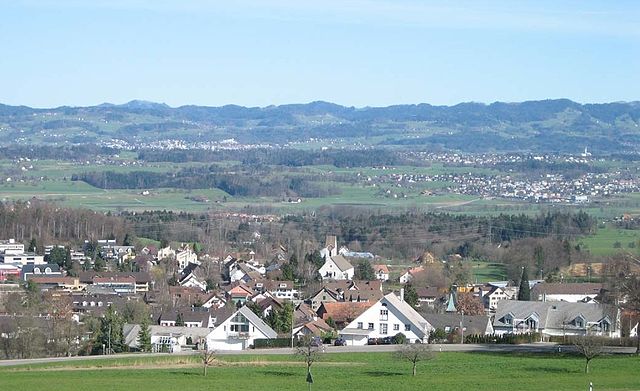
Gossau, located in the Zurich region of Switzerland, is surrounded by beautiful landscapes that offer a variety of hiking opportunities. Here are some highlights and tips for hiking in and around Gossau:
Trails and Routes
-
Nature Trails: Gossau has several well-marked nature trails that showcase the local flora and fauna. These trails can vary in difficulty, making them suitable for both novice and experienced hikers.
-
Zürcher Oberland: Just a short distance from Gossau, you can access the Zürich Oberland region, known for its picturesque hills and valleys. There are numerous trails that offer stunning views over Lake Zurich and the distant Alps.
-
Forest Paths: The surrounding forests provide tranquil hiking paths. The woods around Gossau can be great for a leisurely walk and are particularly beautiful in the fall when the leaves change color.
-
Mountain Routes: For those looking for more challenging hikes, consider venturing towards the nearby Uetliberg Mountain, which offers both hiking and biking routes with panoramic views over Zurich.
Tips for Hiking in Gossau
-
Maps and Signage: Always carry a map and check local maps and signage for trail markers. Switzerland has excellent marking of hiking trails.
-
Weather: The weather can change rapidly in the region, so it's advisable to check forecasts before heading out and dress in layers.
-
Local Amenities: Gossau has various amenities including cafes and restaurants where you can rest and enjoy local cuisine after a long trek.
-
Public Transport: The public transport system in Switzerland is efficient. You can reach Gossau easily by train or bus from Zurich city center, making it convenient for day hikes.
-
Safety Precautions: Always inform someone of your hiking plans, especially if you’re going on less-traveled paths. Carry enough water and snacks, and consider bringing a first aid kit.
-
Respect Nature: Follow Leave No Trace principles to ensure that the area remains pristine for future hikers.
Conclusion
Hiking in Gossau and its surroundings provides a great way to experience the natural beauty of Switzerland. With a variety of trails and stunning views, it's a fantastic destination for outdoor enthusiasts. Whether you prefer a peaceful nature walk or a more strenuous mountain hike, you’ll find suitable options to enjoy the outdoors.
- Страна:

- Почтовый код: 8614, 8624, 8625, 8626
- Телефонный код: 044
- Код автомобильного номера: ZH
- Координаты: 47° 18' 29" N, 8° 45' 24" E


- GPS треки (wikiloc): [Ссылка]
- Высота над уровнем моря: 455 м m
- Площадь: 18.26 кв.км
- Население: 9937
- Веб сайт: http://www.gossau-zh.ch
- Википедия русская: wiki(ru)
- Википедия английская: wiki(en)
- Википедия национальная: wiki(de)
- Хранилище Wikidata: Wikidata: Q67525
- Катеория в википедии: [Ссылка]
- код Freebase: [/m/0gv0mw]
- код GeoNames: Альт: [7285946]
- ID отношения в OpenStreetMap: [1682129]
- код LCNAF: Альт: [n86112454]
- место в MusicBrainz: [215f0066-5752-48c5-b760-b213386ff417]
- идентификатор HDS: [87]
- код швейцарского муниципалитета: [0115]
Граничит с регионами:

Эгг (Цюрих)
Hiking in Эгг (Цюрих)
Egg, located in the Canton of Zurich in Switzerland, is a charming village nestled in the lush landscapes of the Zürcher Oberland. It offers a variety of hiking options suitable for all skill levels. Here are some highlights of hiking in and around Egg:...
- Страна:
- Почтовый код: 8132
- Телефонный код: 01; 043; 044
- Код автомобильного номера: ZH
- Координаты: 47° 18' 7" N, 8° 41' 26" E
- GPS треки (wikiloc): [Ссылка]
- Высота над уровнем моря: 545 м m
- Площадь: 14.48 кв.км
- Население: 8452
- Веб сайт: [Ссылка]

Бубикон
- коммуна в Швейцарии
Hiking in Бубикон
Bubikon, located in the Zurich region of Switzerland, offers picturesque hiking opportunities with breathtaking views of the surrounding landscape. It is part of the Zurich Oberland and is situated near the eastern shores of Lake Zurich. Here are some highlights and tips for hiking in Bubikon:...
- Страна:
- Почтовый код: 8608
- Телефонный код: 055
- Код автомобильного номера: ZH
- Координаты: 47° 16' 10" N, 8° 49' 13" E
- GPS треки (wikiloc): [Ссылка]
- Высота над уровнем моря: 523 м m
- Площадь: 11.58 кв.км
- Население: 7194
- Веб сайт: [Ссылка]