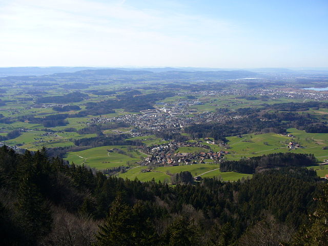
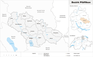
Хинвиль (Hinwil District, Bezirk Hinwil)

- округ в кантоне Цюрих (Швейцария)
 Hiking in Хинвиль
Hinwil District, located in the canton of Zurich in Switzerland, offers a variety of hiking opportunities that cater to all levels of experience. The beautiful landscapes, lush forests, and scenic views make it an attractive destination for outdoor enthusiasts.
Hiking Trails
-
Greifensee Loop: This is a popular hiking route around Lake Greifensee, offering stunning views of the water and surrounding countryside. The trail is relatively flat and suitable for families, taking approximately 2-3 hours to complete.
-
Säntis Trail: For those looking for more challenging hikes, venturing into the foothills of the Alps can be rewarding. There are multiple trails that lead up to various scenic viewpoints, including the Säntis, which offers breathtaking panoramic views.
-
Hinwil – Zürich Hiking Trail: This trail connects Hinwil to Zurich and passes through beautiful landscapes, forests, and quaint villages. It's a longer trek, ideal for a day hike and takes approximately 4-6 hours.
-
Pfäffikersee Circular Walk: Close by, the Pfäffikersee area offers enjoyable hikes that combine nature with historical landmarks, providing a rich experience along the way.
Best Times to Hike
The best time for hiking in Hinwil District is generally from late spring to early autumn (May to September) when the weather is mild and the trails are clear of snow. However, late summer can be quite warm, so be prepared with plenty of water.
Tips for Hiking in Hinwil District
- Trail Maps: Always carry a map or use a hiking app to stay on track, as some trails might be less marked.
- Footwear: Wear sturdy hiking shoes suitable for the terrain, especially if you’re tackling more challenging trails.
- Weather Preparedness: The weather can change quickly in the mountains, so bring layers and be prepared for rain.
- Local Guidelines: Respect local wildlife and follow any posted guidelines, especially in protected areas.
Local Features
The district is not only rich in natural beauty but also offers cultural experiences. You can visit local farms, taste regional products, and explore charming villages like Hinwil and Wetzikon.
Whether you're a seasoned hiker or just starting out, Hinwil District provides a fantastic backdrop for enjoying nature and exploring the Swiss outdoors. Happy hiking!
- Страна:

- Столица: Хинвиль
- Код автомобильного номера: ZH
- Координаты: 47° 18' 0" N, 8° 51' 0" E


- GPS треки (wikiloc): [Ссылка]
- Высота над уровнем моря: 558 м m
- Википедия русская: wiki(ru)
- Википедия английская: wiki(en)
- Википедия национальная: wiki(de)
- Хранилище Wikidata: Wikidata: Q660382
- Катеория в википедии: [Ссылка]
- код Freebase: [/m/026lhvl]
- код GeoNames: Альт: [6458797]
- код VIAF: Альт: [247826614]
- код GND: Альт: [4523225-8]
- идентификатор местоположения ArchINFORM: [42728]
Включает регионы:

Фишенталь
Hiking in Фишенталь
Fischenthal, located in the Zürcher Oberland in Switzerland, offers a delightful hiking experience with its picturesque landscapes, charming villages, and scenic trails. Here are some highlights of hiking in the Fischenthal area:...
- Страна:
- Почтовый код: 8496
- Телефонный код: 055
- Код автомобильного номера: ZH
- Координаты: 47° 20' 12" N, 8° 56' 29" E
- GPS треки (wikiloc): [Ссылка]
- Высота над уровнем моря: 769 м m
- Площадь: 30.25 кв.км
- Население: 2504
- Веб сайт: [Ссылка]
Беретсвиль
Hiking in Беретсвиль
Bäretswil is a charming municipality located in the Zürcher Oberland region of Switzerland, known for its scenic beauty and diverse hiking opportunities. Here are some key highlights for hiking in Bäretswil:...
- Страна:
- Телефонный код: 044
- Код автомобильного номера: ZH
- Координаты: 47° 20' 13" N, 8° 51' 27" E
- GPS треки (wikiloc): [Ссылка]
- Высота над уровнем моря: 702 м m
- Площадь: 22.19 кв.км
- Население: 5026
- Веб сайт: [Ссылка]

Бубикон
- коммуна в Швейцарии
Hiking in Бубикон
Bubikon, located in the Zurich region of Switzerland, offers picturesque hiking opportunities with breathtaking views of the surrounding landscape. It is part of the Zurich Oberland and is situated near the eastern shores of Lake Zurich. Here are some highlights and tips for hiking in Bubikon:...
- Страна:
- Почтовый код: 8608
- Телефонный код: 055
- Код автомобильного номера: ZH
- Координаты: 47° 16' 10" N, 8° 49' 13" E
- GPS треки (wikiloc): [Ссылка]
- Высота над уровнем моря: 523 м m
- Площадь: 11.58 кв.км
- Население: 7194
- Веб сайт: [Ссылка]
Грюнинген
Hiking in Грюнинген
Grüningen is a charming municipality located in Switzerland, near the city of Zurich. It offers beautiful landscapes and trails that cater to varying skill levels, making it a great destination for hiking enthusiasts. Here are some highlights about hiking in Grüningen:...
- Страна:
- Почтовый код: 8627
- Телефонный код: 044; 043
- Код автомобильного номера: ZH
- Координаты: 47° 17' 3" N, 8° 45' 45" E
- GPS треки (wikiloc): [Ссылка]
- Высота над уровнем моря: 502 м m
- Площадь: 8.78 кв.км
- Население: 3361
- Веб сайт: [Ссылка]

Дюрнтен
- коммуна в Швейцарии
Hiking in Дюрнтен
Dürnten, located in the Zurich Region of Switzerland, offers a variety of beautiful hiking trails characterized by scenic views, lush landscapes, and the charming atmosphere of the Swiss countryside. Here are some aspects to consider when planning a hike in Dürnten:...
- Страна:
- Почтовый код: 8635
- Телефонный код: 055
- Код автомобильного номера: ZH
- Координаты: 47° 16' 44" N, 8° 50' 36" E
- GPS треки (wikiloc): [Ссылка]
- Высота над уровнем моря: 514 м m
- Площадь: 10.22 кв.км
- Население: 7518
- Веб сайт: [Ссылка]

Вальд
- община в Швейцарии, Цюрих, Хинвиль
Hiking in Вальд
Wald is a beautiful area located in the Canton of Zürich, Switzerland, known for its scenic landscapes and picturesque hiking trails. Here are some highlights of hiking in Wald:...
- Страна:
- Почтовый код: 8636
- Телефонный код: 055
- Код автомобильного номера: ZH
- Координаты: 47° 16' 31" N, 8° 54' 52" E
- GPS треки (wikiloc): [Ссылка]
- Высота над уровнем моря: 619 м m
- Площадь: 25.25 кв.км
- Население: 9758
- Веб сайт: [Ссылка]

Зеегребен
Hiking in Зеегребен
Seegräben, located in Switzerland, is a great destination for hiking enthusiasts. Nestled near the picturesque Lake Zürich and surrounded by stunning natural scenery, it offers a variety of trails suitable for different skill levels....
- Страна:
- Почтовый код: 8607
- Телефонный код: 044
- Код автомобильного номера: ZH
- Координаты: 47° 20' 36" N, 8° 46' 19" E
- GPS треки (wikiloc): [Ссылка]
- Высота над уровнем моря: 561 м m
- Площадь: 3.77 кв.км
- Население: 1426
- Веб сайт: [Ссылка]


Госсау
Hiking in Госсау
Gossau, located in the Zurich region of Switzerland, is surrounded by beautiful landscapes that offer a variety of hiking opportunities. Here are some highlights and tips for hiking in and around Gossau:...
- Страна:
- Почтовый код: 8614, 8624, 8625, 8626
- Телефонный код: 044
- Код автомобильного номера: ZH
- Координаты: 47° 18' 29" N, 8° 45' 24" E
- GPS треки (wikiloc): [Ссылка]
- Высота над уровнем моря: 455 м m
- Площадь: 18.26 кв.км
- Население: 9937
- Веб сайт: [Ссылка]

Ветцикон
Hiking in Ветцикон
Wetzikon, located in the canton of Zurich, Switzerland, is surrounded by beautiful natural landscapes that make it an excellent destination for hiking enthusiasts. Here’s an overview of what you can expect when hiking in this picturesque area:...
- Страна:
- Почтовый код: 8620
- Телефонный код: 044
- Код автомобильного номера: ZH
- Координаты: 47° 19' 15" N, 8° 47' 35" E
- GPS треки (wikiloc): [Ссылка]
- Высота над уровнем моря: 539 м m
- Площадь: 16.73 кв.км
- Население: 24452
- Веб сайт: [Ссылка]
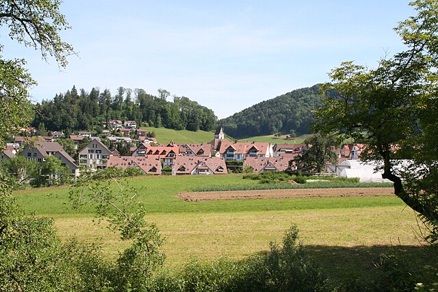
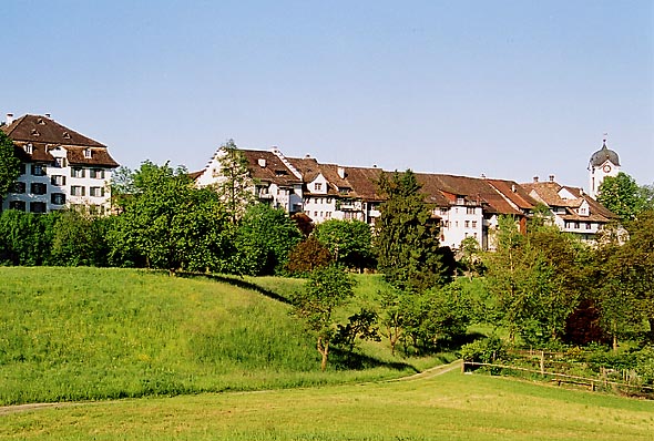
Хинвиль
- коммуна в Швейцарии
Hiking in Хинвиль
Hinwil, located in the Zurich Oberland region of Switzerland, is a fantastic destination for hiking enthusiasts. The area is characterized by its beautiful landscapes, including rolling hills, dense forests, and scenic views of the surrounding mountains. Here are some highlights and tips for hiking in Hinwil:...
- Страна:
- Почтовый код: 8340
- Телефонный код: 044
- Код автомобильного номера: ZH
- Координаты: 47° 18' 12" N, 8° 50' 40" E
- GPS треки (wikiloc): [Ссылка]
- Высота над уровнем моря: 573 м m
- Площадь: 22.3 кв.км
- Население: 11179
- Веб сайт: [Ссылка]

Рюти
Hiking in Рюти
Rüti is a picturesque municipality located in the Zürich canton of Switzerland, surrounded by beautiful landscapes and offering various hiking opportunities. Here’s what you can expect when hiking in Rüti:...
- Страна:
- Почтовый код: 8630
- Телефонный код: 055
- Код автомобильного номера: ZH
- Координаты: 47° 15' 41" N, 8° 51' 20" E
- GPS треки (wikiloc): [Ссылка]
- Высота над уровнем моря: 482 м m
- Площадь: 10.19 кв.км
- Население: 12098
- Веб сайт: [Ссылка]
Граничит с регионами:


Устер
Hiking in Устер
Uster District, located in the canton of Zurich in Switzerland, offers a variety of hiking opportunities that cater to different skill levels and preferences. The lush landscapes, scenic lakes, and picturesque hills make it an appealing destination for nature lovers and outdoor enthusiasts. Here are some highlights and suggestions for hiking in Uster District:...
- Страна:
- Столица: Устер
- Код автомобильного номера: ZH
- Координаты: 47° 21' 0" N, 8° 41' 0" E
- GPS треки (wikiloc): [Ссылка]
- Высота над уровнем моря: 433 м m
- Площадь: 112.35 кв.км

Майлен
Hiking in Майлен
Meilen District, located in the Canton of Zurich in Switzerland, offers several beautiful hiking opportunities with stunning views of Lake Zurich and the surrounding landscapes. Here are some highlights and recommended trails for hiking in the area:...
- Страна:
- Столица: Майлен
- Код автомобильного номера: ZH
- Координаты: 47° 16' 0" N, 8° 40' 0" E
- GPS треки (wikiloc): [Ссылка]
- Высота над уровнем моря: 568 м m
- Площадь: 84.64 кв.км

Пфеффикон
Hiking in Пфеффикон
Pfäffikon District, located in the canton of Zurich, Switzerland, offers a picturesque landscape that's ideal for hiking enthusiasts. It's characterized by rolling hills, lush forests, and scenic lakes, making it a beautiful destination for outdoor activities....
- Страна:
- Столица: Пфеффикон
- Код автомобильного номера: ZH
- Координаты: 47° 24' 0" N, 8° 47' 0" E
- GPS треки (wikiloc): [Ссылка]
- Высота над уровнем моря: 715 м m
- Площадь: 163.55 кв.км