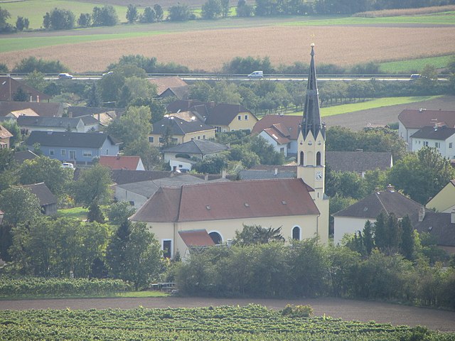
Хауслайтен (Hausleiten, Hausleiten)
 Hiking in Хауслайтен
Hausleiten, located in Lower Austria, offers a variety of hiking opportunities set against picturesque landscapes. While the region is known for its rolling hills and scenic views, here are some general tips and highlights for hiking in Hausleiten:
Hiking Trails
-
Nature Trails: Explore trails that wind through forests, meadows, and along riverbanks. These paths often provide a chance to see local flora and fauna.
-
Panoramic Views: Seek out trails that lead to vantage points for breathtaking views of the surrounding countryside. The higher elevations offer a great panorama of the Pulkau Valley and beyond.
-
Marked Hiking Routes: Look for well-marked hiking paths that cater to different skill levels, from easy strolls to more challenging hikes. Local hiking maps are usually available at tourist information centers.
Points of Interest
- Historic Sites: Along your hike, you may encounter historical landmarks, such as charming villages or old churches.
- Local Flora and Fauna: The region is rich in biodiversity, so keep an eye out for native wildlife and plants.
Practical Tips
- Best Time to Hike: Spring and autumn are ideal seasons for hiking in Hausleiten, offering pleasant weather and beautiful foliage.
- Preparation: Always check the local weather forecast and carry suitable supplies, including water, snacks, and a first-aid kit.
- Footwear: Wear appropriate hiking boots for comfort and safety, especially on uneven terrain.
Safety
- Inform someone about your hiking plans and expected return time.
- Follow the marked trails to avoid getting lost and to protect the environment.
Local Resources
- Visit the local tourism office for maps and additional information on guided hikes or events that might be taking place during your visit.
Whether you’re looking for a leisurely walk or a more challenging hike, Hausleiten is a delightful place to enjoy the outdoors. Remember to appreciate the natural beauty and tread lightly to preserve it for future generations. Happy hiking!
- Страна:

- Почтовый код: 3464
- Телефонный код: 02265
- Код автомобильного номера: KO
- Координаты: 48° 23' 41" N, 16° 6' 15" E


- GPS треки (wikiloc): [Ссылка]
- Высота над уровнем моря: 207 м m
- Площадь: 61.03 кв.км
- Население: 3784
- Веб сайт: http://www.hausleiten.gv.at
- Википедия русская: wiki(ru)
- Википедия английская: wiki(en)
- Википедия национальная: wiki(de)
- Хранилище Wikidata: Wikidata: Q691586
- Катеория в википедии: [Ссылка]
- код Freebase: [/m/02q0rxb]
- код GeoNames: Альт: [2776641]
- код VIAF: Альт: [239569093]
- код GND: Альт: [4276221-2]
- идентификатор местоположения ArchINFORM: [10442]
- код австрийского муниципалитета: [31208]
Граничит с регионами:

Цайзельмауэр-Вольфпассинг
Hiking in Цайзельмауэр-Вольфпассинг
Zeiselmauer-Wolfpassing is a picturesque area located in Lower Austria, known for its beautiful landscapes and accessibility for both casual and experienced hikers. Here are some highlights and tips for hiking in this region:...
- Страна:
- Почтовый код: 3424
- Телефонный код: 02242
- Код автомобильного номера: TU
- Координаты: 48° 19' 10" N, 16° 10' 30" E
- GPS треки (wikiloc): [Ссылка]
- Высота над уровнем моря: 175 м m
- Площадь: 12.7 кв.км
- Население: 2302
- Веб сайт: [Ссылка]


Тульн-на-Дунае
Hiking in Тульн-на-Дунае
Tulln an der Donau, located in Lower Austria near the Danube River, offers a variety of scenic hiking opportunities that showcase the region's natural beauty and rich cultural heritage. Here are some highlights for hiking in and around Tulln:...
- Страна:
- Почтовый код: 3425, 3430
- Телефонный код: 02272
- Код автомобильного номера: TU
- Координаты: 48° 20' 0" N, 16° 3' 0" E
- GPS треки (wikiloc): [Ссылка]
- Высота над уровнем моря: 180 м m
- Площадь: 72.23 кв.км
- Население: 16197
- Веб сайт: [Ссылка]

Штоккерау
- город в Австрии
Hiking in Штоккерау
Stockerau is a small town located in Lower Austria, close to Vienna. It offers a variety of hiking opportunities that appeal to both beginners and seasoned hikers. Here are some highlights and tips for hiking in and around Stockerau:...
- Страна:
- Телефонный код: 0 22 66
- Код автомобильного номера: KO
- Координаты: 48° 23' 9" N, 16° 12' 39" E
- GPS треки (wikiloc): [Ссылка]
- Высота над уровнем моря: 176 м m
- Площадь: 37.41 кв.км
- Население: 16916
- Веб сайт: [Ссылка]
Штеттельдорф-ам-Ваграм
Hiking in Штеттельдорф-ам-Ваграм
Stetteldorf am Wagram is a charming village located in the Lower Austria region, near the Danube River and surrounded by scenic landscapes. Hiking in this area offers a mix of beautiful nature, vineyards, and cultural sites. Here are some highlights and tips for hiking in and around Stetteldorf am Wagram:...
- Страна:
- Почтовый код: 3463
- Телефонный код: 02278
- Код автомобильного номера: KO
- Координаты: 48° 24' 31" N, 16° 0' 59" E
- GPS треки (wikiloc): [Ссылка]
- Высота над уровнем моря: 213 м m
- Площадь: 25.74 кв.км
- Население: 1041
- Веб сайт: [Ссылка]

Муккендорф-Випфинг
Hiking in Муккендорф-Випфинг
Muckendorf-Wipfing, located in Lower Austria, is a charming area that offers a variety of hiking opportunities for outdoor enthusiasts. This region is characterized by its scenic landscapes, rolling hills, and picturesque views of the surrounding nature....
- Страна:
- Почтовый код: 3426
- Телефонный код: 02242
- Код автомобильного номера: TU
- Координаты: 48° 19' 47" N, 16° 9' 4" E
- GPS треки (wikiloc): [Ссылка]
- Высота над уровнем моря: 173 м m
- Площадь: 6.27 кв.км
- Население: 1573
- Веб сайт: [Ссылка]

Зирндорф
Hiking in Зирндорф
Sierndorf, located in Lower Austria, offers a quaint backdrop for hiking enthusiasts who are looking to explore the natural beauty of the region. While it may not be as widely recognized as some of the larger hiking destinations in Austria, it provides several opportunities to enjoy the countryside and engage with nature....
- Страна:
- Почтовый код: 2011
- Телефонный код: 02267
- Код автомобильного номера: KO
- Координаты: 48° 25' 43" N, 16° 10' 3" E
- GPS треки (wikiloc): [Ссылка]
- Высота над уровнем моря: 191 м m
- Площадь: 55.08 кв.км
- Население: 3933
- Веб сайт: [Ссылка]
Русбах
Hiking in Русбах
Rußbach is a beautiful village located in the Salzburger Land region of Austria, known for its stunning natural scenery and excellent hiking opportunities. Nestled in the Dachstein Mountains, Rußbach offers a variety of hiking trails suitable for all experience levels, from leisurely walks to challenging mountain hikes....
- Страна:
- Почтовый код: 3702
- Телефонный код: 02955
- Код автомобильного номера: KO
- Координаты: 48° 27' 5" N, 16° 2' 22" E
- GPS треки (wikiloc): [Ссылка]
- Высота над уровнем моря: 247 м m
- Площадь: 30.65 кв.км
- Население: 1424
- Веб сайт: [Ссылка]