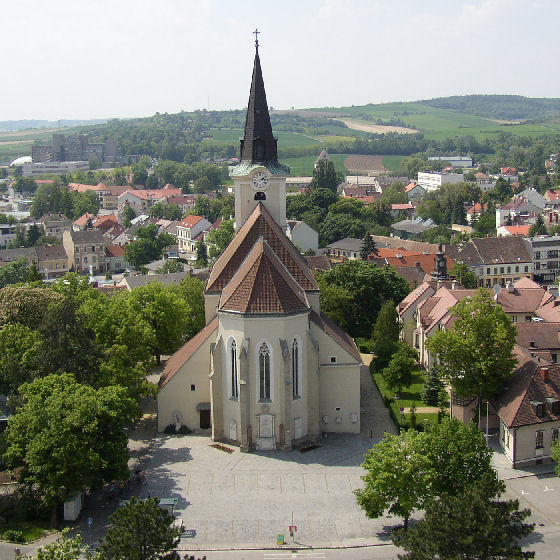
Русбах (Rußbach, Rußbach)
 Hiking in Русбах
Rußbach is a beautiful village located in the Salzburger Land region of Austria, known for its stunning natural scenery and excellent hiking opportunities. Nestled in the Dachstein Mountains, Rußbach offers a variety of hiking trails suitable for all experience levels, from leisurely walks to challenging mountain hikes.
Popular Hiking Trails in Rußbach:
-
Schutzhaus Gablonzer Hütte Trail: This moderate trail takes you through picturesque meadows and offers breathtaking views of the surrounding peaks. The Gablonzer Hütte itself is a great spot to rest and enjoy some local cuisine.
-
Dachstein West Region: Rußbach acts as a gateway to the Dachstein West ski and hiking area. During the hiking season, numerous trails lead to stunning alpine scenery, with options for both beginners and advanced hikers.
-
Lammertal Valley: A beautiful hike through this valley allows you to experience diverse landscapes, with opportunities to see wildlife and enjoy the tranquil atmosphere of the region.
-
Panoramic Trails: There are several panoramic trails in the area that provide stunning vistas of the Dachstein massif and the surrounding landscapes. These trails are often less steep and suitable for families.
Tips for Hiking in Rußbach:
-
Weather Conditions: Always check the weather forecast before heading out, as conditions can change rapidly in the mountains. Dress in layers and be prepared for sudden changes in temperature.
-
Altitude: Be aware of altitude changes, especially on higher trails. Ensure you are acclimatized and know your physical limits.
-
Equipment: Comfortable hiking boots, a good backpack, trekking poles, and sufficient water and snacks are recommended.
-
Maps and Marked Trails: Use a detailed hiking map or a hiking app to help navigate the trails. Trails are usually well-marked, but it’s a good idea to be prepared.
-
Respect Nature: Follow the Leave No Trace principles to help keep these beautiful trails and landscapes pristine.
Whether you’re looking for a day hike or planning to explore more extended routes, Rußbach offers many opportunities to immerse yourself in nature. Enjoy your hike!
- Страна:

- Почтовый код: 3702
- Телефонный код: 02955
- Код автомобильного номера: KO
- Координаты: 48° 27' 5" N, 16° 2' 22" E


- GPS треки (wikiloc): [Ссылка]
- Высота над уровнем моря: 247 м m
- Площадь: 30.65 кв.км
- Население: 1424
- Веб сайт: http://www.russbach.at
- Википедия русская: wiki(ru)
- Википедия английская: wiki(en)
- Википедия национальная: wiki(de)
- Хранилище Wikidata: Wikidata: Q675246
- Катеория в википедии: [Ссылка]
- код Freebase: [/m/02qxb77]
- код GeoNames: Альт: [7872909]
- код темы Quora: [Russbach]
- код австрийского муниципалитета: [31224]
Граничит с регионами:
Холлабрунн
Hiking in Холлабрунн
Hollabrunn is a town located in Lower Austria, surrounded by beautiful landscapes, which makes it a great place for hiking enthusiasts. The region offers a variety of trails suitable for different skill levels, ranging from leisurely walks to more challenging hikes....
- Страна:
- Почтовый код: 2020
- Телефонный код: 02952
- Код автомобильного номера: HL
- Координаты: 48° 34' 0" N, 16° 5' 0" E
- GPS треки (wikiloc): [Ссылка]
- Высота над уровнем моря: 236 м m
- Площадь: 152.38 кв.км
- Население: 11681
- Веб сайт: [Ссылка]

Гёллерсдорф
Hiking in Гёллерсдорф
Göllersdorf, located in Lower Austria, is a charming area offering a variety of hiking opportunities, suitable for both beginners and more experienced hikers. The region boasts beautiful landscapes, rolling hills, vineyards, and serene countryside, making it an ideal destination for nature enthusiasts....
- Страна:
- Почтовый код: 2013
- Телефонный код: 02954
- Код автомобильного номера: HL
- Координаты: 48° 29' 29" N, 16° 7' 14" E
- GPS треки (wikiloc): [Ссылка]
- Высота над уровнем моря: 202 м m
- Площадь: 59.56 кв.км
- Население: 2999
- Веб сайт: [Ссылка]
Штеттельдорф-ам-Ваграм
Hiking in Штеттельдорф-ам-Ваграм
Stetteldorf am Wagram is a charming village located in the Lower Austria region, near the Danube River and surrounded by scenic landscapes. Hiking in this area offers a mix of beautiful nature, vineyards, and cultural sites. Here are some highlights and tips for hiking in and around Stetteldorf am Wagram:...
- Страна:
- Почтовый код: 3463
- Телефонный код: 02278
- Код автомобильного номера: KO
- Координаты: 48° 24' 31" N, 16° 0' 59" E
- GPS треки (wikiloc): [Ссылка]
- Высота над уровнем моря: 213 м m
- Площадь: 25.74 кв.км
- Население: 1041
- Веб сайт: [Ссылка]


Гросвайкерсдорф
Hiking in Гросвайкерсдорф
Großweikersdorf, located in the Lower Austria region, offers some beautiful hiking opportunities. The area features scenic landscapes, charming vineyards, and rolling hills, making it a great destination for outdoor enthusiasts....
- Страна:
- Почтовый код: 3701
- Телефонный код: 02955
- Код автомобильного номера: TU
- Координаты: 48° 28' 21" N, 15° 58' 48" E
- GPS треки (wikiloc): [Ссылка]
- Высота над уровнем моря: 211 м m
- Площадь: 43.32 кв.км
- Население: 3180
- Веб сайт: [Ссылка]

Зирндорф
Hiking in Зирндорф
Sierndorf, located in Lower Austria, offers a quaint backdrop for hiking enthusiasts who are looking to explore the natural beauty of the region. While it may not be as widely recognized as some of the larger hiking destinations in Austria, it provides several opportunities to enjoy the countryside and engage with nature....
- Страна:
- Почтовый код: 2011
- Телефонный код: 02267
- Код автомобильного номера: KO
- Координаты: 48° 25' 43" N, 16° 10' 3" E
- GPS треки (wikiloc): [Ссылка]
- Высота над уровнем моря: 191 м m
- Площадь: 55.08 кв.км
- Население: 3933
- Веб сайт: [Ссылка]

Хауслайтен
Hiking in Хауслайтен
Hausleiten, located in Lower Austria, offers a variety of hiking opportunities set against picturesque landscapes. While the region is known for its rolling hills and scenic views, here are some general tips and highlights for hiking in Hausleiten:...
- Страна:
- Почтовый код: 3464
- Телефонный код: 02265
- Код автомобильного номера: KO
- Координаты: 48° 23' 41" N, 16° 6' 15" E
- GPS треки (wikiloc): [Ссылка]
- Высота над уровнем моря: 207 м m
- Площадь: 61.03 кв.км
- Население: 3784
- Веб сайт: [Ссылка]