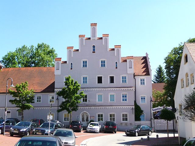
Хернгирсдорф (Herrngiersdorf, Herrngiersdorf)

 Hiking in Хернгирсдорф
Herrngiersdorf is a small village located in Bavaria, Germany, and it offers a wonderful experience for hiking enthusiasts. While it may not be as renowned as other hiking destinations, its surrounding landscapes provide charming trails and a glimpse into the scenic beauty of the Bavarian countryside.
Hiking Options:
-
Scenic Trails:
- The area around Herrngiersdorf features several well-marked trails that take you through the beautiful Bavarian landscape, including rolling hills, forests, and farmlands.
-
Nearby Nature Reserves:
- Depending on your hiking preferences, you can explore nearby nature reserves or parks that offer more extensive trail networks. For instance, the Danube River is not far, and the trails along its banks provide a picturesque setting.
-
Viewpoints:
- There are opportunities to find local viewpoints where you can take in panoramic views of the surrounding hills and valleys, perfect for photography or relaxing breaks.
Tips for Hiking in Herrngiersdorf:
- Trail Maps: Always carry a trail map or use a reliable hiking app on your phone for navigation.
- Local Information: Check for local tourist information centers for recommendations on trails and current conditions.
- Weather: Bavaria can experience variable weather, so be prepared with appropriate gear, including rainwear and sturdy hiking boots.
- Footwear: Ensure you have good footwear suited for the terrain, especially if you plan to tackle uneven paths or meander through forested areas.
- Respect Nature: Stay on marked trails to protect the local flora and fauna, and carry out any trash you bring along.
- Hydration and Snacks: Carry enough water and snacks to keep your energy up during hikes.
Accessibility:
Herrngiersdorf is generally accessible by car, and public transport options may be available depending on your starting point. If you're staying in nearby towns or cities, consider organizing day trips to explore the area by foot.
Whether you're looking for a peaceful day hike or a more extended trekking experience, Herrngiersdorf can provide a beautiful backdrop for your outdoor adventure. Enjoy your hike!
- Страна:

- Почтовый код: 84097
- Телефонный код: 09452
- Код автомобильного номера: KEH
- Координаты: 48° 48' 0" N, 12° 4' 0" E


- GPS треки (wikiloc): [Ссылка]
- Высота над уровнем моря: 405 м m
- Площадь: 25.08 кв.км
- Население: 1010
- Веб сайт: http://www.herrngiersdorf.de
- Википедия русская: wiki(ru)
- Википедия английская: wiki(en)
- Википедия национальная: wiki(de)
- Хранилище Wikidata: Wikidata: Q260271
- Катеория в википедии: [Ссылка]
- код Freebase: [/m/02q3rqq]
- код GeoNames: Альт: [2905652]
- код VIAF: Альт: [248986495]
- ID отношения в OpenStreetMap: [956644]
- код GND: Альт: [4089211-6]
- идентификатор местоположения ArchINFORM: [14554]
- код Historical Gazetteer: [HERORF_W8301]
- Bavarikon ID: [ODB_A00001492]
- идентификатор муниципалитетов в Германии: 09273127
Граничит с регионами:

Роттенбург-на-Лабере
Hiking in Роттенбург-на-Лабере
Rottenburg an der Laaber is a charming town in Bavaria, Germany, that offers a variety of hiking opportunities in its surrounding landscapes. The region is known for its picturesque countryside, forested areas, and the scenic Laaber River, making it an excellent destination for hikers of all skill levels....
- Страна:
- Почтовый код: 84056
- Телефонный код: 08781
- Координаты: 48° 42' 7" N, 12° 1' 38" E
- GPS треки (wikiloc): [Ссылка]
- Высота над уровнем моря: 453 м m
- Площадь: 90.11 кв.км
- Население: 7827
- Веб сайт: [Ссылка]


Ширлинг
Hiking in Ширлинг
Schierling, located in Bavaria, Germany, is a charming area that offers a variety of hiking opportunities. Nestled in the picturesque countryside near the Regen River, it features a mix of scenic landscapes, rolling hills, and lush forests. Here are some highlights and tips for hiking in Schierling:...
- Страна:
- Почтовый код: 84069
- Телефонный код: 09451
- Код автомобильного номера: R
- Координаты: 48° 50' 5" N, 12° 8' 23" E
- GPS треки (wikiloc): [Ссылка]
- Высота над уровнем моря: 381 м m
- Площадь: 77.42 кв.км
- Население: 6322
- Веб сайт: [Ссылка]


Лангквайд
Hiking in Лангквайд
Langquaid, a charming village located in Bavaria, Germany, is surrounded by picturesque landscapes and offers a variety of hiking opportunities. The region is characterized by its rolling hills, meadows, and forests, making it a great destination for nature lovers and hiking enthusiasts....
- Страна:
- Почтовый код: 84083–84085
- Телефонный код: 09452
- Код автомобильного номера: KEH
- Координаты: 48° 49' 0" N, 12° 3' 0" E
- GPS треки (wikiloc): [Ссылка]
- Высота над уровнем моря: 389 м m
- Площадь: 56.77 кв.км
- Население: 3777
- Веб сайт: [Ссылка]


Рор
- муниципалитет в Германии, Бавария
Hiking in Рор
Rohr in Niederbayern, located in the Lower Bavaria region of Germany, is surrounded by beautiful landscapes that are ideal for hiking. The area features a mix of scenic forests, rolling hills, and charming villages, making it a great destination for outdoor enthusiasts....
- Страна:
- Почтовый код: 93352
- Телефонный код: 08783
- Код автомобильного номера: KEH
- Координаты: 48° 46' 0" N, 11° 58' 0" E
- GPS треки (wikiloc): [Ссылка]
- Высота над уровнем моря: 426 м m
- Площадь: 54.12 кв.км
- Население: 2956
- Веб сайт: [Ссылка]