Верхний Таунус (Hochtaunuskreis, Hochtaunuskreis)


 Hiking in Верхний Таунус
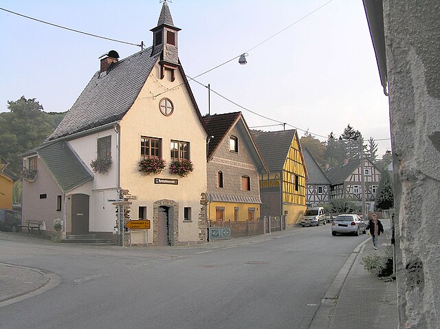
Hochtaunuskreis, located in the state of Hesse, Germany, is a fantastic area for hiking enthusiasts. This region is characterized by its rolling hills, dense forests, and stunning vistas, making it a wonderful destination for both casual walkers and experienced hikers. Here are some highlights and tips for hiking in Hochtaunuskreis:
Trails and Walking Routes
-
Taunus Ridge Trail (Taunus Höhenweg): This long-distance hiking trail offers panoramic views over the Taunus mountains and beyond. The trail is well-marked and stretches across various scenic landscapes.
-
Nister Valley Trail: A beautiful route that follows the Nister River. It is a moderately challenging trail suitable for families and offers many spots for picnicking.
-
Bergwanderweg (Mountain Hiking Trail): This trail features more serious inclines, suitable for experienced hikers. It leads you through dense forest areas and rocky outcrops.
-
Local Circular Routes (Rundwanderwege): There are many well-marked circular trails starting in villages and towns throughout the Hochtaunuskreis, such as Bad Homburg or Oberursel. These trails allow hikers to experience different aspects of the local flora and fauna.
Scenic Highlights
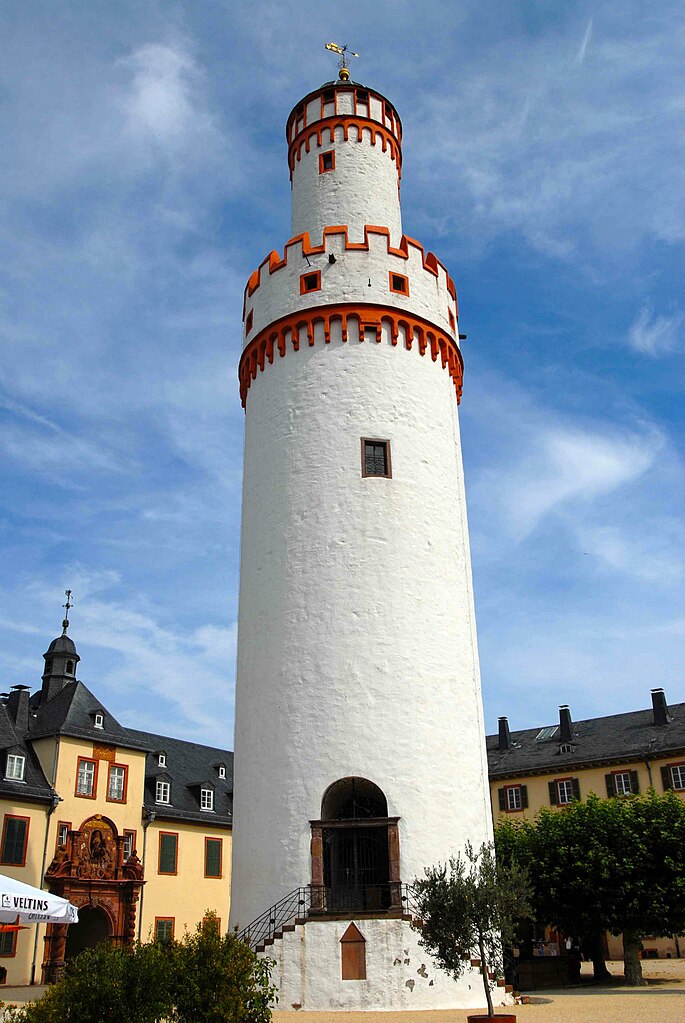
- The Großer Feldberg: The highest peak in the Taunus mountain range, offering panoramic views and a tower for visitors to enjoy the scenery.
- Schwarzenbach Dam: A picturesque area with opportunities for bird watching and enjoying the tranquility of nature.
- Historical Sites: Along some trails, you may encounter remnants of historical castles and ruins, adding a cultural aspect to your hike.
Tips for Hiking in Hochtaunuskreis
- Prepare for Weather: The weather can change quickly in the mountains. Ensure you have appropriate clothing and equipment.
- Stay Hydrated: Bring sufficient water, especially on longer hikes.
- Respect Wildlife: Keep a safe distance from wildlife and adhere to local guidelines to protect nature.
- Follow Markings: The trails are generally well-marked, but always carry a map or use a GPS-enabled device to avoid getting lost.
- Seasonal Considerations: Spring and autumn are particularly beautiful times to hike due to blooming flowers and vibrant fall foliage, but summer can be hot, and winter trails may require snow gear.
Local Amenities
You'll find plenty of amenities in towns like Bad Homburg or Oberursel, including restaurants, cafes, and shops for supplies. Many locals are also friendly and keen to share information about the best trails.
Overall, Hochtaunuskreis offers a diverse hiking experience with its natural beauty and historical significance, making it a worthwhile destination for hikers of all levels.
- Страна:

- Столица: Бад-Хомбург
- Код автомобильного номера: HG
- Координаты: 50° 12' 56" N, 8° 36' 59" E


- GPS треки (wikiloc): [Ссылка]
- Высота над уровнем моря: 385 м m
- Площадь: 482.03 кв.км
- Веб сайт: http://www.hochtaunuskreis.de
- Википедия русская: wiki(ru)
- Википедия английская: wiki(en)
- Википедия национальная: wiki(de)
- Хранилище Wikidata: Wikidata: Q7908
- Катеория в википедии: [Ссылка]
- Карты в википедии: [Ссылка]
- код Freebase: [/m/01d930]
- код GeoNames: Альт: [3220970]
- код VIAF: Альт: [148396925]
- ID отношения в OpenStreetMap: [62566]
- код GND: Альт: [4025276-0]
- идентификатор местоположения ArchINFORM: [2459]
- код LCNAF: Альт: [n85149017]
- код TGN: [7077065]
- код NUTS: [DE718]
- код района Германии: 06434
Включает регионы:

Бад-Хомбург
- город в Германии, районный центр, курорт, расположен в земле Гессен
Hiking in Бад-Хомбург
Bad Homburg vor der Höhe, located in Hesse, Germany, is a charming spa town surrounded by picturesque landscapes, making it an excellent destination for hiking enthusiasts. The area is characterized by its blend of natural beauty, historical sites, and well-marked trails....
- Страна:
- Почтовый код: 61352; 61350; 61348
- Телефонный код: 06172
- Код автомобильного номера: USI; HG
- Координаты: 50° 13' 45" N, 8° 36' 38" E
- GPS треки (wikiloc): [Ссылка]
- Высота над уровнем моря: 194 м m
- Площадь: 51.17 кв.км
- Население: 52752
- Веб сайт: [Ссылка]


Кронберг
Hiking in Кронберг
Kronberg im Taunus is a picturesque town in Hesse, Germany, located in the Taunus mountain range. It offers a variety of hiking trails that cater to different skill levels, making it an attractive destination for hikers. Here's what you need to know about hiking in this region:...
- Страна:
- Почтовый код: 61476
- Телефонный код: 06173
- Код автомобильного номера: HG
- Координаты: 50° 10' 47" N, 8° 30' 31" E
- GPS треки (wikiloc): [Ссылка]
- Высота над уровнем моря: 251 м m
- Площадь: 18.62 кв.км
- Население: 18465
- Веб сайт: [Ссылка]


Кёнигштайн
Hiking in Кёнигштайн
Königstein im Taunus is a picturesque town located in the Taunus mountain range in Germany, known for its beautiful natural landscapes and numerous hiking trails. Here are some key points about hiking in this area:...
- Страна:
- Почтовый код: 61462
- Телефонный код: 06174
- Код автомобильного номера: HG
- Координаты: 50° 10' 59" N, 8° 27' 49" E
- GPS треки (wikiloc): [Ссылка]
- Высота над уровнем моря: 362 м m
- Площадь: 25.1 кв.км
- Население: 16150
- Веб сайт: [Ссылка]

Вайльрод
Hiking in Вайльрод
Weilrod is a charming municipality located in the Taunus mountain range of Hesse, Germany. It offers a variety of hiking opportunities that cater to different fitness levels and interests. Here are some highlights for hiking in Weilrod:...
- Страна:
- Почтовый код: 61276
- Телефонный код: 06084; 06083
- Код автомобильного номера: HG
- Координаты: 50° 20' 44" N, 8° 22' 58" E
- GPS треки (wikiloc): [Ссылка]
- Высота над уровнем моря: 434 м m
- Площадь: 71.16 кв.км
- Население: 6422
- Веб сайт: [Ссылка]


Шмиттен
Hiking in Шмиттен
Schmitten is a charming area located in the state of Hesse, Germany, nestled in the beautiful surroundings of the Taunus mountain range. Known for its stunning landscapes, Schmitten offers a range of hiking opportunities suitable for all levels of experience....
- Страна:
- Почтовый код: 61389
- Телефонный код: 06084; 06082
- Код автомобильного номера: HG
- Координаты: 50° 16' 11" N, 8° 26' 40" E
- GPS треки (wikiloc): [Ссылка]
- Высота над уровнем моря: 465 м m
- Площадь: 36 кв.км
- Население: 9379
- Веб сайт: [Ссылка]


Ной-Анспах
Hiking in Ной-Анспах
Neu-Anspach, located in the state of Hesse, Germany, is surrounded by the scenic landscapes of the Hochtaunus Nature Park. This area offers a variety of hiking opportunities, making it an excellent destination for both novice and experienced hikers....
- Страна:
- Почтовый код: 61267
- Телефонный код: 06081
- Код автомобильного номера: HG
- Координаты: 50° 18' 1" N, 8° 30' 26" E
- GPS треки (wikiloc): [Ссылка]
- Высота над уровнем моря: 342 м m
- Площадь: 36.14 кв.км
- Население: 14704
- Веб сайт: [Ссылка]

Узинген
- город в Гессене
Hiking in Узинген
Usingen is a charming town located in the state of Hesse, Germany, and it offers a variety of scenic hiking opportunities. The area is characterized by beautiful landscapes, including forests, hills, and streams, making it ideal for nature enthusiasts and hikers....
- Страна:
- Почтовый код: 61250
- Телефонный код: 06081
- Координаты: 50° 20' 3" N, 8° 32' 14" E
- GPS треки (wikiloc): [Ссылка]
- Высота над уровнем моря: 269 м m
- Площадь: 55.83 кв.км
- Население: 14437
- Веб сайт: [Ссылка]

Штайнбах
- небольшой город в Германии, Гессен, Административный округ Дармштадт, Верхний Таунус
Hiking in Штайнбах
Steinbach, located in the Taunus mountain range in Germany, offers a variety of hiking opportunities for all skill levels. The region is known for its picturesque landscapes, forests, and scenic views. Here are some highlights and tips for hiking in Steinbach:...
- Страна:
- Почтовый код: 61449
- Телефонный код: 06171
- Код автомобильного номера: HG
- Координаты: 50° 10' 4" N, 8° 34' 19" E
- GPS треки (wikiloc): [Ссылка]
- Высота над уровнем моря: 170 м m
- Площадь: 4.4 кв.км
- Население: 10570
- Веб сайт: [Ссылка]


Гревенвисбах
Hiking in Гревенвисбах
Grävenwiesbach, located in the scenic Hochtaunus region of Germany, offers a variety of hiking opportunities that showcase its beautiful natural landscapes, charming villages, and rich cultural heritage. The area is part of the Taunus Mountains, which feature rolling hills, dense forests, and panoramic views....
- Страна:
- Почтовый код: 61279
- Телефонный код: 06086
- Код автомобильного номера: HG
- Координаты: 50° 23' 8" N, 8° 27' 25" E
- GPS треки (wikiloc): [Ссылка]
- Высота над уровнем моря: 326 м m
- Площадь: 43.16 кв.км
- Население: 5374
- Веб сайт: [Ссылка]


Фридрихсдорф
Hiking in Фридрихсдорф
Friedrichsdorf is a charming town located in the state of Hesse, Germany. It's situated near the Taunus mountain range, which offers a variety of hiking trails and outdoor opportunities for nature enthusiasts....
- Страна:
- Почтовый код: 61381
- Телефонный код: 06007; 06175; 06172
- Код автомобильного номера: HG
- Координаты: 50° 15' 25" N, 8° 38' 31" E
- GPS треки (wikiloc): [Ссылка]
- Высота над уровнем моря: 200 м m
- Площадь: 30.12 кв.км
- Население: 25268
- Веб сайт: [Ссылка]


Верхайм
Hiking in Верхайм
Wehrheim is a charming town located in the Hochtaunuskreis district of Hesse, Germany. It is surrounded by beautiful natural landscapes, making it a great destination for hiking enthusiasts. Here’s what you should know about hiking in and around Wehrheim:...
- Страна:
- Почтовый код: 61273
- Телефонный код: 06081
- Код автомобильного номера: HG
- Координаты: 50° 18' 12" N, 8° 34' 15" E
- GPS треки (wikiloc): [Ссылка]
- Высота над уровнем моря: 305 м m
- Площадь: 38.34 кв.км
- Население: 9410
- Веб сайт: [Ссылка]


Гласхюттен
Hiking in Гласхюттен
Glashütten, located in the Taunus mountain range in Germany, is a charming village known for its beautiful natural scenery and excellent hiking opportunities. The region offers a variety of trails suitable for different skill levels, from leisurely walks to more challenging hikes....
- Страна:
- Почтовый код: 61479
- Телефонный код: 06174
- Код автомобильного номера: HG
- Координаты: 50° 13' 0" N, 8° 24' 0" E
- GPS треки (wikiloc): [Ссылка]
- Высота над уровнем моря: 510 м m
- Площадь: 27.1 кв.км
- Население: 5446
- Веб сайт: [Ссылка]


Оберурзель
Hiking in Оберурзель
Oberursel (Taunus) is a picturesque town located on the northern edge of the Taunus mountain range in Germany, making it an excellent base for hiking enthusiasts. The area offers a variety of trails that cater to different skill levels, allowing both beginners and experienced hikers to enjoy the natural beauty and scenic views of the region....
- Страна:
- Почтовый код: 61440
- Телефонный код: 06171
- Код автомобильного номера: HG
- Координаты: 50° 12' 10" N, 8° 34' 37" E
- GPS треки (wikiloc): [Ссылка]
- Высота над уровнем моря: 197 м m
- Площадь: 45.37 кв.км
- Население: 46069
- Веб сайт: [Ссылка]
Граничит с регионами:
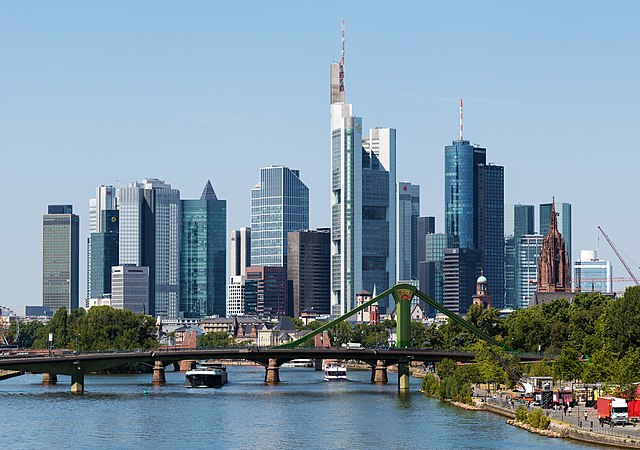

Франкфурт-на-Майне
- город в земле Гессен, Германия
Hiking in Франкфурт-на-Майне
Hiking in Frankfurt offers a unique blend of urban and natural experiences. While Frankfurt itself is a bustling financial hub, it is also surrounded by beautiful landscapes that are great for outdoor enthusiasts. Here are some key points to consider:...
- Страна:
- Почтовый код: 65929–65936; 60308–60599
- Телефонный код: 069; 6101; 6109
- Код автомобильного номера: F
- Координаты: 50° 6' 49" N, 8° 40' 47" E
- GPS треки (wikiloc): [Ссылка]
- Высота над уровнем моря: 112 м m
- Площадь: 248.31 кв.км
- Население: 736414
- Веб сайт: [Ссылка]


Райнгау-Таунус
Hiking in Райнгау-Таунус
The Rheingau-Taunus-Kreis region in Germany is an excellent destination for hiking enthusiasts, offering a diverse landscape that includes rolling hills, vineyards, and dense forests. Located in the state of Hesse, this area is known for its natural beauty and cultural significance, making it a great spot for both experienced hikers and those new to the activity....
- Страна:
- Столица: Бад-Швальбах
- Код автомобильного номера: RÜD
- Координаты: 50° 8' 54" N, 8° 4' 24" E
- GPS треки (wikiloc): [Ссылка]
- Высота над уровнем моря: 308 м m
- Веб сайт: [Ссылка]


Майн-Таунус
Hiking in Майн-Таунус
Main-Taunus-Kreis, located in Hesse, Germany, is a beautiful area known for its picturesque landscapes, including the Taunus mountains. Hiking in this region can be a rewarding experience, offering a mix of nature, history, and outdoor activities....
- Страна:
- Столица: Хофхайм-ам-Таунус
- Код автомобильного номера: MTK
- Координаты: 50° 4' 46" N, 8° 26' 58" E
- GPS треки (wikiloc): [Ссылка]
- Высота над уровнем моря: 245 м m
- Площадь: 222.40 кв.км
- Население: 226113
- Веб сайт: [Ссылка]