Ирнфриц-Мессерн (Irnfritz-Messern, Irnfritz-Messern)
 Hiking in Ирнфриц-Мессерн
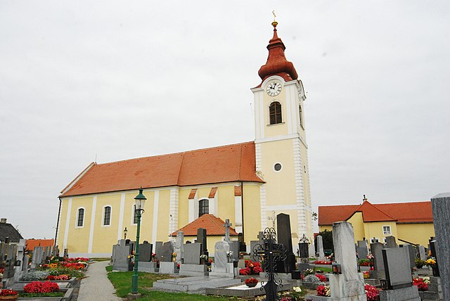
Irnfritz-Messern, located in Lower Austria, is a charming area known for its picturesque landscapes and scenic hiking trails. While it may not be as well-known as some of Austria's larger hiking destinations, it offers a peaceful retreat for nature lovers and hiking enthusiasts.
Hiking Trails
-
Local Trails: The region features various local hiking paths that take you through beautiful forests, rolling hills, and along rivers. Trails vary in difficulty, making it suitable for both beginners and more experienced hikers.
-
Nature Reserves: Explore nearby nature reserves that provide opportunities to observe local wildlife and enjoy the natural beauty. These areas often feature well-marked trails.
-
Cultural Trails: Some trails may also include historical or cultural points of interest, such as old churches and traditional farming landscapes, providing insight into the local culture.
Tips for Hiking in Irnfritz-Messern
- Trail Maps: Always carry a detailed map or use a hiking app to track your route and stay oriented.
- Weather Preparedness: The weather can change quickly, so check forecasts and dress in layers. Waterproof gear can also be beneficial.
- Hydration and Snacks: Bring plenty of water and snacks to keep your energy up during your hikes.
- Respect Nature: Stay on marked trails to minimize your impact on the environment and enjoy the flora and fauna.
Additional Activities
- Cycling: In addition to hiking, the area is also great for cycling, with routes available for various skill levels.
- Local Cuisine: After a day of hiking, consider enjoying some local Austrian cuisine at nearby inns or restaurants to really experience the culture.
Hiking in Irnfritz-Messern offers a serene experience in nature, making it a great choice for outdoor enthusiasts looking to explore the beauty of Lower Austria. Always make sure to check local resources for the latest trail conditions and any specific regulations before your hike.
- Страна:

- Телефонный код: 02986
- Код автомобильного номера: HO
- Координаты: 48° 44' 23" N, 15° 33' 29" E


- GPS треки (wikiloc): [Ссылка]
- Высота над уровнем моря: 561 м m
- Площадь: 55.92 кв.км
- Население: 1409
- Веб сайт: http://www.irnfritz.at
- Википедия русская: wiki(ru)
- Википедия английская: wiki(en)
- Википедия национальная: wiki(de)
- Хранилище Wikidata: Wikidata: Q666324
- Катеория в википедии: [Ссылка]
- код Freebase: [/m/02qx8sv]
- код GeoNames: Альт: [7872899]
- код VIAF: Альт: [235695305]
- код австрийского муниципалитета: [31110]
Граничит с регионами:

Герас
Hiking in Герас
Geras, located in the Waldviertel region of Austria, is surrounded by beautiful landscapes that offer a variety of hiking opportunities. The picturesque countryside, with its rolling hills, dense forests, and charming villages, provides an excellent backdrop for outdoor enthusiasts....
- Страна:
- Телефонный код: 02912
- Код автомобильного номера: HO
- Координаты: 48° 47' 56" N, 15° 40' 28" E
- GPS треки (wikiloc): [Ссылка]
- Высота над уровнем моря: 460 м m
- Площадь: 67.66 кв.км
- Население: 1325
- Веб сайт: [Ссылка]

Лудвайс-Айген
Hiking in Лудвайс-Айген
Ludweis-Aigen, located in Austria, is a beautiful destination for hiking enthusiasts. Nestled in the rolling hills of the region, it offers picturesque landscapes, lush forests, and a variety of trails suited for all skill levels, from beginners to advanced hikers....
- Страна:
- Почтовый код: 3762
- Телефонный код: 02847
- Код автомобильного номера: WT
- Координаты: 48° 46' 0" N, 15° 29' 0" E
- GPS треки (wikiloc): [Ссылка]
- Высота над уровнем моря: 507 м m
- Площадь: 51.18 кв.км
- Население: 914
- Веб сайт: [Ссылка]

Брун-ан-дер-Вильд
Hiking in Брун-ан-дер-Вильд
Brunn an der Wild is a quaint village located in the Austrian state of Lower Austria, nestled within the scenic Waldviertel region. The area is renowned for its lush landscapes, rolling hills, and dense forests, making it a fantastic destination for hiking enthusiasts....
- Страна:
- Почтовый код: 3595
- Телефонный код: 02989
- Код автомобильного номера: HO
- Координаты: 48° 41' 39" N, 15° 31' 10" E
- GPS треки (wikiloc): [Ссылка]
- Высота над уровнем моря: 442 м m
- Площадь: 32.03 кв.км
- Население: 826
- Веб сайт: [Ссылка]

Санкт-Бернхард-Фрауэнхофен
Hiking in Санкт-Бернхард-Фрауэнхофен
Sankt Bernhard-Frauenhofen is a picturesque region located in Austria, known for its beautiful landscapes and outdoor activities, including hiking. Here are some key aspects to consider for hiking in this area:...
- Страна:
- Почтовый код: 3580
- Телефонный код: 02982
- Код автомобильного номера: HO
- Координаты: 48° 40' 58" N, 15° 35' 38" E
- GPS треки (wikiloc): [Ссылка]
- Высота над уровнем моря: 328 м m
- Площадь: 29.47 кв.км
- Население: 1299
- Веб сайт: [Ссылка]
Японс
Hiking in Японс
Hiking in Japan offers a diverse range of experiences, thanks to the country's varied landscapes, rich culture, and well-maintained trails. Here are some key points to consider when planning a hiking trip in Japan:...
- Страна:
- Почтовый код: 3763
- Телефонный код: 02914
- Код автомобильного номера: HO
- Координаты: 48° 47' 34" N, 15° 34' 5" E
- GPS треки (wikiloc): [Ссылка]
- Высота над уровнем моря: 525 м m
- Площадь: 29.38 кв.км
- Население: 733
- Веб сайт: [Ссылка]

Пернег
Hiking in Пернег
Pernegg is a beautiful area located in Austria, known for its picturesque landscapes and hiking opportunities. Nestled in the Styrian region, it offers a variety of trails suitable for different skill levels, making it a great destination for both novice hikers and seasoned trekkers....
- Страна:
- Почтовый код: 3753
- Телефонный код: 02913
- Код автомобильного номера: HO
- Координаты: 48° 44' 21" N, 15° 37' 38" E
- GPS треки (wikiloc): [Ссылка]
- Высота над уровнем моря: 530 м m
- Площадь: 36.59 кв.км
- Население: 701
- Веб сайт: [Ссылка]