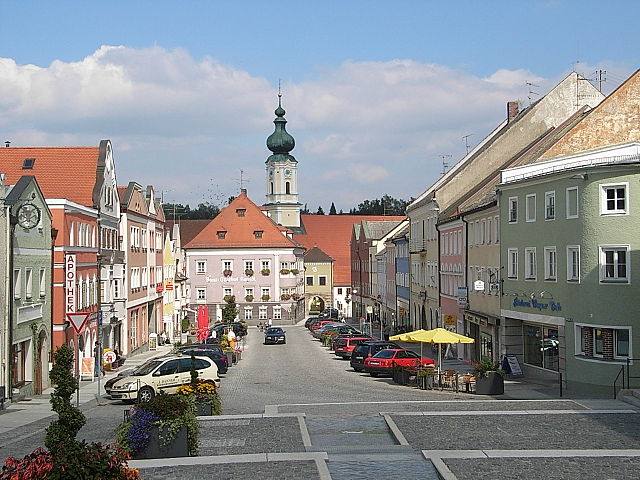
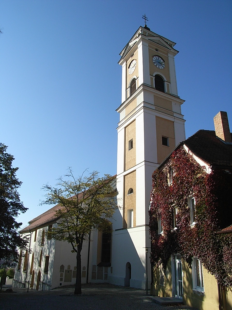
Кёсларн (Kößlarn, Kößlarn)

 Hiking in Кёсларн
Kößlarn is a village located in Bavaria, Germany, known for its picturesque landscapes and outdoor activities, including hiking. The region surrounding Kößlarn offers various trails suitable for different skill levels, making it an appealing destination for both novice and experienced hikers.
Hiking Opportunities in Kößlarn:
-
Scenic Trails: The area features a mix of easy and moderate hiking trails that allow you to enjoy the natural beauty of the Bavarian countryside, including lush forests, rolling hills, and serene lakes.
-
Local Nature: Hikers can expect to encounter diverse flora and fauna, with opportunities for birdwatching and enjoying the local wildlife.
-
Cultural Points of Interest: Some trails may lead to nearby historical sites and local villages, allowing hikers to explore Bavarian culture alongside their outdoor adventure.
-
Accessibility: Many trails around Kößlarn are accessible year-round, but it is recommended to check trail conditions, especially during winter months when snow might make some paths more challenging.
-
Guided Tours: For those interested in more structured experiences, guided hiking tours might be available, led by local experts who can provide insights into the region's history and natural environment.
Tips for Hiking in Kößlarn:
- Equipment: Ensure you have the right hiking gear, including sturdy shoes, a backpack, sufficient water, and snacks.
- Weather: Check the weather forecast before heading out, as conditions can change rapidly.
- Maps and Navigation: Having a map or a GPS device is advisable, as some trails may not be well-marked.
- Respect Nature: Follow Leave No Trace principles to keep the area pristine for future hikers.
Directions and Accommodations:
Kößlarn is easily reachable by car and public transport. If you plan to hike over multiple days, look for local accommodations, such as guesthouses or inns, which may also provide meals or hiking resources.
Overall, hiking in Kößlarn offers a delightful experience for those looking to explore the beauty of Bavaria while enjoying an active outdoor lifestyle.
- Страна:

- Почтовый код: 94149
- Телефонный код: 08536
- Код автомобильного номера: PA
- Координаты: 48° 22' 25" N, 13° 7' 26" E


- GPS треки (wikiloc): [Ссылка]
- Высота над уровнем моря: 425 м m
- Площадь: 25.48 кв.км
- Население: 1696
- Веб сайт: http://www.koesslarn.de
- Википедия русская: wiki(ru)
- Википедия английская: wiki(en)
- Википедия национальная: wiki(de)
- Хранилище Wikidata: Wikidata: Q509821
- Катеория в википедии: [Ссылка]
- код Freebase: [/m/02q6sqb]
- код VIAF: Альт: [240409886]
- ID отношения в OpenStreetMap: [958100]
- код GND: Альт: [4224763-9]
- идентификатор местоположения ArchINFORM: [13463]
- код Historical Gazetteer: [KOSAR1JN68NI]
- Bavarikon ID: [ODB_A00001562]
- идентификатор муниципалитетов в Германии: 09275131
Граничит с регионами:


Мальхинг
Hiking in Мальхинг
Malching is a lesser-known trekking destination, and specific details about its hiking trails may be limited. However, when exploring any hiking area, it's important to consider a few general tips:...
- Страна:
- Почтовый код: 94094
- Телефонный код: 08573
- Код автомобильного номера: PA
- Координаты: 48° 19' 0" N, 13° 12' 0" E
- GPS треки (wikiloc): [Ссылка]
- Высота над уровнем моря: 345 м m
- Площадь: 25.23 кв.км
- Население: 1154
- Веб сайт: [Ссылка]

Роттальмюнстер
Hiking in Роттальмюнстер
Rotthalmünster is a picturesque village located in Bavaria, Germany, offering a variety of hiking opportunities amid beautiful landscapes. When planning a hiking trip in and around Rotthalmünster, here are some highlights and tips to consider:...
- Страна:
- Почтовый код: 94094
- Телефонный код: 08533
- Код автомобильного номера: PA
- Координаты: 48° 21' 35" N, 13° 12' 10" E
- GPS треки (wikiloc): [Ссылка]
- Высота над уровнем моря: 405 м m
- Площадь: 44.55 кв.км
- Население: 4538
- Веб сайт: [Ссылка]

Трифтерн
Hiking in Трифтерн
Triftern is a small town located in the district of Rottal-Inn in Bavaria, Germany. While it may not be as well-known for hiking as some other regions, it offers access to the beautiful Bavarian countryside, where you can enjoy various nature trails and paths....
- Страна:
- Почтовый код: 84371
- Телефонный код: 08562
- Код автомобильного номера: PAN
- Координаты: 48° 24' 0" N, 13° 1' 0" E
- GPS треки (wikiloc): [Ссылка]
- Высота над уровнем моря: 391 м m
- Площадь: 62.24 кв.км
- Население: 5012
- Веб сайт: [Ссылка]

Байербах
Hiking in Байербах
Bayerbach is a charming area in Bavaria, Germany, known for its picturesque landscapes and excellent hiking opportunities. Situated in the Lower Bavaria region, it's surrounded by rolling hills, forests, and rivers, making it an ideal spot for outdoor enthusiasts....
- Страна:
- Почтовый код: 94137
- Телефонный код: 08532
- Код автомобильного номера: PAN
- Координаты: 48° 25' 0" N, 13° 9' 0" E
- GPS треки (wikiloc): [Ссылка]
- Высота над уровнем моря: 357 м m
- Площадь: 19.43 кв.км
- Население: 1574
- Веб сайт: [Ссылка]
Бад-Бирнбах
Hiking in Бад-Бирнбах
Bad Birnbach, located in the Lower Bavaria region of Germany, is known for its scenic landscapes, natural hot springs, and wellness facilities. The area is a great choice for hiking enthusiasts of all levels, offering a variety of trails that showcase the beautiful Bavarian countryside....
- Страна:
- Почтовый код: 84364
- Телефонный код: 08563
- Код автомобильного номера: PAN
- Координаты: 48° 27' 0" N, 13° 5' 0" E
- GPS треки (wikiloc): [Ссылка]
- Высота над уровнем моря: 376 м m
- Площадь: 68.83 кв.км
- Население: 5743
- Веб сайт: [Ссылка]

Эринг
Hiking in Эринг
Ering is a beautiful area that offers a variety of hiking opportunities, characterized by its stunning natural landscapes, diverse flora and fauna, and picturesque views. While specific trails and details can vary, here are some general aspects you can consider while hiking in Ering:...
- Страна:
- Почтовый код: 94140
- Телефонный код: 08573
- Код автомобильного номера: PAN
- Координаты: 48° 18' 0" N, 13° 9' 0" E
- GPS треки (wikiloc): [Ссылка]
- Высота над уровнем моря: 340 м m
- Площадь: 39.56 кв.км
- Население: 1845
- Веб сайт: [Ссылка]

Штубенберг
Hiking in Штубенберг
Stubenberg, located in Bavaria, Germany, is a charming area that offers numerous opportunities for hiking enthusiasts. While it may not be as widely known as some of the larger Bavarian hiking destinations, it boasts beautiful landscapes and trails that can cater to various skill levels....
- Страна:
- Почтовый код: 94166
- Телефонный код: 08571
- Код автомобильного номера: PAN
- Координаты: 48° 19' 0" N, 13° 5' 0" E
- GPS треки (wikiloc): [Ссылка]
- Высота над уровнем моря: 425 м m
- Площадь: 18.19 кв.км
- Население: 1307
- Веб сайт: [Ссылка]