Эринг (Ering, Ering)

 Hiking in Эринг
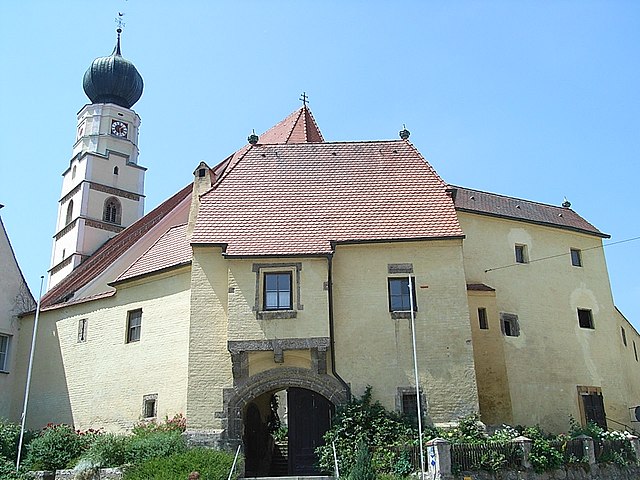
Ering is a beautiful area that offers a variety of hiking opportunities, characterized by its stunning natural landscapes, diverse flora and fauna, and picturesque views. While specific trails and details can vary, here are some general aspects you can consider while hiking in Ering:
-
Trail Variety: Ering may offer a range of trails suitable for different skill levels, from easy paths for beginners to more challenging routes for experienced hikers. Check local resources for trail maps and difficulty ratings.
-
Scenic Views: Many hikes in Ering will take you through forests, along rivers, or up to scenic overlooks. Be sure to bring your camera to capture the breathtaking landscapes.
-
Flora and Fauna: Depending on the season, you might encounter a variety of wildlife and plant species. It's a good idea to familiarize yourself with local flora and fauna for a more enriching experience.
-
Safety Considerations: Always check the weather forecast before heading out, wear appropriate footwear, and carry sufficient water and snacks. Be mindful of your surroundings and stay on marked trails to avoid any accidents or getting lost.
-
Leave No Trace: Make sure to follow the Leave No Trace principles. Pack out everything you bring in, and be respectful of the natural environment, including wildlife and vegetation.
-
Local Regulations: Check if there are any permits or regulations required for hiking in certain areas, as well as any seasonal restrictions or guidelines.
-
Guided Hikes: If you’re not familiar with the area, consider joining a guided hike. This can enhance your experience and ensure safety as you explore Ering’s trails.
Before you set out, it’s always a good idea to gather as much information as possible on specific trails and conditions to make the most of your hiking adventure in Ering. Happy hiking!
- Страна:

- Почтовый код: 94140
- Телефонный код: 08573
- Код автомобильного номера: PAN
- Координаты: 48° 18' 0" N, 13° 9' 0" E


- GPS треки (wikiloc): [Ссылка]
- Высота над уровнем моря: 340 м m
- Площадь: 39.56 кв.км
- Население: 1845
- Веб сайт: https://www.ering-inn.de/
- Википедия русская: wiki(ru)
- Википедия английская: wiki(en)
- Википедия национальная: wiki(de)
- Хранилище Wikidata: Wikidata: Q589578
- Катеория в википедии: [Ссылка]
- код Freebase: [/m/02p71qz]
- код GeoNames: Альт: [2929631]
- код VIAF: Альт: [245668595]
- ID отношения в OpenStreetMap: [957052]
- код GND: Альт: [4097982-9]
- код Historical Gazetteer: [ERIIN1JN68NH]
- Bavarikon ID: [ODB_A00009186]
- идентификатор муниципалитетов в Германии: 09277118
Граничит с регионами:


Мальхинг
Hiking in Мальхинг
Malching is a lesser-known trekking destination, and specific details about its hiking trails may be limited. However, when exploring any hiking area, it's important to consider a few general tips:...
- Страна:
- Почтовый код: 94094
- Телефонный код: 08573
- Код автомобильного номера: PA
- Координаты: 48° 19' 0" N, 13° 12' 0" E
- GPS треки (wikiloc): [Ссылка]
- Высота над уровнем моря: 345 м m
- Площадь: 25.23 кв.км
- Население: 1154
- Веб сайт: [Ссылка]

Кёсларн
Hiking in Кёсларн
Kößlarn is a village located in Bavaria, Germany, known for its picturesque landscapes and outdoor activities, including hiking. The region surrounding Kößlarn offers various trails suitable for different skill levels, making it an appealing destination for both novice and experienced hikers....
- Страна:
- Почтовый код: 94149
- Телефонный код: 08536
- Код автомобильного номера: PA
- Координаты: 48° 22' 25" N, 13° 7' 26" E
- GPS треки (wikiloc): [Ссылка]
- Высота над уровнем моря: 425 м m
- Площадь: 25.48 кв.км
- Население: 1696
- Веб сайт: [Ссылка]


Санкт-Петер-на-Харте
Hiking in Санкт-Петер-на-Харте
Sankt Peter am Hart, located in the Austrian state of Upper Austria, is a charming village that offers various outdoor activities, including hiking. The region is known for its picturesque landscapes, featuring rolling hills, lush forests, and scenic views, making it a great destination for nature lovers and hikers....
- Страна:

- Почтовый код: 4963
- Телефонный код: 07722
- Код автомобильного номера: BR
- Координаты: 48° 15' 15" N, 13° 5' 40" E
- GPS треки (wikiloc): [Ссылка]
- Высота над уровнем моря: 372 м m
- Площадь: 2285 кв.км
- Население: 2447
- Веб сайт: [Ссылка]
Мининг
Hiking in Мининг
Hiking in Mining, Austria is a fantastic experience, thanks to the region's stunning natural beauty, rich cultural heritage, and well-maintained trails. While Mining itself is a small village, it's located in proximity to the larger area of Upper Austria, which offers a variety of hiking opportunities in the picturesque landscapes of the Salzkammergut region and the nearby Alps....
- Страна:
- Почтовый код: 4962
- Телефонный код: 07723
- Код автомобильного номера: BR
- Координаты: 48° 16' 40" N, 13° 9' 40" E
- GPS треки (wikiloc): [Ссылка]
- Высота над уровнем моря: 346 м m
- Площадь: 16.58 кв.км
- Население: 1195
- Веб сайт: [Ссылка]

Штубенберг
Hiking in Штубенберг
Stubenberg, located in Bavaria, Germany, is a charming area that offers numerous opportunities for hiking enthusiasts. While it may not be as widely known as some of the larger Bavarian hiking destinations, it boasts beautiful landscapes and trails that can cater to various skill levels....
- Страна:
- Почтовый код: 94166
- Телефонный код: 08571
- Код автомобильного номера: PAN
- Координаты: 48° 19' 0" N, 13° 5' 0" E
- GPS треки (wikiloc): [Ссылка]
- Высота над уровнем моря: 425 м m
- Площадь: 18.19 кв.км
- Население: 1307
- Веб сайт: [Ссылка]