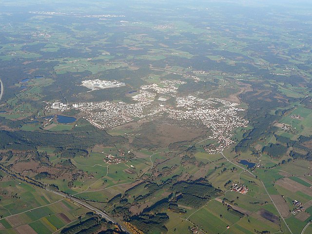
Кёнигсдорф (Königsdorf, Königsdorf)

 Hiking in Кёнигсдорф
Königsdorf is a picturesque village located in Bavaria, Germany, surrounded by beautiful natural landscapes that offer excellent hiking opportunities. The area is characterized by rolling hills, dense forests, and stunning views of the surrounding mountains, making it a great destination for both novice and experienced hikers.
Hiking Trails
-
Local Trails: Königsdorf has several well-marked hiking trails that cater to different skill levels. You can find short loops suitable for families or longer, more challenging hikes that lead to higher elevations with breathtaking viewpoints.
-
Bavarian Alps: The village is close to the Bavarian Alps, where more challenging hikes can be found. Trails in this region often offer stunning panoramic views, alpine meadows, and encounters with local wildlife.
-
Nature Reserves: Many trails in and around Königsdorf pass through nature reserves, where you can appreciate the unique flora and fauna of the area. These trails are often peaceful and provide a chance to connect with nature.
Preparation Tips
- Weather: The weather can change quickly in this region, so always check the forecast before heading out. Layered clothing is advisable.
- Gear: Wear sturdy hiking boots and bring a daypack with water, snacks, a first aid kit, and a map of the area.
- Navigation: Although trails are usually well-marked, it's wise to bring a map or GPS device, especially for more remote hikes.
Attractions
- Scenic Views: Many trails lead to viewpoints where you can take in the stunning landscapes of the Alps and the surrounding countryside.
- Historical Sites: Explore local historical landmarks or charming Bavarian architecture in and around Königsdorf.
Additional Activities
Besides hiking, the area offers opportunities for mountain biking, bird watching, and photography. In the winter, certain trails may be suitable for snowshoeing or winter hiking.
Recommendations
- Local Guides: Consider hiring a local guide for a more in-depth hiking experience, especially if you're unfamiliar with the area.
- Community Events: Check if there are any local hiking events or groups that you can join for a social aspect to your hikes.
Königsdorf is an excellent choice for outdoor enthusiasts looking to explore the natural beauty of Bavaria. Happy hiking!
- Страна:

- Почтовый код: 82549
- Телефонный код: 08046; 08171; 08179
- Координаты: 47° 49' 0" N, 11° 29' 0" E


- GPS треки (wikiloc): [Ссылка]
- Высота над уровнем моря: 625 м m
- Площадь: 45.69 кв.км
- Население: 2988
- Веб сайт: http://www.gemeinde-koenigsdorf.de
- Википедия русская: wiki(ru)
- Википедия английская: wiki(en)
- Википедия национальная: wiki(de)
- Хранилище Wikidata: Wikidata: Q377715
- Катеория в википедии: [Ссылка]
- код Freebase: [/m/02q0yk5]
- код GeoNames: Альт: [6556126]
- ID отношения в OpenStreetMap: [935160]
- код GND: Альт: [4364981-6]
- место в MusicBrainz: [cc7added-bfd9-42a8-89a6-d2304894ffaf]
- код Historical Gazetteer: [object_301035]
- Bavarikon ID: [ODB_A00000962]
- идентификатор муниципалитетов в Германии: 09173134
Граничит с регионами:

Пенцберг
Hiking in Пенцберг
Penzberg, located in Bavaria, Germany, offers a variety of hiking opportunities that cater to different skill levels and preferences. The region is known for its stunning landscapes, which include rolling hills, forests, and panoramic views of the Alps. Here are some highlights and tips for hiking in Penzberg:...
- Страна:
- Почтовый код: 82377
- Телефонный код: 08856
- Код автомобильного номера: WM
- Координаты: 47° 45' 0" N, 11° 22' 0" E
- GPS треки (wikiloc): [Ссылка]
- Высота над уровнем моря: 596 м m
- Площадь: 25.73 кв.км
- Население: 12949
- Веб сайт: [Ссылка]


Геретсрид
Hiking in Геретсрид
Geretsried, located in Bavaria, Germany, is a great spot for hiking enthusiasts due to its scenic natural surroundings and access to various trails. Nestled close to the foothills of the Alps, Geretsried offers a mix of easy walks and more challenging hikes, catering to different skill levels....
- Страна:
- Почтовый код: 82538
- Телефонный код: 08171
- Координаты: 47° 52' 0" N, 11° 28' 0" E
- GPS треки (wikiloc): [Ссылка]
- Высота над уровнем моря: 605 м m
- Площадь: 24.65 кв.км
- Население: 20722
- Веб сайт: [Ссылка]