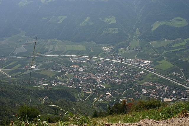
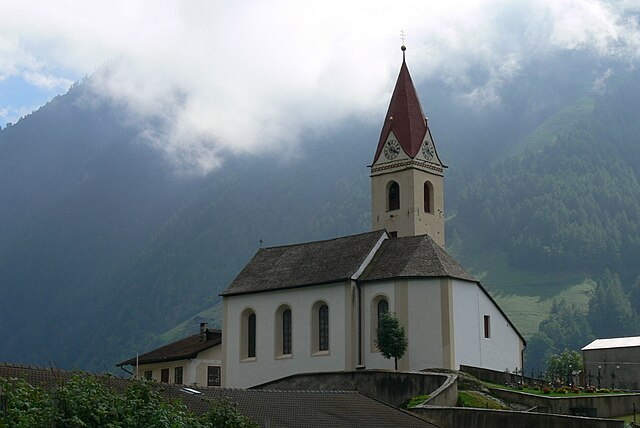
Кастельбелло-Чиардес (Kastelbell-Tschars, Castelbello-Ciardes)
.svg)
- коммуна Италии
 Hiking in Кастельбелло-Чиардес
Kastelbell-Tschars is a picturesque town located in South Tyrol, Italy, surrounded by stunning mountain scenery, making it an ideal destination for hiking enthusiasts. Nestled at the entrance of the Vinschgau Valley, the area offers a variety of hiking trails that cater to different skill levels, from leisurely walks to more challenging routes.
Hiking Trails and Attractions:
-
Tschars Castle: A popular starting point for hikes, the ruins of Tschars Castle are accessible via a short but steep hike. The views from the castle are spectacular, and visitors can enjoy the historical significance of the site.
-
Nörderburg Castle: Another historical site, this castle is reachable via hiking paths that meander through the beautiful landscape, providing views of the surrounding valleys and vineyards.
-
Val Martello: A stunning valley just a short drive away, Val Martello offers trails that lead deeper into the mountains, with opportunities to see alpine flora and fauna. The area is also known for its apple orchards.
-
The hiking trails of the Vinschgau Valley: Numerous trails lead through meadows, vineyards, and forests. The Vinschgau high-altitude hiking trails offer breathtaking panoramas of the Ortler and subsequent mountain ranges.
-
The Watles Mountain: A hiking area accessible by cable car, where you can enjoy various well-marked trails at different elevations. In the summer, you can hike or bike around the area, and in the winter, it transforms into a ski resort.
Tips for Hiking in Kastelbell-Tschars:
-
Best Time to Hike: Late spring through early autumn is ideal for weather and trail conditions. Summers can be warm, so morning hikes are often best.
-
Equipment: Waterproof hiking boots, proper layering clothing, a good backpack, and plenty of water are essential. Although some trails are easy, others can be steep and rocky.
-
Navigation: While many trails are well-marked, it's always a good idea to have a map or a GPS device. Local tourism offices can provide maps if needed.
Local Attractions:
-
Culinary Delights: Don’t miss the chance to enjoy local South Tyrolean cuisine at village restaurants, which often feature dishes made from locally-sourced ingredients.
-
Wine and Apple Tastings: As you trek through the vineyards and orchards, consider stopping for tastings of the region's wines and famous apples.
-
Cultural Events: Keep an eye out for local festivals and events that celebrate South Tyrolean culture, adding a unique flavor to your hiking experience.
Conclusion:
With its stunning landscapes, rich history, and diverse trails, Kastelbell-Tschars offers an unforgettable hiking experience. Whether you're looking for a gentle stroll or a challenging trek, there's something for everyone in this charming part of South Tyrol. Always be sure to check local conditions before heading out, and prepare accordingly for a safe and enjoyable hike!
- Страна:

- Почтовый код: 39020
- Телефонный код: 0473
- Код автомобильного номера: BZ
- Координаты: 46° 37' 42" N, 10° 54' 24" E


- GPS треки (wikiloc): [Ссылка]
- Высота над уровнем моря: 587 м m
- Площадь: 53.79 кв.км
- Население: 2311
- Веб сайт: http://www.comune.castelbello-ciardes.bz.it/system/web/default.aspx?sprache=3
- Википедия русская: wiki(ru)
- Википедия английская: wiki(en)
- Википедия национальная: wiki(it)
- Хранилище Wikidata: Wikidata: Q377177
- Галерея изображений в википедии: [Ссылка]
- Катеория в википедии: [Ссылка]
- код Freebase: [/m/0g9g21]
- код GeoNames: Альт: [6535955]
- код VIAF: Альт: [305427234]
- ID отношения в OpenStreetMap: [47269]
- код GND: Альт: [1044666749]
- код LCNAF: Альт: [no2014057995]
- UN/LOCODE: [ITCT9]
- код ISTAT: 021018
- кадастровый код Италии: C062
Граничит с регионами:

Натурно
- коммуна Италии
Hiking in Натурно
Naturns (or Naturno) is a beautiful village located in South Tyrol, Italy, nestled in the Adige Valley, near the Merano region. It’s an excellent destination for hiking enthusiasts, offering a diverse range of trails that cater to various skill levels and preferences....
- Страна:
- Почтовый код: 39025
- Телефонный код: 0473
- Код автомобильного номера: BZ
- Координаты: 46° 39' 1" N, 11° 0' 30" E
- GPS треки (wikiloc): [Ссылка]
- Высота над уровнем моря: 528 м m
- Площадь: 67.11 кв.км
- Население: 5777
- Веб сайт: [Ссылка]


Лачес
- коммуна Италии
Hiking in Лачес
Latsch, located in South Tyrol, Italy, is a fantastic destination for hiking enthusiasts, offering a mix of beautiful landscapes, diverse trails, and stunning views of the surrounding Alps. Here are some highlights and tips for hiking in Latsch:...
- Страна:
- Почтовый код: 39021
- Телефонный код: 0473
- Код автомобильного номера: BZ
- Координаты: 46° 36' 59" N, 10° 51' 26" E
- GPS треки (wikiloc): [Ссылка]
- Высота над уровнем моря: 639 м m
- Площадь: 78.71 кв.км
- Население: 5216
- Веб сайт: [Ссылка]


Ультимо
- коммуна в Италии
Hiking in Ультимо
Hiking in Ulten, which is located in South Tyrol (Südtirol), northern Italy, offers a fantastic experience for outdoor enthusiasts. The region is characterized by its stunning alpine scenery, lush valleys, and a rich diversity of flora and fauna. Here’s what you need to know about hiking in Ulten:...
- Страна:
- Почтовый код: 39016
- Телефонный код: 0473
- Код автомобильного номера: BZ
- Координаты: 46° 32' 54" N, 11° 0' 15" E
- GPS треки (wikiloc): [Ссылка]
- Высота над уровнем моря: 1190 м m
- Площадь: 208.12 кв.км
- Население: 2871
- Веб сайт: [Ссылка]

Сеналес
- коммуна в Италии
Hiking in Сеналес
Schnals, located in the South Tyrol region of Italy, is a picturesque valley that offers stunning landscapes and diverse hiking opportunities. Nestled in the Ötztal Alps, it is a popular destination for outdoor enthusiasts, especially those who enjoy alpine hiking....
- Страна:
- Почтовый код: 39020
- Телефонный код: 0473
- Код автомобильного номера: BZ
- Координаты: 46° 42' 0" N, 10° 55' 0" E
- GPS треки (wikiloc): [Ссылка]
- Высота над уровнем моря: 1317 м m
- Площадь: 209.84 кв.км
- Население: 1231
- Веб сайт: [Ссылка]