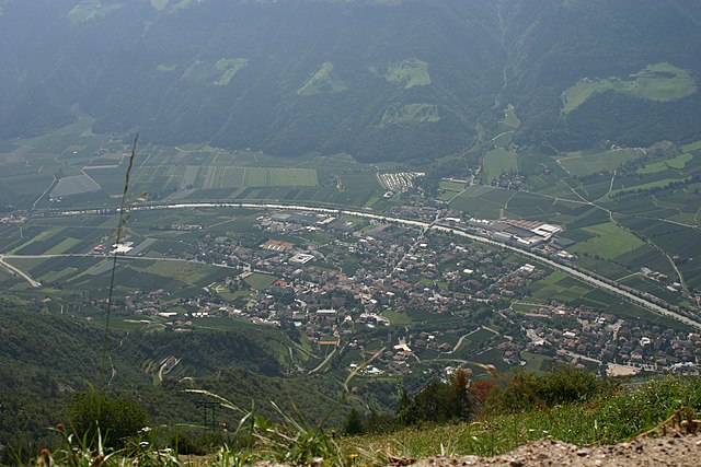
Ультимо (Ulten, Ultimo)
.svg)
- коммуна в Италии
 Hiking in Ультимо
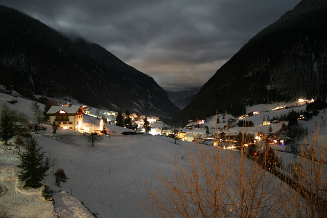
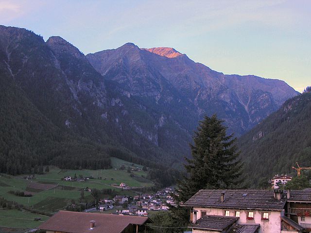
Hiking in Ulten, which is located in South Tyrol (Südtirol), northern Italy, offers a fantastic experience for outdoor enthusiasts. The region is characterized by its stunning alpine scenery, lush valleys, and a rich diversity of flora and fauna. Here’s what you need to know about hiking in Ulten:
Scenic Trails
Ulten boasts numerous well-marked trails suitable for various fitness levels, from leisurely walks to challenging hikes. The panoramic views of the surrounding mountains, such as the Ortler Group, are breathtakingly beautiful. Popular trails include:
- Ultner Höfeweg: A relatively easy path that takes you through charming rural areas and traditional farms.
- Hike to the Ultner Weid Alm: A moderate hike that leads to a mountain hut where you can enjoy local delicacies.
Nature and Wildlife
The area is known for its rich biodiversity. While hiking, you might encounter deer, chamois, and various bird species. The lush meadows and forests also provide an ideal setting for photography and nature observation.
Best Time to Hike
The optimal time for hiking in Ulten typically spans from late spring to early autumn (May to October). During these months, the weather is generally mild, and the trails are accessible. However, always check local weather conditions before heading out.
Hiking Tips
- Preparation: Ensure you have proper hiking gear, such as sturdy boots, weather-appropriate clothing, ample water, and snacks.
- Maps and Navigation: Make use of trail maps or GPS apps dedicated to hiking in the area.
- Respect Nature: Follow local guidelines to preserve the natural habitat and leave no trace.
Local Cuisine
After a day of hiking, don’t miss the opportunity to indulge in local cuisine at mountain huts or restaurants. Traditional South Tyrolean dishes often feature hearty ingredients and reflect both Italian and Austrian influences.
Accessibility
Ulten is accessible by car and public transportation from nearby towns. It may be less crowded than more famous hiking destinations, making it a great choice for those seeking tranquility in nature.
Whether you’re an experienced hiker or a family looking for a day outdoors, Ulten offers a diverse range of hiking opportunities in a stunning natural setting.
- Страна:

- Почтовый код: 39016
- Телефонный код: 0473
- Код автомобильного номера: BZ
- Координаты: 46° 32' 54" N, 11° 0' 15" E


- GPS треки (wikiloc): [Ссылка]
- Высота над уровнем моря: 1190 м m
- Площадь: 208.12 кв.км
- Население: 2871
- Веб сайт: http://www.gemeinde.ulten.bz.it
- Википедия русская: wiki(ru)
- Википедия английская: wiki(en)
- Википедия национальная: wiki(it)
- Хранилище Wikidata: Wikidata: Q494050
- Галерея изображений в википедии: [Ссылка]
- Катеория в википедии: [Ссылка]
- код Freebase: [/m/0g9kt4]
- код GeoNames: Альт: [3165053]
- код VIAF: Альт: [136119537]
- ID отношения в OpenStreetMap: [47213]
- код GND: Альт: [4530632-1]
- код LCNAF: Альт: [n85358467]
- код ISTAT: 021104
- кадастровый код Италии: L490
Граничит с регионами:
Брезимо
- коммуна Италии
Hiking in Брезимо
Bresimo, located in the Province of Trento in Northern Italy, is a hidden gem for hiking enthusiasts. Nestled in the Val di Non region, it offers stunning landscapes, diverse trails, and a deep connection with nature....
- Страна:
- Почтовый код: 38020
- Телефонный код: 0463
- Код автомобильного номера: TN
- Координаты: 46° 25' 0" N, 10° 58' 0" E
- GPS треки (wikiloc): [Ссылка]
- Высота над уровнем моря: 900 м m
- Площадь: 41.01 кв.км
- Население: 249
- Веб сайт: [Ссылка]

Натурно
- коммуна Италии
Hiking in Натурно
Naturns (or Naturno) is a beautiful village located in South Tyrol, Italy, nestled in the Adige Valley, near the Merano region. It’s an excellent destination for hiking enthusiasts, offering a diverse range of trails that cater to various skill levels and preferences....
- Страна:
- Почтовый код: 39025
- Телефонный код: 0473
- Код автомобильного номера: BZ
- Координаты: 46° 39' 1" N, 11° 0' 30" E
- GPS треки (wikiloc): [Ссылка]
- Высота над уровнем моря: 528 м m
- Площадь: 67.11 кв.км
- Население: 5777
- Веб сайт: [Ссылка]

Рабби
- коммуна Италии
Hiking in Рабби
Rabbi, located in the Trentino region of northern Italy, is a picturesque valley known for its natural beauty and excellent hiking opportunities. Nestled in the Val di Rabbi, which is part of the larger Stelvio National Park, it offers a range of trails suitable for various skill levels, from easy walks to more challenging hikes....
- Страна:
- Почтовый код: 38020
- Телефонный код: 0463
- Код автомобильного номера: TN
- Координаты: 46° 24' 0" N, 10° 51' 0" E
- GPS треки (wikiloc): [Ссылка]
- Высота над уровнем моря: 1095 м m
- Площадь: 132.79 кв.км
- Население: 1363
- Веб сайт: [Ссылка]
Румо
- коммуна Италии
Hiking in Румо
Rumo is a small municipality located in the Trentino-Alto Adige/Südtirol region of northern Italy. It's known for its stunning natural landscapes, including the Dolomites, which are recognized as a UNESCO World Heritage Site. Here are some features and tips for hiking in and around Rumo:...
- Страна:
- Почтовый код: 38020
- Телефонный код: 0463
- Код автомобильного номера: TN
- Координаты: 46° 27' 0" N, 11° 1' 0" E
- GPS треки (wikiloc): [Ссылка]
- Высота над уровнем моря: 944 м m
- Площадь: 30.85 кв.км
- Население: 811
- Веб сайт: [Ссылка]


Кастельбелло-Чиардес
- коммуна Италии
Hiking in Кастельбелло-Чиардес
Kastelbell-Tschars is a picturesque town located in South Tyrol, Italy, surrounded by stunning mountain scenery, making it an ideal destination for hiking enthusiasts. Nestled at the entrance of the Vinschgau Valley, the area offers a variety of hiking trails that cater to different skill levels, from leisurely walks to more challenging routes....
- Страна:
- Почтовый код: 39020
- Телефонный код: 0473
- Код автомобильного номера: BZ
- Координаты: 46° 37' 42" N, 10° 54' 24" E
- GPS треки (wikiloc): [Ссылка]
- Высота над уровнем моря: 587 м m
- Площадь: 53.79 кв.км
- Население: 2311
- Веб сайт: [Ссылка]


Лачес
- коммуна Италии
Hiking in Лачес
Latsch, located in South Tyrol, Italy, is a fantastic destination for hiking enthusiasts, offering a mix of beautiful landscapes, diverse trails, and stunning views of the surrounding Alps. Here are some highlights and tips for hiking in Latsch:...
- Страна:
- Почтовый код: 39021
- Телефонный код: 0473
- Код автомобильного номера: BZ
- Координаты: 46° 36' 59" N, 10° 51' 26" E
- GPS треки (wikiloc): [Ссылка]
- Высота над уровнем моря: 639 м m
- Площадь: 78.71 кв.км
- Население: 5216
- Веб сайт: [Ссылка]


Лауреньо
- коммуна Италии
Hiking in Лауреньо
Laurein, located in the South Tyrol region of northern Italy, offers a unique and picturesque hiking experience. Nestled in the scenic Mendel Pass area, it provides stunning views of the surrounding valleys, mountains, and vineyards. Here are some highlights of hiking in Laurein:...
- Страна:
- Почтовый код: 39040
- Телефонный код: 0463
- Код автомобильного номера: BZ
- Координаты: 46° 27' 16" N, 11° 3' 42" E
- GPS треки (wikiloc): [Ссылка]
- Высота над уровнем моря: 1150 м m
- Площадь: 13.89 кв.км
- Население: 338
- Веб сайт: [Ссылка]

Мартелло
- коммуна Италии
Hiking in Мартелло
Martell is a picturesque valley located in South Tyrol, Italy, known for its breathtaking landscapes, diverse flora and fauna, and excellent hiking trails. Here are some key points to consider if you're planning a hiking trip to Martell:...
- Страна:
- Почтовый код: 39020
- Телефонный код: 0473
- Код автомобильного номера: BZ
- Координаты: 46° 33' 17" N, 10° 46' 50" E
- GPS треки (wikiloc): [Ссылка]
- Высота над уровнем моря: 1312 м m
- Площадь: 142.8 кв.км
- Население: 853
- Веб сайт: [Ссылка]

Провес
- коммуна в Италии
Hiking in Провес
Proveis, a small village in the Trentino region of Italy, offers some stunning hiking opportunities surrounded by the natural beauty of the Dolomites. Here are some highlights to consider if you're planning to hike in this area:...
- Страна:
- Почтовый код: 39040
- Телефонный код: 0463
- Код автомобильного номера: BZ
- Координаты: 46° 28' 36" N, 11° 1' 21" E
- GPS треки (wikiloc): [Ссылка]
- Высота над уровнем моря: 1420 м m
- Площадь: 18.37 кв.км
- Население: 267
- Веб сайт: [Ссылка]


Сан-Панкрацио
- коммуна в Италии
Hiking in Сан-Панкрацио
St. Pankraz, located in the picturesque region of South Tyrol in Italy, offers a range of hiking opportunities for outdoor enthusiasts of all levels. Here are some key highlights about hiking in St. Pankraz:...
- Страна:
- Почтовый код: 39010
- Телефонный код: 0473
- Код автомобильного номера: BZ
- Координаты: 46° 35' 10" N, 11° 5' 9" E
- GPS треки (wikiloc): [Ссылка]
- Высота над уровнем моря: 735 м m
- Площадь: 63.17 кв.км
- Население: 1549
- Веб сайт: [Ссылка]