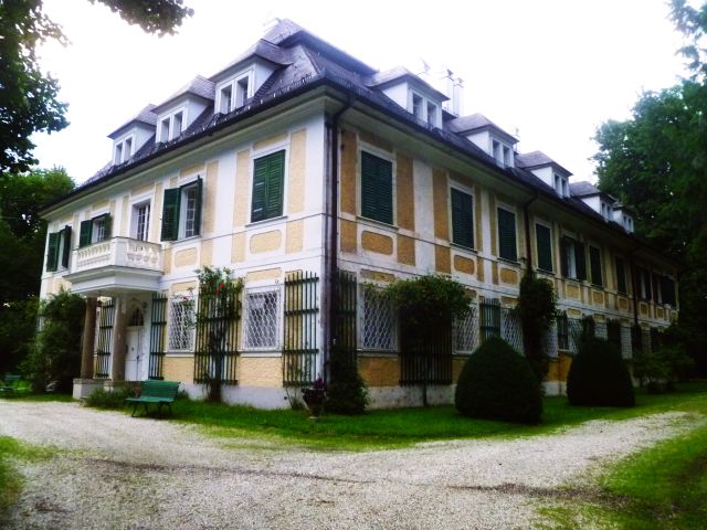
Кирхгайм (Kirchheim im Innkreis, Kirchheim im Innkreis)

- муниципалитет в Австрии, Верхняя Австрия, Рид-Инн
 Hiking in Кирхгайм
Kirchheim im Innkreis, located in Austria, is a charming region that offers several opportunities for hiking enthusiasts. The area is characterized by its beautiful landscapes, including rolling hills, forests, and scenic views of the Inn River. Here are some key points to consider when hiking in this region:
-
Trails: There are various marked hiking trails catering to different skill levels. The paths range from easy walks suitable for families to more challenging routes for experienced hikers. Be sure to check local trail maps for specific routes, distances, and difficulty ratings.
-
Scenery: Hiking around Kirchheim im Innkreis provides the opportunity to enjoy stunning natural surroundings, including meadows, woodlands, and panoramic views of the surrounding countryside. The area's biodiversity adds to the experience, with various flora and fauna to observe.
-
Cultural Sites: Along the hiking trails, you may encounter local cultural sites, including historical landmarks and charming villages. These can enrich your hiking experience by providing insights into the region's culture and history.
-
Seasonal Considerations: The best time for hiking in Kirchheim im Innkreis is typically from spring to autumn when the weather is mild and the trails are accessible. Winter hiking is also possible, but conditions can vary, so proper gear and caution are essential.
-
Safety: Always ensure that you are well-prepared for your hike. This includes wearing appropriate footwear, carrying enough water and snacks, and having a map or GPS device. It's also wise to check the weather forecast before heading out.
-
Local Guides and Tours: If you're unfamiliar with the area, consider hiring a local guide or joining a hiking tour. They can provide valuable insights into the landscape, local flora and fauna, and hidden gems that you might not discover on your own.
-
Sustainable Hiking: As always, practice Leave No Trace principles to help preserve the natural beauty of the region. This includes sticking to marked trails, disposing of waste properly, and respecting wildlife.
Overall, Kirchheim im Innkreis is a lovely destination for hiking, providing a mix of natural beauty, cultural experiences, and a chance to enjoy the great outdoors. Happy hiking!
- Страна:

- Почтовый код: 4932
- Телефонный код: 07755
- Код автомобильного номера: RI
- Координаты: 48° 12' 35" N, 13° 21' 40" E


- GPS треки (wikiloc): [Ссылка]
- Высота над уровнем моря: 429 м m
- Площадь: 10 кв.км
- Население: 716
- Веб сайт: http://www.kirchheim.at/
- Википедия русская: wiki(ru)
- Википедия английская: wiki(en)
- Википедия национальная: wiki(de)
- Хранилище Wikidata: Wikidata: Q684528
- Катеория в википедии: [Ссылка]
- код Freebase: [/m/03gv89k]
- код GeoNames: Альт: [7873183]
- код VIAF: Альт: [248794242]
- код GND: Альт: [7735119-8]
- код австрийского муниципалитета: [41211]
Граничит с регионами:

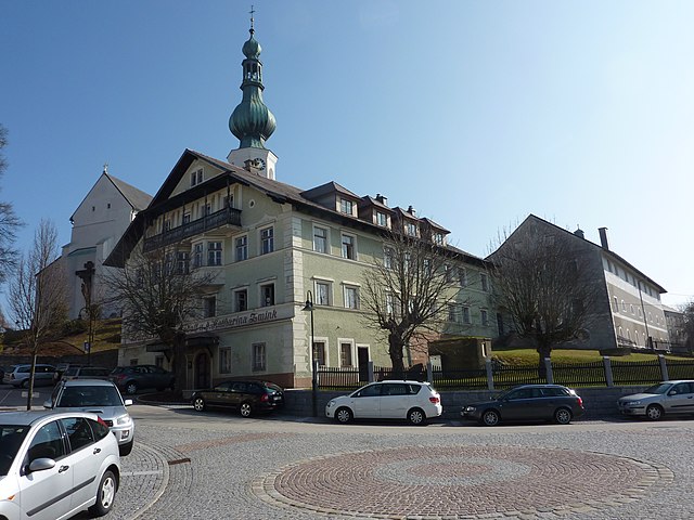
Поллинг
- община в Австрии, Верхняя Австрия, Браунау-ам-Инн
Hiking in Поллинг
Polling im Innkreis, a charming municipality in Austria, offers a variety of hiking opportunities surrounded by picturesque landscapes. The region features rolling hills, meadows, and forests that provide a serene setting for outdoor enthusiasts....
- Страна:
- Почтовый код: 4951
- Телефонный код: 07723
- Код автомобильного номера: BR
- Координаты: 48° 13' 50" N, 13° 16' 50" E
- GPS треки (wikiloc): [Ссылка]
- Высота над уровнем моря: 385 м m
- Площадь: 15.11 кв.км
- Население: 997
- Веб сайт: [Ссылка]

Виппенхам
Hiking in Виппенхам
Wippenham is not widely recognized as a hiking destination, but if you're referring to a specific region or nearby area that has hiking trails, I’d be glad to help you with general hiking tips and suggestions for the type of terrain or landscapes you might expect....
- Страна:
- Почтовый код: 4942
- Телефонный код: 07757
- Код автомобильного номера: RI
- Координаты: 48° 13' 18" N, 13° 22' 56" E
- GPS треки (wikiloc): [Ссылка]
- Высота над уровнем моря: 450 м m
- Площадь: 8 кв.км
- Население: 578
- Веб сайт: [Ссылка]

Меттмах
Hiking in Меттмах
Mettmach, located in Upper Austria, offers a range of hiking opportunities for outdoor enthusiasts. The landscape around Mettmach is characterized by rolling hills, lush forests, and scenic farmland, making it a delightful area for both casual strolls and more challenging hikes....
- Страна:
- Почтовый код: 4931
- Телефонный код: 07755
- Код автомобильного номера: RI
- Координаты: 48° 10' 24" N, 13° 20' 34" E
- GPS треки (wikiloc): [Ссылка]
- Высота над уровнем моря: 464 м m
- Площадь: 30 кв.км
- Население: 2355
- Веб сайт: [Ссылка]
Мернбах
Hiking in Мернбах
Mehrnbach is a small, picturesque village located in Austria, surrounded by beautiful mountainous landscapes and natural scenery. Although it's not as widely known as some major hiking destinations, it offers a serene and charming environment for hiking enthusiasts....
- Страна:
- Почтовый код: 4941
- Телефонный код: 07752
- Код автомобильного номера: RI
- Координаты: 48° 12' 32" N, 13° 26' 11" E
- GPS треки (wikiloc): [Ссылка]
- Высота над уровнем моря: 443 м m
- Площадь: 22 кв.км
- Население: 2363
- Веб сайт: [Ссылка]
Аспах
Hiking in Аспах
Aspach, located in Upper Austria, is a charming destination for hiking enthusiasts. The region is characterized by its picturesque landscapes, rolling hills, and lush forests, making it ideal for outdoor activities. Here are some key points to consider when hiking in Aspach:...
- Страна:
- Телефонный код: 07755
- Код автомобильного номера: BR
- Координаты: 48° 11' 10" N, 13° 18' 20" E
- GPS треки (wikiloc): [Ссылка]
- Высота над уровнем моря: 443 м m
- Площадь: 31.46 кв.км
- Население: 2596
- Веб сайт: [Ссылка]
Гуртен
Hiking in Гуртен
Gurten is actually located in Switzerland, specifically near Bern, and is not in Upper Austria. However, if you are looking for hiking opportunities in Upper Austria, I can certainly provide information on that....
- Страна:
- Почтовый код: 4942
- Телефонный код: 07757
- Код автомобильного номера: RI
- Координаты: 48° 14' 28" N, 13° 20' 41" E
- GPS треки (wikiloc): [Ссылка]
- Высота над уровнем моря: 400 м m
- Площадь: 16.2 кв.км
- Население: 1187
- Веб сайт: [Ссылка]