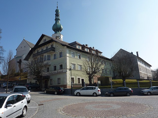
Поллинг (Polling im Innkreis, Polling im Innkreis)
- община в Австрии, Верхняя Австрия, Браунау-ам-Инн
 Hiking in Поллинг
Polling im Innkreis, a charming municipality in Austria, offers a variety of hiking opportunities surrounded by picturesque landscapes. The region features rolling hills, meadows, and forests that provide a serene setting for outdoor enthusiasts.
Hiking Trails
-
Markierte Wanderwege: There are several marked hiking trails in and around Polling im Innkreis. These trails vary in difficulty and length, catering to both casual walkers and more experienced hikers. Popular routes typically showcase the beautiful countryside and may take you through local woodlands and past charming farms.
-
Scenic Views: One of the highlights of hiking in this area is the opportunity to see the stunning views of the Inn Valley and the surrounding mountains. Many trails offer lookout points that are perfect for taking in the scenery.
-
Nature and Wildlife: As you hike, you may encounter diverse flora and fauna native to the region, making it a great spot for nature lovers and photographers.
-
Seasonal Hiking: Depending on the season, the landscape changes dramatically. Spring and summer bring vibrant wildflowers, while fall offers a stunning display of autumn colors.
Recommendations
-
Equipment: Be sure to wear good hiking boots and dress in layers to accommodate changing weather conditions. Bringing a map or using a hiking app can help with navigation.
-
Safety: Always inform someone about your hiking plans and carry a basic first aid kit, plenty of water, and snacks.
-
Local Guides: If you're unfamiliar with the area or prefer a guided experience, consider hiring a local guide who can provide insight into the region’s ecology and history as you hike.
-
Access: Polling im Innkreis is accessible from nearby cities, making it a convenient location for day hikes or weekend excursions.
Hiking in Polling im Innkreis can be a peaceful and rejuvenating experience, allowing you to connect with nature while enjoying the scenic beauty of Austria.
- Страна:

- Почтовый код: 4951
- Телефонный код: 07723
- Код автомобильного номера: BR
- Координаты: 48° 13' 50" N, 13° 16' 50" E


- GPS треки (wikiloc): [Ссылка]
- Высота над уровнем моря: 385 м m
- Площадь: 15.11 кв.км
- Население: 997
- Веб сайт: http://www.polling-innkreis.ooe.gv.at/
- Википедия русская: wiki(ru)
- Википедия английская: wiki(en)
- Википедия национальная: wiki(de)
- Хранилище Wikidata: Wikidata: Q669456
- Катеория в википедии: [Ссылка]
- код Freebase: [/m/03gv2mb]
- код GeoNames: Альт: [7873107]
- код VIAF: Альт: [248720259]
- код австрийского муниципалитета: [40433]
Граничит с регионами:

Альтхайм (Верхняя Австрия)
Hiking in Альтхайм (Верхняя Австрия)
Altheim, Austria, is a small but charming town located in the upper part of the country, nestled amidst beautiful landscapes that provide opportunities for various outdoor activities, including hiking. While Altheim itself might not be a major hiking destination, its surrounding areas offer numerous trails and routes suitable for hikers of all skill levels....
- Страна:
- Почтовый код: 4950
- Телефонный код: 07723
- Код автомобильного номера: BR
- Координаты: 48° 15' 0" N, 13° 14' 0" E
- GPS треки (wikiloc): [Ссылка]
- Высота над уровнем моря: 363 м m
- Площадь: 22.63 кв.км
- Население: 4839
- Веб сайт: [Ссылка]

Санкт-Файт
- община в Австрии, Верхняя Австрия, Браунау-ам-Инн
Hiking in Санкт-Файт
Sankt Veit im Innkreis, located in the Austrian state of Upper Austria, offers a charming setting for hiking enthusiasts. The region is characterized by picturesque landscapes featuring rolling hills, lush forests, and stunning views of the surrounding countryside....
- Страна:
- Почтовый код: 5273
- Телефонный код: 07723
- Код автомобильного номера: BR
- Координаты: 48° 12' 33" N, 13° 16' 32" E
- GPS треки (wikiloc): [Ссылка]
- Высота над уровнем моря: 411 м m
- Площадь: 5.39 кв.км
- Население: 408
- Веб сайт: [Ссылка]

Гайнберг
Hiking in Гайнберг
Geinberg, located in the Upper Austria region, is known for its scenic landscapes and serene environment, making it a great destination for hiking enthusiasts. The area is characterized by rolling hills, lush forests, and picturesque countryside, providing a variety of hiking experiences suitable for different skill levels....
- Страна:
- Почтовый код: 4943
- Телефонный код: 07723
- Код автомобильного номера: RI
- Координаты: 48° 15' 52" N, 13° 17' 41" E
- GPS треки (wikiloc): [Ссылка]
- Высота над уровнем моря: 403 м m
- Площадь: 14 кв.км
- Население: 1435
- Веб сайт: [Ссылка]
Аспах
Hiking in Аспах
Aspach, located in Upper Austria, is a charming destination for hiking enthusiasts. The region is characterized by its picturesque landscapes, rolling hills, and lush forests, making it ideal for outdoor activities. Here are some key points to consider when hiking in Aspach:...
- Страна:
- Телефонный код: 07755
- Код автомобильного номера: BR
- Координаты: 48° 11' 10" N, 13° 18' 20" E
- GPS треки (wikiloc): [Ссылка]
- Высота над уровнем моря: 443 м m
- Площадь: 31.46 кв.км
- Население: 2596
- Веб сайт: [Ссылка]


Кирхгайм
- муниципалитет в Австрии, Верхняя Австрия, Рид-Инн
Hiking in Кирхгайм
Kirchheim im Innkreis, located in Austria, is a charming region that offers several opportunities for hiking enthusiasts. The area is characterized by its beautiful landscapes, including rolling hills, forests, and scenic views of the Inn River. Here are some key points to consider when hiking in this region:...
- Страна:
- Почтовый код: 4932
- Телефонный код: 07755
- Код автомобильного номера: RI
- Координаты: 48° 12' 35" N, 13° 21' 40" E
- GPS треки (wikiloc): [Ссылка]
- Высота над уровнем моря: 429 м m
- Площадь: 10 кв.км
- Население: 716
- Веб сайт: [Ссылка]
Гуртен
Hiking in Гуртен
Gurten is actually located in Switzerland, specifically near Bern, and is not in Upper Austria. However, if you are looking for hiking opportunities in Upper Austria, I can certainly provide information on that....
- Страна:
- Почтовый код: 4942
- Телефонный код: 07757
- Код автомобильного номера: RI
- Координаты: 48° 14' 28" N, 13° 20' 41" E
- GPS треки (wikiloc): [Ссылка]
- Высота над уровнем моря: 400 м m
- Площадь: 16.2 кв.км
- Население: 1187
- Веб сайт: [Ссылка]