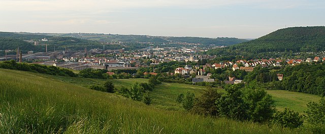
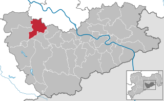
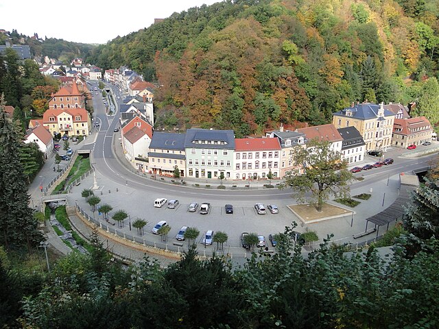
Клингенберг (Klingenberg, Klingenberg)

- населённый пункт в Саксонии
 Hiking in Клингенберг
Klingenberg, located in Saxony, Germany, is an excellent destination for hiking enthusiasts. Nestled among picturesque landscapes that include rolling hills, forests, and vineyards, Klingenberg offers a variety of trails suited for different skill levels.
Key Hiking Areas:
-
Elbe River Trails: The proximity to the Elbe River provides scenic hiking routes along the riverbank, with options to explore both gentle paths and more challenging terrains.
-
Vineyard Trails: Klingenberg is known for its wine production, particularly white wines. There are delightful trails that meander through the vineyards, offering stunning views of the landscape and opportunities to taste local wines.
-
Nature Reserves: The surrounding area has beautiful nature reserves, such as the nearby "Sächsische Schweiz" (Saxon Switzerland), which features unique rock formations, deep valleys, and dense woods. These areas offer more challenging hikes and breathtaking vistas.
Trail Recommendations:
-
Klingenberger Rundweg: A circular trail around Klingenberg that showcases the natural beauty of the region and provides a glimpse into the local culture.
-
Hiking to the Views: Some trails lead to viewpoints where you can enjoy panoramic views over the Elbe Valley and surrounding areas.
Tips for Hiking in Klingenberg:
-
Seasonal Considerations: Spring and fall are particularly beautiful times to hike, with wildflowers blooming and foliage changing colors. Summer can be hot, so early morning hikes are advisable.
-
Proper Gear: Ensure that you wear appropriate hiking boots and bring enough water, as well as snacks for the trail.
-
Local Amenities: After a day of hiking, enjoy local cuisine and wine at nearby restaurants or wine taverns.
-
Trail Maps: Consider picking up a detailed map or using a hiking app to navigate the trails effectively.
Overall, Klingenberg in Saxony is a fantastic destination for hiking, offering a mix of natural beauty, cultural experiences, and outdoor adventure.
- Страна:

- Почтовый код: 01774
- Телефонный код: 037326; 035202; 035058; 035055
- Координаты: 50° 54' 7" N, 13° 32' 39" E


- GPS треки (wikiloc): [Ссылка]
- Высота над уровнем моря: 410 м m
- Площадь: 86.56 кв.км
- Население: 6817
- Веб сайт: http://www.gemeinde-klingenberg.de
- Википедия русская: wiki(ru)
- Википедия английская: wiki(en)
- Википедия национальная: wiki(de)
- Хранилище Wikidata: Wikidata: Q1774519
- Катеория в википедии: [Ссылка]
- код Freebase: [/m/0pd9dd9]
- код Freebase: [/m/0pd9dd9]
- код GeoNames: Альт: [8658983]
- код GeoNames: Альт: [8658983]
- ID отношения в OpenStreetMap: [2673574]
- ID отношения в OpenStreetMap: [2673574]
- код GND: Альт: [1029726159]
- код GND: Альт: [1029726159]
- идентификатор местоположения ArchINFORM: [460]
- идентификатор местоположения ArchINFORM: [460]
- идентификатор муниципалитетов в Германии: 14628205
- идентификатор муниципалитетов в Германии: 14628205
Включает регионы:
Ruppendorf
Hiking in Ruppendorf
Ruppendorf is a quaint village located in Germany, often characterized by its picturesque surroundings and proximity to natural landscapes that are ideal for hiking. The region typically offers a mix of forest trails, rolling hills, and scenic views, making it a great destination for outdoor enthusiasts....
- Страна:
- Почтовый код: 01774
- Телефонный код: 035055
- Координаты: 50° 54' 26" N, 13° 36' 7" E
- GPS треки (wikiloc): [Ссылка]
- Высота над уровнем моря: 378 м m
- Площадь: 7.3 кв.км
Paulshain
Hiking in Paulshain
Paulshain is a picturesque village located in the Saxon Switzerland region of Germany, well-known for its stunning landscapes and numerous hiking trails. If you're planning a hiking trip in this area, here are some key highlights and tips to consider:...
- Страна:
- Почтовый код: 01774
- Телефонный код: 035055
- Координаты: 50° 54' 51" N, 13° 37' 9" E
- GPS треки (wikiloc): [Ссылка]
- Площадь: 0.7 кв.км
Röthenbach
Hiking in Röthenbach
Röthenbach in Klingenberg, located in Bavaria, Germany, offers beautiful hiking opportunities surrounded by picturesque landscapes. The area is characterized by its rolling hills, forests, and views of the nearby vineyards and the scenic Main River....
- Страна:
- Почтовый код: 01774
- Телефонный код: 035058
- Координаты: 50° 51' 8" N, 13° 33' 47" E
- GPS треки (wikiloc): [Ссылка]
- Высота над уровнем моря: 550 м m
Beerwalde
Hiking in Beerwalde
Beerwalde, located near Klingenberg in Germany, offers a range of scenic hiking opportunities for outdoor enthusiasts. The region is characterized by its picturesque landscapes, including rolling hills, forests, and the beautiful surrounding countryside, which create a perfect backdrop for a variety of hiking trails....
- Страна:
- Почтовый код: 01774
- Телефонный код: 035055
- Координаты: 50° 53' 18" N, 13° 34' 59" E
- GPS треки (wikiloc): [Ссылка]
- Высота над уровнем моря: 439 м m
- Площадь: 7.7 кв.км
Colmnitz
Hiking in Colmnitz
Colmnitz is a picturesque village located near Klingenberg in the Saxony region of Germany, and it's surrounded by beautiful natural landscapes that are ideal for hiking enthusiasts. The area is characterized by its rolling hills, dense forests, and scenic views, making it a great destination for both casual walkers and experienced hikers....
- Страна:
- Почтовый код: 01774
- Телефонный код: 035202
- Координаты: 50° 54' 31" N, 13° 29' 47" E
- GPS треки (wikiloc): [Ссылка]
- Высота над уровнем моря: 418 м m
Friedersdorf
Hiking in Friedersdorf
Friedersdorf, located near Klingenberg in the Saxony region of Germany, offers picturesque hiking opportunities in a serene natural environment. The area is characterized by lush forests, rolling hills, and beautiful landscapes, making it an excellent destination for both casual hikers and more experienced trekkers....
- Страна:
- Почтовый код: 01774
- Телефонный код: 037326
- Координаты: 50° 50' 40" N, 13° 31' 17" E
- GPS треки (wikiloc): [Ссылка]
- Высота над уровнем моря: 473 м m
Klingenberg
Hiking in Klingenberg
Klingenberg, located in the picturesque Odenwald region of Germany, offers a variety of splendid hiking trails that cater to both novice and experienced hikers. The area is known for its stunning landscapes, charming villages, and rich cultural history, making it an excellent destination for outdoor enthusiasts....
- Страна:
- Почтовый код: 01774
- Телефонный код: 035202
- Координаты: 50° 55' 0" N, 13° 32' 0" E
- GPS треки (wikiloc): [Ссылка]
- Высота над уровнем моря: 373 м m
- Площадь: 5.732 кв.км
Obercunnersdorf
Hiking in Obercunnersdorf
Obercunnersdorf, located in the Klingenberg region of Saxony, Germany, is a charming area known for its beautiful landscapes and traditional architecture. It provides a great backdrop for hiking enthusiasts. Here are some features of hiking in Obercunnersdorf:...
- Страна:
- Почтовый код: 01774
- Телефонный код: 035055
- Координаты: 50° 55' 1" N, 13° 33' 41" E
- GPS треки (wikiloc): [Ссылка]
- Высота над уровнем моря: 384 м m
- Площадь: 5.9 кв.км

Хёкендорф
Hiking in Хёкендорф
Höckendorf is a charming village located in Saxony, Germany, offering various hiking opportunities for nature lovers and outdoor enthusiasts. The surrounding landscape features picturesque woodlands, rolling hills, and scenic views, making it an excellent destination for both casual and experienced hikers....
- Страна:
- Почтовый код: 01774
- Телефонный код: 035055
- Координаты: 51° 13' 27" N, 13° 54' 34" E
- GPS треки (wikiloc): [Ссылка]
- Высота над уровнем моря: 376 м m
- Площадь: 36.65 кв.км
- Веб сайт: [Ссылка]

Пречендорф
Hiking in Пречендорф
Pretzschendorf is a lovely village located in Germany, primarily known for its beautiful surroundings, making it a great spot for hiking enthusiasts. Nestled in the picturesque Ore Mountains (Erzgebirge), Pretzschendorf offers a variety of trails that cater to different skill levels, from easy walks suitable for families to more challenging hikes....
- Страна:
- Почтовый код: 01774
- Телефонный код: 035058
- Координаты: 50° 52' 0" N, 13° 31' 0" E
- GPS треки (wikiloc): [Ссылка]
- Высота над уровнем моря: 475 м m
- Площадь: 49.85 кв.км
- Веб сайт: [Ссылка]
Borlas
Hiking in Borlas
I'm sorry, but I don't have specific information on "Borlas." It could be a lesser-known area or location that hasn't gained widespread recognition or documentation. If you meant a different location or if it's a specific trail or region, please provide additional context or clarify the name, and I'd be happy to help with hiking tips, trail suggestions, or general outdoor advice for that area!...
- Страна:
- Почтовый код: 01774
- Телефонный код: 035055
- Координаты: 50° 56' 23" N, 13° 36' 46" E
- GPS треки (wikiloc): [Ссылка]
- Высота над уровнем моря: 336 м m
- Площадь: 5.2 кв.км
Граничит с регионами:
Фрайталь
- город в Саксонии
Hiking in Фрайталь
Freital, located in Saxony, Germany, is surrounded by beautiful landscapes and offers various hiking opportunities for both novice and experienced hikers. Here are some highlights about hiking in the Freital area:...
- Страна:
- Почтовый код: 01705; 8225; 8212; 8211; 8210
- Телефонный код: 0351
- Координаты: 51° 1' 0" N, 13° 39' 0" E
- GPS треки (wikiloc): [Ссылка]
- Высота над уровнем моря: 171 м m
- Площадь: 40.45 кв.км
- Население: 39300
- Веб сайт: [Ссылка]


Диппольдисвальде
- город в Саксонии, Германия
Hiking in Диппольдисвальде
Dippoldiswalde, located in the German state of Saxony, is a lovely area for hiking enthusiasts. Nestled near the Erzgebirge (Ore Mountains), it offers beautiful landscapes, diverse trails, and rich natural scenery. Here are some highlights for hiking in and around Dippoldiswalde:...
- Страна:
- Почтовый код: 01744
- Телефонный код: 035052; 03504
- Координаты: 50° 53' 36" N, 13° 40' 0" E
- GPS треки (wikiloc): [Ссылка]
- Высота над уровнем моря: 375 м m
- Площадь: 104.13 кв.км
- Население: 14405
- Веб сайт: [Ссылка]


Дорфхайн
Hiking in Дорфхайн
Dorfhain, a small village in Germany, is known for its picturesque landscapes and natural surroundings, making it a great spot for hiking enthusiasts. Here are some aspects to consider if you're planning a hiking trip there:...
- Страна:
- Почтовый код: 01738
- Телефонный код: 035055
- Код автомобильного номера: PIR
- Координаты: 50° 56' 0" N, 13° 34' 0" E
- GPS треки (wikiloc): [Ссылка]
- Высота над уровнем моря: 341 м m
- Площадь: 6.25 кв.км
- Население: 1073
- Веб сайт: [Ссылка]


Хартмансдорф-Райхенау
Hiking in Хартмансдорф-Райхенау
Hartmannsdorf-Reichenau is a picturesque area located in the Saxony region of Germany, known for its beautiful landscapes and outdoor activities. The region offers numerous hiking opportunities for various skill levels, ranging from easy walks to more challenging trails....
- Страна:
- Почтовый код: 01762
- Телефонный код: 037326
- Код автомобильного номера: PIR
- Координаты: 50° 49' 0" N, 13° 34' 30" E
- GPS треки (wikiloc): [Ссылка]
- Высота над уровнем моря: 569 м m
- Площадь: 28.37 кв.км
- Население: 1031
- Веб сайт: [Ссылка]


Рабенау
Hiking in Рабенау
Rabenau, a charming town located in Saxony, Germany, offers numerous opportunities for hiking enthusiasts. Nestled near the picturesque Saxon Switzerland National Park and the Erzgebirge (Ore Mountains), Rabenau serves as a great starting point for exploring the natural beauty of the region....
- Страна:
- Почтовый код: 01734
- Телефонный код: 0351
- Код автомобильного номера: PIR
- Координаты: 50° 58' 0" N, 13° 38' 0" E
- GPS треки (wikiloc): [Ссылка]
- Высота над уровнем моря: 320 м m
- Площадь: 30.73 кв.км
- Население: 4359
- Веб сайт: [Ссылка]

Тарандт
Hiking in Тарандт
Tharandt, located in Saxony, Germany, is known for its beautiful natural landscapes and excellent hiking opportunities. The region is characterized by its dense forests, rolling hills, and stunning vistas. Here are some highlights and tips for hiking in Tharandt:...
- Страна:
- Почтовый код: 01737
- Телефонный код: 035203
- Координаты: 50° 59' 0" N, 13° 34' 51" E
- GPS треки (wikiloc): [Ссылка]
- Высота над уровнем моря: 214 м m
- Площадь: 71.22 кв.км
- Население: 5380
- Веб сайт: [Ссылка]