
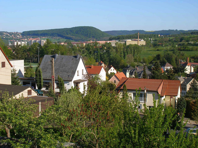
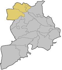
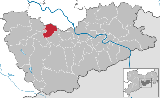
Фрайталь (Freital, Freital)


- город в Саксонии
 Hiking in Фрайталь
Freital, located in Saxony, Germany, is surrounded by beautiful landscapes and offers various hiking opportunities for both novice and experienced hikers. Here are some highlights about hiking in the Freital area:
Trails and Nature
-
Dresden-Elbland Hiking Trail: This trail runs through the region and offers stunning views of the Elbe River, picturesque vineyards, and charming villages, including sections that lead into Freital.
-
Saxon Switzerland National Park: Although a bit further away, this famous national park is easily accessible and features dramatic sandstone cliffs, deep valleys, and a network of well-marked hiking trails. It’s perfect for day trips from Freital.
-
Local Nature Reserves: Freital is close to several nature reserves where you can find quieter trails that showcase the local flora and fauna, ideal for nature enthusiasts.
Hiking Tips
- Difficulty Levels: Trails vary in difficulty, so make sure to choose a hike that suits your skill level and physical condition.
- Best Time to Hike: The best times to hike in the Freital area are late spring and early autumn, when temperatures are mild, and nature is at its most vibrant.
Amenities
- Access to Trails: Many trails in and around Freital are easily accessible by public transport or by car. There are usually signage and maps available to guide hikers.
- Local Facilities: Freital has cafes, restaurants, and accommodations that cater to hikers, making it easy to refuel after a day on the trails.
Safety Considerations
- Weather Conditions: Always check the weather forecast before heading out, and be prepared for changing weather conditions, especially in mountainous areas.
- Personal Safety: Carry a map or a GPS device, inform someone of your hiking plans, and ensure you have adequate supplies such as water, snacks, and a first aid kit.
Overall, hiking in Freital offers a great way to explore the natural beauty of Saxony, and there’s something for everyone, whether you're looking for a leisurely stroll or a challenging trek. Happy hiking!
- Страна:

- Почтовый код: 01705; 8225; 8212; 8211; 8210
- Телефонный код: 0351
- Координаты: 51° 1' 0" N, 13° 39' 0" E


- GPS треки (wikiloc): [Ссылка]
- Высота над уровнем моря: 171 м m
- Площадь: 40.45 кв.км
- Население: 39300
- Веб сайт: http://www.freital.de
- Википедия русская: wiki(ru)
- Википедия английская: wiki(en)
- Википедия национальная: wiki(de)
- Хранилище Wikidata: Wikidata: Q5870
- Галерея изображений в википедии: [Ссылка]
- Катеория в википедии: [Ссылка]
- Карты в википедии: [Ссылка]
- код Freebase: [/m/0d9xwb]
- код GeoNames: Альт: [2925017]
- код VIAF: Альт: [153743154]
- ID отношения в OpenStreetMap: [455475]
- код GND: Альт: [4253146-9]
- код LCNAF: Альт: [n91076732]
- место в MusicBrainz: [494494a3-e401-40a1-a04b-9b13091ad1ce]
- WOEID: [650527]
- код темы Quora: [Freital]
- код Historical Gazetteer: [FRETALJO61TA]
- код места в Facebook: [112171378795314]
- код NLI: [001028948]
- идентификатор муниципалитетов в Германии: 14628110
- код региона Германии: 146280110110
Включает регионы:
Potschappel
Hiking in Potschappel
Potschappel is a small district located in the town of Dresden, Germany. While it may not be a widely recognized hiking destination, there are several wonderful opportunities for hiking in the surrounding areas....
- Страна:
- Почтовый код: 01705
- Телефонный код: 0351
- Координаты: 51° 0' 48" N, 13° 39' 42" E
- GPS треки (wikiloc): [Ссылка]
Burgk
Hiking in Burgk
Burgk, located in Freital, Germany, offers a unique combination of hiking opportunities and scenic views, making it an attractive destination for outdoor enthusiasts. The region is characterized by its lush green landscapes, hills, and historical landmarks, including the impressive Burgk Castle (Burg Freital), which adds a cultural element to your hiking experience....
- Страна:
- Почтовый код: 01705
- Телефонный код: 0351
- Координаты: 51° 0' 12" N, 13° 40' 52" E
- GPS треки (wikiloc): [Ссылка]
- Высота над уровнем моря: 270 м m
- Площадь: 2.4 кв.км
Döhlen
Hiking in Döhlen
Döhlen, located in Freital, Germany, is a charming area that offers several hiking opportunities, particularly due to its proximity to the picturesque landscapes of the Saxon Switzerland region. Here are some key points about hiking in and around Döhlen:...
- Страна:
- Почтовый код: 01705
- Телефонный код: 0351
- Координаты: 51° 0' 26" N, 13° 38' 48" E
- GPS треки (wikiloc): [Ссылка]
- Высота над уровнем моря: 175 м m
- Площадь: 2.68 кв.км


Хайнсберг
Hiking in Хайнсберг
Hainsberg, a district in Freital, Germany, is situated near the picturesque landscape of the Saxon Switzerland region. This area is known for its stunning natural beauty, making it a great destination for hiking enthusiasts....
- Страна:
- Почтовый код: 01705
- Телефонный код: 0351
- Координаты: 50° 58' 54" N, 13° 37' 46" E
- GPS треки (wikiloc): [Ссылка]
Kleinnaundorf
Hiking in Kleinnaundorf
Kleinnaundorf, a district in Freital, Germany, is surrounded by beautiful natural landscapes that make it a nice spot for hiking enthusiasts. The area features a mix of lush forests, rolling hills, and picturesque valleys, making it ideal for both casual walks and more challenging hikes....
- Страна:
- Почтовый код: 01705
- Телефонный код: 0351
- Координаты: 50° 59' 29" N, 13° 41' 48" E
- GPS треки (wikiloc): [Ссылка]
- Высота над уровнем моря: 320 м m
- Площадь: 1.63 кв.км
Niederhäslich
Hiking in Niederhäslich
Niederhäslich is a small village located in Saxony, Germany, near the city of Dresden. It offers beautiful, scenic landscapes and opportunities for outdoor activities, including hiking. Here are some key points to consider when hiking in Niederhäslich and the surrounding areas:...
- Страна:
- Почтовый код: 01705
- Телефонный код: 0351
- Координаты: 50° 59' 9" N, 13° 39' 59" E
- GPS треки (wikiloc): [Ссылка]
Saalhausen
Hiking in Saalhausen
Saalhausen, part of the municipality of Freital in Saxony, Germany, is surrounded by picturesque landscapes and offers several hiking opportunities. The area is characterized by its beautiful natural surroundings, including forests, hills, and views of the nearby Elbe Valley....
- Страна:
- Почтовый код: 01705
- Телефонный код: 0351
- Координаты: 51° 0' 42" N, 13° 37' 0" E
- GPS треки (wikiloc): [Ссылка]
- Высота над уровнем моря: 260 м m
- Площадь: 1.01 кв.км
Schweinsdorf
Hiking in Schweinsdorf
Schweinsdorf, located in the municipality of Freital in Saxony, Germany, offers unique hiking opportunities with its scenic landscapes and proximity to the natural beauty of the region. Though it may not be as popular as some other hiking destinations, it provides a peaceful environment and several trails that cater to various skill levels....
- Страна:
- Почтовый код: 01705
- Телефонный код: 0351
- Координаты: 50° 59' 15" N, 13° 38' 52" E
- GPS треки (wikiloc): [Ссылка]
- Высота над уровнем моря: 224 м m
- Площадь: 1.31 кв.км


Birkigt (Freital)
Hiking in Birkigt (Freital)
Birkigt, part of the Freital municipality in Germany, is located in the picturesque Saxon Switzerland region. This area is known for its striking sandstone formations, dense forests, and beautiful landscapes, making it a great destination for hikers and nature lovers....
- Страна:
- Почтовый код: 01705
- Телефонный код: 0351
- Координаты: 51° 0' 40" N, 13° 40' 50" E
- GPS треки (wikiloc): [Ссылка]
- Высота над уровнем моря: 200 м m
- Площадь: 0.85 кв.км


Дойбен
- район Фрайталя, Саксония
Hiking in Дойбен
Deuben is a charming district located in Freital, Germany, nestled in the picturesque Saxon Switzerland region. This area is known for its beautiful landscapes, dense forests, and scenic trails, making it a great destination for hiking enthusiasts....
- Страна:
- Почтовый код: 01705
- Телефонный код: 0351
- Координаты: 50° 59' 59" N, 13° 38' 48" E
- GPS треки (wikiloc): [Ссылка]
- Высота над уровнем моря: 174 м m
- Площадь: 1.56 кв.км


Pesterwitz
Hiking in Pesterwitz
Pesterwitz is a small village located near Dresden, Germany, and is surrounded by beautiful landscapes that offer various hiking opportunities. Here are some details about hiking in and around Pesterwitz:...
- Страна:
- Почтовый код: 01705
- Телефонный код: 0351
- Координаты: 51° 1' 41" N, 13° 39' 14" E
- GPS треки (wikiloc): [Ссылка]
- Высота над уровнем моря: 271 м m
- Площадь: 2.7 кв.км
- Население: 3263


Somsdorf
Hiking in Somsdorf
Somsdorf is a small village in Germany, located in the Saxony region. While it may not be as widely recognized as some larger hiking destinations, it offers opportunities to explore the surrounding nature and enjoy scenic walks....
- Страна:
- Почтовый код: 01705
- Телефонный код: 0351
- Координаты: 50° 58' 33" N, 13° 36' 15" E
- GPS треки (wikiloc): [Ссылка]
- Высота над уровнем моря: 312 м m
- Площадь: 6.39 кв.км
Вайсиг
- район Фрайталя, Германия
Hiking in Вайсиг
Weißig is a picturesque district located in the city of Freital, which is situated in the Saxony region of Germany. This area offers a variety of hiking opportunities, particularly due to its proximity to the beautiful landscapes of the Saxon Switzerland National Park and the surrounding hills and forests....
- Страна:
- Почтовый код: 01705
- Телефонный код: 0351
- Координаты: 51° 0' 10" N, 13° 36' 56" E
- GPS треки (wikiloc): [Ссылка]
- Высота над уровнем моря: 318 м m
Wurgwitz
Hiking in Wurgwitz
Wurgwitz is a small district in the municipality of Fürstenberg, located in the Saxony region of Germany. While it may not be as well-known as other hiking destinations, it serves as a charming base for exploring the surrounding natural landscapes, including the Erzgebirge (Ore Mountains) and the picturesque areas along the Elbe River....
- Страна:
- Почтовый код: 01705
- Телефонный код: 0351
- Координаты: 51° 1' 31" N, 13° 37' 41" E
- GPS треки (wikiloc): [Ссылка]
- Площадь: 4.87 кв.км


Zauckerode
Hiking in Zauckerode
Zauckerode is a small village located in the state of Saxony, Germany, and it offers picturesque landscapes for hiking enthusiasts. While it might not be as widely known as other hiking destinations in the region, it serves as a great starting point for exploring the surrounding areas, especially the beautiful scenery of the Saxon Switzerland National Park....
- Страна:
- Почтовый код: 01705
- Телефонный код: 0351
- Координаты: 51° 1' 5" N, 13° 38' 20" E
- GPS треки (wikiloc): [Ссылка]
- Высота над уровнем моря: 186 м m
- Площадь: 1.5 кв.км
Граничит с регионами:
Cunnersdorf
Hiking in Cunnersdorf
Cunnersdorf, a small village in the municipality of Bannewitz near Dresden, Germany, is a great base for hiking enthusiasts looking to explore the picturesque surroundings of the Saxon Switzerland region and the Dresden area....
- Страна:
- Почтовый код: 01728
- Телефонный код: 0351
- Координаты: 51° 0' 3" N, 13° 42' 22" E
- GPS треки (wikiloc): [Ссылка]
Gompitz
Hiking in Gompitz
Gompitz is a small district located in the city of Dresden, Germany. While it may not be as widely known as some larger hiking destinations, it offers opportunities for outdoor enthusiasts to explore the surrounding natural beauty and enjoy a variety of hiking experiences....
- Страна:
- Координаты: 51° 2' 39" N, 13° 37' 33" E
- GPS треки (wikiloc): [Ссылка]
- Площадь: 11.72 кв.км


Дрезден
- город в Германии, административный центр Саксонии, на реке Эльбе
Hiking in Дрезден
Dresden, located in eastern Germany, is not only known for its rich history and stunning architecture but also offers wonderful hiking opportunities in its surrounding areas. Here are some highlights:...
- Страна:
- Почтовый код: 01279; 01129; 01307; 01127; 01159; 01099; 01097; 01069; 01309; 01326; 01067
- Телефонный код: 35201; 351
- Код автомобильного номера: DD
- Координаты: 51° 2' 57" N, 13° 44' 18" E
- GPS треки (wikiloc): [Ссылка]
- Высота над уровнем моря: 112 м m
- Площадь: 328.48 кв.км
- Население: 550948
- Веб сайт: [Ссылка]


Клингенберг
- населённый пункт в Саксонии
Hiking in Клингенберг
Klingenberg, located in Saxony, Germany, is an excellent destination for hiking enthusiasts. Nestled among picturesque landscapes that include rolling hills, forests, and vineyards, Klingenberg offers a variety of trails suited for different skill levels....
- Страна:
- Почтовый код: 01774
- Телефонный код: 037326; 035202; 035058; 035055
- Координаты: 50° 54' 7" N, 13° 32' 39" E
- GPS треки (wikiloc): [Ссылка]
- Высота над уровнем моря: 410 м m
- Площадь: 86.56 кв.км
- Население: 6817
- Веб сайт: [Ссылка]
Obernaundorf
Hiking in Obernaundorf
Obernaundorf, located in Germany, provides a scenic backdrop for hiking enthusiasts. Nestled near the Elbe River and surrounded by lush forests, hills, and picturesque landscapes, this area offers a variety of hiking trails suited for different skill levels....
- Страна:
- Почтовый код: 01734
- Телефонный код: 0351
- Координаты: 50° 58' 19" N, 13° 39' 46" E
- GPS треки (wikiloc): [Ссылка]
- Высота над уровнем моря: 308 м m


Кессельдорф
Hiking in Кессельдорф
Kesselsdorf, located near the larger city of Dresden in Germany, offers a charming setting for hiking enthusiasts. The area is characterized by its wooded landscapes, rolling hills, and scenic views of the surrounding countryside. Here are some key points to consider for hiking in Kesselsdorf:...
- Страна:
- Почтовый код: 01723
- Телефонный код: 035204
- Координаты: 51° 2' 0" N, 13° 36' 0" E
- GPS треки (wikiloc): [Ссылка]
- Высота над уровнем моря: 300 м m
Burgk
Hiking in Burgk
Burgk, located in Freital, Germany, offers a unique combination of hiking opportunities and scenic views, making it an attractive destination for outdoor enthusiasts. The region is characterized by its lush green landscapes, hills, and historical landmarks, including the impressive Burgk Castle (Burg Freital), which adds a cultural element to your hiking experience....
- Страна:
- Почтовый код: 01705
- Телефонный код: 0351
- Координаты: 51° 0' 12" N, 13° 40' 52" E
- GPS треки (wikiloc): [Ссылка]
- Высота над уровнем моря: 270 м m
- Площадь: 2.4 кв.км
Хайнсберг
Hiking in Хайнсберг
Hainsberg, a district in Freital, Germany, is situated near the picturesque landscape of the Saxon Switzerland region. This area is known for its stunning natural beauty, making it a great destination for hiking enthusiasts....
- Страна:
- Почтовый код: 01705
- Телефонный код: 0351
- Координаты: 50° 58' 54" N, 13° 37' 46" E
- GPS треки (wikiloc): [Ссылка]
Kleinnaundorf
Hiking in Kleinnaundorf
Kleinnaundorf, a district in Freital, Germany, is surrounded by beautiful natural landscapes that make it a nice spot for hiking enthusiasts. The area features a mix of lush forests, rolling hills, and picturesque valleys, making it ideal for both casual walks and more challenging hikes....
- Страна:
- Почтовый код: 01705
- Телефонный код: 0351
- Координаты: 50° 59' 29" N, 13° 41' 48" E
- GPS треки (wikiloc): [Ссылка]
- Высота над уровнем моря: 320 м m
- Площадь: 1.63 кв.км
Saalhausen
Hiking in Saalhausen
Saalhausen, part of the municipality of Freital in Saxony, Germany, is surrounded by picturesque landscapes and offers several hiking opportunities. The area is characterized by its beautiful natural surroundings, including forests, hills, and views of the nearby Elbe Valley....
- Страна:
- Почтовый код: 01705
- Телефонный код: 0351
- Координаты: 51° 0' 42" N, 13° 37' 0" E
- GPS треки (wikiloc): [Ссылка]
- Высота над уровнем моря: 260 м m
- Площадь: 1.01 кв.км
Birkigt (Freital)
Hiking in Birkigt (Freital)
Birkigt, part of the Freital municipality in Germany, is located in the picturesque Saxon Switzerland region. This area is known for its striking sandstone formations, dense forests, and beautiful landscapes, making it a great destination for hikers and nature lovers....
- Страна:
- Почтовый код: 01705
- Телефонный код: 0351
- Координаты: 51° 0' 40" N, 13° 40' 50" E
- GPS треки (wikiloc): [Ссылка]
- Высота над уровнем моря: 200 м m
- Площадь: 0.85 кв.км
Pesterwitz
Hiking in Pesterwitz
Pesterwitz is a small village located near Dresden, Germany, and is surrounded by beautiful landscapes that offer various hiking opportunities. Here are some details about hiking in and around Pesterwitz:...
- Страна:
- Почтовый код: 01705
- Телефонный код: 0351
- Координаты: 51° 1' 41" N, 13° 39' 14" E
- GPS треки (wikiloc): [Ссылка]
- Высота над уровнем моря: 271 м m
- Площадь: 2.7 кв.км
- Население: 3263
Somsdorf
Hiking in Somsdorf
Somsdorf is a small village in Germany, located in the Saxony region. While it may not be as widely recognized as some larger hiking destinations, it offers opportunities to explore the surrounding nature and enjoy scenic walks....
- Страна:
- Почтовый код: 01705
- Телефонный код: 0351
- Координаты: 50° 58' 33" N, 13° 36' 15" E
- GPS треки (wikiloc): [Ссылка]
- Высота над уровнем моря: 312 м m
- Площадь: 6.39 кв.км
Вайсиг
- район Фрайталя, Германия
Hiking in Вайсиг
Weißig is a picturesque district located in the city of Freital, which is situated in the Saxony region of Germany. This area offers a variety of hiking opportunities, particularly due to its proximity to the beautiful landscapes of the Saxon Switzerland National Park and the surrounding hills and forests....
- Страна:
- Почтовый код: 01705
- Телефонный код: 0351
- Координаты: 51° 0' 10" N, 13° 36' 56" E
- GPS треки (wikiloc): [Ссылка]
- Высота над уровнем моря: 318 м m
Wurgwitz
Hiking in Wurgwitz
Wurgwitz is a small district in the municipality of Fürstenberg, located in the Saxony region of Germany. While it may not be as well-known as other hiking destinations, it serves as a charming base for exploring the surrounding natural landscapes, including the Erzgebirge (Ore Mountains) and the picturesque areas along the Elbe River....
- Страна:
- Почтовый код: 01705
- Телефонный код: 0351
- Координаты: 51° 1' 31" N, 13° 37' 41" E
- GPS треки (wikiloc): [Ссылка]
- Площадь: 4.87 кв.км

Банневиц
- объединение общин в Саксонии
Hiking in Банневиц
Bannewitz is a charming municipality located in Saxony, Germany, not far from the city of Dresden. It offers a variety of hiking opportunities that showcase the beautiful landscapes of the region, including rolling hills, forests, and scenic views. Here are some highlights for hiking in Bannewitz:...
- Страна:
- Почтовый код: 01728
- Телефонный код: 035206; 0351
- Код автомобильного номера: PIR
- Координаты: 50° 59' 35" N, 13° 43' 0" E
- GPS треки (wikiloc): [Ссылка]
- Высота над уровнем моря: 280 м m
- Площадь: 25.81 кв.км
- Население: 10803
- Веб сайт: [Ссылка]

Хёкендорф
Hiking in Хёкендорф
Höckendorf is a charming village located in Saxony, Germany, offering various hiking opportunities for nature lovers and outdoor enthusiasts. The surrounding landscape features picturesque woodlands, rolling hills, and scenic views, making it an excellent destination for both casual and experienced hikers....
- Страна:
- Почтовый код: 01774
- Телефонный код: 035055
- Координаты: 51° 13' 27" N, 13° 54' 34" E
- GPS треки (wikiloc): [Ссылка]
- Высота над уровнем моря: 376 м m
- Площадь: 36.65 кв.км
- Веб сайт: [Ссылка]
Zauckerode
Hiking in Zauckerode
Zauckerode is a small village located in the state of Saxony, Germany, and it offers picturesque landscapes for hiking enthusiasts. While it might not be as widely known as other hiking destinations in the region, it serves as a great starting point for exploring the surrounding areas, especially the beautiful scenery of the Saxon Switzerland National Park....
- Страна:
- Почтовый код: 01705
- Телефонный код: 0351
- Координаты: 51° 1' 5" N, 13° 38' 20" E
- GPS треки (wikiloc): [Ссылка]
- Высота над уровнем моря: 186 м m
- Площадь: 1.5 кв.км


Рабенау
Hiking in Рабенау
Rabenau, a charming town located in Saxony, Germany, offers numerous opportunities for hiking enthusiasts. Nestled near the picturesque Saxon Switzerland National Park and the Erzgebirge (Ore Mountains), Rabenau serves as a great starting point for exploring the natural beauty of the region....
- Страна:
- Почтовый код: 01734
- Телефонный код: 0351
- Код автомобильного номера: PIR
- Координаты: 50° 58' 0" N, 13° 38' 0" E
- GPS треки (wikiloc): [Ссылка]
- Высота над уровнем моря: 320 м m
- Площадь: 30.73 кв.км
- Население: 4359
- Веб сайт: [Ссылка]
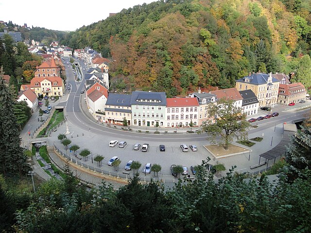

Тарандт
Hiking in Тарандт
Tharandt, located in Saxony, Germany, is known for its beautiful natural landscapes and excellent hiking opportunities. The region is characterized by its dense forests, rolling hills, and stunning vistas. Here are some highlights and tips for hiking in Tharandt:...
- Страна:
- Почтовый код: 01737
- Телефонный код: 035203
- Координаты: 50° 59' 0" N, 13° 34' 51" E
- GPS треки (wikiloc): [Ссылка]
- Высота над уровнем моря: 214 м m
- Площадь: 71.22 кв.км
- Население: 5380
- Веб сайт: [Ссылка]


Вильсдруф
Hiking in Вильсдруф
Wilsdruff, located in Saxony, Germany, is a charming town that offers access to various hiking opportunities in the surrounding area. The region is characterized by scenic landscapes, forests, and hills, making it suitable for both novice and experienced hikers. Here are some highlights and tips for hiking in and around Wilsdruff:...
- Страна:
- Почтовый код: 01723; 8224
- Телефонный код: 0351; 035203; 035209; 035204
- Код автомобильного номера: PIR
- Координаты: 51° 3' 8" N, 13° 32' 18" E
- GPS треки (wikiloc): [Ссылка]
- Высота над уровнем моря: 273 м m
- Площадь: 81.6 кв.км
- Население: 14163
- Веб сайт: [Ссылка]

Altfranken
Hiking in Altfranken
Altfranken, located in Germany, is known for its picturesque landscapes, charming villages, and rich cultural history. There are various hiking opportunities in this region, allowing hikers to explore its natural beauty and historical landmarks. Here are some highlights and tips for hiking in Altfranken:...
- Страна:
- Координаты: 51° 2' 0" N, 13° 38' 45" E
- GPS треки (wikiloc): [Ссылка]
- Площадь: 1.28 кв.км
Borlas
Hiking in Borlas
I'm sorry, but I don't have specific information on "Borlas." It could be a lesser-known area or location that hasn't gained widespread recognition or documentation. If you meant a different location or if it's a specific trail or region, please provide additional context or clarify the name, and I'd be happy to help with hiking tips, trail suggestions, or general outdoor advice for that area!...
- Страна:
- Почтовый код: 01774
- Телефонный код: 035055
- Координаты: 50° 56' 23" N, 13° 36' 46" E
- GPS треки (wikiloc): [Ссылка]
- Высота над уровнем моря: 336 м m
- Площадь: 5.2 кв.км
Braunsdorf
Hiking in Braunsdorf
Braunsdorf, located near Wilsdruff in the Saxony region of Germany, offers access to various hiking opportunities that showcase the natural beauty of the area. Here are some details you might find helpful:...
- Страна:
- Почтовый код: 01737
- Телефонный код: 035203
- Координаты: 51° 0' 58" N, 13° 34' 16" E
- GPS треки (wikiloc): [Ссылка]
- Высота над уровнем моря: 316 м m