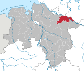
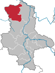
Люхов-Данненберг (Lüchow-Dannenberg District, Landkreis Lüchow-Dannenberg)

- район в Нижней Саксонии (Германия)
 Hiking in Люхов-Данненберг
Lüchow-Dannenberg, located in lower Saxony, Germany, offers a distinctive blend of natural beauty, cultural heritage, and a variety of outdoor activities, making it an excellent region for hiking enthusiasts.
Scenic Trails
-
Elbuferweg: This trail runs along the banks of the Elbe River, offering stunning views of the river and its landscapes. The path is relatively easy and suitable for families and casual hikers.
-
Guardian Trail (Wächterweg): A longer trail that connects various villages in the region, it allows hikers to explore the cultural landmarks and picturesque countryside. This path often combines hiking with opportunities to visit historical sites.
-
Nature Reserves: The area around Lüchow-Dannenberg includes beautiful natural reserves such as the Düpendorfer Moor and the Gorleben forest. These offer more rugged and tranquil hiking experiences, with opportunities for birdwatching and enjoying the local flora and fauna.
Best Hiking Practices
- Preparation: Always check the weather conditions before your hike. The region can be subject to sudden changes in weather.
- Navigation: While many trails are well-marked, having a map or a GPS device can help in navigating less familiar routes.
- Gear: Comfortable hiking boots, appropriate clothing, and a small backpack with water and snacks are essential for a pleasant experience.
- Respect Nature: Stick to designated trails to minimize your impact on the environment, and be mindful of local wildlife.
Season Considerations
- Spring and Fall: These seasons offer the best hiking conditions in Lüchow-Dannenberg, with mild temperatures and vibrant colors in nature.
- Summer: Enjoyable, but ensure you stay hydrated and use sun protection.
- Winter: Some trails may be less accessible due to snow or ice, but winter hiking can offer a unique, serene experience.
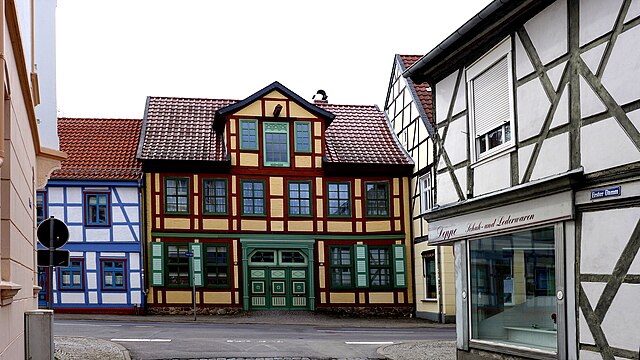
Cultural Highlights
Many hiking trails lead through charming villages like Lüchow and Dannenberg, where you can explore historical architecture, local cuisine, and regional traditions. Consider stopping at local eateries to sample traditional dishes.
Conclusion
Hiking in Lüchow-Dannenberg can provide a refreshing escape into nature, paired with the opportunity to immerse yourself in the area's rich cultural landscape. Whether you are a beginner or an experienced hiker, there are options available for all levels. Enjoy your adventure!
- Страна:

- Столица: Люхов
- Код автомобильного номера: DAN
- Координаты: 53° 0' 0" N, 11° 10' 12" E


- GPS треки (wikiloc): [Ссылка]
- Высота над уровнем моря: 13 м m
- Площадь: 1220.00 кв.км
- Население: 48825
- Веб сайт: http://www.luechow-dannenberg.de/
- Википедия русская: wiki(ru)
- Википедия английская: wiki(en)
- Википедия национальная: wiki(de)
- Хранилище Wikidata: Wikidata: Q5913
- Катеория в википедии: [Ссылка]
- Карты в википедии: [Ссылка]
- код Freebase: [/m/0135m8]
- код Freebase: [/m/0135m8]
- код GeoNames: Альт: [3221038]
- код GeoNames: Альт: [3221038]
- код VIAF: Альт: [132572371]
- код VIAF: Альт: [132572371]
- ID отношения в OpenStreetMap: [62662]
- ID отношения в OpenStreetMap: [62662]
- код GND: Альт: [4099888-5]
- код GND: Альт: [4099888-5]
- идентификатор местоположения ArchINFORM: [11974]
- идентификатор местоположения ArchINFORM: [11974]
- код LCNAF: Альт: [n84081585]
- код LCNAF: Альт: [n84081585]
- код TGN: [7076854]
- код TGN: [7076854]
- код NLI: [001004073]
- код NLI: [001004073]
- код NUTS: [DE934]
- код NUTS: [DE934]
- код BabelNet: [00708621n]
- код BabelNet: [00708621n]
- код района Германии: 03354
- код района Германии: 03354
Включает регионы:
Даннеберг
- укрупнённая община Нижней Саксонии
Hiking in Даннеберг
Samtgemeinde Dannenberg (Elbe) is a scenic area located in Lower Saxony, Germany, known for its natural beauty and quaint villages. Here are some highlights about hiking in this region:...
- Страна:
- Координаты: 53° 6' 0" N, 11° 6' 0" E
- GPS треки (wikiloc): [Ссылка]
Samtgemeinde Clenze
Hiking in Samtgemeinde Clenze
Samtgemeinde Clenze, located in Lower Saxony, Germany, is a picturesque area that offers a variety of hiking opportunities, particularly for those who enjoy peaceful, rural landscapes. The region features beautiful trails that wind through forests, fields, and along rivers, allowing hikers to experience the tranquil charm of the countryside....
- Страна:
- Координаты: 52° 56' 0" N, 10° 56' 0" E
- GPS треки (wikiloc): [Ссылка]
Samtgemeinde Lüchow
Hiking in Samtgemeinde Lüchow
Samtgemeinde Lüchow, located in the Lower Saxony region of Germany, offers a variety of hiking opportunities for enthusiasts looking to explore its natural beauty and landscapes. Here are some points to consider when hiking in this area:...
- Страна:
- Координаты: 52° 58' 0" N, 11° 9' 0" E
- GPS треки (wikiloc): [Ссылка]
Samtgemeinde Hitzacker
Hiking in Samtgemeinde Hitzacker
Samtgemeinde Hitzacker (Elbe) is a picturesque area located in Lower Saxony, Germany, known for its rich history, charming landscapes, and natural beauty, making it an attractive destination for hiking enthusiasts. Here are some highlights about hiking in this region:...
- Страна:
- Координаты: 53° 9' 0" N, 11° 3' 0" E
- GPS треки (wikiloc): [Ссылка]
Gartow
Hiking in Gartow
Gartow, located in the Samtgemeinde of Gartow in Lower Saxony, Germany, offers scenic landscapes and a variety of hiking opportunities. The region is characterized by its lush forests, picturesque meadows, and the proximity to natural water bodies, including the Elbe River, which can create charming spots for hiking and outdoor activities....
- Страна:
- Координаты: 53° 2' 0" N, 11° 28' 0" E
- GPS треки (wikiloc): [Ссылка]
- Население: 3683

Эльбтальауэ
- коммуна в Нижней Саксонии
Hiking in Эльбтальауэ
Elbtalaue, located in the Lower Saxony region of Germany, is part of the scenic Elbe River valley, known for its unique landscapes, natural beauty, and rich cultural heritage. This area offers a wonderful opportunity for hiking enthusiasts of all skill levels, with a variety of trails that wind through lush forests, past rivers, and through charming villages....
- Страна:
- Координаты: 53° 6' 0" N, 11° 6' 0" E
- GPS треки (wikiloc): [Ссылка]
- Площадь: 422.39 кв.км
- Население: 20850
- Веб сайт: [Ссылка]

Люхов
Hiking in Люхов
Lüchow, located in the Lower Saxony region of Germany, offers a range of hiking opportunities for outdoor enthusiasts. The area is characterized by its picturesque landscapes, which include lush forests, rolling hills, and scenic meadows. Here are some key features and tips for hiking in Lüchow (Samtgemeinde):...
- Страна:
- Координаты: 52° 58' 0" N, 11° 9' 0" E
- GPS треки (wikiloc): [Ссылка]
- Население: 24292


Хёбек
Hiking in Хёбек
Höhbeck is a picturesque area located in Lower Saxony, Germany, known for its beautiful landscapes and natural features. While it may not be as popular as some other hiking destinations, it offers a range of opportunities for outdoor enthusiasts looking for a tranquil hiking experience....
- Страна:
- Почтовый код: 29478
- Телефонный код: 05846
- Код автомобильного номера: DAN
- Координаты: 53° 3' 17" N, 11° 25' 59" E
- GPS треки (wikiloc): [Ссылка]
- Высота над уровнем моря: 30 м m
- Площадь: 19.4 кв.км
- Население: 642
- Веб сайт: [Ссылка]
Граничит с регионами:
Пархим
Hiking in Пархим
Parchim is located in the state of Mecklenburg-Western Pomerania in Germany. This district offers a mix of natural beauty, historical landmarks, and a peaceful rural landscape, making it a great place for hiking enthusiasts. Here’s what you can expect while hiking in and around Parchim:...
- Страна:
- Координаты: 53° 30' 0" N, 11° 55' 12" E
- GPS треки (wikiloc): [Ссылка]
- Площадь: 2233 кв.км
- Веб сайт: [Ссылка]

Люнебург
- район Нижней Саксонии
Hiking in Люнебург
Lüneburg district, located in Lower Saxony, Germany, is a wonderful area for hiking enthusiasts. The region is known for its scenic landscapes, featuring rolling hills, forests, rivers, and charming villages. Here are some highlights for hiking in Lüneburg:...
- Страна:
- Столица: Люнебург
- Код автомобильного номера: LG
- Координаты: 53° 15' 0" N, 10° 30' 0" E
- GPS треки (wikiloc): [Ссылка]
- Высота над уровнем моря: 8 м m
- Площадь: 1323.10 кв.км
- Население: 181605
- Веб сайт: [Ссылка]
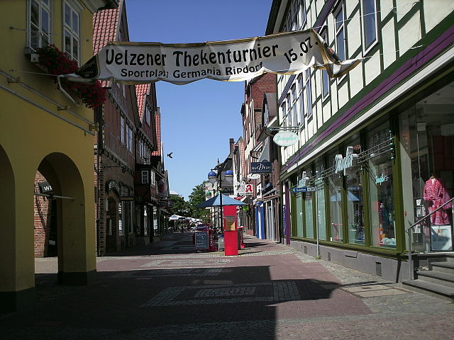

Ильцен
- район в Нижней Саксонии (Германия)
Hiking in Ильцен
Uelzen District in Lower Saxony, Germany, offers a variety of hiking opportunities for outdoor enthusiasts. While it might not be as widely known for hiking as some other regions, it provides beautiful natural scenery, charming villages, and historical sites to explore. Here are some aspects to consider for hiking in Uelzen:...
- Страна:
- Код автомобильного номера: UE
- Координаты: 53° 0' 0" N, 10° 34' 48" E
- GPS треки (wikiloc): [Ссылка]
- Высота над уровнем моря: 32 м m
- Площадь: 1454.00 кв.км
- Население: 92961
- Веб сайт: [Ссылка]
Штендаль
Hiking in Штендаль
Stendal is a district located in the state of Saxony-Anhalt in Germany. While it may not be as well-known for hiking as some other regions, it does provide some opportunities for outdoor activities in a scenic, largely rural setting. Here are some highlights about hiking in the Stendal district:...
- Страна:
- Код автомобильного номера: SDL; OBG; HV
- Координаты: 52° 41' 0" N, 11° 51' 0" E
- GPS треки (wikiloc): [Ссылка]
- Высота над уровнем моря: 39 м m
- Площадь: 2423.04 кв.км
- Население: 116666
- Веб сайт: [Ссылка]
Зальцведель
Hiking in Зальцведель
Altmarkkreis Salzwedel, located in Saxony-Anhalt, Germany, offers a unique hiking experience characterized by its diverse landscapes, historical sites, and tranquil rural environment. Here’s a guide to help you explore the area safely and enjoyably....
- Страна:
- Столица: Зальцведель
- Код автомобильного номера: SAW
- Координаты: 52° 41' 0" N, 11° 13' 0" E
- GPS треки (wikiloc): [Ссылка]
- Высота над уровнем моря: 41 м m
- Площадь: 2293.05 кв.км
- Население: 86878
- Веб сайт: [Ссылка]
Пригниц
- район в земле Бранденбург (Германия)
Hiking in Пригниц
Prignitz, located in the state of Brandenburg, Germany, offers a variety of hiking opportunities in a largely rural and picturesque landscape. Known for its diverse nature, including forests, meadows, and rivers, Prignitz provides a tranquil escape for outdoor enthusiasts. Here are some highlights for hiking in the region:...
- Страна:
- Код автомобильного номера: PR
- Координаты: 53° 0' 0" N, 12° 0' 0" E
- GPS треки (wikiloc): [Ссылка]
- Высота над уровнем моря: 41 м m
- Площадь: 2123.31 кв.км
- Веб сайт: [Ссылка]