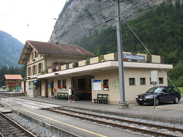
Люченталь (Lütschental, Lütschental)

 Hiking in Люченталь
Lütschental is a picturesque valley located in the Bernese Oberland region of Switzerland, known for its stunning alpine scenery and diverse hiking opportunities. Here are some highlights and tips for hiking in Lütschental:
Scenic Trails
-
Lütschental Valley Trail: This trail runs through the valley and provides breathtaking views of the surrounding mountains and lush green landscapes. It's suitable for various skill levels and offers a tranquil hiking experience.
-
Niesen Mountain: A prominent peak near Lütschental, the Niesen offers a challenging hike for experienced walkers. The ascent rewards hikers with panoramic views of the Bernese Alps and the Thunersee.
-
Aare Gorge: Close to Lütschental, hiking trails lead to the spectacular Aare Gorge, a natural wonder with impressive rock formations and thrilling footbridges.
Difficulty Levels
- Easy Trails: Perfect for beginners or families, these trails often feature gentle gradients and well-marked pathways, making it easy to enjoy the surrounding nature.
- Moderate to Hard Trails: For more experienced hikers, there are steeper trails that may involve climbing and navigating rocky paths. Always check trail conditions and prepare accordingly.
Best Times to Hike
- Summer (June to September): This is the peak hiking season, with warmer temperatures and clear trails. Early morning hikes can help avoid the heat and crowds.
- Autumn (October): For a quieter experience, enjoy the fall colors. The weather can be unpredictable, so be prepared for cooler temperatures.
Essential Tips
- Gear: Make sure to wear sturdy hiking boots, dress in layers, and carry a waterproof jacket. Good navigation tools (maps, GPS) are essential, especially on less marked trails.
- Safety: Always inform someone of your hiking plans, carry sufficient water and snacks, and be aware of your physical limits.
- Wildlife: Keep an eye out for local wildlife but observe from a distance. It’s important to follow local regulations to protect the environment.
Access
Lütschental can be accessed via public transport from major cities in Switzerland. Local bus services connect with hiking trailheads, making it convenient to reach various starting points.
Overall, Lütschental offers a wonderful combination of natural beauty and outdoor adventure for hikers of all levels. Enjoy your trek and embrace the stunning landscapes!
- Страна:

- Почтовый код: 3816
- Телефонный код: 033
- Код автомобильного номера: BE
- Координаты: 46° 38' 38" N, 7° 57' 8" E


- GPS треки (wikiloc): [Ссылка]
- Высота над уровнем моря: 1243 м m
- Площадь: 12.4 кв.км
- Население: 219
- Веб сайт: http://www.luetschental.ch
- Википедия русская: wiki(ru)
- Википедия английская: wiki(en)
- Википедия национальная: wiki(de)
- Хранилище Wikidata: Wikidata: Q66017
- Катеория в википедии: [Ссылка]
- код Freebase: [/m/0dx5ws]
- код GeoNames: Альт: [7286404]
- код VIAF: Альт: [244757408]
- ID отношения в OpenStreetMap: [1682543]
- идентификатор HDS: [340]
- код швейцарского муниципалитета: [0586]
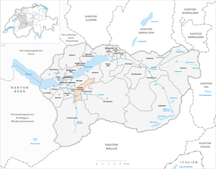
Граничит с регионами:


Гриндельвальд
Hiking in Гриндельвальд
Grindelwald is a stunning alpine village located in the Bernese Oberland region of Switzerland, known for its breathtaking landscapes, towering peaks, and diverse hiking trails. Here’s what you need to know about hiking in Grindelwald:...
- Страна:
- Почтовый код: 3818
- Телефонный код: 033
- Код автомобильного номера: BE
- Координаты: 46° 37' 9" N, 8° 3' 4" E
- GPS треки (wikiloc): [Ссылка]
- Высота над уровнем моря: 1142 м m
- Площадь: 171.28 кв.км
- Население: 4138
- Веб сайт: [Ссылка]


Лаутербруннен
Hiking in Лаутербруннен
Lauterbrunnen is a stunning valley located in the Swiss Alps, known for its dramatic cliffs and impressive waterfalls. It serves as a gateway to the Jungfrau region and offers a variety of hiking opportunities, suitable for different skill levels. Here are some key highlights and tips for hiking in Lauterbrunnen:...
- Страна:
- Почтовый код: 3822
- Телефонный код: 033
- Код автомобильного номера: BE
- Координаты: 46° 33' 6" N, 7° 53' 37" E
- GPS треки (wikiloc): [Ссылка]
- Высота над уровнем моря: 1407 м m
- Площадь: 164.4 кв.км
- Население: 2732
- Веб сайт: [Ссылка]


Изельтвальд
Hiking in Изельтвальд
Iseltwald, a charming village located along the shores of Lake Brienz in Switzerland, offers a stunning backdrop for hiking enthusiasts. The area is known for its breathtaking landscapes, including pristine lake views and majestic alpine scenery. Here are some key points to consider when hiking in Iseltwald:...
- Страна:
- Почтовый код: 3807
- Телефонный код: 033
- Код автомобильного номера: BE
- Координаты: 46° 42' 35" N, 7° 57' 49" E
- GPS треки (wikiloc): [Ссылка]
- Высота над уровнем моря: 1986 м m
- Площадь: 21.9 кв.км
- Население: 441
- Веб сайт: [Ссылка]
Гюндлишванд
Hiking in Гюндлишванд
Gündlischwand is a picturesque village located in the Bernese Oberland region of Switzerland, and it serves as a fantastic base for hiking enthusiasts. The area boasts stunning views of the surrounding mountains, lush valleys, and the iconic Eiger, Mönch, and Jungfrau peaks. Here are some highlights and tips for hiking in Gündlischwand:...
- Страна:
- Почтовый код: 3815
- Телефонный код: 033
- Код автомобильного номера: BE
- Координаты: 46° 36' 59" N, 7° 53' 59" E
- GPS треки (wikiloc): [Ссылка]
- Высота над уровнем моря: 1551 м m
- Площадь: 16.9 кв.км
- Население: 324
- Веб сайт: [Ссылка]