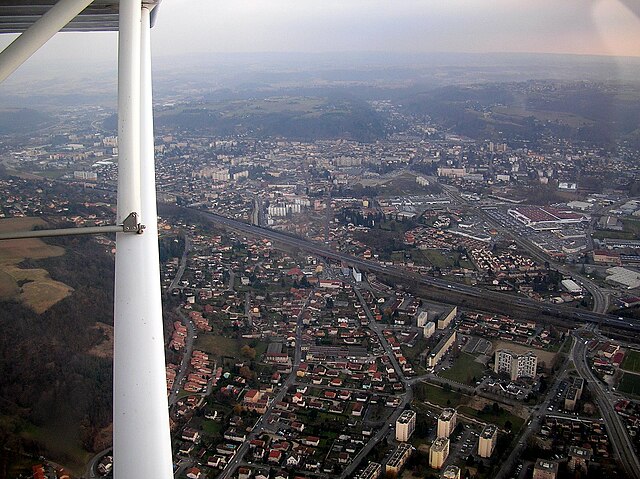
Л’Иль-д’Або (L'Isle-d'Abeau, L'Isle-d'Abeau)
.svg)

- коммуна во Франции
 Hiking in Л’Иль-д’Або
L'Isle-d'Abeau, located in the Auvergne-Rhône-Alpes region of France, is surrounded by a variety of landscapes that offer several hiking opportunities. While the town itself is primarily urban and industrial, its location makes it a convenient starting point for exploring nearby natural areas.
Hiking Options Near L'Isle-d'Abeau
-
Chambarans Forest: Just a short drive away, this forest offers a network of trails perfect for hiking. You can find paths suitable for all skill levels, ranging from easy walks to more challenging hikes.
-
Parc Naturel Régional de la Chartreuse: This regional park is a bit further away but is well worth the trip. It features beautiful mountain landscapes, diverse wildlife, and numerous hiking trails that can accommodate all levels. The hiking routes range from leisurely strolls to strenuous hikes, such as those leading to the top of the Chartreuse mountains.
-
Isère River Trails: The banks of the Isère River provide scenic walking and hiking paths. These trails are generally flat and accessible, making them ideal for family outings or casual hikes.
-
Pilat Regional Natural Park: Located south of L'Isle-d'Abeau, this park offers a fantastic variety of trails that showcase rugged hills, forests, and panoramic views. There are routes of various lengths and difficulties, catering to both novice and experienced hikers.
Tips for Hiking in the Area
- Check Trail Conditions: Before setting out, ensure you check the current trail conditions and any local advisories.
- Stay Hydrated: Bring plenty of water, especially in warmer months, as it can be easy to underestimate hydration needs.
- Dress Appropriately: Weather can change quickly, so wear layers and appropriate footwear for hiking.
- Follow Local Guidelines: Respect nature by following the Leave No Trace principles and any specific regulations for the areas you visit.
- Map and GPS: Even though many trails may be well-marked, carrying a map or GPS device is helpful for more remote areas.
Whether you’re looking for a leisurely walk or a more challenging hike, the areas around L'Isle-d'Abeau offer a variety of options to explore the beautiful natural landscapes of the Rhône-Alpes region.
- Страна:

- Почтовый код: 38080
- Координаты: 45° 37' 10" N, 5° 13' 59" E


- GPS треки (wikiloc): [Ссылка]
- Площадь: 9.11 кв.км
- Население: 16282
- Википедия русская: wiki(ru)
- Википедия английская: wiki(en)
- Википедия национальная: wiki(fr)
- Хранилище Wikidata: Wikidata: Q1106991
- Катеория в википедии: [Ссылка]
- код Freebase: [/m/03g_6ls]
- код Freebase: [/m/03g_6ls]
- код GeoNames: Альт: [6614370]
- код GeoNames: Альт: [6614370]
- номер SIREN: [213801939]
- номер SIREN: [213801939]
- код BNF: [15258011t]
- код BNF: [15258011t]
- идентификатор местоположения ArchINFORM: [3433]
- идентификатор местоположения ArchINFORM: [3433]
- место в MusicBrainz: [75b2ec52-1723-42c2-9bd1-f60da731098a]
- место в MusicBrainz: [75b2ec52-1723-42c2-9bd1-f60da731098a]
- WOEID: [596651]
- WOEID: [596651]
- код муниципалитета INSEE: 38193
- код муниципалитета INSEE: 38193
Граничит с регионами:


Сент-Альбан-де-Рош
- коммуна во Франции
Hiking in Сент-Альбан-де-Рош
Saint-Alban-de-Roche is a charming commune located in the Auvergne-Rhône-Alpes region of France, near the city of Bourgoin-Jallieu. The area is characterized by its beautiful landscapes and a mix of rural and suburban environments, making it an attractive destination for hiking enthusiasts....
- Страна:
- Почтовый код: 38300
- Координаты: 45° 35' 46" N, 5° 13' 27" E
- GPS треки (wikiloc): [Ссылка]
- Площадь: 6.11 кв.км
- Население: 1905
- Веб сайт: [Ссылка]

Бургуэн-Жальё
- коммуна во Франции
Hiking in Бургуэн-Жальё
Bourgoin-Jallieu, located in the Auvergne-Rhône-Alpes region of eastern France, offers a variety of hiking opportunities for outdoor enthusiasts. The town is nestled between the Isère River and the Chartreuse Mountains, providing both flat terrain and more challenging trails....
- Страна:
- Почтовый код: 38300
- Координаты: 45° 35' 27" N, 5° 16' 45" E
- GPS треки (wikiloc): [Ссылка]
- Высота над уровнем моря: 254 м m
- Площадь: 24.37 кв.км
- Население: 27502
- Веб сайт: [Ссылка]


Сен-Марсель-Бель-Аккёй
- коммуна во Франции
Hiking in Сен-Марсель-Бель-Аккёй
Saint-Marcel-Bel-Accueil is a charming commune located in the Auvergne-Rhône-Alpes region of France. While it may not be as well-known as some major hiking destinations, it provides opportunities for outdoor enthusiasts to explore beautiful natural landscapes....
- Страна:
- Почтовый код: 38080
- Координаты: 45° 38' 51" N, 5° 14' 9" E
- GPS треки (wikiloc): [Ссылка]
- Площадь: 18.23 кв.км
- Население: 1357
- Веб сайт: [Ссылка]


Фронтонас
- коммуна во Франции
Hiking in Фронтонас
Frontonas, located in the Auvergne-Rhône-Alpes region of France, is a charming town that offers a unique hiking experience. The surrounding natural landscape features rolling hills, forests, and picturesque views, making it an ideal destination for outdoor enthusiasts looking to explore trails off the beaten path....
- Страна:
- Почтовый код: 38290
- Координаты: 45° 38' 56" N, 5° 11' 3" E
- GPS треки (wikiloc): [Ссылка]
- Площадь: 12.65 кв.км
- Население: 2030
- Веб сайт: [Ссылка]


Во-Мильё
- коммуна во Франции
Hiking in Во-Мильё
Vaulx-Milieu is a charming commune located in the Isère department in the Auvergne-Rhône-Alpes region of southeastern France. While it may not be as well-known as some larger hiking destinations, it offers a beautiful natural environment that can be explored through various hiking trails. Here are some key points to consider when hiking in and around Vaulx-Milieu:...
- Страна:
- Почтовый код: 38090
- Координаты: 45° 36' 45" N, 5° 10' 52" E
- GPS треки (wikiloc): [Ссылка]
- Площадь: 9.02 кв.км
- Население: 2472
- Веб сайт: [Ссылка]


Фур
- коммуна во Франции
Hiking in Фур
Four is a small village in the Isère department in the Auvergne-Rhône-Alpes region of southeastern France. While it may not be as well known as some of its neighboring areas, it provides a great opportunity for hiking enthusiasts to explore the beautiful scenery of the French Alps....
- Страна:
- Почтовый код: 38080
- Координаты: 45° 35' 14" N, 5° 11' 44" E
- GPS треки (wikiloc): [Ссылка]
- Площадь: 11.82 кв.км
- Население: 1434
- Веб сайт: [Ссылка]