Бургуэн-Жальё (Bourgoin-Jallieu, Bourgoin-Jallieu)

- коммуна во Франции
 Hiking in Бургуэн-Жальё
Bourgoin-Jallieu, located in the Auvergne-Rhône-Alpes region of eastern France, offers a variety of hiking opportunities for outdoor enthusiasts. The town is nestled between the Isère River and the Chartreuse Mountains, providing both flat terrain and more challenging trails.
Local Hiking Trails
-
Parc de la Grangette: This park features easy walking paths perfect for families and casual hikers. It’s a great place to enjoy nature close to town, with scenic views and picnic areas.
-
The Aiguebelette Lake Trail: Located a short drive from Bourgoin-Jallieu, this scenic lake provides beautiful trails around the water, making it an excellent choice for nature walks and leisurely hikes.
-
Chartreuse Regional Natural Park: Head towards the mountains for more challenging hikes. The park features a variety of trails that cater to different skill levels. Here, you can enjoy stunning vistas, diverse flora and fauna, and the tranquility of nature.
-
The Viarhôna: This is a famous cycling and walking trail that runs alongside the Rhône River. It offers a flat and well-maintained path ideal for longer walks and bike rides.
Tips for Hiking in Bourgoin-Jallieu
- Weather Awareness: Check the weather conditions before heading out, as they can change rapidly, especially in the mountains.
- Gear Up: Wear appropriate hiking shoes and attire. It's advisable to bring a backpack with water, snacks, and a first aid kit.
- Local Maps and Guides: Consider obtaining local hiking maps or using a hiking app for route navigation.
- Safety: Always let someone know your hiking plans and expected return time, especially for more secluded trails.
Best Time to Hike
Spring and fall are particularly pleasant times for hiking in Bourgoin-Jallieu, when temperatures are mild, and the landscapes are vibrant. Summer can be hot, while winter may bring snow and ice conditions in the higher elevations.
Bourgoin-Jallieu's close proximity to both natural beauty and historic towns makes it a charming location for hiking enthusiasts looking for both adventure and relaxation.
- Страна:

- Почтовый код: 38300
- Координаты: 45° 35' 27" N, 5° 16' 45" E


- GPS треки (wikiloc): [Ссылка]
- Высота над уровнем моря: 254 м m
- Площадь: 24.37 кв.км
- Население: 27502
- Веб сайт: http://www.bourgoinjallieu.fr
- Википедия русская: wiki(ru)
- Википедия английская: wiki(en)
- Википедия национальная: wiki(fr)
- Хранилище Wikidata: Wikidata: Q208893
- Катеория в википедии: [Ссылка]
- код Freebase: [/m/0dhs9c]
- код Freebase: [/m/0dhs9c]
- код GeoNames: Альт: [6615539]
- код GeoNames: Альт: [6615539]
- номер SIREN: [213800535]
- номер SIREN: [213800535]
- код BNF: [152578829]
- код BNF: [152578829]
- код VIAF: Альт: [140520317]
- код VIAF: Альт: [140520317]
- код GND: Альт: [4211015-4]
- код GND: Альт: [4211015-4]
- код тезауруса PACTOLS: [pcrtW6y30EppfH]
- код тезауруса PACTOLS: [pcrtW6y30EppfH]
- место в MusicBrainz: [c7e570a0-e3ef-4f5b-8453-c7cf7084541a]
- место в MusicBrainz: [c7e570a0-e3ef-4f5b-8453-c7cf7084541a]
- код SUDOC: [081688008]
- код SUDOC: [081688008]
- код Цифрового атласа Римской империи: [8000]
- код Цифрового атласа Римской империи: [8000]
- код ISNI: Альт: [0000 0001 0724 7338]
- код ISNI: Альт: [0000 0001 0724 7338]
- код канала YouTube: [UCcMTehtNYBd8iTUPk9KySYg]
- код канала YouTube: [UCcMTehtNYBd8iTUPk9KySYg]
- код муниципалитета INSEE: 38053
- код муниципалитета INSEE: 38053
- код US National Archives: 10045681
- код US National Archives: 10045681
Граничит с регионами:


Домарен
- коммуна во Франции
Hiking in Домарен
Domarin is a small town located in Slovenia, surrounded by stunning natural landscapes ideal for hiking enthusiasts. The area offers a variety of trails suitable for different skill levels, making it a great destination for both beginners and experienced hikers....
- Страна:
- Почтовый код: 38300
- Координаты: 45° 35' 8" N, 5° 14' 39" E
- GPS треки (wikiloc): [Ссылка]
- Площадь: 2.99 кв.км
- Население: 1556
- Веб сайт: [Ссылка]


Сент-Альбан-де-Рош
- коммуна во Франции
Hiking in Сент-Альбан-де-Рош
Saint-Alban-de-Roche is a charming commune located in the Auvergne-Rhône-Alpes region of France, near the city of Bourgoin-Jallieu. The area is characterized by its beautiful landscapes and a mix of rural and suburban environments, making it an attractive destination for hiking enthusiasts....
- Страна:
- Почтовый код: 38300
- Координаты: 45° 35' 46" N, 5° 13' 27" E
- GPS треки (wikiloc): [Ссылка]
- Площадь: 6.11 кв.км
- Население: 1905
- Веб сайт: [Ссылка]


Ниволас-Вермель
- коммуна во Франции
Hiking in Ниволас-Вермель
Nivolas-Vermelle is a charming commune located in the Auvergne-Rhône-Alpes region of southeastern France. While it may not be as widely known for hiking as some other regions in the Alps, it still offers beautiful natural surroundings and various outdoor activities....
- Страна:
- Почтовый код: 38300
- Координаты: 45° 33' 24" N, 5° 18' 23" E
- GPS треки (wikiloc): [Ссылка]
- Площадь: 6.09 кв.км
- Население: 2536
- Веб сайт: [Ссылка]


Мобек
- коммуна во Франции
Hiking in Мобек
Maubec, a small commune in the department of Isère in the Auvergne-Rhône-Alpes region of France, offers a charming backdrop for hiking enthusiasts. Nestled in the picturesque French Alps, it provides access to a variety of trails suitable for different skill levels, ranging from easy walks to more challenging hikes....
- Страна:
- Почтовый код: 38300
- Координаты: 45° 34' 6" N, 5° 15' 57" E
- GPS треки (wikiloc): [Ссылка]
- Площадь: 8.57 кв.км
- Население: 1704
- Веб сайт: [Ссылка]


Мерье
- коммуна во Франции
Hiking in Мерье
Meyrié is a lesser-known gem for hikers, often appreciated for its natural beauty and tranquility. Located in the French Alps, it offers a range of hiking trails suitable for different skill levels, from leisurely strolls to more challenging treks....
- Страна:
- Почтовый код: 38300
- Координаты: 45° 33' 34" N, 5° 17' 14" E
- GPS треки (wikiloc): [Ссылка]
- Площадь: 3.43 кв.км
- Население: 1022
- Веб сайт: [Ссылка]


Л’Иль-д’Або
- коммуна во Франции
Hiking in Л’Иль-д’Або
L'Isle-d'Abeau, located in the Auvergne-Rhône-Alpes region of France, is surrounded by a variety of landscapes that offer several hiking opportunities. While the town itself is primarily urban and industrial, its location makes it a convenient starting point for exploring nearby natural areas....
- Страна:
- Почтовый код: 38080
- Координаты: 45° 37' 10" N, 5° 13' 59" E
- GPS треки (wikiloc): [Ссылка]
- Площадь: 9.11 кв.км
- Население: 16282


Сен-Савен
Hiking in Сен-Савен
Saint-Savin, located in the Isère department of the Auvergne-Rhône-Alpes region of France, is a charming village known for its natural beauty and access to various hiking trails. The area features stunning landscapes, rolling hills, and proximity to the Chartreuse and Vercors mountain ranges, making it a great destination for outdoor enthusiasts....
- Страна:
- Почтовый код: 38300
- Координаты: 45° 37' 43" N, 5° 18' 22" E
- GPS треки (wikiloc): [Ссылка]
- Площадь: 24.55 кв.км
- Население: 3967
- Веб сайт: [Ссылка]
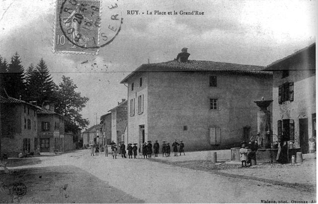

Рюй
- коммуна во Франции
Hiking in Рюй
Ruy, located in the Isère department of southeastern France, is a charming area that offers a variety of hiking opportunities, taking advantage of the beautiful natural landscapes of the region. Although Ruy itself may not be as widely recognized for hiking as some other areas in the Alps, it's conveniently located near various trails and natural parks that are ideal for outdoor enthusiasts....
- Страна:
- Почтовый код: 38300
- Координаты: 45° 35' 18" N, 5° 19' 4" E
- GPS треки (wikiloc): [Ссылка]
- Площадь: 20.81 кв.км
- Население: 4434
- Веб сайт: [Ссылка]


Сен-Марсель-Бель-Аккёй
- коммуна во Франции
Hiking in Сен-Марсель-Бель-Аккёй
Saint-Marcel-Bel-Accueil is a charming commune located in the Auvergne-Rhône-Alpes region of France. While it may not be as well-known as some major hiking destinations, it provides opportunities for outdoor enthusiasts to explore beautiful natural landscapes....
- Страна:
- Почтовый код: 38080
- Координаты: 45° 38' 51" N, 5° 14' 9" E
- GPS треки (wikiloc): [Ссылка]
- Площадь: 18.23 кв.км
- Население: 1357
- Веб сайт: [Ссылка]