La Chavanne (La Chavanne)

- коммуна во Франции
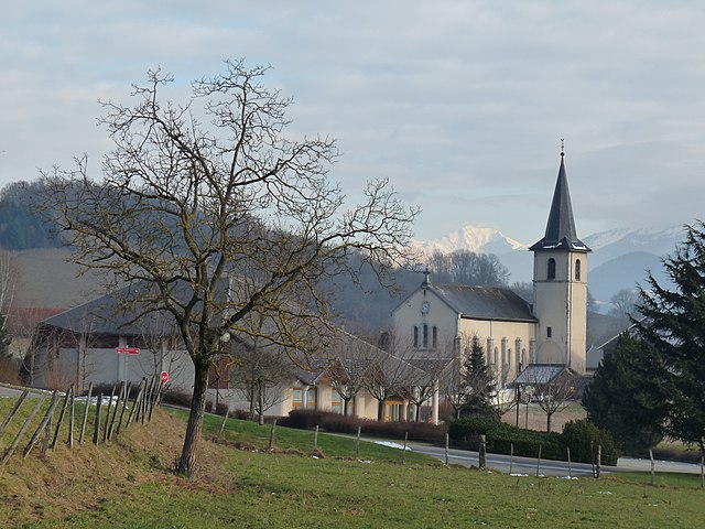
 Hiking in La Chavanne
La Chavanne is a picturesque area located in the French Alps, known for its stunning landscapes and hiking trails. While specific trails may vary by season and accessibility, here are some general points to consider when hiking in La Chavanne:
Trails and Routes
- Scenic Views: Many trails in La Chavanne offer breathtaking views of the surrounding mountains, valleys, and meadows. Look for routes that take you to viewpoints or summits for the best experiences.
- Difficulty Levels: Hiking trails range from easy, family-friendly paths to more challenging routes suitable for experienced hikers. Always choose a trail that matches your skill level.
- Well-Marked Paths: Most hiking trails in this region are well-marked with signs and trail markers, making navigation easier.
Best Time to Hike
- Summer Months: Late spring through early autumn (June to September) is typically the best time for hiking. The weather is generally mild, and trails are clear of snow.
- Autumn: Fall can be beautiful, especially with the changing foliage; however, it's essential to check trail conditions, as some routes may close due to early snow.
Safety Considerations
- Weather Conditions: Always check the weather forecast before heading out. Conditions in the mountains can change rapidly.
- Be Prepared: Carry enough water, snacks, and a first-aid kit. A map or GPS device can help you stay on track.
- Respect Wildlife: Keep a safe distance from any wildlife you may encounter and follow Leave No Trace principles.
Gear
- Footwear: Wear sturdy hiking boots suitable for rugged terrain.
- Clothing: Dress in layers, considering temperature changes throughout the day.
- Backpack Essentials: Bring enough supplies, including water, snacks, a map, a compass or GPS, and a fully charged phone.
Local Tips
- Guided Hikes: Consider joining a guided hike if you’re unfamiliar with the area or want to learn more about the local flora and fauna.
- Local Advice: Chat with locals or park rangers for trail recommendations and tips on beautiful spots to explore.
Conclusion
Hiking in La Chavanne can be a memorable experience filled with stunning views and the beauty of nature. Always prepare well, respect the environment, and enjoy your hiking adventure!
- Страна:

- Почтовый код: 73800
- Координаты: 45° 29' 42" N, 6° 4' 30" E


- GPS треки (wikiloc): [Ссылка]
- Площадь: 3.06 кв.км
- Население: 637
- Веб сайт: http://lachavanne.fr
- Википедия английская: wiki(en)
- Википедия национальная: wiki(fr)
- Хранилище Wikidata: Wikidata: Q979253
- Катеория в википедии: [Ссылка]
- код Freebase: [/m/02pmnpm]
- код GeoNames: Альт: [6617574]
- номер SIREN: [217300821]
- код BNF: [152740160]
- код муниципалитета INSEE: 73082
Граничит с регионами:


Монмельян
- коммуна во Франции
Hiking in Монмельян
Montmélian, located in the Savoie region of France, is an excellent destination for hiking enthusiasts. Nestled at the foot of the Alps, it offers a variety of trails that cater to all skill levels, from beginners to experienced hikers. Here are some highlights and tips for hiking in Montmélian:...
- Страна:
- Почтовый код: 73800
- Координаты: 45° 30' 10" N, 6° 3' 13" E
- GPS треки (wikiloc): [Ссылка]
- Площадь: 5.69 кв.км
- Население: 4112


Planaise
- коммуна во Франции
Hiking in Planaise
Planaise, located in the French Alps, is a fantastic destination for hiking enthusiasts. The area is known for its stunning landscapes, ranging from alpine meadows to rugged mountain terrain. Here’s what you should know about hiking in Planaise:...
- Страна:
- Почтовый код: 73800
- Координаты: 45° 30' 12" N, 6° 5' 26" E
- GPS треки (wikiloc): [Ссылка]
- Площадь: 4.16 кв.км
- Население: 520
- Веб сайт: [Ссылка]

Sainte-Hélène-du-Lac
- коммуна во Франции
Hiking in Sainte-Hélène-du-Lac
Sainte-Hélène-du-Lac is a picturesque commune in the Savoie region of France, nestled in the French Alps. It's a great destination for hikers because of its stunning landscapes, diverse trails, and proximity to the Maurienne Valley and the Chartreuse Mountains....
- Страна:
- Почтовый код: 73800
- Координаты: 45° 28' 56" N, 6° 3' 57" E
- GPS треки (wikiloc): [Ссылка]
- Площадь: 7.09 кв.км
- Население: 767
- Веб сайт: [Ссылка]