Les Molunes (Les Molunes)

- коммуна во Франции
 Hiking in Les Molunes
Les Molunes is a picturesque area that offers a range of hiking opportunities, typically situated within the Jura mountain range in France. The region is known for its scenic landscapes, diverse ecosystems, and rich flora and fauna, making it a favored destination for outdoor enthusiasts.
Hiking Trails
-
Variety of Terrain: Les Molunes features trails that can cater to different skill levels, from easy walks suitable for families to more challenging routes for seasoned hikers. The terrain usually includes rolling hills, wooded areas, and open pastures.
-
Marked Trails: There are well-marked paths in the area, often indicated by color-coded signs, which help hikers navigate easily. It’s advisable to have a good map or a hiking app when exploring.
-
Views and Vistas: Many trails offer stunning views of the surrounding countryside, valleys, and sometimes even the Alps or the nearby lakes.
Recommended Hiking Routes
- La Combe de la Frasse: A popular route that offers both beautiful panoramic views and a chance to spot local wildlife.
- Les Crêts: This trail may lead you through dense forests and up to viewpoints where you can appreciate the vast landscapes.
Best Time to Hike
- Spring and Fall: These seasons are generally the best for hiking in Les Molunes because of the moderate temperatures and stunning natural scenery; wildflowers bloom in spring, and fall foliage is vibrant.
Preparation Tips
- Appropriate Gear: Always wear comfortable hiking boots and carry a daypack with essentials such as water, snacks, a first aid kit, and weather-appropriate clothing.
- Weather Awareness: The weather can change quickly in mountainous regions, so it's wise to check forecasts before heading out.
Safety Considerations
- Wildlife: Be aware of local wildlife and maintain a safe distance.
- Stay on Trails: For your safety and to protect the environment, stick to marked trails.
Local Amenities
Make sure to check for nearby facilities such as visitor centers, accommodations, or eateries in the area if you plan on extending your stay.
Conclusion
Hiking in Les Molunes offers a wonderful opportunity to connect with nature, enjoy breathtaking views, and experience the rich biodiversity of the Jura Mountains. Whether you're a local or a visitor, it’s a place that promises memorable outdoor adventures!
- Страна:

- Почтовый код: 39310
- Координаты: 46° 20' 42" N, 5° 55' 25" E


- GPS треки (wikiloc): [Ссылка]
- Высота над уровнем моря: 1274 м m
- Площадь: 20.51 кв.км
- Население: 156
- Википедия английская: wiki(en)
- Википедия национальная: wiki(fr)
- Хранилище Wikidata: Wikidata: Q910002
- Катеория в википедии: [Ссылка]
- код Freebase: [/m/03npzrv]
- код GeoNames: Альт: [6616718]
- код BNF: [15258704g]
- код муниципалитета INSEE: 39341
Граничит с регионами:

Мижу
- коммуна на востоке Франции, префектура департамента Эн.
Hiking in Мижу
Mijoux is a charming commune located in the Jura region of France, known for its beautiful landscapes and outdoor activities, particularly hiking. Nestled near the Swiss border and surrounded by rolling hills, forests, and scenic views, Mijoux offers a great starting point for various hiking trails suitable for different skill levels. Here are some key points to consider when hiking in Mijoux:...
- Страна:
- Почтовый код: 01170
- Координаты: 46° 21' 58" N, 5° 59' 43" E
- GPS треки (wikiloc): [Ссылка]
- Площадь: 22 кв.км
- Население: 336
- Веб сайт: [Ссылка]
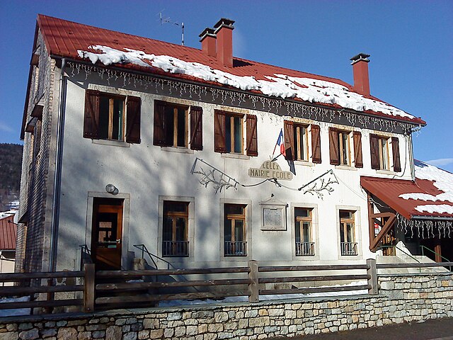
Леле
- коммуна во Франции
Hiking in Леле
Lélex is a charming mountain village located in the Jura region of France, known for its stunning natural landscapes and outdoor activities, particularly hiking. Here are some key points about hiking in Lélex:...
- Страна:
- Почтовый код: 01410
- Координаты: 46° 18' 12" N, 5° 56' 32" E
- GPS треки (wikiloc): [Ссылка]
- Площадь: 17.63 кв.км
- Население: 227
- Веб сайт: [Ссылка]
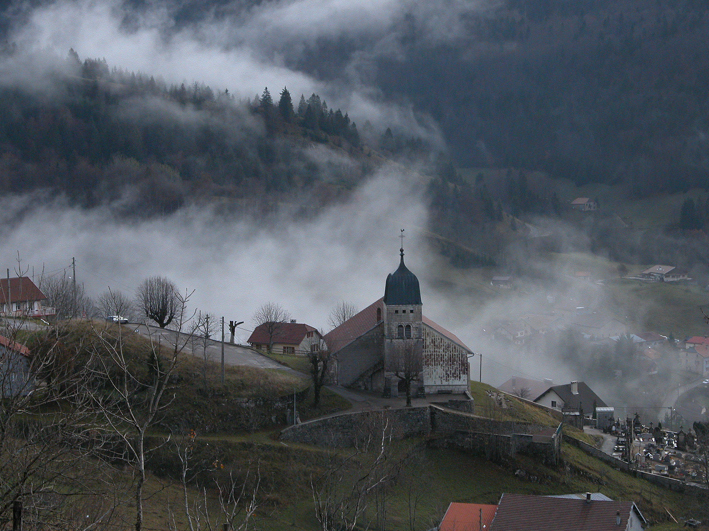

Septmoncel
- коммуна во Франции
Hiking in Septmoncel
Septmoncel is a picturesque village located in the Jura Mountains of France, known for its beautiful natural landscapes and various outdoor activities, including hiking. Here are some key points to consider if you're planning a hiking trip in Septmoncel:...
- Страна:
- Почтовый код: 39310
- Координаты: 46° 22' 14" N, 5° 54' 47" E
- GPS треки (wikiloc): [Ссылка]
- Площадь: 19.4 кв.км
- Население: 683


Bellecombe
- коммуна во Франции
Hiking in Bellecombe
Bellecombe is a picturesque area in the Alps, offering a range of hiking opportunities for all levels of experience. Nestled in stunning natural scenery, it provides a great backdrop for outdoor activities. Here are some key details about hiking in Bellecombe:...
- Страна:
- Почтовый код: 39310
- Координаты: 46° 19' 27" N, 5° 55' 20" E
- GPS треки (wikiloc): [Ссылка]
- Высота над уровнем моря: 1200 м m
- Площадь: 12.17 кв.км
- Население: 65
- Веб сайт: [Ссылка]
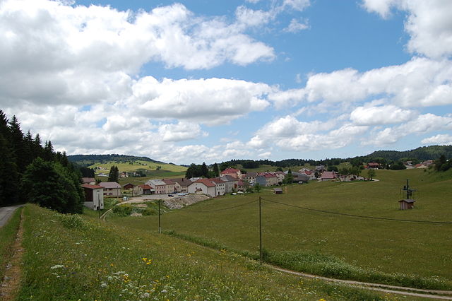

Лажу
- коммуна во Франции
Hiking in Лажу
Lajoux, a charming village located in the Jura region of France, offers a picturesque setting for hiking enthusiasts. Nestled in a stunning landscape characterized by rolling hills, dense forests, and beautiful meadows, it serves as an excellent base for exploring the surrounding natural beauty....
- Страна:
- Почтовый код: 01410
- Координаты: 46° 22' 30" N, 5° 58' 18" E
- GPS треки (wikiloc): [Ссылка]
- Площадь: 23.65 кв.км
- Население: 248


Villard-Saint-Sauveur
- коммуна во Франции
Hiking in Villard-Saint-Sauveur
Villard-Saint-Sauveur, located in the French Alps, is a fantastic destination for hiking enthusiasts. The area is known for its stunning landscapes, diverse flora and fauna, and a variety of trails that cater to different skill levels. Here are some highlights for hiking in Villard-Saint-Sauveur:...
- Страна:
- Почтовый код: 39200
- Координаты: 46° 22' 18" N, 5° 52' 28" E
- GPS треки (wikiloc): [Ссылка]
- Площадь: 9.05 кв.км
- Население: 614


Les Moussières
- коммуна во Франции
Hiking in Les Moussières
Les Moussières is a beautiful hiking destination situated in the French Jura Mountains, renowned for its stunning landscapes, rich biodiversity, and charming rural atmosphere. Here are some key points to consider if you're planning to hike in the area:...
- Страна:
- Почтовый код: 39310
- Координаты: 46° 19' 33" N, 5° 53' 24" E
- GPS треки (wikiloc): [Ссылка]
- Площадь: 16.95 кв.км
- Население: 168