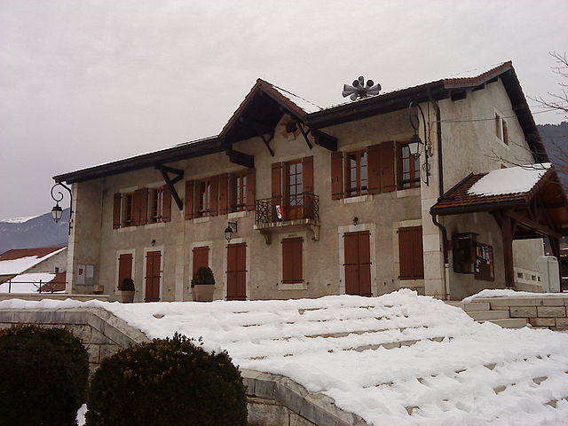
Леле (Lélex, Lélex)
- коммуна во Франции
 Hiking in Леле
Lélex is a charming mountain village located in the Jura region of France, known for its stunning natural landscapes and outdoor activities, particularly hiking. Here are some key points about hiking in Lélex:
Trails and Scenery
-
Diverse Trails: Lélex offers a variety of hiking trails suitable for all levels, from easy walks to more challenging hikes. The trails typically feature well-marked paths, making it easy for hikers to navigate.
-
Breathtaking Views: Hikers can enjoy panoramic views of the Jura mountains, valleys, and surrounding landscapes. The region is especially beautiful during the fall, when the foliage changes colors.
-
Nature and Wildlife: The area is rich in biodiversity, with opportunities to observe local flora and fauna. Keep an eye out for various bird species and other wildlife along the trails.
Popular Hiking Routes
-
Col de la Faucille: A popular starting point for many hikes, this area offers routes leading to scenic viewpoints, such as the Crêt de la Neige, the highest peak in the Jura mountains.
-
Les Monts Jura Trail: This is a longer, multi-day trek that showcases the beauty of the entire Jura mountain range. Some sections can be accessed from Lélex.
-
Le Circuit des lacs: This family-friendly hike takes you around several small lakes, providing a serene atmosphere for a casual walk or picnic.
Best Time to Hike
- Spring and Summer: The best time for hiking in Lélex is from late spring to early fall when trails are clear of snow and temperatures are mild.
- Fall: Autumn also offers stunning views due to the changing colors of the leaves, although the weather can be unpredictable.
- Winter: While often associated with skiing, Lélex can be explored in winter for snowshoeing and winter hikes, as many trails transform into picturesque snowy paths.
Practical Information
- Trail Maps: It's advisable to pick up a trail map from local tourist offices or use hiking apps that provide GPS and trail information.
- Safety: Always check weather conditions before heading out, and be prepared with appropriate gear, food, and water.
Local Amenities
- Lélex has accommodation options ranging from hotels to chalet rentals, as well as restaurants serving local cuisine, which can be a great way to unwind after a day of hiking.
Conclusion
Hiking in Lélex combines the beauty of nature with the charm of a traditional mountain village, making it an excellent destination for both experienced hikers and families looking for a day out in the great outdoors.
- Страна:

- Почтовый код: 01410
- Координаты: 46° 18' 12" N, 5° 56' 32" E


- GPS треки (wikiloc): [Ссылка]
- Площадь: 17.63 кв.км
- Население: 227
- Веб сайт: https://www.lelex.fr
- Википедия английская: wiki(en)
- Википедия национальная: wiki(fr)
- Хранилище Wikidata: Wikidata: Q24643
- Катеория в википедии: [Ссылка]
- Карты в википедии: [Ссылка]
- код Freebase: [/m/08165j]
- код GeoNames: Альт: [6612203]
- номер SIREN: [210102109]
- код муниципалитета INSEE: 01210
Граничит с регионами:
Crozet
- коммуна во Франции
Hiking in Crozet
Crozet, located in the Ain department of the Auvergne-Rhône-Alpes region in France, offers beautiful hiking opportunities with stunning views of the Jura Mountains and the surrounding countryside. Here are some highlights for hiking in and around Crozet:...
- Страна:
- Почтовый код: 01170
- Координаты: 46° 16' 50" N, 6° 0' 45" E
- GPS треки (wikiloc): [Ссылка]
- Площадь: 27.47 кв.км
- Население: 2115
- Веб сайт: [Ссылка]

Мижу
- коммуна на востоке Франции, префектура департамента Эн.
Hiking in Мижу
Mijoux is a charming commune located in the Jura region of France, known for its beautiful landscapes and outdoor activities, particularly hiking. Nestled near the Swiss border and surrounded by rolling hills, forests, and scenic views, Mijoux offers a great starting point for various hiking trails suitable for different skill levels. Here are some key points to consider when hiking in Mijoux:...
- Страна:
- Почтовый код: 01170
- Координаты: 46° 21' 58" N, 5° 59' 43" E
- GPS треки (wikiloc): [Ссылка]
- Площадь: 22 кв.км
- Население: 336
- Веб сайт: [Ссылка]

Шезери-Форан
- коммуна во Франции
Hiking in Шезери-Форан
Chézery-Forens is a charming commune located in the Ain department in the Auvergne-Rhône-Alpes region of southeastern France. Known for its beautiful natural landscapes, it is a fantastic spot for hiking and exploring the great outdoors. Here are some key highlights about hiking in and around Chézery-Forens:...
- Страна:
- Почтовый код: 01200
- Координаты: 46° 13' 18" N, 5° 51' 59" E
- GPS треки (wikiloc): [Ссылка]
- Площадь: 46.57 кв.км
- Население: 460
- Веб сайт: [Ссылка]

Сержи (Эн)
- коммуна во Франции, департамент Эн
Hiking in Сержи (Эн)
Sergy is a picturesque village located in the Ain department in the Auvergne-Rhône-Alpes region of France, near the border with Switzerland. This area offers a blend of beautiful landscapes, lush forests, and various trails that cater to different levels of hiking experience....
- Страна:
- Почтовый код: 01630
- Координаты: 46° 15' 11" N, 6° 0' 0" E
- GPS треки (wikiloc): [Ссылка]
- Площадь: 9.46 кв.км
- Население: 2015
- Веб сайт: [Ссылка]

Туари
- коммуна во Франции, департамент Эн
Hiking in Туари
Thoiry, located in the Ain department of France, is a beautiful area that offers various hiking opportunities, particularly due to its picturesque landscapes that blend mountains, forests, and countryside. Here are some highlights and tips for hiking in this region:...
- Страна:
- Почтовый код: 01710
- Координаты: 46° 14' 11" N, 5° 58' 47" E
- GPS треки (wikiloc): [Ссылка]
- Площадь: 28.93 кв.км
- Население: 6161
- Веб сайт: [Ссылка]


Bellecombe
- коммуна во Франции
Hiking in Bellecombe
Bellecombe is a picturesque area in the Alps, offering a range of hiking opportunities for all levels of experience. Nestled in stunning natural scenery, it provides a great backdrop for outdoor activities. Here are some key details about hiking in Bellecombe:...
- Страна:
- Почтовый код: 39310
- Координаты: 46° 19' 27" N, 5° 55' 20" E
- GPS треки (wikiloc): [Ссылка]
- Высота над уровнем моря: 1200 м m
- Площадь: 12.17 кв.км
- Население: 65
- Веб сайт: [Ссылка]


Les Molunes
- коммуна во Франции
Hiking in Les Molunes
Les Molunes is a picturesque area that offers a range of hiking opportunities, typically situated within the Jura mountain range in France. The region is known for its scenic landscapes, diverse ecosystems, and rich flora and fauna, making it a favored destination for outdoor enthusiasts....
- Страна:
- Почтовый код: 39310
- Координаты: 46° 20' 42" N, 5° 55' 25" E
- GPS треки (wikiloc): [Ссылка]
- Высота над уровнем моря: 1274 м m
- Площадь: 20.51 кв.км
- Население: 156