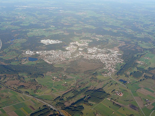
Мюнзинг (Münsing, Münsing)

 Hiking in Мюнзинг
Münsing, located in Bavaria, Germany, is a picturesque area near the Starnberger See, known for its beautiful landscapes and rich natural beauty. Hiking around Münsing offers a range of options for both beginners and experienced hikers. Here are some highlights:
Trails and Routes
-
Münsing to Starnberg Trail: This scenic route takes you along the edge of Lake Starnberg, offering stunning views of the water and the surrounding mountains. It's relatively flat and suitable for most hikers.
-
The Buchenberger Rundweg: This circular trail is approximately 8-10 kilometers long and provides a mix of forest paths and open fields, making it great for experiencing the local flora and fauna.
-
Nature Reserve Haching: This area features well-marked trails and is ideal for those looking to immerse themselves in nature. The serene environment is perfect for birdwatching and enjoying peace and quiet.
-
Panoramic Views: There are several points along the trails that offer panoramic views of the Alps, especially on clear days. The vantage points are excellent spots for a rest and photography.
Tips for Hiking in Münsing
- Seasonal Considerations: The best time to hike in the Münsing area is during spring and autumn when the weather is pleasant and the scenery is vibrant.
- Gear Up: Ensure you have appropriate hiking gear, including sturdy boots, a good backpack, and plenty of water. Weather can change quickly, so layers and a waterproof jacket are advisable.
- Navigation: While many trails are well-marked, having a map or a navigation app can be very helpful, especially if you wish to explore less traveled paths.
- Local Advice: Consider stopping by a local information center or consulting with locals for up-to-date trail conditions and recommendations.
Additional Activities
In addition to hiking, Münsing offers opportunities for cycling, swimming, and even sailing on Lake Starnberg. After a day of hiking, you can relax in one of the local restaurants, enjoying Bavarian cuisine and local specialties.
Overall, Münsing provides a delightful hiking experience with its natural beauty, scenic views, and well-maintained trails. Happy hiking!
- Страна:

- Почтовый код: 82541
- Телефонный код: 08177
- Координаты: 47° 54' 0" N, 11° 22' 0" E


- GPS треки (wikiloc): [Ссылка]
- Высота над уровнем моря: 666 м m
- Площадь: 52.20 кв.км
- Население: 3317
- Веб сайт: http://www.muensing.de
- Википедия русская: wiki(ru)
- Википедия английская: wiki(en)
- Википедия национальная: wiki(de)
- Хранилище Wikidata: Wikidata: Q532939
- Катеория в википедии: [Ссылка]
- код Freebase: [/m/02q0ykj]
- код GeoNames: Альт: [2867561]
- код VIAF: Альт: [240374909]
- ID отношения в OpenStreetMap: [935105]
- код GND: Альт: [4115276-1]
- идентификатор местоположения ArchINFORM: [5673]
- место в MusicBrainz: [dfd4b99f-1a5c-4834-ac6c-1f4112198f04]
- WOEID: [676847]
- код Historical Gazetteer: [MUNINGJN57QV]
- Bavarikon ID: [ODB_A00000964]
- идентификатор муниципалитетов в Германии: 09173137
Граничит с регионами:

Пенцберг
Hiking in Пенцберг
Penzberg, located in Bavaria, Germany, offers a variety of hiking opportunities that cater to different skill levels and preferences. The region is known for its stunning landscapes, which include rolling hills, forests, and panoramic views of the Alps. Here are some highlights and tips for hiking in Penzberg:...
- Страна:
- Почтовый код: 82377
- Телефонный код: 08856
- Код автомобильного номера: WM
- Координаты: 47° 45' 0" N, 11° 22' 0" E
- GPS треки (wikiloc): [Ссылка]
- Высота над уровнем моря: 596 м m
- Площадь: 25.73 кв.км
- Население: 12949
- Веб сайт: [Ссылка]


Иффельдорф
Hiking in Иффельдорф
Iffeldorf, located in Bavaria, Germany, is surrounded by picturesque landscapes, making it a great destination for hiking enthusiasts. The region features rolling hills, lush forests, and scenic views of the Alps in the distance....
- Страна:
- Почтовый код: 82393
- Телефонный код: 08856
- Код автомобильного номера: WM
- Координаты: 47° 46' 16" N, 11° 19' 10" E
- GPS треки (wikiloc): [Ссылка]
- Высота над уровнем моря: 603 м m
- Площадь: 27.59 кв.км
- Население: 1942
- Веб сайт: [Ссылка]


Зеесхаупт
- коммуна в Баварии, Германия
Hiking in Зеесхаупт
Seeshaupt is a beautiful village located on the southern edge of Lake Starnberg in Bavaria, Germany. It’s a fantastic destination for hiking enthusiasts, offering a variety of trails that showcase the stunning natural beauty of the area. Here are some key points to consider if you're planning a hiking trip in Seeshaupt:...
- Страна:
- Почтовый код: 82402
- Телефонный код: 08801
- Код автомобильного номера: WM
- Координаты: 47° 49' 28" N, 11° 18' 3" E
- GPS треки (wikiloc): [Ссылка]
- Высота над уровнем моря: 497 м m
- Площадь: 29.97 кв.км
- Население: 3108
- Веб сайт: [Ссылка]