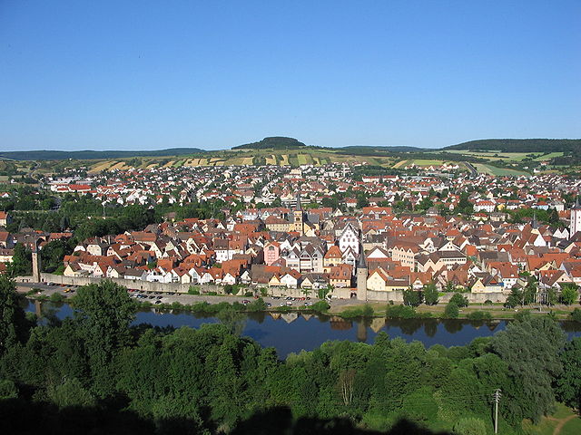
Майн-Таубер (Main-Tauber, Main-Tauber-Kreis)

 Hiking in Майн-Таубер
Main-Tauber-Kreis, located in the Baden-Württemberg state of Germany, is a beautiful region known for its stunning landscapes, historic towns, and rich cultural heritage, making it an excellent destination for hiking enthusiasts. Here are some key aspects of hiking in this picturesque area:
1. Scenic Trails:
The region offers a variety of hiking trails catering to different skill levels, from easy walks to challenging hikes. The trails often wind through vineyards, forests, and picturesque valleys, providing breathtaking views of the Main and Tauber rivers.
2. Romantic Road:
The Main-Tauber-Kreis is part of the famous Romantic Road, which is known for its medieval towns and fairy-tale castles. While hiking along this route, you can explore charming towns like Rothenburg ob der Tauber and Tauberbischofsheim.
3. Nature and Wildlife:
The area is rich in biodiversity, and hikers may encounter various flora and fauna. The landscapes include forests, meadows, and riverbanks, all of which provide habitats for various species.
4. Historical Sites:
Many trails lead to historical sites, including castles, churches, and ancient ruins. The hiking experience can be enriched by exploring these cultural landmarks along the way.
5. Hiking in the Vineyards:
One of the unique experiences in the Main-Tauber-Kreis is hiking through vineyards, especially around the wine town of Bad Mergentheim. This region is renowned for its wine production, particularly Riesling and other white wine varieties.
6. Regional Cuisine:
After a day of hiking, you can enjoy local cuisine at one of the many restaurants or wine taverns in the area. Sampling regional specialties and wines can be a delightful way to conclude your hiking adventures.
7. Accessibility:
The trails are generally well-marked and accessible. Many areas also have public transportation options, making it easier to reach starting points for hikes.
8. Safety Tips:
- Weather: Check the weather before heading out, as conditions can change.
- Footwear: Wear sturdy hiking shoes to provide proper support on varied terrain.
- Hydration: Bring plenty of water and snacks, especially on longer hikes.
- Trail Conditions: Be aware of trail conditions and follow local advisories.
Overall, hiking in Main-Tauber-Kreis offers a fantastic combination of natural beauty, history, and cultural experiences, making it a rewarding destination for outdoor enthusiasts. Happy hiking!
- Страна:

- Столица: Таубербишофсхайм
- Код автомобильного номера: TBB
- Координаты: 49° 34' 12" N, 9° 42' 36" E


- GPS треки (wikiloc): [Ссылка]
- Высота над уровнем моря: 190 м m
- Площадь: 1304.41 кв.км
- Население: 132181
- Веб сайт: http://www.main-tauber-kreis.de/
- Википедия русская: wiki(ru)
- Википедия английская: wiki(en)
- Википедия национальная: wiki(de)
- Хранилище Wikidata: Wikidata: Q8517
- Катеория в википедии: [Ссылка]
- код Freebase: [/m/01k8xy]
- код GeoNames: Альт: [3220782]
- код VIAF: Альт: [247205966]
- ID отношения в OpenStreetMap: [62542]
- код GND: Альт: [4100025-0]
- идентификатор местоположения ArchINFORM: [5671]
- код TGN: [7077334]
- код NUTS: [DE11B]
- код района Германии: 08128
Включает регионы:


Креглинген
Hiking in Креглинген
Creglingen is a picturesque town located in the Baden-Württemberg region of Germany, known for its scenic landscapes and charming countryside. The region offers various hiking opportunities that cater to different skill levels, making it a great destination for both avid hikers and casual walkers....
- Страна:
- Почтовый код: 97993
- Телефонный код: 09335; 07939; 07933; 07932
- Код автомобильного номера: TBB
- Координаты: 49° 28' 0" N, 10° 2' 0" E
- GPS треки (wikiloc): [Ссылка]
- Высота над уровнем моря: 278 м m
- Площадь: 117.22 кв.км
- Население: 4731
- Веб сайт: [Ссылка]


Вербах
Hiking in Вербах
Werbach is a picturesque village located in the Main-Tauber-Kreis district of Baden-Württemberg, Germany. The surrounding area offers a variety of hiking opportunities that showcase the natural beauty of the region, with rolling hills, dense forests, and charming rural landscapes....
- Страна:
- Почтовый код: 97956
- Телефонный код: 09341
- Код автомобильного номера: TBB
- Координаты: 49° 40' 15" N, 9° 38' 22" E
- GPS треки (wikiloc): [Ссылка]
- Высота над уровнем моря: 187 м m
- Площадь: 43.18 кв.км
- Население: 3276
- Веб сайт: [Ссылка]

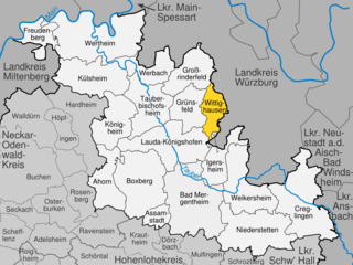
Виттигхаузен
Hiking in Виттигхаузен
Wittighausen, located in the southwest of Germany, offers a serene and picturesque setting for hiking enthusiasts. The area is characterized by lush forests, rolling hills, and charming countryside, making it an ideal destination for both casual walkers and seasoned hikers....
- Страна:
- Почтовый код: 97957
- Телефонный код: 09347
- Код автомобильного номера: TBB
- Координаты: 49° 36' 45" N, 9° 50' 18" E
- GPS треки (wikiloc): [Ссылка]
- Высота над уровнем моря: 245 м m
- Площадь: 32.36 кв.км
- Население: 1641
- Веб сайт: [Ссылка]


Кюльсхайм
Hiking in Кюльсхайм
Külsheim is a charming village located in the Main-Tauber district of Baden-Württemberg, Germany. The region surrounding Külsheim offers a variety of hiking opportunities, characterized by picturesque landscapes, rolling hills, vineyards, and serene forests....
- Страна:
- Почтовый код: 97900
- Телефонный код: 09345
- Код автомобильного номера: TBB
- Координаты: 49° 40' 10" N, 9° 31' 14" E
- GPS треки (wikiloc): [Ссылка]
- Высота над уровнем моря: 327 м m
- Площадь: 81.46 кв.км
- Население: 5234
- Веб сайт: [Ссылка]


Нидерштеттен
Hiking in Нидерштеттен
Niederstetten, located in the Baden-Württemberg region of Germany, offers a charming landscape ideal for hiking enthusiasts. The area is characterized by its picturesque trails, which wind through scenic woodlands, rolling hills, and lush fields, providing wonderful views of the Swabian countryside....
- Страна:
- Почтовый код: 97996
- Телефонный код: 07932
- Код автомобильного номера: TBB
- Координаты: 49° 24' 3" N, 9° 55' 5" E
- GPS треки (wikiloc): [Ссылка]
- Высота над уровнем моря: 306 м m
- Площадь: 104.06 кв.км
- Население: 5222
- Веб сайт: [Ссылка]


Ассамштадт
Hiking in Ассамштадт
Assamstadt, located in the Baden-Württemberg region of Germany, offers a variety of scenic hiking opportunities, surrounded by beautiful landscapes, woodland areas, and picturesque countryside. Here are some key aspects to consider when planning your hike in and around Assamstadt:...
- Страна:
- Почтовый код: 97959
- Телефонный код: 06294
- Код автомобильного номера: TBB
- Координаты: 49° 25' 41" N, 9° 41' 10" E
- GPS треки (wikiloc): [Ссылка]
- Высота над уровнем моря: 331 м m
- Площадь: 17.23 кв.км
- Население: 2246
- Веб сайт: [Ссылка]


Лауда-Кёнигсхофен
Hiking in Лауда-Кёнигсхофен
Lauda-Königshofen is a charming town located in the state of Baden-Württemberg, Germany. It lies in a picturesque area known for its rolling hills, vineyards, and beautiful natural landscapes, making it an attractive destination for hiking enthusiasts....
- Страна:
- Почтовый код: 97922
- Телефонный код: 09343
- Код автомобильного номера: TBB
- Координаты: 49° 34' 7" N, 9° 42' 14" E
- GPS треки (wikiloc): [Ссылка]
- Высота над уровнем моря: 192 м m
- Площадь: 94.47 кв.км
- Население: 14443
- Веб сайт: [Ссылка]


Таубербишофсхайм
- город в Германии
Hiking in Таубербишофсхайм
Tauberbischofsheim, located in the Main-Tauber district of Baden-Württemberg, Germany, offers a variety of hiking opportunities that showcase its beautiful landscape and cultural heritage. Nestled in the picturesque Tauber valley, this region is ideal for both casual and experienced hikers....
- Страна:
- Почтовый код: 97941
- Телефонный код: 09341
- Код автомобильного номера: TBB
- Координаты: 49° 37' 22" N, 9° 39' 57" E
- GPS треки (wikiloc): [Ссылка]
- Высота над уровнем моря: 178 м m
- Площадь: 69.32 кв.км
- Население: 13201
- Веб сайт: [Ссылка]


Гросриндерфельд
Hiking in Гросриндерфельд
Großrinderfeld, located in the Baden-Württemberg region of Germany, offers picturesque landscapes and a variety of hiking opportunities. While it’s not as widely known as some other hiking destinations in Germany, it provides beautiful rural scenery, charming villages, and tranquil countryside....
- Страна:
- Почтовый код: 97950
- Телефонный код: 09344; 09349
- Код автомобильного номера: TBB
- Координаты: 49° 39' 0" N, 9° 45' 0" E
- GPS треки (wikiloc): [Ссылка]
- Высота над уровнем моря: 311 м m
- Площадь: 56.28 кв.км
- Население: 3920
- Веб сайт: [Ссылка]

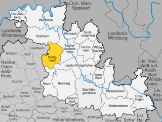
Кёнигхайм
Hiking in Кёнигхайм
Königheim, located in the northern part of Baden-Württemberg, Germany, offers beautiful hiking opportunities amidst picturesque landscapes. The area is characterized by rolling hills, lush forests, vineyards, and charming villages, making it a great destination for both casual and experienced hikers....
- Страна:
- Почтовый код: 97953
- Телефонный код: 09341; 09340
- Код автомобильного номера: TBB
- Координаты: 49° 37' 13" N, 9° 35' 45" E
- GPS треки (wikiloc): [Ссылка]
- Высота над уровнем моря: 223 м m
- Площадь: 61.23 кв.км
- Население: 3041
- Веб сайт: [Ссылка]


Фройденберг
Hiking in Фройденберг
Freudenberg, located in the Baden-Württemberg region of Germany, is a picturesque destination for hiking enthusiasts. Nestled in the beautiful landscape of the Northern Black Forest, it offers a variety of trails catering to different skill levels, from easy walks to more challenging hikes. Here are some highlights for hiking in Freudenberg:...
- Страна:
- Почтовый код: 97896
- Телефонный код: 09378; 09377; 09375
- Код автомобильного номера: TBB
- Координаты: 49° 45' 0" N, 9° 20' 0" E
- GPS треки (wikiloc): [Ссылка]
- Высота над уровнем моря: 133 м m
- Площадь: 34.78 кв.км
- Население: 3760
- Веб сайт: [Ссылка]


Вайкерсхайм
- населённый пункт в Баден-Вюртемберге
Hiking in Вайкерсхайм
Weikersheim, located in the Baden-Württemberg region of Germany, offers a picturesque setting for hiking enthusiasts. Nestled in the lovely Tauber Valley, it features a blend of cultural heritage and natural beauty, making it a great destination for outdoor activities....
- Страна:
- Почтовый код: 97990
- Телефонный код: 07934
- Код автомобильного номера: TBB
- Координаты: 49° 28' 54" N, 9° 53' 57" E
- GPS треки (wikiloc): [Ссылка]
- Высота над уровнем моря: 296 м m
- Площадь: 80.92 кв.км
- Население: 7288
- Веб сайт: [Ссылка]

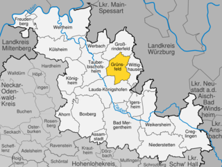
Грюнсфельд
Hiking in Грюнсфельд
Grünsfeld is a picturesque municipality in the Main-Tauber-Kreis district in Baden-Württemberg, Germany. While it might not be as widely known as some other hiking destinations, it offers a range of trails that cater to various hiking preferences, from leisurely strolls to more challenging treks. Here are some highlights to consider when hiking in Grünsfeld:...
- Страна:
- Почтовый код: 97947
- Телефонный код: 09346
- Код автомобильного номера: TBB
- Координаты: 49° 36' 0" N, 9° 45' 0" E
- GPS треки (wikiloc): [Ссылка]
- Высота над уровнем моря: 210 м m
- Площадь: 44.72 кв.км
- Население: 3673
- Веб сайт: [Ссылка]


Боксберг
- город в Германии, Баден-Вюртемберг
Hiking in Боксберг
Boxberg, located in the Baden-Württemberg region of Germany, offers a variety of hiking opportunities for outdoor enthusiasts. The area is characterized by its picturesque landscapes, including rolling hills, dense forests, and scenic views, making it a great destination for both casual walkers and dedicated hikers....
- Страна:
- Почтовый код: 97944
- Телефонный код: 07930
- Код автомобильного номера: TBB
- Координаты: 49° 28' 53" N, 9° 38' 30" E
- GPS треки (wikiloc): [Ссылка]
- Высота над уровнем моря: 269 м m
- Площадь: 101.81 кв.км
- Население: 6623
- Веб сайт: [Ссылка]


Ахорн
Hiking in Ахорн
Ahorn, located in Baden-Württemberg, is a charming destination for hiking enthusiasts. Nestled in the picturesque landscape of the northern part of Baden-Württemberg, the area features a variety of trails that cater to different skill levels, from easy walks suitable for families to more challenging routes for experienced hikers....
- Страна:
- Почтовый код: 74744
- Телефонный код: 09340; 07930; 06296
- Код автомобильного номера: TBB
- Координаты: 49° 30' 3" N, 9° 32' 23" E
- GPS треки (wikiloc): [Ссылка]
- Высота над уровнем моря: 360 м m
- Площадь: 53.96 кв.км
- Население: 2209
- Веб сайт: [Ссылка]


Вертхайм
- город в земле Баден-Вюртемберг (Германия)
Hiking in Вертхайм
Wertheim am Main is a beautiful town located at the confluence of the Main and Tauber rivers in Bavaria, Germany. The region is known for its picturesque landscapes, rich history, and a variety of outdoor activities, including hiking....
- Страна:
- Почтовый код: 97877
- Телефонный код: 09397; 09342
- Код автомобильного номера: TBB
- Координаты: 49° 45' 0" N, 9° 31' 0" E
- GPS треки (wikiloc): [Ссылка]
- Высота над уровнем моря: 145 м m
- Площадь: 138.63 кв.км
- Население: 23405
- Веб сайт: [Ссылка]

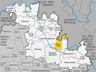
Игерсхайм
Hiking in Игерсхайм
Igersheim, located in the beautiful Baden-Württemberg region of Germany, offers a variety of hiking opportunities for both casual walkers and more experienced hikers. The surrounding countryside is characterized by rolling hills, wooded areas, and picturesque landscapes, making it a great destination for nature enthusiasts....
- Страна:
- Почтовый код: 97999
- Телефонный код: 07931
- Код автомобильного номера: TBB
- Координаты: 49° 29' 40" N, 9° 49' 1" E
- GPS треки (wikiloc): [Ссылка]
- Высота над уровнем моря: 220 м m
- Площадь: 42.83 кв.км
- Население: 5496
- Веб сайт: [Ссылка]


Бад-Мергентхайм
- город в земле Баден-Вюртемберг (Германия)
Hiking in Бад-Мергентхайм
Bad Mergentheim, a charming spa town located in the northeastern part of Baden-Württemberg, Germany, offers a range of hiking opportunities amidst beautiful landscapes, vineyards, and historical sites. Here are some highlights for hiking in and around Bad Mergentheim:...
- Страна:
- Почтовый код: 97980
- Телефонный код: 07931
- Координаты: 49° 30' 0" N, 9° 46' 0" E
- GPS треки (wikiloc): [Ссылка]
- Высота над уровнем моря: 206 м m
- Площадь: 129.97 кв.км
- Население: 23502
- Веб сайт: [Ссылка]
Граничит с регионами:

Ансбах
Hiking in Ансбах
Ansbach district, located in the region of Bavaria, Germany, offers a variety of hiking opportunities suitable for different skill levels. The region is characterized by its picturesque landscapes, including rolling hills, forests, and historical sites, making it a great destination for outdoor enthusiasts....
- Страна:
- Столица: Ансбах
- Код автомобильного номера: ROT; FEU; DKB; AN
- Координаты: 49° 19' 48" N, 10° 30' 0" E
- GPS треки (wikiloc): [Ссылка]
- Высота над уровнем моря: 426 м m
- Площадь: 1972.00 кв.км
- Население: 157632
- Веб сайт: [Ссылка]
Нойштадт-ан-дер-Айш-Бад-Виндсхайм
- район в Баварии, Германия
Hiking in Нойштадт-ан-дер-Айш-Бад-Виндсхайм
Neustadt (Aisch)-Bad Windsheim, located in the Franconian region of Bavaria, Germany, offers a variety of scenic hiking opportunities for outdoor enthusiasts. The area is characterized by its picturesque landscapes, charming villages, and the rich cultural heritage of Franconia. Here are some highlights of hiking in this region:...
- Страна:
- Столица: Нойштадт-ан-дер-Айш
- Код автомобильного номера: UFF; SEF; NEA
- Координаты: 49° 34' 48" N, 10° 30' 0" E
- GPS треки (wikiloc): [Ссылка]
- Высота над уровнем моря: 384 м m
- Площадь: 1267.54 кв.км
- Население: 85686
- Веб сайт: [Ссылка]

Вюрцбург
Hiking in Вюрцбург
Würzburg, located in the Lower Franconia region of Bavaria, Germany, is surrounded by beautiful landscapes, making it a great starting point for hiking adventures. Here are some highlights and considerations for hiking in and around the Würzburg district:...
- Страна:
- Столица: Вюрцбург
- Код автомобильного номера: OCH; WÜ
- Координаты: 49° 39' 36" N, 10° 0' 0" E
- GPS треки (wikiloc): [Ссылка]
- Высота над уровнем моря: 346 м m
- Площадь: 967.56 кв.км
- Население: 161340
- Веб сайт: [Ссылка]
Майн-Шпессарт
Hiking in Майн-Шпессарт
Main-Spessart is a beautiful region located in Bavaria, Germany, known for its scenic landscapes, charming villages, and rich cultural heritage. It's a fantastic destination for hiking enthusiasts, offering a variety of trails that cater to different skill levels. Here’s what you can expect when hiking in Main-Spessart:...
- Страна:
- Столица: Карлштадт
- Код автомобильного номера: MSP
- Координаты: 49° 55' 12" N, 9° 45' 0" E
- GPS треки (wikiloc): [Ссылка]
- Высота над уровнем моря: 313 м m
- Площадь: 1321.4186 кв.км
- Население: 125915
- Веб сайт: [Ссылка]


Мильтенберг
Hiking in Мильтенберг
Miltenberg, located in the Bavaria region of Germany, is a charming town nestled along the Main River and surrounded by picturesque landscapes, making it an excellent destination for hiking enthusiasts. Here are some highlights about hiking in the Miltenberg district:...
- Страна:
- Столица: Мильтенберг
- Код автомобильного номера: MIL
- Координаты: 49° 45' 0" N, 9° 15' 0" E
- GPS треки (wikiloc): [Ссылка]
- Высота над уровнем моря: 224 м m
- Площадь: 716.00 кв.км
- Население: 114255
- Веб сайт: [Ссылка]