
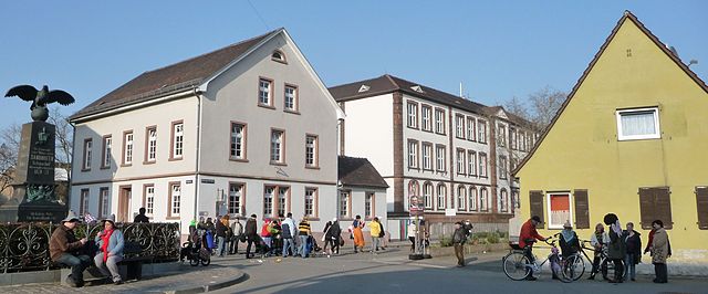
Мангейм (Mannheim, Mannheim)


- город в земле Баден-Вюртемберг, Германия
 Hiking in Мангейм
Mannheim, located in southwestern Germany, is not typically known as a hiking destination compared to some of the more mountainous regions of the country. However, it does offer some pleasant walking and hiking opportunities, particularly along the Rhine and Neckar rivers. Here are some options for hiking in and around Mannheim:
1.
- Description: The Rhine promenade along the river is a beautiful place for walking and offers scenic views. You can enjoy a leisurely stroll or cycle along the path.
- Length: Varies, but you can extend your walk by continuing towards nearby towns like Ludwigshafen or even further to Worms.
2.
- Description: This large park in Mannheim combines nature with gardens, lakes, and recreational areas. While not a traditional hiking area, it offers many trails where you can walk and explore.
- Highlights: Japanese gardens, a butterfly house, and open spaces perfect for picnics.
3.
- Description: A long-distance hiking trail that runs along the Rhine between Mannheim and the French border, providing lovely views and diverse landscapes.
- Length: This trail spans over 200 km, but you can easily choose shorter segments.
4.
- Distance: While not in Mannheim itself, it’s about 1.5 to 2 hours away by car. The area offers stunning hikes through dense forests, waterfalls, and panoramic views if you're willing to travel.
- Description: A great spot for a day trip, with trails that cater to all levels of hikers.
5.
- Distance: The Odenwald region is also a short drive from Mannheim, offering varied terrain with extensive hiking trails.
- Description: Popular for its scenic landscapes, charming villages, and historical sites. Look for the Hiking Trail "Nibelungensteig” for a comprehensive experience.
Hiking Tips:
- Maps and Guides: Make sure to have a map of the area or a hiking app on your phone to guide you through the trails.
- Weather Prep: Check the weather before heading out, as conditions can change quickly.
- Stay Hydrated: Bring plenty of water, especially if you'll be hiking in warmer weather.
Overall, while Mannheim may not be the first choice for avid hikers, it offers a variety of pleasant trails and walks suitable for a leisurely day out in nature.
- Страна:

- Почтовый код: 68309; 68307; 68305; 68259; 68239; 68229; 68219; 68199; 68169; 68167; 68165; 68163; 68161; 68159
- Телефонный код: 0621
- Код автомобильного номера: MA
- Координаты: 49° 29' 1" N, 8° 27' 47" E


- GPS треки (wikiloc): [Ссылка]
- Высота над уровнем моря: 97 м m
- Площадь: 144.97 кв.км
- Население: 304781
- Веб сайт: https://www.mannheim.de/
- Википедия русская: wiki(ru)
- Википедия английская: wiki(en)
- Википедия национальная: wiki(de)
- Хранилище Wikidata: Wikidata: Q2119
- Галерея изображений в википедии: [Ссылка]
- Катеория в википедии: [Ссылка]
- Карты в википедии: [Ссылка]
- код Freebase: [/m/0pf5y]
- код GeoNames: Альт: [2873891]
- код BNF: [11963140b]
- код VIAF: Альт: [135518763]
- ID отношения в OpenStreetMap: [62691]
- код GND: Альт: [4037372-1]
- идентификатор местоположения ArchINFORM: [170]
- код LCNAF: Альт: [n79142598]
- место в MusicBrainz: [b07271ff-75a4-4dbd-96ee-6386cf3c5fab]
- WOEID: [673711]
- код темы Quora: [Mannheim-Germany]
- код TGN: [7005179]
- UN/LOCODE: [DEMHG]
- код SUDOC: [129467944]
- код в энциклопедии «Британника онлайн»: [place/Mannheim]
- код места в Facebook: [107945412571299]
- код в Большой российской энциклопедии онлайн: [2156399]
- dmoz: Альт: [Regional/Europe/Germany/States/Baden-Württemberg/Localities/Mannheim/]
- код NLI: [000977600]
- код NUTS: [DE126]
- код статьи Klexikon: [Mannheim]
- идентификатор муниципалитетов в Германии: 08222000
- код US National Archives: 10044744
- код района Германии: 08222
Включает регионы:
Feudenheim
Hiking in Feudenheim
Feudenheim is a district of Mannheim, located in the southwestern part of Germany. While it may not be a well-known hiking destination, it offers some pleasant opportunities for outdoor activities and exploration in the surrounding areas....
- Страна:
- Почтовый код: 68259
- Телефонный код: 0621
- Координаты: 49° 29' 11" N, 8° 32' 0" E
- GPS треки (wikiloc): [Ссылка]
- Площадь: 6.07 кв.км
Friedrichsfeld
Hiking in Friedrichsfeld
Friedrichsfeld is a district located within Mannheim, Germany, and while it may not be primarily known for extensive hiking trails, there are still some opportunities for outdoor activities in and around the area. Here are a few suggestions:...
- Страна:
- Почтовый код: 68229
- Телефонный код: 0621
- Координаты: 49° 26' 25" N, 8° 34' 20" E
- GPS треки (wikiloc): [Ссылка]
- Площадь: 7.01 кв.км
Waldhof
Hiking in Waldhof
Hiking in Waldhof, a district in Mannheim, can be a unique experience. While Waldhof itself is an urban area, it is close to various green spaces and natural sites where you can enjoy hiking and walking. Here are some options for hiking near Waldhof:...
- Страна:
- Координаты: 49° 31' 28" N, 8° 29' 6" E
- GPS треки (wikiloc): [Ссылка]
- Площадь: 12.87 кв.км
Schwetzingerstadt/Oststadt
Hiking in Schwetzingerstadt/Oststadt
Schwetzingerstadt-Oststadt is a district located in the city of Mannheim, Germany. While it may not be primarily known for extensive hiking trails, there are still opportunities for enjoyable walks and outdoor activities in and around the area. Here are some suggestions for hiking and outdoor exploration in the vicinity:...
- Страна:
- Почтовый код: 68165
- Телефонный код: 0621
- Координаты: 49° 28' 55" N, 8° 28' 29" E
- GPS треки (wikiloc): [Ссылка]
- Площадь: 4.41 кв.км
Vogelstang
Hiking in Vogelstang
Vogelstang is a picturesque area located in Germany, specifically in the state of Baden-Württemberg. It offers a variety of outdoor activities, including hiking, which can be a fantastic way to explore the beautiful landscapes....
- Страна:
- Почтовый код: 68309
- Телефонный код: 0621
- Координаты: 49° 30' 36" N, 8° 32' 22" E
- GPS треки (wikiloc): [Ссылка]
- Площадь: 3.16 кв.км

Зандхофен
- район Мангейма
Hiking in Зандхофен
Sandhofen is a district in the city of Mannheim, Germany, and while it may not be as well-known for extensive hiking trails as some other regions in the country, there are still opportunities for enjoyable nature walks and shorter hikes in the surrounding areas. Here are some tips and insights for hiking in and around Sandhofen:...
- Страна:
- Координаты: 49° 33' 0" N, 8° 27' 0" E
- GPS треки (wikiloc): [Ссылка]
- Площадь: 26.71 кв.км
Lindenhof
Hiking in Lindenhof
Lindenhof is a lovely park in Mannheim, Germany, known for its beautiful views and green space, but it's not typically recognized as a traditional hiking destination. However, it can serve as a great starting point for urban walks and leisurely strolls....
- Страна:
- Почтовый код: 68163
- Координаты: 49° 28' 19" N, 8° 28' 12" E
- GPS треки (wikiloc): [Ссылка]
- Площадь: 2.34 кв.км
Neckarau
Hiking in Neckarau
Neckarau, a district in the city of Mannheim, Germany, is not primarily known as a hiking destination, but it can serve as a good starting point for various outdoor activities and explorations in the surrounding areas. Here are some insights on hiking near Neckarau:...
- Страна:
- Координаты: 49° 27' 13" N, 8° 29' 27" E
- GPS треки (wikiloc): [Ссылка]
- Площадь: 10.98 кв.км
Neckarstadt-Ost
Hiking in Neckarstadt-Ost
Neckarstadt-Ost is a district located in Mannheim, Germany, and while it's primarily an urban area, you can still enjoy hiking opportunities in and around the region. Here are some aspects to consider:...
- Страна:
- Координаты: 49° 29' 54" N, 8° 29' 17" E
- GPS треки (wikiloc): [Ссылка]
Neckarstadt-West
Hiking in Neckarstadt-West
Neckarstadt-West is a district in the city of Mannheim, Germany. While it is primarily an urban area and doesn't boast traditional hiking trails like those found in more rural regions, there are still opportunities for walking and exploring green spaces....
- Страна:
- Координаты: 49° 29' 59" N, 8° 27' 58" E
- GPS треки (wikiloc): [Ссылка]
- Площадь: 9.94 кв.км
Neuostheim
Hiking in Neuostheim
Neuostheim and Neuhermsheim are districts located in the city of Mannheim, Germany. While these areas are more urban, there are still opportunities for hiking and enjoying nature nearby....
- Страна:
- Почтовый код: 68163
- Телефонный код: 0621
- Координаты: 49° 27' 58" N, 8° 30' 32" E
- GPS треки (wikiloc): [Ссылка]
- Площадь: 5.24 кв.км
Rheinau
Hiking in Rheinau
Rheinau is a district in Mannheim, Germany, situated on the right bank of the Rhine River. While not traditionally known as a hiking destination, it offers several opportunities for outdoor activities, including hiking along the scenic riverside and through nearby green spaces....
- Страна:
- Координаты: 49° 25' 51" N, 8° 31' 45" E
- GPS треки (wikiloc): [Ссылка]
- Площадь: 15.28 кв.км
Schönau
Hiking in Schönau
Schönau, a district in Mannheim, Germany, offers a variety of hiking opportunities. While the area is primarily urban, it is surrounded by natural landscapes that can cater to outdoor enthusiasts looking for trails and nature experiences....
- Страна:
- Почтовый код: 68307
- Телефонный код: 0621
- Координаты: 49° 32' 39" N, 8° 28' 27" E
- GPS треки (wikiloc): [Ссылка]
- Площадь: 2.97 кв.км
- Население: 12983
Seckenheim
Hiking in Seckenheim
Seckenheim is a district in the city of Mannheim, Germany, located near the Rhine River. While it may not be widely known as a traditional hiking destination, there are some beautiful areas in and around that can offer enjoyable walking and hiking experiences....
- Страна:
- Почтовый код: 68239
- Телефонный код: 0621
- Координаты: 49° 27' 59" N, 8° 33' 52" E
- GPS треки (wikiloc): [Ссылка]
- Площадь: 9.42 кв.км
Wallstadt
Hiking in Wallstadt
Wallstadt is a district in the city of Mannheim, Germany, and while it may not be as renowned for hiking as larger national parks or mountain regions, there are still opportunities for outdoor activities and nature walks in the surrounding areas. Here are some insights on hiking options around Wallstadt and nearby locations:...
- Страна:
- Почтовый код: 68259
- Телефонный код: 0621
- Координаты: 49° 29' 46" N, 8° 32' 57" E
- GPS треки (wikiloc): [Ссылка]
- Площадь: 7.08 кв.км
Innenstadt/Jungbusch
Hiking in Innenstadt/Jungbusch
While Innenstadt_Jungbusch is located in Mannheim, Germany, it’s primarily an urban area rather than a traditional hiking destination. However, it does offer some interesting opportunities for urban hiking and exploration. Here are some key points to consider:...
- Страна:
- Почтовый код: 68161
- Телефонный код: 0621
- Координаты: 49° 29' 22" N, 8° 27' 46" E
- GPS треки (wikiloc): [Ссылка]
Граничит с регионами:


Людвигсхафен-ам-Райн
- город в Германии
Hiking in Людвигсхафен-ам-Райн
Ludwigshafen am Rhein, located in the German state of Rhineland-Palatinate, offers access to a variety of hiking opportunities in the surrounding areas. While the city itself is more industrial and urban, it's strategically positioned near natural attractions and hiking trails, especially along the Rhine River and in nearby forests and hills....
- Страна:
- Почтовый код: 67071; 67070; 67069; 67068; 67067; 67066; 67065; 67064; 67063; 67062; 67061; 67060; 67059
- Телефонный код: 06237; 0621
- Код автомобильного номера: LU
- Координаты: 49° 28' 52" N, 8° 26' 7" E
- GPS треки (wikiloc): [Ссылка]
- Высота над уровнем моря: 96 м m
- Площадь: 77.43 кв.км
- Население: 166621
- Веб сайт: [Ссылка]


Гейдельберг
- город в земле Баден-Вюртемберг, Германия
Hiking in Гейдельберг
Heidelberg, located in the Baden-Württemberg region of Germany, is not only famous for its historic university and picturesque old town but also offers a variety of hiking opportunities for all levels of experience. The surrounding Odenwald Forest and the landscape along the Neckar River provide numerous scenic trails....
- Страна:
- Почтовый код: 69001
- Телефонный код: 6202; 6221
- Код автомобильного номера: HD
- Координаты: 49° 24' 44" N, 8° 42' 36" E
- GPS треки (wikiloc): [Ссылка]
- Высота над уровнем моря: 114 м m
- Площадь: 108.89 кв.км
- Население: 159914
- Веб сайт: [Ссылка]

Рейн-Неккар
Hiking in Рейн-Неккар
The Rhein-Neckar-Kreis, located in the southwest of Germany, is a fantastic destination for hiking enthusiasts. It's part of the larger Rhein-Neckar Metropolitan Region and boasts diverse landscapes, including rolling hills, dense forests, vineyards, and picturesque villages. Here are some highlights and considerations for hiking in the area:...
- Страна:
- Столица: Гейдельберг
- Код автомобильного номера: HD
- Координаты: 49° 22' 0" N, 8° 44' 0" E
- GPS треки (wikiloc): [Ссылка]
- Высота над уровнем моря: 390 м m
- Веб сайт: [Ссылка]