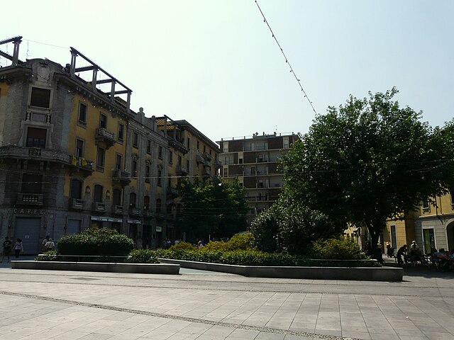
Маркалло-кон-Казоне (Marcallo con Casone, Marcallo con Casone)
.svg)
- коммуна Италии
 Hiking in Маркалло-кон-Казоне
Marcallo con Casone is a small municipality in the Lombardy region of Italy, near Milan. While it may not be the most famous hiking destination in Italy, it has its own charm and offers some opportunities for outdoor activities. Here are some insights on hiking in and around Marcallo con Casone:
Local Trails
-
Natural Landscapes: The area around Marcallo con Casone features some picturesque countryside views, including fields, forests, and waterways. Look for local trails that weave through this natural landscape.
-
Ciclabili (Cycle Paths): While primarily designed for cycling, many of these paths can be enjoyed by hikers as well. They often connect to nearby towns and can provide a nice loop for a day hike.
Nearby Hiking Locations
-
Parco del Ticino: Just a short drive from Marcallo con Casone, this regional park offers a more extensive network of hiking paths. It's known for its beautiful river landscapes, diverse flora and fauna, and serene environment.
-
Monte Rosa: If you're willing to travel a bit further, the Monte Rosa massif provides numerous hiking opportunities, featuring stunning mountain scenery and various trail difficulty levels.
Tips for Hiking in the Area
- Check Weather Conditions: Always check the weather before heading out, as conditions can change quickly, especially in Northern Italy.
- Local Guides: Consider hiring a local guide or joining a hiking group, especially if you're not familiar with the area.
- Respect Nature: Follow Leave No Trace principles by sticking to trails, carrying out your trash, and respecting wildlife.
- Hydration and Snacks: Carry water and some energy-rich snacks to keep your energy up during your hike.
Conclusion
While Marcallo con Casone itself may not be a hiker's paradise, its proximity to various natural attractions adds to its appeal. Whether exploring the immediate surroundings or venturing out to nearby parks, you can find enjoyable hiking experiences in this serene part of Italy.
- Страна:

- Почтовый код: 20010
- Телефонный код: 02
- Код автомобильного номера: MI
- Координаты: 45° 29' 53" N, 8° 52' 35" E


- GPS треки (wikiloc): [Ссылка]
- Высота над уровнем моря: 147 м m
- Площадь: 8.21 кв.км
- Население: 6254
- Веб сайт: http://www.marcallo.it
- Википедия русская: wiki(ru)
- Википедия английская: wiki(en)
- Википедия национальная: wiki(it)
- Хранилище Wikidata: Wikidata: Q42243
- Катеория в википедии: [Ссылка]
- код Freebase: [/m/0gj6hr]
- код GeoNames: Альт: [6536138]
- ID отношения в OpenStreetMap: [45106]
- UN/LOCODE: [ITMLV]
- код ISTAT: 015134
- кадастровый код Италии: E921
Граничит с регионами:


Боффалора-сопра-Тичино
- коммуна Италии
Hiking in Боффалора-сопра-Тичино
Boffalora sopra Ticino is a charming village located in the Lombardy region of Italy, near the banks of the Ticino River. It offers a variety of hiking and outdoor opportunities for nature enthusiasts. Here are some highlights and tips for hiking in the area:...
- Страна:
- Почтовый код: 20010
- Телефонный код: 02
- Код автомобильного номера: MI
- Координаты: 45° 28' 0" N, 8° 50' 0" E
- GPS треки (wikiloc): [Ссылка]
- Высота над уровнем моря: 120 м m
- Площадь: 7.65 кв.км
- Население: 4113
- Веб сайт: [Ссылка]


Оссона
- коммуна Италии
Hiking in Оссона
Hiking in Ossona, a town in the Lombardy region of Italy, can be a delightful experience, as it offers a charming mix of nature and cultural sights. While Ossona itself is not a prominent hiking destination, it is located near larger natural areas and parks that provide great opportunities for outdoor activities....
- Страна:
- Почтовый код: 20010
- Телефонный код: 02
- Код автомобильного номера: MI
- Координаты: 45° 30' 0" N, 8° 54' 0" E
- GPS треки (wikiloc): [Ссылка]
- Высота над уровнем моря: 156 м m
- Площадь: 5.98 кв.км
- Население: 4288
- Веб сайт: [Ссылка]

Маджента
- коммуна Италии
Hiking in Маджента
Magenta, located in the Lombardy region of Italy, is a town rich in history and natural surroundings, though it may not be as well-known for hiking as other destinations in the region like the Alps or Lake Como. However, there are still opportunities to enjoy the outdoors and engage in hiking in and around Magenta....
- Страна:
- Почтовый код: 20013
- Телефонный код: 02
- Код автомобильного номера: MI
- Координаты: 45° 28' 0" N, 8° 53' 0" E
- GPS треки (wikiloc): [Ссылка]
- Высота над уровнем моря: 138 м m
- Площадь: 21.99 кв.км
- Население: 23845
- Веб сайт: [Ссылка]


Бернате-Тичино
- коммуна Италии
Hiking in Бернате-Тичино
Bernate Ticino, located in the Lombardy region of northern Italy, is a wonderful destination for hiking enthusiasts. This area is characterized by lush landscapes, tranquil rivers, and a rich variety of flora and fauna, making it an excellent spot for outdoor activities....
- Страна:
- Почтовый код: 20010
- Телефонный код: 02
- Код автомобильного номера: MI
- Координаты: 45° 29' 0" N, 8° 49' 0" E
- GPS треки (wikiloc): [Ссылка]
- Высота над уровнем моря: 130 м m
- Площадь: 12.16 кв.км
- Население: 3076
- Веб сайт: [Ссылка]


Мезеро
- коммуна Италии
Hiking in Мезеро
Mesero is a small town located in the Lombardy region of Italy, near the larger town of Magenta. While it may not be as widely known for hiking as some other regions in Italy, there are still beautiful trails and natural areas in and around Mesero that can offer a pleasant hiking experience....
- Страна:
- Почтовый код: 20010
- Телефонный код: 02
- Код автомобильного номера: MI
- Координаты: 45° 30' 0" N, 8° 51' 0" E
- GPS треки (wikiloc): [Ссылка]
- Высота над уровнем моря: 154 м m
- Площадь: 5.64 кв.км
- Население: 4159
- Веб сайт: [Ссылка]


Санто-Стефано-Тичино
- коммуна Италии
Hiking in Санто-Стефано-Тичино
Santo Stefano Ticino is a charming municipality located in the metropolitan area of Milan, Italy. While it's not widely known for rugged hiking trails like some of the more mountainous regions of Italy, it offers a few opportunities for pleasant walks in a picturesque setting....
- Страна:
- Почтовый код: 20010
- Телефонный код: 02
- Код автомобильного номера: MI
- Координаты: 45° 29' 0" N, 8° 55' 0" E
- GPS треки (wikiloc): [Ссылка]
- Высота над уровнем моря: 152 м m
- Площадь: 5.01 кв.км
- Население: 4954
- Веб сайт: [Ссылка]