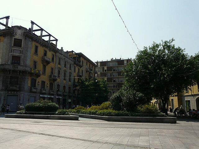
Санто-Стефано-Тичино (Santo Stefano Ticino, Santo Stefano Ticino)
.svg)
- коммуна Италии
 Hiking in Санто-Стефано-Тичино
Santo Stefano Ticino is a charming municipality located in the metropolitan area of Milan, Italy. While it's not widely known for rugged hiking trails like some of the more mountainous regions of Italy, it offers a few opportunities for pleasant walks in a picturesque setting.
Here are some highlights about hiking and outdoor activities in and around Santo Stefano Ticino:
-
Natural Parks: The area is close to the Ticino Park (Parco del Ticino), which is a large natural park that stretches along the Ticino River. The park features various trails that are suitable for hiking, cycling, and nature walks, offering beautiful views and a chance to experience local flora and fauna.
-
Trails: While Santo Stefano Ticino doesn’t have extensive hiking trails directly in the town, you can find several routes in the surrounding areas. The trails often meander through woodlands, countryside, and near the river. These paths vary in difficulty and length, making them accessible for hikers of all levels.
-
Scenic Views: Hiking in this region provides a chance to enjoy the serene landscapes typical of Lombardy, with rolling hills, rivers, and fields. It’s a great opportunity for photography or simply enjoying the tranquility of nature.
-
History and Culture: Combining hiking with a touch of local culture can be a great experience. As you explore the trails, you may come across historical sites, charming villages, and agricultural landscapes that showcase the region's heritage.
-
Accessibility: Due to its proximity to Milan, Santo Stefano Ticino is easily accessible via public transport or by car, making it a perfect destination for a day hike or a weekend getaway.
-
Other Activities: In addition to hiking, visitors can partake in cycling, bird-watching, and picnicking in the parks, making it an excellent spot for outdoor enthusiasts.
If you're planning a hike in Santo Stefano Ticino, be sure to check local maps and guides to find the best routes and to ensure that they match your hiking ability. Always dress appropriately for the weather and carry enough water and snacks. Enjoy your time in this peaceful corner of Italy!
- Страна:

- Почтовый код: 20010
- Телефонный код: 02
- Код автомобильного номера: MI
- Координаты: 45° 29' 0" N, 8° 55' 0" E


- GPS треки (wikiloc): [Ссылка]
- Высота над уровнем моря: 152 м m
- Площадь: 5.01 кв.км
- Население: 4954
- Веб сайт: http://www.comunedisantostefanolodigiano.it
- Википедия русская: wiki(ru)
- Википедия английская: wiki(en)
- Википедия национальная: wiki(it)
- Хранилище Wikidata: Wikidata: Q43045
- Катеория в википедии: [Ссылка]
- код Freebase: [/m/0gj7h1]
- код GeoNames: Альт: [6536521]
- ID отношения в OpenStreetMap: [45111]
- место в MusicBrainz: [502d013f-decd-4390-9872-b4fe308e01b1]
- WOEID: [723696]
- UN/LOCODE: [ITSFC]
- код ISTAT: 015200
- кадастровый код Италии: I361
Граничит с регионами:


Маркалло-кон-Казоне
- коммуна Италии
Hiking in Маркалло-кон-Казоне
Marcallo con Casone is a small municipality in the Lombardy region of Italy, near Milan. While it may not be the most famous hiking destination in Italy, it has its own charm and offers some opportunities for outdoor activities. Here are some insights on hiking in and around Marcallo con Casone:...
- Страна:
- Почтовый код: 20010
- Телефонный код: 02
- Код автомобильного номера: MI
- Координаты: 45° 29' 53" N, 8° 52' 35" E
- GPS треки (wikiloc): [Ссылка]
- Высота над уровнем моря: 147 м m
- Площадь: 8.21 кв.км
- Население: 6254
- Веб сайт: [Ссылка]


Оссона
- коммуна Италии
Hiking in Оссона
Hiking in Ossona, a town in the Lombardy region of Italy, can be a delightful experience, as it offers a charming mix of nature and cultural sights. While Ossona itself is not a prominent hiking destination, it is located near larger natural areas and parks that provide great opportunities for outdoor activities....
- Страна:
- Почтовый код: 20010
- Телефонный код: 02
- Код автомобильного номера: MI
- Координаты: 45° 30' 0" N, 8° 54' 0" E
- GPS треки (wikiloc): [Ссылка]
- Высота над уровнем моря: 156 м m
- Площадь: 5.98 кв.км
- Население: 4288
- Веб сайт: [Ссылка]

Маджента
- коммуна Италии
Hiking in Маджента
Magenta, located in the Lombardy region of Italy, is a town rich in history and natural surroundings, though it may not be as well-known for hiking as other destinations in the region like the Alps or Lake Como. However, there are still opportunities to enjoy the outdoors and engage in hiking in and around Magenta....
- Страна:
- Почтовый код: 20013
- Телефонный код: 02
- Код автомобильного номера: MI
- Координаты: 45° 28' 0" N, 8° 53' 0" E
- GPS треки (wikiloc): [Ссылка]
- Высота над уровнем моря: 138 м m
- Площадь: 21.99 кв.км
- Население: 23845
- Веб сайт: [Ссылка]


Арлуно
- коммуна Италии
Hiking in Арлуно
Arluno, situated in the Lombardy region of Italy, is not widely known as a hiking destination compared to some other areas in Italy. However, there are opportunities for nature walks and light hiking in and around the area, with the surrounding countryside offering some pleasant trails....
- Страна:
- Почтовый код: 20010
- Телефонный код: 02
- Код автомобильного номера: MI
- Координаты: 45° 30' 0" N, 8° 56' 0" E
- GPS треки (wikiloc): [Ссылка]
- Высота над уровнем моря: 156 м m
- Площадь: 12.36 кв.км
- Население: 11807
- Веб сайт: [Ссылка]


Корбетта
- коммуна Италии
Hiking in Корбетта
Corbetta, located in the Lombardy region of Italy, offers a range of opportunities for outdoor enthusiasts, albeit it's not as well-known for hiking as some of the more mountainous areas in Italy. However, it is situated in the proximity of several natural parks and trails that can make for enjoyable hiking experiences....
- Страна:
- Почтовый код: 20011
- Телефонный код: 02
- Код автомобильного номера: MI
- Координаты: 45° 28' 0" N, 8° 55' 0" E
- GPS треки (wikiloc): [Ссылка]
- Высота над уровнем моря: 140 м m
- Площадь: 18.69 кв.км
- Население: 18366
- Веб сайт: [Ссылка]