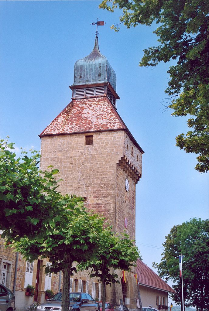
Mièges (Mièges)

- коммуна во Франции
 Hiking in Mièges
Mièges is a charming village located in the Jura department of France, surrounded by beautiful natural landscapes that are perfect for hiking enthusiasts. The area features rolling hills, dense forests, and panoramic views, making it a great destination for outdoor activities.
Hiking Trails and Options:
-
Local Trails: The region has a variety of well-marked hiking trails that cater to different skill levels. These trails can lead you through picturesque countryside, including vineyards and serene pastures.
-
Moderate Hikes: Consider trails that allow you to explore the Jura mountains. These hikes often offer stunning views and opportunities to spot wildlife.
-
Cultural Exploration: Some trails may lead you past historical sites and quaint local architecture, allowing for a blend of nature and culture.
-
Nearby National Parks: If you're willing to travel a bit, the nearby Haut-Jura Regional Nature Park offers extensive hiking options, including more challenging routes with breathtaking vistas.
Tips for Hiking in Mièges:
-
Seasonal Considerations: Spring and fall are ideal for hiking in this region, as the weather is usually mild and the landscapes are particularly beautiful. Summer can be warmer, while winter might limit accessibility due to snow.
-
Equipped Gear: Make sure to wear appropriate hiking boots and carry sufficient water, snacks, and a map or GPS device, as some areas might not have cell service.
-
Local Regulations: Always check for any local guidelines or regulations regarding wildlife and preservation areas to protect the natural beauty of the region.
-
Guided Tours: If you are unfamiliar with the trails, consider joining a guided hike to learn more about the local flora, fauna, and history.
Whether you are a novice hiker or an experienced trekker, Mièges and its surrounding areas offer a rich hiking experience that connects you with nature and offers insight into the region's culture. Happy hiking!
- Страна:

- Почтовый код: 39250
- Координаты: 46° 46' 57" N, 6° 2' 13" E


- GPS треки (wikiloc): [Ссылка]
- Площадь: 3.19 кв.км
- Население: 99
- Википедия английская: wiki(en)
- Википедия национальная: wiki(fr)
- Хранилище Wikidata: Wikidata: Q840483
- Катеория в википедии: [Ссылка]
- код Freebase: [/m/03nq81y]
- код GeoNames: Альт: [6433630]
- ID отношения в OpenStreetMap: [5811988]
- код муниципалитета INSEE: 39329
Граничит с регионами:


Doye
Hiking in Doye
Doye is not widely recognized as a specific hiking destination in popular resources or hiking guides. It's possible that you may be referring to a lesser-known area or a local name for a specific region....
- Страна:
- Почтовый код: 39250
- Координаты: 46° 46' 0" N, 6° 0' 59" E
- GPS треки (wikiloc): [Ссылка]
- Площадь: 3.56 кв.км
- Население: 105


Esserval-Tartre
- коммуна во Франции
Hiking in Esserval-Tartre
Esserval-Tartre is a small village located in the Jura region of France, known for its stunning natural landscapes, forested areas, and charming countryside. Hiking in this area can be a rewarding experience for those who appreciate nature, serenity, and French rural culture....
- Страна:
- Почтовый код: 39250
- Координаты: 46° 48' 31" N, 6° 2' 43" E
- GPS треки (wikiloc): [Ссылка]
- Площадь: 12.19 кв.км
- Население: 115


Esserval-Combe
- коммуна во Франции
Hiking in Esserval-Combe
Esserval-Combe is a picturesque commune located in the Jura region of France, known for its stunning natural landscapes and rich biodiversity. Hiking in this area offers a unique opportunity to explore lush forests, rolling hills, and scenic views of the Jura Mountains. Here are some highlights for hiking in Esserval-Combe:...
- Страна:
- Почтовый код: 39250
- Координаты: 46° 48' 4" N, 6° 2' 24" E
- GPS треки (wikiloc): [Ссылка]
- Высота над уровнем моря: 734 м m
- Площадь: 1.76 кв.км
- Население: 22


Longcochon
- коммуна во Франции
Hiking in Longcochon
Longcochon, situated in the Jura Mountains of France, is a wonderful destination for hiking enthusiasts. It offers stunning natural landscapes, lush forests, and a variety of trails that cater to different skill levels. Here are some key points to consider when hiking in Longcochon:...
- Страна:
- Почтовый код: 39250
- Координаты: 46° 46' 27" N, 6° 4' 12" E
- GPS треки (wikiloc): [Ссылка]
- Площадь: 3.64 кв.км
- Население: 58


Molpré
- коммуна во Франции
Hiking in Molpré
Molpré is a small village located in the Jura mountains of France, known for its picturesque landscapes, lush forests, and tranquil hiking trails. While specific information about trails and conditions in Molpré might not be well-documented, the surrounding Jura region offers a wealth of opportunities for hikers of all skill levels....
- Страна:
- Почтовый код: 39250
- Координаты: 46° 47' 15" N, 6° 4' 3" E
- GPS треки (wikiloc): [Ссылка]
- Высота над уровнем моря: 787 м m
- Площадь: 2.73 кв.км
- Население: 24


Mignovillard
- коммуна во Франции
Hiking in Mignovillard
Mignovillard, located in the Jura department of France, is a charming destination for hiking enthusiasts. Nestled in the foothills of the Jura Mountains, it offers a variety of trails that cater to different skill levels, from leisurely walks to more challenging hikes....
- Страна:
- Почтовый код: 39250
- Координаты: 46° 47' 29" N, 6° 7' 33" E
- GPS треки (wikiloc): [Ссылка]
- Площадь: 49.81 кв.км
- Население: 743
- Веб сайт: [Ссылка]


Censeau
- коммуна во Франции
Hiking in Censeau
Censeau is a lesser-known area in France that may not be widely recognized in hiking circles, but it likely offers beautiful landscapes and trails typical of the surrounding regions. Since specific information about Censeau may vary, here's some general advice and things to consider if you're planning a hiking trip there:...
- Страна:
- Почтовый код: 39250
- Координаты: 46° 48' 49" N, 6° 4' 5" E
- GPS треки (wikiloc): [Ссылка]
- Площадь: 9.86 кв.км
- Население: 299

Нозеруа
- коммуна во Франции
Hiking in Нозеруа
Nozeroy is a charming village in the Jura region of France, known for its picturesque landscapes and rich natural surroundings, making it an excellent destination for hiking enthusiasts. The Jura mountains offer a variety of hiking trails that cater to different skill levels, from easy walks to more challenging routes....
- Страна:
- Почтовый код: 39250
- Координаты: 46° 46' 28" N, 6° 2' 12" E
- GPS треки (wikiloc): [Ссылка]
- Площадь: 3.74 кв.км
- Население: 437


Plénisette
- коммуна во Франции
Hiking in Plénisette
Plénisette is a charming location situated in the French Alps, known for its stunning landscapes and a variety of hiking opportunities. While it might not be as widely recognized as some higher-profile hiking destinations, it offers beautiful trails suitable for both novice and experienced hikers. Here are some key points to consider when hiking in and around Plénisette:...
- Страна:
- Почтовый код: 39250
- Координаты: 46° 47' 58" N, 6° 1' 16" E
- GPS треки (wikiloc): [Ссылка]
- Площадь: 2.61 кв.км
- Население: 24


Onglières
- коммуна во Франции
Hiking in Onglières
Onglières is a picturesque area in France known for its scenic landscapes and hiking opportunities. While it might be less known than some larger national parks or tourist destinations, it offers a unique experience for hiking enthusiasts....
- Страна:
- Почтовый код: 39250
- Координаты: 46° 47' 43" N, 6° 0' 39" E
- GPS треки (wikiloc): [Ссылка]
- Площадь: 8.99 кв.км
- Население: 67

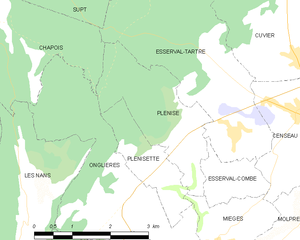
Plénise
- коммуна во Франции
Hiking in Plénise
Plénise, a picturesque region, offers a variety of hiking opportunities for outdoor enthusiasts. While specific trails and information might vary, here's a general guide to hiking in this charming area:...
- Страна:
- Почтовый код: 39250
- Координаты: 46° 48' 23" N, 6° 1' 46" E
- GPS треки (wikiloc): [Ссылка]
- Площадь: 5.43 кв.км
- Население: 62