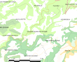
Mont-de-Vougney (Mont-de-Vougney)

- коммуна во Франции
 Hiking in Mont-de-Vougney
Mont-de-Vougney is a lesser-known gem for hikers, located in the Vosges region of France near the border with Switzerland. This area is characterized by its rolling hills, dense forests, and beautiful landscapes, making it a great destination for outdoor enthusiasts.
Hiking Trails
There are various trails in and around Mont-de-Vougney suitable for all skill levels. Popular hikes include:
-
Les Sentiers de Grandes Randonnées (GR Trails): These long-distance trails offer stunning views and well-marked paths. The GR5, for instance, runs through the Vosges and can be incorporated into local hikes.
-
Local Nature Trails: Many smaller, well-marked trails wind through the surrounding forest and countryside, providing opportunities to experience the local flora and fauna. These shorter trails are perfect for families or those looking for a leisurely hike.
Scenic Views
Hikers can enjoy beautiful panoramas of the Vosges mountains and the adjacent valleys. The region is particularly vibrant in the spring and fall when wildflowers bloom and the foliage changes colors.
Wildlife and Flora
The region is home to a variety of wildlife, including deer, wild boar, and numerous bird species. The forests are rich in beech and fir trees, making for a lush hiking experience.
Accessibility
Mont-de-Vougney can be accessed by car, and there are often parking areas available near popular trailheads. Public transportation is limited, so having a vehicle is advisable if you plan to explore multiple trails.
Tips for Hiking in Mont-de-Vougney
- Footwear: Wear appropriate footwear, as trails can be rocky and uneven.
- Weather: Check the weather forecast before heading out, as conditions can change rapidly in the mountains.
- Supplies: Bring plenty of water, snacks, and a map of the area or a GPS device, as cell service may be spotty.
- Leave No Trace: Follow the Leave No Trace principles to preserve the natural beauty of the area.
Conclusion
Hiking in Mont-de-Vougney offers a chance to connect with nature in a serene and less crowded environment. Whether you're looking for a challenging trek or a gentle walk through stunning landscapes, Mont-de-Vougney has trails that cater to every hiker's needs. Enjoy your adventures out there!
- Страна:

- Почтовый код: 25120
- Координаты: 47° 14' 45" N, 6° 43' 53" E


- GPS треки (wikiloc): [Ссылка]
- Площадь: 7.03 кв.км
- Население: 176
- Википедия английская: wiki(en)
- Википедия национальная: wiki(fr)
- Хранилище Wikidata: Wikidata: Q907100
- Катеория в википедии: [Ссылка]
- код Freebase: [/m/03mhbk0]
- код Freebase: [/m/03mhbk0]
- код GeoNames: Альт: [6429889]
- код GeoNames: Альт: [6429889]
- номер SIREN: [212503924]
- номер SIREN: [212503924]
- код BNF: [15252618f]
- код BNF: [15252618f]
- код VIAF: Альт: [127830564]
- код VIAF: Альт: [127830564]
- код LCNAF: Альт: [n79083811]
- код LCNAF: Альт: [n79083811]
- код муниципалитета INSEE: 25392
- код муниципалитета INSEE: 25392
Граничит с регионами:

Orgeans-Blanchefontaine
- коммуна во Франции
Hiking in Orgeans-Blanchefontaine
Orgeans-Blanchefontaine, located in the Vosges department in northeastern France, is an excellent destination for hiking enthusiasts. The region is known for its beautiful natural landscapes, dense forests, and numerous trails that cater to various skill levels. Here’s what you should know about hiking in this picturesque area:...
- Страна:
- Почтовый код: 25120
- Координаты: 47° 15' 48" N, 6° 44' 37" E
- GPS треки (wikiloc): [Ссылка]
- Высота над уровнем моря: 450 м m
- Площадь: 4.83 кв.км
- Население: 49

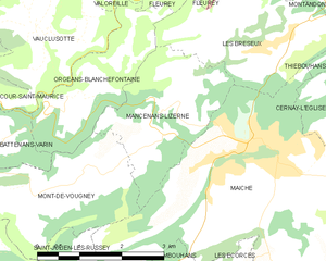
Mancenans-Lizerne
- коммуна во Франции
Hiking in Mancenans-Lizerne
Mancenans-Lizerne is a charming commune located in the Doubs department of the Bourgogne-Franche-Comté region in eastern France. The area is known for its beautiful natural surroundings, making it a great destination for hiking enthusiasts....
- Страна:
- Почтовый код: 25120
- Координаты: 47° 15' 40" N, 6° 46' 41" E
- GPS треки (wikiloc): [Ссылка]
- Площадь: 6.09 кв.км
- Население: 190


Battenans-Varin
- коммуна во Франции
Hiking in Battenans-Varin
Battenans-Varin, a charming commune in the Bourgogne-Franche-Comté region of France, offers a picturesque setting for hiking enthusiasts. The area is characterized by its natural beauty, with rolling hills, lush forests, and scenic trails that vary in difficulty....
- Страна:
- Почтовый код: 25380
- Координаты: 47° 14' 56" N, 6° 42' 43" E
- GPS треки (wikiloc): [Ссылка]
- Высота над уровнем моря: 550 м m
- Площадь: 6.38 кв.км
- Население: 79


Maîche
- коммуна во Франции
Hiking in Maîche
Maîche is a charming town located in the Doubs department of France, nestled in the Jura Mountains. This region is known for its stunning landscapes, rich biodiversity, and various outdoor activities, including hiking. Here are some highlights about hiking in and around Maîche:...
- Страна:
- Почтовый код: 25120
- Координаты: 47° 15' 4" N, 6° 48' 13" E
- GPS треки (wikiloc): [Ссылка]
- Площадь: 17.42 кв.км
- Население: 4273
- Веб сайт: [Ссылка]
Saint-Julien-lès-Russey
- коммуна во Франции
Hiking in Saint-Julien-lès-Russey
Saint-Julien-lès-Russey is a charming commune located in the Doubs department of the Bourgogne-Franche-Comté region in eastern France. It's surrounded by beautiful natural landscapes, making it a great spot for hiking enthusiasts. Here are some highlights you might enjoy:...
- Страна:
- Почтовый код: 25210
- Координаты: 47° 13' 2" N, 6° 43' 28" E
- GPS треки (wikiloc): [Ссылка]
- Высота над уровнем моря: 550 м m
- Площадь: 10.01 кв.км
- Население: 163