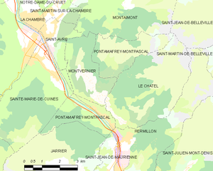
Montaimont (Montaimont)

- коммуна во Франции
 Hiking in Montaimont
Montaimont is a charming commune in the Savoie department of the Auvergne-Rhône-Alpes region in southeastern France. Nestled in the Alps, it offers stunning natural landscapes and a variety of hiking opportunities, making it an excellent destination for outdoor enthusiasts.
Hiking Trails:
-
Local Trails: Montaimont features several local trails that provide access to picturesque views of the surrounding mountains and valleys. These trails vary in difficulty, catering to both beginners and experienced hikers.
-
Col de la Madeleine: A popular hike nearby is the Col de la Madeleine trail. This route offers breathtaking views and leads hikers through stunning alpine scenery. The area is well-marked, and the ascent can be quite rewarding, especially during the summer months when wildflowers are in bloom.
-
The Vanoise National Park: Located not too far from Montaimont, this national park has a plethora of hiking options. You can explore various trails, some of which are more demanding and offer encounters with wildlife, glacial scenery, and beautiful lakes.
Best Season to Hike:
- Summer: June to September is ideal for hiking, with warmer temperatures and often clear skies.
- Autumn: October offers beautiful fall foliage, but be prepared for cooler conditions.
- Winter: While hiking can be challenging in winter due to snow, some areas cater to snowshoeing and winter hiking for those looking for a unique experience.
Preparing for Your Hike:
- Gear: Ensure you have appropriate hiking gear, including durable boots, layers of clothing suitable for changing weather, and a good backpack.
- Safety: Always inform someone about your hiking plans, carry a map, and stay on marked paths. Check the weather before heading out.
- Hydration & Snacks: Bring plenty of water and snacks to maintain your energy levels throughout your hike.
Other Activities:
In addition to hiking, Montaimont offers opportunities for mountain biking, paragliding, and exploring local culture and cuisine in the quaint surrounding villages.
Whether you are looking for a peaceful day in nature or a challenging trek, Montaimont provides a beautiful backdrop for a memorable hiking experience!
- Страна:

- Почтовый код: 73130
- Координаты: 45° 22' 17" N, 6° 20' 49" E


- GPS треки (wikiloc): [Ссылка]
- Площадь: 28.35 кв.км
- Население: 157
- Веб сайт: http://www.montaimont.com
- Википедия английская: wiki(en)
- Википедия национальная: wiki(fr)
- Хранилище Wikidata: Wikidata: Q1216907
- Катеория в википедии: [Ссылка]
- код Freebase: [/m/03npg0b]
- код GeoNames: Альт: [2993074]
- код BNF: [15274096g]
- код VIAF: Альт: [248254614]
- WOEID: [12657370]
- код муниципалитета INSEE: 73163
Граничит с регионами:

Pontamafrey-Montpascal
- коммуна во Франции
Hiking in Pontamafrey-Montpascal
Pontamafrey-Montpascal is a scenic area in the Savoie region of France, known for its beautiful landscapes, diverse trails, and rich natural flora and fauna. While specific trails can vary, here are some general guidelines and tips for hiking in this region:...
- Страна:
- Почтовый код: 73300
- Координаты: 45° 18' 45" N, 6° 20' 29" E
- GPS треки (wikiloc): [Ссылка]
- Площадь: 11.59 кв.км
- Население: 312
- Веб сайт: [Ссылка]


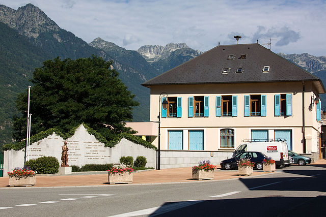
Saint-Martin-sur-la-Chambre
- коммуна во Франции
Hiking in Saint-Martin-sur-la-Chambre
Saint-Martin-sur-la-Chambre is a beautiful village located in the Savoie department in the Auvergne-Rhône-Alpes region of southeastern France. It's nestled in the Alps, making it an excellent destination for hiking enthusiasts. Here are some highlights of hiking in this area:...
- Страна:
- Почтовый код: 73130
- Координаты: 45° 21' 55" N, 6° 19' 0" E
- GPS треки (wikiloc): [Ссылка]
- Площадь: 4.69 кв.км
- Население: 541

Saint-Avre
- коммуна во Франции
Hiking in Saint-Avre
Saint-Avre is a charming commune located in the Savoie region of the French Alps. Nestled in a picturesque valley, it offers a variety of hiking opportunities that cater to different skill levels and preferences. Here are some key points to consider for hiking in and around Saint-Avre:...
- Страна:
- Почтовый код: 73130
- Координаты: 45° 21' 9" N, 6° 18' 36" E
- GPS треки (wikiloc): [Ссылка]
- Площадь: 3.64 кв.км
- Население: 868


Montvernier
- коммуна во Франции
Hiking in Montvernier
Montvernier, located in the Savoie region of the French Alps, is a hidden gem for hikers. The area is renowned for its stunning landscapes, featuring charming alpine villages, lush valleys, and breathtaking mountain views. Here are some key points to consider if you’re planning a hiking trip in Montvernier:...
- Страна:
- Почтовый код: 73300
- Координаты: 45° 19' 17" N, 6° 20' 36" E
- GPS треки (wikiloc): [Ссылка]
- Площадь: 6.68 кв.км
- Население: 223

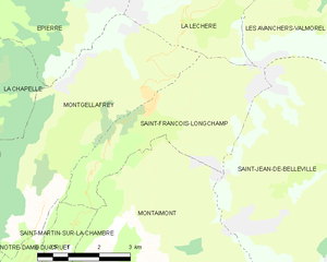
Saint-François-Longchamp
- коммуна во Франции
Hiking in Saint-François-Longchamp
Saint-François-Longchamp is a beautiful alpine resort located in the French Alps, known primarily for its skiing in the winter but also offers a multitude of hiking opportunities during the summer months. Here are some key points about hiking in this area:...
- Страна:
- Почтовый код: 73130
- Координаты: 45° 24' 35" N, 6° 20' 54" E
- GPS треки (wikiloc): [Ссылка]
- Площадь: 12.97 кв.км
- Население: 247
- Веб сайт: [Ссылка]

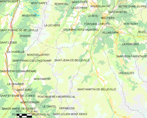
Saint-Jean-de-Belleville
- коммуна во Франции
Hiking in Saint-Jean-de-Belleville
Saint-Jean-de-Belleville is a charming alpine village located in the Savoie region of the French Alps, offering beautiful landscapes and a variety of hiking opportunities. Situated near the Trois Vallées ski area, it serves as a fantastic base for exploring the surrounding mountains, particularly in the warmer months when the snow melts and trails become accessible....
- Страна:
- Почтовый код: 73440
- Координаты: 45° 25' 37" N, 6° 29' 6" E
- GPS треки (wikiloc): [Ссылка]
- Площадь: 59.6 кв.км
- Население: 535
- Веб сайт: [Ссылка]