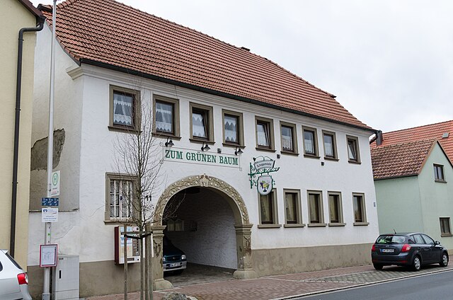
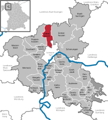
Нидерверн (Niederwerrn, Niederwerrn)
Niederwerrn is a small village in Bavaria, Germany, and while it may not be as well-known for hiking as larger national parks or mountainous regions, it offers some charming opportunities for outdoor enthusiasts. The surrounding countryside features scenic rural landscapes, fields, and wooded areas that can provide a variety of trails for walking and hiking.
Hiking Opportunities in and around Niederwerrn:
-
Local Trails: You can often find well-marked walking and hiking paths that weave through the village and connect to surrounding areas. These trails may offer a mix of terrain, perfect for both leisurely strolls and more vigorous hikes.
-
Nature Exploration: The area around Niederwerrn features beautiful natural scenery, including fields and small woodlands. Hiking here can be ideal for nature lovers looking to spot local wildlife and enjoy peaceful outdoor experiences.
-
Access to Larger Trails: Niederwerrn is relatively close to the larger Franconian regions, which have extensive networks of hiking trails. With a short drive or bike ride, you can access additional hiking opportunities, including scenic routes along rivers and through forests.
-
Seasonal Hiking: Depending on the season, hiking conditions can vary. Spring and summer are wonderful for wildflower viewing, while autumn offers beautiful foliage. In winter, you might find snow-covered paths, although it’s less common to hike in extremely cold conditions.
-
Community Events: Check for local hiking events or guided tours that might be taking place in Niederwerrn or nearby. These can be a great way to meet fellow hiking enthusiasts and explore the area with knowledgeable guides.
Tips for Hiking in Niederwerrn:
- Maps and Guidance: Always have a reliable map or GPS device, as rural trails might not be as well-marked.
- Footwear: Wear sturdy hiking boots for comfort and protection, especially if you plan on tackling uneven terrain.
- Weather Readiness: The weather can change quickly, so be prepared with appropriate clothing and gear.
- Stay Hydrated: Bring plenty of water and snacks, especially on longer hikes.
- Respect Nature: Follow Leave No Trace principles to preserve the beauty of the outdoors.
Whether you’re a beginner or an experienced hiker, Niederwerrn and its surroundings can provide a lovely backdrop for a day of outdoor activity. Happy hiking!
- Страна:

- Почтовый код: 97464
- Телефонный код: 09721
- Код автомобильного номера: SW
- Координаты: 50° 4' 0" N, 10° 10' 59" E


- GPS треки (wikiloc): [Ссылка]
- Высота над уровнем моря: 240 м m
- Площадь: 9.77 кв.км
- Население: 6146
- Веб сайт: https://www.niederwerrn.de/
- Википедия русская: wiki(ru)
- Википедия английская: wiki(en)
- Википедия национальная: wiki(de)
- Хранилище Wikidata: Wikidata: Q589503
- Катеория в википедии: [Ссылка]
- код Freebase: [/m/02q8g5x]
- код GeoNames: Альт: [2862733]
- код BNF: [12217226x]
- код VIAF: Альт: [124763901]
- ID отношения в OpenStreetMap: [318745]
- код GND: Альт: [4242568-2]
- место в MusicBrainz: [874379bc-84ed-4632-b701-1ad6ce016c94]
- Bavarikon ID: [ODB_A00000477]
- идентификатор муниципалитетов в Германии: 09678160
Граничит с регионами:


Поппенхаузен
Poppenhausen, located in the picturesque Rhön region of Germany, offers a variety of hiking opportunities for both beginners and experienced hikers alike. This charming village is an ideal starting point for exploring the stunning landscapes, diverse ecosystems, and unique geological formations that the Rhön has to offer....
- Страна:

- Почтовый код: 97490
- Телефонный код: 09725
- Код автомобильного номера: SW
- Координаты: 50° 6' 0" N, 10° 9' 0" E


- GPS треки (wikiloc): [Ссылка]
- Высота над уровнем моря: 250 м m
- Площадь: 39.13 кв.км
- Население: 3682
- Веб сайт: [Ссылка]


Диттельбрунн
Dittelbrunn is a charming municipality located in Bavaria, Germany, near the larger city of Schweinfurt. The surrounding area boasts beautiful landscapes and nature, making it a great destination for hiking enthusiasts....
- Страна:

- Почтовый код: 97456
- Телефонный код: 09738; 09725; 09721
- Код автомобильного номера: SW
- Координаты: 50° 5' 42" N, 10° 12' 34" E


- GPS треки (wikiloc): [Ссылка]
- Высота над уровнем моря: 237 м m
- Площадь: 23.84 кв.км
- Население: 6838
- Веб сайт: [Ссылка]

