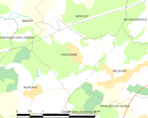
Noironte (Noironte)

- коммуна во Франции
 Hiking in Noironte
Noironte is a lesser-known destination for hiking, and getting specific information might be challenging if you haven’t found particular trails or parks in mind. However, if it's located in a region known for outdoor activities, you can generally expect a few common features:
-
Scenic Landscapes: Hiking trails often feature picturesque views, whether it's rugged mountains, lush forests, or sparkling lakes. Always check local resources for the best vistas!
-
Varied Terrain: Depending on the area, trails may range from easy walks suitable for families to challenging hikes for more experienced adventurers, including elevation changes or rocky paths.
-
Wildlife Watching: Keep an eye out for local flora and fauna. Many regions have unique wildlife that can often be spotted along the trails.
-
Safety and Preparation: Ensure you're prepared for the terrain you’ll encounter. Bring adequate supplies, such as water, food, appropriate footwear, and navigation aids.
-
Local Regulations: Check for any permits required for hiking, as well as any specific regulations about staying on trails or camping if you plan on extending your adventure.
If you could provide a bit more context about Noironte—such as its country or region—I could give you more tailored advice regarding specific trails, useful tips, or general hiking conditions in that area!
- Страна:

- Почтовый код: 25170
- Координаты: 47° 16' 19" N, 5° 52' 28" E


- GPS треки (wikiloc): [Ссылка]
- Площадь: 6.73 кв.км
- Население: 380
- Веб сайт: http://noironte.fr
- Википедия английская: wiki(en)
- Википедия национальная: wiki(fr)
- Хранилище Wikidata: Wikidata: Q958644
- Катеория в википедии: [Ссылка]
- код Freebase: [/m/02q1y4k]
- код Freebase: [/m/02q1y4k]
- номер SIREN: [212504278]
- номер SIREN: [212504278]
- код BNF: [15252653z]
- код BNF: [15252653z]
- код муниципалитета INSEE: 25427
- код муниципалитета INSEE: 25427
Граничит с регионами:


Émagny
- коммуна во Франции
Hiking in Émagny
Émagny is a small commune in the Doubs department in the Bourgogne-Franche-Comté region of eastern France. While it may not be as widely known as some larger hiking destinations, its natural surroundings and rural charm can offer a pleasant experience for hikers looking to explore the region....
- Страна:
- Почтовый код: 25170
- Координаты: 47° 18' 41" N, 5° 52' 10" E
- GPS треки (wikiloc): [Ссылка]
- Площадь: 5.15 кв.км
- Население: 589
- Веб сайт: [Ссылка]

Chaucenne
- коммуна во Франции
Hiking in Chaucenne
Chaucenne is not widely recognized as a hiking destination, and there may be some confusion regarding its exact location or spelling. However, it’s possible that you meant a specific area or trail that has similar sounding names....
- Страна:
- Почтовый код: 25170
- Координаты: 47° 17' 5" N, 5° 53' 52" E
- GPS треки (wikiloc): [Ссылка]
- Площадь: 4.88 кв.км
- Население: 519
- Веб сайт: [Ссылка]


Audeux
- коммуна во Франции
Hiking in Audeux
Audeux is a picturesque village located in the Jura department of France. Known for its scenic landscapes and natural beauty, it offers several opportunities for hiking and outdoor activities. Here are some highlights and tips for hiking in the Audeux area:...
- Страна:
- Почтовый код: 25170
- Координаты: 47° 15' 41" N, 5° 52' 13" E
- GPS треки (wikiloc): [Ссылка]
- Площадь: 1.75 кв.км
- Население: 432


Recologne
Hiking in Recologne
Recologne is a charming commune located in the Doubs department in the Bourgogne-Franche-Comté region of eastern France. This area is known for its natural beauty, rolling hills, and forests, making it an excellent place for hiking enthusiasts....
- Страна:
- Почтовый код: 25170
- Координаты: 47° 16' 23" N, 5° 49' 48" E
- GPS треки (wikiloc): [Ссылка]
- Площадь: 6.78 кв.км
- Население: 646


Chevigney-sur-l'Ognon
- коммуна во Франции
Hiking in Chevigney-sur-l'Ognon
Chevigney-sur-l'Ognon, located in the Bourgogne-Franche-Comté region of eastern France, offers a tranquil setting for hiking enthusiasts. The area is characterized by its lush landscapes, rolling hills, and proximity to the Ognon River, making it an excellent destination for both casual walkers and experienced hikers....
- Страна:
- Почтовый код: 25170
- Координаты: 47° 17' 52" N, 5° 50' 18" E
- GPS треки (wikiloc): [Ссылка]
- Площадь: 4.58 кв.км
- Население: 280


Champagney
Hiking in Champagney
Hiking in Champagney, Doubs, offers a wonderful opportunity to explore the beautiful natural landscapes of the region. Champagney itself is located in the Bourgogne-Franche-Comté region of eastern France, a place known for its picturesque scenery, dense forests, rolling hills, and a network of well-marked hiking trails....
- Страна:
- Почтовый код: 25170
- Координаты: 47° 15' 21" N, 5° 54' 21" E
- GPS треки (wikiloc): [Ссылка]
- Высота над уровнем моря: 200 м m
- Площадь: 3.01 кв.км
- Население: 275


Champvans-les-Moulins
- коммуна во Франции
Hiking in Champvans-les-Moulins
Champvans-les-Moulins is a small village located in the Bourgogne-Franche-Comté region of France. While it's not widely known as a hiking destination, the surrounding area offers beautiful landscapes typical of the French countryside, with rolling hills, forests, and streams that can provide a tranquil setting for hiking enthusiasts....
- Страна:
- Почтовый код: 25170
- Координаты: 47° 15' 19" N, 5° 54' 56" E
- GPS треки (wikiloc): [Ссылка]
- Площадь: 2.52 кв.км
- Население: 352


Pouilley-les-Vignes
- коммуна во Франции
Hiking in Pouilley-les-Vignes
Pouilley-les-Vignes is a charming commune located in the Doubs department of France, nearby the city of Besançon. The area is known for its picturesque landscapes, which makes it a great spot for hiking enthusiasts....
- Страна:
- Почтовый код: 25115
- Координаты: 47° 15' 25" N, 5° 56' 9" E
- GPS треки (wikiloc): [Ссылка]
- Площадь: 9.34 кв.км
- Население: 1951
- Веб сайт: [Ссылка]


Placey
- коммуна во Франции
Hiking in Placey
It seems like there might be a typo or misunderstanding regarding "Placey." If you meant a specific location such as "Placer County" in California or a different hiking destination, please let me know! However, if you were asking about a place I might not be familiar with, I can still offer general tips for hiking....
- Страна:
- Почтовый код: 25170
- Координаты: 47° 15' 36" N, 5° 50' 48" E
- GPS треки (wikiloc): [Ссылка]
- Площадь: 2.57 кв.км
- Население: 191