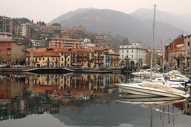
Нонио (Nonio, Nonio)
- коммуна Италии
 Hiking in Нонио
Nonio is a small municipality located in the Piedmont region of Italy, near Lake Orta, which is known for its stunning natural scenery and outdoor recreational opportunities, including hiking. Here are some highlights if you're considering hiking in Nonio:
Trails and Nature
-
Lake Orta Region: The area surrounding Nonio offers several trails that provide breathtaking views of Lake Orta and the surrounding mountains. Hiking trails vary in difficulty, accommodating both beginners and more experienced hikers.
-
Monte Mottarone: Close to Nonio, Monte Mottarone offers a range of hiking trails with varied terrains. The summit provides panoramic views of the Alps, Lake Maggiore, and Lake Orta.
-
Nature Reserves: Explore the nearby Parco Nazionale della Val Grande, which is one of the largest wilderness areas in Italy, with rugged trails that take you through untouched nature.
Difficulty Levels
Hiking trails in the Nonio area can vary in difficulty from easy walks suitable for families to more strenuous hikes aimed at seasoned trekkers. It is essential to choose a trail that matches your ability and fitness level.
Preparation
- Gear: Wear comfortable hiking shoes, and bring layers, as weather conditions can change rapidly in the mountains.
- Maps and Guides: Having a map or a reliable guide will help you navigate the trails. Trail markers are common, but it’s advisable to be prepared with a navigation tool.
Local Recommendations
- Guided Tours: Consider joining a local hiking guide for a more in-depth experience. They can provide insights into the local flora and fauna, history, and culture.
- Timing: The best time for hiking in the region is typically late spring to early autumn when the weather is mild.
Safety
- Always inform someone about your hiking plans.
- Carry enough water and snacks for your hike.
- Be cautious of wildlife and adhere to local guidelines.
Hiking in Nonio not only allows you to connect with nature but also gives you a taste of the beautiful Italian countryside and its rich history. Enjoy your hike!
- Страна:

- Почтовый код: 28891
- Телефонный код: 0323
- Код автомобильного номера: VB
- Координаты: 45° 50' 46" N, 8° 22' 39" E


- GPS треки (wikiloc): [Ссылка]
- Высота над уровнем моря: 476 м m
- Площадь: 9.8 кв.км
- Население: 850
- Веб сайт: http://www.comune.nonio.vb.it
- Википедия русская: wiki(ru)
- Википедия английская: wiki(en)
- Википедия национальная: wiki(it)
- Хранилище Wikidata: Wikidata: Q23657
- Катеория в википедии: [Ссылка]
- код Freebase: [/m/0gr8m2]
- код GeoNames: Альт: [6543709]
- ID отношения в OpenStreetMap: [46299]
- код ISTAT: 103048
- кадастровый код Италии: F932
Граничит с регионами:

Пелла
- коммуна Италии
Hiking in Пелла
Pella, located in the Piedmont region of Italy, is surrounded by beautiful landscapes ideal for hiking enthusiasts. The area features rolling hills, scenic vineyards, and woodlands, offering a range of trails suitable for various skill levels. Here are some highlights and tips for hiking in the Pella area:...
- Страна:
- Почтовый код: 28010
- Телефонный код: 0322
- Код автомобильного номера: NO
- Координаты: 45° 48' 0" N, 8° 23' 0" E
- GPS треки (wikiloc): [Ссылка]
- Высота над уровнем моря: 305 м m
- Площадь: 8.13 кв.км
- Население: 985
- Веб сайт: [Ссылка]

Петтенаско
- коммуна Италии
Hiking in Петтенаско
Pettenasco is a picturesque village located on the shores of Lake Orta in the Piedmont region of northern Italy. The area is characterized by its stunning natural scenery, charming architecture, and a range of outdoor activities, making it an excellent destination for hiking enthusiasts....
- Страна:
- Почтовый код: 28028
- Телефонный код: 0323
- Код автомобильного номера: NO
- Координаты: 45° 48' 0" N, 8° 25' 0" E
- GPS треки (wikiloc): [Ссылка]
- Высота над уровнем моря: 331 м m
- Площадь: 7.07 кв.км
- Население: 1380
- Веб сайт: [Ссылка]
Чезара
- коммуна Италии
Hiking in Чезара
Cesara is a charming village located in the Piedmont region of Italy, nestled in the scenic valleys of the Verbano-Cusio-Ossola province. This area offers a wealth of hiking opportunities thanks to its stunning landscapes, lush forests, and panoramic views of the surrounding mountains....
- Страна:
- Почтовый код: 28010
- Телефонный код: 0323
- Код автомобильного номера: VB
- Координаты: 45° 50' 0" N, 8° 22' 0" E
- GPS треки (wikiloc): [Ссылка]
- Высота над уровнем моря: 499 м m
- Площадь: 11.65 кв.км
- Население: 599
- Веб сайт: [Ссылка]
Оменья
- коммуна Италии
Hiking in Оменья
Omegna, located in the Piedmont region of Italy, is a charming town situated at the northern end of Lake Orta, surrounded by the beautiful landscapes of the Italian Alps. Hiking around Omegna offers a variety of trails that cater to different skill levels and preferences....
- Страна:
- Почтовый код: 28887
- Телефонный код: 0323
- Код автомобильного номера: VB
- Координаты: 45° 52' 0" N, 8° 24' 0" E
- GPS треки (wikiloc): [Ссылка]
- Высота над уровнем моря: 295 м m
- Площадь: 30.37 кв.км
- Население: 15285
- Веб сайт: [Ссылка]

Куарна-Сотто
- коммуна Италии
Hiking in Куарна-Сотто
Quarna Sotto is a charming village located in the Piedmont region of northern Italy, nestled in the mountains near Lake Orta. The area is known for its picturesque hiking trails, offering a mix of landscapes, including lush forests, scenic viewpoints, and charming alpine meadows. Here are a few things to consider when hiking in Quarna Sotto:...
- Страна:
- Почтовый код: 28896
- Телефонный код: 0323
- Код автомобильного номера: VB
- Координаты: 45° 52' 0" N, 8° 21' 0" E
- GPS треки (wikiloc): [Ссылка]
- Высота над уровнем моря: 802 м m
- Площадь: 16.05 кв.км
- Население: 392
- Веб сайт: [Ссылка]

Варалло
- коммуна Италии
Hiking in Варалло
Varallo Sesia is a charming town located in the Valsesia Valley in northern Italy, known for its stunning natural landscapes and rich cultural heritage. It's a fantastic destination for hiking enthusiasts, offering a variety of trails that cater to different skill levels, from easy walks to challenging treks....
- Страна:
- Почтовый код: 13019
- Телефонный код: 0163
- Код автомобильного номера: VC
- Координаты: 45° 48' 50" N, 8° 15' 29" E
- GPS треки (wikiloc): [Ссылка]
- Высота над уровнем моря: 456 м m
- Площадь: 88.12 кв.км
- Население: 7146
- Веб сайт: [Ссылка]