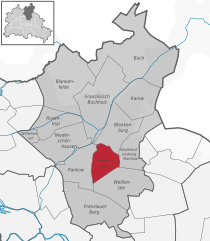
Панков (Pankow, Pankow)

- район в одноимённом округе в Берлине
 Hiking in Панков
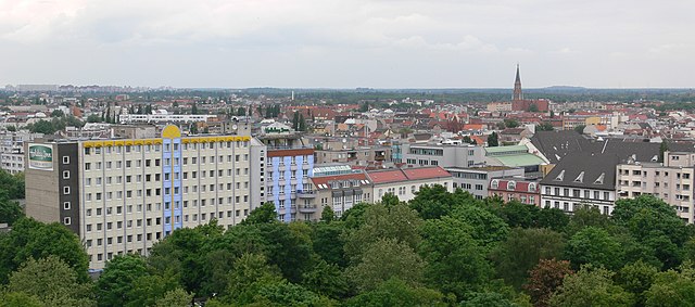
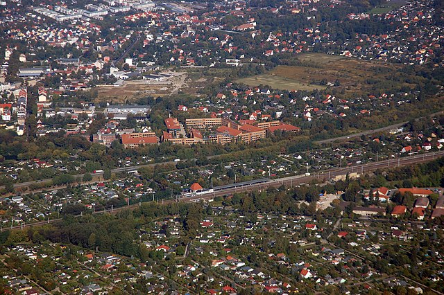
Pankow is a district in northeastern Berlin, Germany, known for its charming neighborhoods, parks, and green areas. While it is more urban compared to rural hiking destinations, there are still opportunities for enjoyable walks and hikes within and around the area.
Hiking and Walking Opportunities in Pankow:
-
Parks and Green Spaces:
- Volkspark Friedrichshain: While not in Pankow itself, it’s close enough for a day trip and offers a variety of trails, open fields, and beautiful landscapes.
- Schönholzer Heide: This area features wooded trails and scenic spots, ideal for nature walks and light hiking.
-
Norman D. R. Park: Smaller parks within Pankow, such as the Norman D. R. Park, provide nice walking paths, green spaces, and a chance to enjoy a bit of nature within the urban environment.
-
Tegel Lake and the Tegel Forest: Located a bit further away, just beyond Pankow, this area provides ample opportunities for longer hikes through expansive forested regions and along the lakeside.
-
Pankow's History: Incorporate some local history into your hikes by exploring the historic architecture and sites in Pankow. The district has several parks and buildings that reflect its rich past.
-
Cycle and Walking Trails: Utilize the well-marked cycling and walking paths that connect Pankow to other nearby districts, making it easy to expand your hiking experience.
Tips for Hiking in Pankow:
- Best Seasons: Spring and fall are particularly pleasant for walking, with milder temperatures and beautiful foliage.
- Local Amenities: Take advantage of local cafes and restaurants for a meal or snack during your outing.
- Transportation: Pankow is well-served by public transportation (U-Bahn and S-Bahn), making it easy to reach other hiking areas in Berlin and beyond.
While Pankow may not be known for extensive hiking trails, the combination of its parks, historical attributes, and proximity to larger natural areas makes it a lovely locale for casual hikes and nature walks. Always remember to wear appropriate footwear and check local maps for the best trails.
- Страна:

- Координаты: 52° 34' 0" N, 13° 24' 0" E


- GPS треки (wikiloc): [Ссылка]
- Высота над уровнем моря: 47 м m
- Площадь: 5.66 кв.км
- Население: 57113
- Википедия русская: wiki(ru)
- Википедия английская: wiki(en)
- Википедия национальная: wiki(de)
- Хранилище Wikidata: Wikidata: Q4707648
- Галерея изображений в википедии: [Ссылка]
- Катеория в википедии: [Ссылка]
- Карты в википедии: [Ссылка]
- код Freebase: [/m/05zjr7l]
- код GeoNames: Альт: [2855598]
- код VIAF: Альт: [146196873]
- код GND: Альт: [4298424-5]
- идентификатор местоположения ArchINFORM: [3621]
Граничит с регионами:

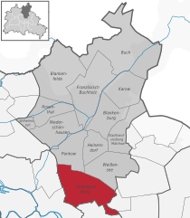
Пренцлауэр-Берг
- район в Берлине
Hiking in Пренцлауэр-Берг
Prenzlauer Berg, a vibrant district in Berlin, is primarily known for its urban environment, charming architecture, and lively atmosphere rather than traditional hiking trails. However, there are plenty of opportunities for enjoyable walks and exploration in this area. Here are some aspects to consider if you're looking to hike or walk in Prenzlauer Berg:...
- Страна:
- Координаты: 52° 32' 3" N, 13° 25' 7" E
- GPS треки (wikiloc): [Ссылка]
- Высота над уровнем моря: 54 м m
- Площадь: 11 кв.км
- Население: 156910


Нидершёнхаузен
- район в Берлине
Hiking in Нидершёнхаузен
Niederschönhausen is a district located in the Pankow borough of Berlin, Germany. While it may not be as widely known for hiking as some of the more rural areas surrounding Berlin, there are still opportunities for walks and nature exploration in and around the area....
- Страна:
- Координаты: 52° 35' 0" N, 13° 24' 0" E
- GPS треки (wikiloc): [Ссылка]
- Высота над уровнем моря: 48 м m
- Площадь: 6.49 кв.км
- Население: 28313

Гезундбруннен
- район в Берлине
Hiking in Гезундбруннен
Gesundbrunnen is a neighborhood in Berlin, known more for its urban environment than traditional hiking trails. However, there are options for those looking to enjoy the outdoors and some nature walks in and around the area. Here are a few recommendations:...
- Страна:
- Почтовый код: 13409; 13359; 13357; 13355; 13353; 13347
- Координаты: 52° 32' 55" N, 13° 23' 25" E
- GPS треки (wikiloc): [Ссылка]
- Высота над уровнем моря: 53 м m
- Площадь: 6.13 кв.км
- Население: 90748
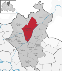
Францёзиш-Буххольц
- район в Берлине
Hiking in Францёзиш-Буххольц
Französisch Buchholz is a charming district located in the northern part of Berlin, Germany. While it may not be a traditional hiking destination like some of Germany's national parks, there are still several beautiful spots and trails in and around this area that offer pleasant walking and hiking experiences....
- Страна:
- Координаты: 52° 36' 0" N, 13° 26' 0" E
- GPS треки (wikiloc): [Ссылка]
- Высота над уровнем моря: 46 м m
- Площадь: 12 кв.км


Вайсензе
- район в Берлине
Hiking in Вайсензе
Weissensee is a district in the northeastern part of Berlin, known for its large lake, Weissensee, which is a popular destination for both locals and tourists looking to enjoy nature and outdoor activities. While Weissensee is not traditionally associated with extensive hiking trails like some of the larger natural parks or forested areas, it offers some lovely spots for walking and enjoying the outdoors....
- Страна:
- Координаты: 52° 33' 0" N, 13° 28' 0" E
- GPS треки (wikiloc): [Ссылка]
- Высота над уровнем моря: 53 м m
- Площадь: 7.93 кв.км
- Население: 51699
- Веб сайт: [Ссылка]

Хайнерсдорф
- район в Берлине
Hiking in Хайнерсдорф
Heinersdorf, a charming district on the outskirts of Berlin, offers a unique opportunity for hiking enthusiasts to explore a blend of natural landscapes and quaint, urban settings. While Heinersdorf itself may not have extensive hiking trails like those found in more rugged areas, it serves as an excellent base for accessing nearby natural areas....
- Страна:
- Координаты: 52° 34' 1" N, 13° 26' 24" E
- GPS треки (wikiloc): [Ссылка]
- Высота над уровнем моря: 50 м m
- Площадь: 3.95 кв.км
Бланкенбург
- район в Берлине
Hiking in Бланкенбург
Blankenburg, a district in the northeastern part of Berlin, is not typically known for traditional hiking trails like those found in more mountainous or rural areas. However, it still offers opportunities for outdoor exploration and walking in a more urban and suburban environment. Here are some highlights and suggestions for enjoying the area:...
- Страна:
- Координаты: 52° 35' 35" N, 13° 27' 15" E
- GPS треки (wikiloc): [Ссылка]
- Высота над уровнем моря: 47 м m
- Площадь: 6.03 кв.км
- Население: 6536


Райниккендорф
- район в одноимённом округе Берлина
Hiking in Райниккендорф
Reinickendorf is a district located in the northern part of Berlin, Germany. While it's primarily an urban area, it offers several opportunities for hiking and outdoor activities, particularly in its parks and natural reserves....
- Страна:
- Почтовый код: 13409; 13407; 13403
- Координаты: 52° 34' 0" N, 13° 20' 0" E
- GPS треки (wikiloc): [Ссылка]
- Высота над уровнем моря: 42 м m
- Площадь: 10.5 кв.км
- Население: 80687