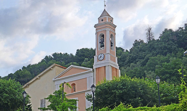
Пей (Peille, Peille)
- коммуна в департаменте Приморские Альпы, регион Прованс — Альпы — Лазурный Берег, Франция
 Hiking in Пей
Peille is a charming village located in the Alpes-Maritimes department in the Provence-Alpes-Côte d'Azur region of France. Nestled in the hills above the Mediterranean, it offers a variety of hiking opportunities with stunning views, lush vegetation, and a rich history.
Hiking Trails:
-
Sentier des Vignobles: This trail takes you through the vineyards surrounding Peille, providing scenic vistas and a chance to enjoy the local flora and fauna. It’s a relatively easy hike, making it accessible for families and less experienced hikers.
-
Le Chemin des Crêtes: This hike offers more challenging terrain, taking you along the ridges with breathtaking views of the surrounding mountains and valleys. It is suitable for more experienced hikers.
-
Trail to the Tête de Chien: A popular hike that provides a panoramic view of the Mediterranean and the surrounding area. The trail might be steep in parts, so proper footwear and a moderate level of fitness are recommended.
Points of Interest:
- Historic Villages: While hiking, you can explore the historic architecture of Peille and surrounding villages.
- Flora and Fauna: The area is rich in biodiversity, with many trails passing through fragrant maquis and forests, where you can spot various wildlife and plant species native to the region.
Tips for Hiking in Peille:
-
Time of Year: The best times to hike in Peille are in the spring (April to June) and fall (September to October) when the weather is mild. Summers can be hot, and winter hikes may require snow gear depending on conditions.
-
Hydration & Gear: Bring plenty of water, snacks, a hat for sun protection, and wear appropriate hiking boots.
-
Local Guides: If you’re unfamiliar with the area or prefer guided hikes, consider hiring a local guide who can provide insights about the landscape and history.
-
Respect Nature: Stay on marked trails, respect wildlife, and pack out any trash.
Accessibility:
Peille is accessible from major cities like Nice, making it a great day trip destination. Public transport options might be limited, so consider driving or arranging for a tour if you're coming from further away.
Overall, hiking in Peille provides an excellent combination of natural beauty, cultural heritage, and the chance to experience the tranquility of the French countryside.
- Страна:

- Почтовый код: 06440
- Координаты: 43° 48' 9" N, 7° 24' 6" E


- GPS треки (wikiloc): [Ссылка]
- Площадь: 43.16 кв.км
- Население: 2353
- Веб сайт: http://www.peille.fr
- Википедия русская: wiki(ru)
- Википедия английская: wiki(en)
- Википедия национальная: wiki(fr)
- Хранилище Wikidata: Wikidata: Q866754
- Катеория в википедии: [Ссылка]
- код Freebase: [/m/0289yfy]
- код Freebase: [/m/0289yfy]
- код GeoNames: Альт: [2988214]
- код GeoNames: Альт: [2988214]
- номер SIREN: [210600912]
- номер SIREN: [210600912]
- код BNF: [12451617s]
- код BNF: [12451617s]
- код VIAF: Альт: [158433521]
- код VIAF: Альт: [158433521]
- код LCNAF: Альт: [n95032714]
- код LCNAF: Альт: [n95032714]
- код муниципалитета INSEE: 06091
- код муниципалитета INSEE: 06091
Граничит с регионами:


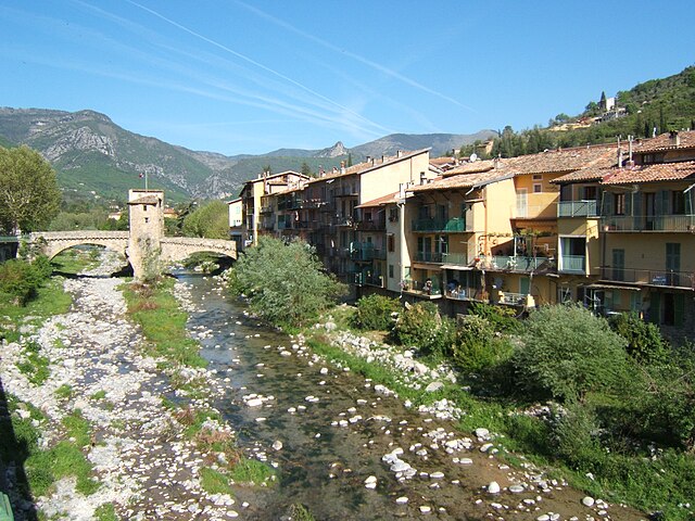
Л’Эскарен
- коммуна в департаменте Приморские Альпы, регион Прованс — Альпы — Лазурный Берег, Франция
Hiking in Л’Эскарен
L'Escarène is a charming village located in the Alpes-Maritimes department in southeastern France, nestled in the beautiful hills of the Côte d'Azur. The area around L'Escarène offers a variety of hiking opportunities, characterized by its picturesque landscapes, stunning views of the surrounding hills and valleys, and proximity to the Mediterranean coastline....
- Страна:
- Почтовый код: 06440
- Координаты: 43° 50' 4" N, 7° 21' 24" E
- GPS треки (wikiloc): [Ссылка]
- Площадь: 10.67 кв.км
- Население: 2507

Сент-Аньес
- коммуна в департаменте Приморские Альпы, регион Прованс — Альпы — Лазурный Берег, Франция
Hiking in Сент-Аньес
Sainte-Agnès, located in the Alpes-Maritimes region of France, is a charming hilltop village that offers stunning views of the surrounding landscape, including the Mediterranean Sea. It is known for its rich history, picturesque streets, and a variety of hiking trails that cater to different skill levels....
- Страна:
- Почтовый код: 06500
- Координаты: 43° 47' 21" N, 7° 28' 9" E
- GPS треки (wikiloc): [Ссылка]
- Площадь: 9.37 кв.км
- Население: 1214

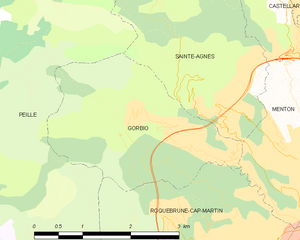
Горбьо
- коммуна в департаменте Приморские Альпы, регион Прованс — Альпы — Лазурный Берег, Франция
Hiking in Горбьо
Gorbio is a charming village located in the Alpes-Maritimes department in the Provence-Alpes-Côte d'Azur region of southeastern France. Nestled in the foothills of the French Alps, Gorbio offers a unique blend of stunning landscapes, cultural heritage, and hiking opportunities....
- Страна:
- Почтовый код: 06500
- Координаты: 43° 47' 12" N, 7° 26' 42" E
- GPS треки (wikiloc): [Ссылка]
- Площадь: 7.02 кв.км
- Население: 1387
- Веб сайт: [Ссылка]

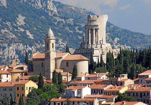
Рокебрюн — Кап-Мартен
- коммуна в департаменте Приморские Альпы, регион Прованс — Альпы — Лазурный Берег, Франция
- Страна:
- Почтовый код: 06190
- Координаты: 43° 45' 26" N, 7° 28' 27" E
- GPS треки (wikiloc): [Ссылка]
- Площадь: 9.33 кв.км
- Население: 12679
- Веб сайт: [Ссылка]
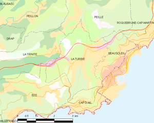
Ла-Тюрби
- коммуна в департаменте Приморские Альпы, регион Прованс — Альпы — Лазурный Берег, Франция
- Страна:
- Почтовый код: 06320
- Координаты: 43° 44' 44" N, 7° 24' 3" E
- GPS треки (wikiloc): [Ссылка]
- Площадь: 7.42 кв.км
- Население: 3119
- Веб сайт: [Ссылка]


Босолей
- коммуна в департаменте Приморские Альпы, регион Прованс — Альпы — Лазурный Берег, Франция
- Страна:
- Почтовый код: 06240
- Координаты: 43° 44' 31" N, 7° 25' 25" E
- GPS треки (wikiloc): [Ссылка]
- Площадь: 2.79 кв.км
- Население: 13625
- Веб сайт: [Ссылка]

Пейон
- коммуна в департаменте Приморские Альпы, регион Прованс — Альпы — Лазурный Берег, Франция
Hiking in Пейон
Peillon is a charming medieval village located in the French Riviera, not far from Nice. Nestled in the hills, it offers stunning views of the surrounding landscape, making it a wonderful destination for hiking enthusiasts....
- Страна:
- Почтовый код: 06440
- Координаты: 43° 46' 7" N, 7° 22' 2" E
- GPS треки (wikiloc): [Ссылка]
- Площадь: 8.7 кв.км
- Население: 1483
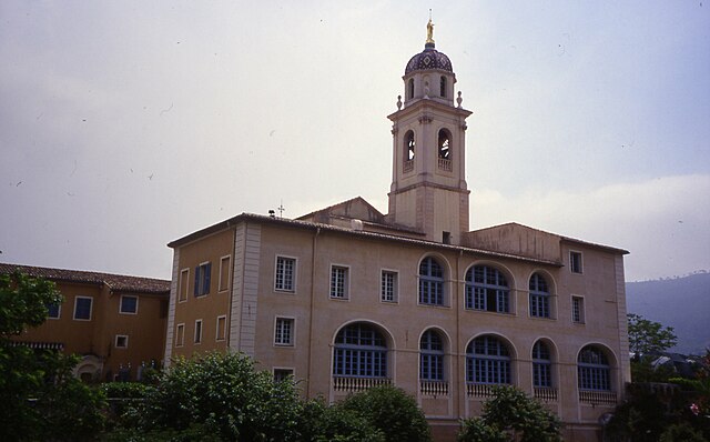

Ла-Трините
- коммуна в департаменте Приморские Альпы, регион Прованс — Альпы — Лазурный Берег, Франция
Hiking in Ла-Трините
La Trinité, located in the Alpes-Maritimes department of France, offers several beautiful hiking opportunities for outdoor enthusiasts. Nestled near Nice and the Mediterranean coast, it provides a mix of coastal views, lush greenery, and panoramic mountain scenery. Here are some highlights and considerations for hiking in this area:...
- Страна:
- Почтовый код: 06340
- Координаты: 43° 44' 27" N, 7° 18' 51" E
- GPS треки (wikiloc): [Ссылка]
- Площадь: 14.9 кв.км
- Население: 10222
- Веб сайт: [Ссылка]

Соспель
- коммуна в департаменте Приморские Альпы, регион Прованс — Альпы — Лазурный Берег, Франция
Hiking in Соспель
Sospel is a charming village located in the Alpes-Maritimes department of France, nestled in the scenic hills near the Italian border. It's an excellent base for hikers, offering a variety of trails that showcase the stunning natural beauty of the region. Here are some highlights of hiking in Sospel:...
- Страна:
- Почтовый код: 06380
- Координаты: 43° 52' 37" N, 7° 26' 54" E
- GPS треки (wikiloc): [Ссылка]
- Высота над уровнем моря: 348 м m
- Площадь: 62.39 кв.км
- Население: 3782
- Веб сайт: [Ссылка]

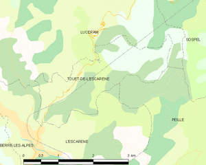
Туэ-де-л’Эскарен
- коммуна в департаменте Приморские Альпы, регион Прованс — Альпы — Лазурный Берег, Франция
Hiking in Туэ-де-л’Эскарен
Touët-de-l'Escarène is a charming village located in the Alpes-Maritimes department of France, not far from Nice. It serves as a great base for hiking enthusiasts looking to explore the scenic beauty of the surrounding regions. Here’s what you should know about hiking around Touët-de-l'Escarène:...
- Страна:
- Почтовый код: 06440
- Координаты: 43° 50' 51" N, 7° 21' 54" E
- GPS треки (wikiloc): [Ссылка]
- Высота над уровнем моря: 415 м m
- Площадь: 4.57 кв.км
- Население: 289

Блозаск
- коммуна в департаменте Приморские Альпы, регион Прованс — Альпы — Лазурный Берег, Франция
Hiking in Блозаск
Blausasc is a charming village located in the Alpes-Maritimes department of France, near Nice. It is known for its stunning landscapes and diverse hiking opportunities, making it a great destination for outdoor enthusiasts....
- Страна:
- Почтовый код: 06440
- Координаты: 43° 48' 17" N, 7° 21' 55" E
- GPS треки (wikiloc): [Ссылка]
- Площадь: 10.21 кв.км
- Население: 1448


Кастийон
- коммуна в департаменте Приморские Альпы, регион Прованс — Альпы — Лазурный Берег, Франция
Hiking in Кастийон
Hiking in Castillon, Alpes-Maritimes, offers a unique blend of stunning landscapes, Mediterranean climate, and rich natural biodiversity. Nestled in the foothills of the French Riviera, Castillon is known for its picturesque views, quaint village charm, and a variety of hiking trails suitable for all levels of experience....
- Страна:
- Почтовый код: 06500
- Координаты: 43° 50' 0" N, 7° 28' 20" E
- GPS треки (wikiloc): [Ссылка]
- Площадь: 7.51 кв.км
- Население: 378
- Веб сайт: [Ссылка]


Люсерам
- коммуна в департаменте Приморские Альпы, регион Прованс — Альпы — Лазурный Берег, Франция
Hiking in Люсерам
Lucéram is a picturesque village located in the Alpes-Maritimes department of France, nestled in the hills of Provence near the French Riviera. The area surrounding Lucéram offers a variety of hiking opportunities, showcasing stunning landscapes, rich flora, and charming rural architecture....
- Страна:
- Почтовый код: 06440
- Координаты: 43° 52' 57" N, 7° 21' 38" E
- GPS треки (wikiloc): [Ссылка]
- Площадь: 65.52 кв.км
- Население: 1261