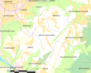
Пуаза (Poisat, Poisat)

- коммуна во Франции
 Hiking in Пуаза
Poisat, located near Grenoble in the French Alps, offers beautiful hiking options with stunning views of the surrounding mountains and valleys. Here are some key points about hiking in the Poisat area:
Trail Options:
- Le Mont Rachais: This is a popular hike that offers panoramic views of Grenoble and the surrounding mountains. It's moderate in difficulty and suitable for most hikers.
- Gorges de la Bourne: A beautiful trail that runs along the river, providing breathtaking views of the gorges and the rocky landscape. It’s a fantastic trail for those who enjoy scenic spots and the sound of water.
- Col de L'Alpe: This hike presents a more challenging ascent but rewards hikers with stunning views and the opportunity to experience alpine flora.
Things to Consider:
- Season: The hiking season typically runs from late spring to early autumn. Winter hiking is also an option, but necessary precautions and gear should be used due to snow and ice.
- Weather: Always check the weather forecast before heading out, as it can change rapidly in mountainous areas.
- Safety: Ensure you have proper footwear and supplies, including water, snacks, a map, and a first aid kit.
- Wildlife: Keep an eye out for local wildlife, such as chamois and various bird species. Respect their habitat by keeping a safe distance.
Accessibility:
Poisat is conveniently located near Grenoble, making it easily accessible for both locals and visitors. There are also public transport options available, but some trails may require a short drive.
In summary, Poisat provides a variety of hiking trails suitable for different skill levels, combined with impressive natural beauty. Just remember to plan ahead to make the most of your hiking experience!
- Страна:

- Почтовый код: 38320
- Координаты: 45° 9' 29" N, 5° 45' 43" E


- GPS треки (wikiloc): [Ссылка]
- Площадь: 2.56 кв.км
- Население: 2165
- Веб сайт: http://ville-poisat.fr
- Википедия русская: wiki(ru)
- Википедия английская: wiki(en)
- Википедия национальная: wiki(fr)
- Хранилище Wikidata: Wikidata: Q1151434
- Катеория в википедии: [Ссылка]
- код Freebase: [/m/03g_562]
- код GeoNames: Альт: [6433287]
- номер SIREN: [213803091]
- код BNF: [15258121d]
- место в MusicBrainz: [79ae1c69-9863-479b-925f-f7971bf2b1db]
- код муниципалитета INSEE: 38309
Граничит с регионами:


Эбенс
- коммуна во Франции
Hiking in Эбенс
Eybens, located near Grenoble in the Auvergne-Rhône-Alpes region of France, offers a mix of urban and natural landscapes, making it a great base for hiking enthusiasts. Here are some aspects of hiking in and around Eybens:...
- Страна:
- Почтовый код: 38320
- Координаты: 45° 8' 55" N, 5° 45' 1" E
- GPS треки (wikiloc): [Ссылка]
- Площадь: 4.5 кв.км
- Население: 10259
- Веб сайт: [Ссылка]

Брие-э-Ангон
- коммуна во Франции
Hiking in Брие-э-Ангон
Brié-et-Angonnes is a charming commune located in the Auvergne-Rhône-Alpes region of France, situated near the city of Grenoble. The area offers a variety of hiking opportunities that cater to different skill levels, making it a great destination for both beginners and experienced hikers....
- Страна:
- Почтовый код: 38320
- Координаты: 45° 6' 41" N, 5° 47' 12" E
- GPS треки (wikiloc): [Ссылка]
- Площадь: 9.7 кв.км
- Население: 2531
- Веб сайт: [Ссылка]


Эрбей
- коммуна во Франции
Hiking in Эрбей
Herbeys is a charming village located near the French Alps, offering a range of hiking opportunities for outdoor enthusiasts. Here are some highlights and tips for hiking in Herbeys:...
- Страна:
- Почтовый код: 38320
- Координаты: 45° 8' 20" N, 5° 47' 36" E
- GPS треки (wikiloc): [Ссылка]
- Площадь: 7.73 кв.км
- Население: 1364
- Веб сайт: [Ссылка]


Сен-Мартен-д'Эр
- коммуна во Франции
Hiking in Сен-Мартен-д'Эр
Saint-Martin-d'Hères is a charming commune located near Grenoble in the Auvergne-Rhône-Alpes region of southeastern France. It offers a variety of hiking opportunities, typically set against the stunning backdrop of the surrounding mountains, particularly the Chambéranger and Chartreuse ranges....
- Страна:
- Почтовый код: 38400
- Координаты: 45° 11' 1" N, 5° 45' 19" E
- GPS треки (wikiloc): [Ссылка]
- Высота над уровнем моря: 234 м m
- Площадь: 9.26 кв.км
- Население: 38479
- Веб сайт: [Ссылка]