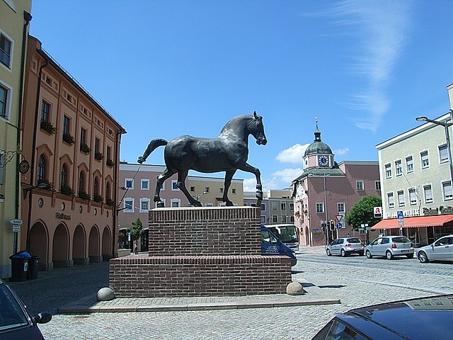
Постмюнстер (Postmünster, Postmünster)

 Hiking in Постмюнстер
Postmünster is a charming village located in Bavaria, Germany, surrounded by scenic landscapes that make it an excellent destination for hiking enthusiasts. Here are some highlights and tips for hiking in and around Postmünster:
Hiking Trails
-
Local Trails: Postmünster offers a variety of local trails that cater to different skill levels. You can enjoy leisurely walks along well-marked paths, ideal for families and casual hikers.
-
Scenic Views: The trails often provide stunning views of the surrounding countryside, including fields, forests, and hills. Look for viewpoints along the way that offer great photo opportunities.
-
Nature Parks: Nearby nature parks, such as the Bavarian Forest National Park, feature extensive hiking routes with diverse flora and fauna. These areas can be perfect for more challenging hikes as well as nature exploration.
Trail Recommendations
- Rundweg Postmünster: A circular trail that takes you around the village, blending scenic views with cultural insights, perfect for a half-day hike.
- Path to the River: Trails that lead to nearby rivers can provide a peaceful experience, often with picnic spots along the way.
Tips for Hiking in Postmünster
- Trail Maps: Make sure to take a physical or digital map or use a hiking app, as some paths may not be well-marked.
- Proper Footwear: Wear sturdy hiking boots, as some trails may be uneven or muddy.
- Weather Considerations: Check the weather forecast before heading out and be prepared for sudden changes, especially in autumn or spring.
- Hydration and Snacks: Bring sufficient water and snacks, particularly if you're planning on hiking longer trails.
- Respect Nature: Stay on marked trails and follow local guidelines to help preserve the natural environment.
Conclusion
Hiking in Postmünster can be a memorable experience, whether you're looking for a short walk or a more challenging trek. The combination of natural beauty and Bavarian charm makes it a delightful spot for outdoor enthusiasts. Enjoy your hike!
- Страна:

- Почтовый код: 84389
- Телефонный код: 08561
- Код автомобильного номера: PAN
- Координаты: 48° 25' 0" N, 12° 54' 0" E


- GPS треки (wikiloc): [Ссылка]
- Высота над уровнем моря: 405 м m
- Площадь: 43.5 кв.км
- Население: 2240
- Веб сайт: http://www.postmuenster.de
- Википедия русская: wiki(ru)
- Википедия английская: wiki(en)
- Википедия национальная: wiki(de)
- Хранилище Wikidata: Wikidata: Q559918
- Катеория в википедии: [Ссылка]
- код Freebase: [/m/02q8384]
- код GeoNames: Альт: [2852479]
- код VIAF: Альт: [241481560]
- ID отношения в OpenStreetMap: [957051]
- код GND: Альт: [4116078-2]
- место в MusicBrainz: [e6b973e6-e933-4a90-9243-5f0197ef5d92]
- Bavarikon ID: [ODB_A00009184]
- идентификатор муниципалитетов в Германии: 09277139
Граничит с регионами:

Шёнау
- муниципалитет в Германии, Бавария
Hiking in Шёнау
Schönau, located in Lower Bavaria, is a delightful destination for hiking enthusiasts. Nestled near the foothills of the Bavarian Forest and close to the picturesque Berchtesgaden National Park, it offers a variety of trails and stunning landscapes. Here are some highlights for hiking in Schönau:...
- Страна:
- Почтовый код: 84337
- Телефонный код: 08726
- Код автомобильного номера: PAN
- Координаты: 48° 29' 0" N, 12° 51' 0" E
- GPS треки (wikiloc): [Ссылка]
- Высота над уровнем моря: 453 м m
- Площадь: 36.14 кв.км
- Население: 1540
- Веб сайт: [Ссылка]
Пфаркирхен
Hiking in Пфаркирхен
Pfarrkirchen is a charming town located in Bavaria, Germany, surrounded by beautiful countryside that offers several hiking opportunities. The region is characterized by its rolling hills, lush forests, and tranquil rivers, making it an excellent destination for outdoor enthusiasts....
- Страна:
- Почтовый код: 84347
- Телефонный код: 08561
- Код автомобильного номера: PAN
- Координаты: 48° 26' 31" N, 12° 56' 39" E
- GPS треки (wikiloc): [Ссылка]
- Высота над уровнем моря: 469 м m
- Площадь: 52.35 кв.км
- Население: 10275
- Веб сайт: [Ссылка]

Трифтерн
Hiking in Трифтерн
Triftern is a small town located in the district of Rottal-Inn in Bavaria, Germany. While it may not be as well-known for hiking as some other regions, it offers access to the beautiful Bavarian countryside, where you can enjoy various nature trails and paths....
- Страна:
- Почтовый код: 84371
- Телефонный код: 08562
- Код автомобильного номера: PAN
- Координаты: 48° 24' 0" N, 13° 1' 0" E
- GPS треки (wikiloc): [Ссылка]
- Высота над уровнем моря: 391 м m
- Площадь: 62.24 кв.км
- Население: 5012
- Веб сайт: [Ссылка]

Хебертсфельден
Hiking in Хебертсфельден
Hebertsfelden, located in Bavaria, Germany, is a charming village surrounded by picturesque landscapes that offer excellent hiking opportunities. The region is characterized by rolling hills, lush forests, and scenic views, making it perfect for both casual strolls and more challenging hikes....
- Страна:
- Почтовый код: 84332
- Телефонный код: 08721
- Код автомобильного номера: PAN
- Координаты: 48° 24' 0" N, 12° 49' 0" E
- GPS треки (wikiloc): [Ссылка]
- Высота над уровнем моря: 446 м m
- Площадь: 49.89 кв.км
- Население: 3547
- Веб сайт: [Ссылка]

Дитерсбург
Hiking in Дитерсбург
Dietersburg, located in Bavaria, Germany, offers a variety of hiking opportunities for outdoor enthusiasts. While it may not be as well-known as some of the larger hiking destinations in Bavaria, it is surrounded by beautiful landscapes typical of the region, including rolling hills, forests, and picturesque countryside....
- Страна:
- Почтовый код: 84385; 84378
- Телефонный код: 08726; 08565; 08564; 08561
- Код автомобильного номера: PAN
- Координаты: 48° 30' 0" N, 12° 55' 0" E
- GPS треки (wikiloc): [Ссылка]
- Высота над уровнем моря: 427 м m
- Площадь: 55.03 кв.км
- Население: 3110
- Веб сайт: [Ссылка]

Танн
Hiking in Танн
Hiking in Tann, Bavaria, offers a delightful experience with stunning landscapes, picturesque villages, and a range of trails for all levels of hikers. Nestled in the beautiful Bavarian region, Tann is surrounded by the rolling hills of the Bavarian Forest and offers a mix of well-marked trails, scenic views, and opportunities to immerse yourself in nature....
- Страна:
- Почтовый код: 84367
- Телефонный код: 08572
- Код автомобильного номера: PAN
- Координаты: 48° 19' 0" N, 12° 54' 0" E
- GPS треки (wikiloc): [Ссылка]
- Высота над уровнем моря: 476 м m
- Площадь: 37.55 кв.км
- Население: 3289
- Веб сайт: [Ссылка]